Directions to Makati Park & Garden station (Makati City) with public transit
The following transit lines have routes that pass near Makati Park & Garden
How to get to Makati Park & Garden station by bus?
Click on the bus route to see step by step directions with maps, line arrival times and updated time schedules.
How to get to Makati Park & Garden station by train?
Click on the train route to see step by step directions with maps, line arrival times and updated time schedules.
Bus stops near Makati Park & Garden in Makati City
- Makati Aqua Sports Arena, Dr Jose P. Rizal Extension, Makati City, Manila, 5 min walk,
- Lawton Ave Near Kalayaan Ave Intersection , Makati City, Manila, 6 min walk,
- Kalayaan Ave, Makati City, Manila, 8 min walk,
Train station near Makati Park & Garden in Makati City
- Guadalupe Mrt, 13 min walk,
Bus lines to Makati Park & Garden station in Makati City
- JEEP, Artemio Natividad Elementary School, M. Almeda, Taguig City, Manila,
- JEEP, M. Almeda, Pateros, Manila,
- JEEP, B. Morcilla St, Pateros, Manila,
- JEEP, Villa Monica Resort, M. Almeda, Pateros, Manila,
- JEEP, Sgt. Fabian Yabut Circle / P.Burgos Intersection, Makati City, Manila,
- JEEP, Makati Ave / A. Arnaiz Ave, Makati City, Manila,
- JEEP, Guadalupe (ABC) - FTI via J.P. Rizal Extension,
- JEEP, EDSA SHAW Guadalupe via S MAdre,
- JEEP, GUDALUPE-FTI via J.P.RIZAL Ext. C5,
- JEEP, Guadalupe Mkt. - L. Guinto via P. Gil,
- JEEP, Guadalupe FTI v JP Rizal,
- JEEP, Fort Bonifacio (Gate III) - Guadalupe,
- JEEP, AFP/PNP Housing (Taguig) - Guadalupe (ABC) via Bayani Road,
- JEEP, EDSA CENTRAL - GUADALUPE via PIONEER,
- JEEP, F. Flores / M. Concepcion Ave Intersection, Pateros, Manila,
- JEEP, Carlos P. Garcia Ave, Taguig City, Manila,
- JEEP, Kalayaan Ave, Makati City, Manila,
What are the closest stations to Makati Park & Garden?
The closest stations to Makati Park & Garden are:
- Makati Aqua Sports Arena, Dr Jose P. Rizal Extension, Makati City, Manila is 308 meters away, 5 min walk.
- Lawton Ave Near Kalayaan Ave Intersection , Makati City, Manila is 441 meters away, 6 min walk.
- Kalayaan Ave, Makati City, Manila is 566 meters away, 8 min walk.
- Guadalupe Mrt is 1027 meters away, 13 min walk.
Which bus line stops near Makati Park & Garden?
JEEP (Epifanio De Los Santos Avenue, Makati City, Manila→Villa Monica Resort, M. Almeda, Pateros, Manila)
Which train line stops near Makati Park & Garden?
MRT3 (North Avenue)
What’s the nearest train station to Makati Park & Garden in Makati City?
The nearest train station to Makati Park & Garden in Makati City is Guadalupe Mrt. It’s a 13 min walk away.
What’s the nearest bus station to Makati Park & Garden in Makati City?
The nearest bus station to Makati Park & Garden in Makati City is Makati Aqua Sports Arena, Dr Jose P. Rizal Extension, Makati City, Manila. It’s a 5 min walk away.
What time is the first train to Makati Park & Garden in Makati City?
The MRT3 is the first train that goes to Makati Park & Garden in Makati City. It stops nearby at 5:10 AM.
What time is the last train to Makati Park & Garden in Makati City?
The MRT3 is the last train that goes to Makati Park & Garden in Makati City. It stops nearby at 9:28 PM.
What time is the first bus to Makati Park & Garden in Makati City?
The JEEP is the first bus that goes to Makati Park & Garden in Makati City. It stops nearby at 6:00 AM.
What time is the last bus to Makati Park & Garden in Makati City?
The JEEP is the last bus that goes to Makati Park & Garden in Makati City. It stops nearby at 12:53 AM.
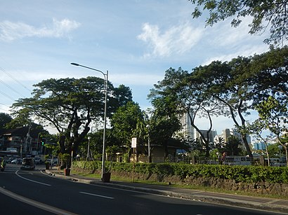
See Makati Park & Garden, Makati City, on the map
Public Transit to Makati Park & Garden in Makati City
Wondering how to get to Makati Park & Garden in Makati City, Philippines? Moovit helps you find the best way to get to Makati Park & Garden with step-by-step directions from the nearest public transit station.
Moovit provides free maps and live directions to help you navigate through your city. View schedules, routes, timetables, and find out how long does it take to get to Makati Park & Garden in real time.
Looking for the nearest stop or station to Makati Park & Garden? Check out this list of stops closest to your destination: Makati Aqua Sports Arena; Lawton Ave Near Kalayaan Ave Intersection ; Kalayaan Ave; Guadalupe Mrt.
Bus: JEEP.Train: MRT3.
Want to see if there’s another route that gets you there at an earlier time? Moovit helps you find alternative routes or times. Get directions from and directions to Makati Park & Garden easily from the Moovit App or Website.
We make riding to Makati Park & Garden easy, which is why over 1.5 million users, including users in Makati City, trust Moovit as the best app for public transit. You don’t need to download an individual bus app or train app, Moovit is your all-in-one transit app that helps you find the best bus time or train time available.
For information on prices of bus and train, costs and ride fares to Makati Park & Garden, please check the Moovit app.
Use the app to navigate to popular places including to the airport, hospital, stadium, grocery store, mall, coffee shop, school, college, and university.
Makati Park & Garden Address: J. P. Rizal Ext street in Makati City
Places Near Makati Park & Garden (Makati City)
How to get to popular places in Manila with public transit
Get around Makati City by public transit!
Traveling around Makati City has never been so easy. See step by step directions as you travel to any attraction, street or major public transit station. View bus and train schedules, arrival times, service alerts and detailed routes on a map, so you know exactly how to get to anywhere in Makati City.
When traveling to any destination around Makati City use Moovit's Live Directions with Get Off Notifications to know exactly where and how far to walk, how long to wait for your line, and how many stops are left. Moovit will alert you when it's time to get off — no need to constantly re-check whether yours is the next stop.
Wondering how to use public transit in Makati City or how to pay for public transit in Makati City? Moovit public transit app can help you navigate your way with public transit easily, and at minimum cost. It includes public transit fees, ticket prices, and costs. Looking for a map of Makati City public transit lines? Moovit public transit app shows all public transit maps in Makati City with all Bus and Train routes and stops on an interactive map.
Manila has 2 transit type(s), including: Bus and Train, operated by several transit agencies, including LRTA, LTFRB, MRTC, PNR, P2P, UV Express and BGC Bus