Directions to Malcolm Contracting Services (Boston) with public transportation
The following transit lines have routes that pass near Malcolm Contracting Services
 Bus: 215, 22, 23, 15, 18.
- Train: FAIRMOUNT, FRANKLIN/FOXBORO, FAIRMOUNT LINE SHUTTLE, PROVIDENCE/STOUGHTON.
- Subway: RED LINE.
How to get to Malcolm Contracting Services by bus?
Click on the bus route to see step by step directions with maps, line arrival times and updated time schedules.
From Braintree, MA, Braintree Town
56 minFrom 300 Longwood Ave, Boston
73 minFrom Rosenberg Building Bidmc, Boston
52 minFrom South Boston Waterfront, Boston
72 minFrom The Mall At Chestnut Hill, Newton
83 minFrom Harvard Vanguard - Kenmore, Boston
56 minFrom rmv Braintree, Braintree Town
70 minFrom Bunker Hill Community College, Boston
98 minFrom Bunker Hill Monument, Boston
87 minFrom Quincy Market, Boston
66 min
How to get to Malcolm Contracting Services by train?
Click on the train route to see step by step directions with maps, line arrival times and updated time schedules.
How to get to Malcolm Contracting Services by subway?
Click on the subway route to see step by step directions with maps, line arrival times and updated time schedules.
From Braintree, MA, Braintree Town
53 minFrom 300 Longwood Ave, Boston
32 minFrom Rosenberg Building Bidmc, Boston
57 minFrom South Boston Waterfront, Boston
39 minFrom The Mall At Chestnut Hill, Newton
82 minFrom Harvard Vanguard - Kenmore, Boston
52 minFrom rmv Braintree, Braintree Town
60 minFrom Bunker Hill Community College, Boston
36 minFrom Bunker Hill Monument, Boston
43 minFrom Quincy Market, Boston
30 min
Bus stops near Malcolm Contracting Services in Boston
Train stations near Malcolm Contracting Services in Boston
- Talbot Avenue, 27 min walk,VIEW
Bus lines to Malcolm Contracting Services in Boston
- 15, Haymarket Via Fields Corner & Nubian,VIEW
- 18, Andrew,VIEW
- 12, Ashmont,VIEW
- 21, Forest Hills - Ashmont,VIEW
- 22, Ruggles - Ashmont,VIEW
- 23, Ruggles - Ashmont,VIEW
- 24, Ashmont - Wakefield Ave,VIEW
- 26, Gallivan Blvd via Norfolk St - Ashmont via Washington St,VIEW
- 215, Ashmont - Quincy Center,VIEW
- 217, Ashmont via North Quincy - Quincy Center via North Quincy,VIEW
- 240, Ashmont - Avon Square,VIEW
- MATTAPAN LINE SHUTTLE, Mattapan - Ashmont (Shuttle),VIEW
- MATTAPAN LINE SHUTTLE, Mattapan - Ashmont,VIEW
- RED LINE SHUTTLE, Ashmont - JFK/UMass,VIEW
- RED LINE SHUTTLE, Ashmont - Braintree,VIEW
- RED LINE SHUTTLE, Ashmont - JFK/UMass (Shuttle),VIEW
- RED LINE SHUTTLE, Ashmont - Park Street via Post Office,VIEW
- RED LINE SHUTTLE, Ashmont - Broadway (Shuttle),VIEW
- RED/MATTAPAN LINE SHUTTLE, Mattapan - JFK/UMass,VIEW
- MATTAPAN LINE, Mattapan Line,VIEW
What are the closest stations to Malcolm Contracting Services?
The closest stations to Malcolm Contracting Services are:
- Dorchester Ave @ Shepton St is 374 yards away, 5 min walk.
- Dorchester Ave And Mercier St is 419 yards away, 6 min walk.
- Ashmont / Peabody Sq. is 435 yards away, 6 min walk.
- Talbot Avenue is 2233 yards away, 27 min walk.
Which bus lines stop near Malcolm Contracting Services?
These bus lines stop near Malcolm Contracting Services: 215, 22, 23.
Which train line stops near Malcolm Contracting Services?
FAIRMOUNT (#1627 | Fairmount)
Which subway line stops near Malcolm Contracting Services?
RED LINE (Ashmont/Braintree)
What’s the nearest train station to Malcolm Contracting Services in Boston?
The nearest train station to Malcolm Contracting Services in Boston is Talbot Avenue. It’s a 27 min walk away.
What’s the nearest bus station to Malcolm Contracting Services in Boston?
The nearest bus station to Malcolm Contracting Services in Boston is Dorchester Ave @ Shepton St. It’s a 5 min walk away.
What time is the first subway to Malcolm Contracting Services in Boston?
The MATTAPAN LINE is the first subway that goes to Malcolm Contracting Services in Boston. It stops nearby at 5:10 AM.
What time is the last subway to Malcolm Contracting Services in Boston?
The MATTAPAN LINE is the last subway that goes to Malcolm Contracting Services in Boston. It stops nearby at 2:31 AM.
What time is the first train to Malcolm Contracting Services in Boston?
The FAIRMOUNT is the first train that goes to Malcolm Contracting Services in Boston. It stops nearby at 4:41 AM.
What time is the last train to Malcolm Contracting Services in Boston?
The FAIRMOUNT is the last train that goes to Malcolm Contracting Services in Boston. It stops nearby at 12:03 AM.
What time is the first bus to Malcolm Contracting Services in Boston?
The 15 is the first bus that goes to Malcolm Contracting Services in Boston. It stops nearby at 3:26 AM.
What time is the last bus to Malcolm Contracting Services in Boston?
The 23 is the last bus that goes to Malcolm Contracting Services in Boston. It stops nearby at 2:43 AM.
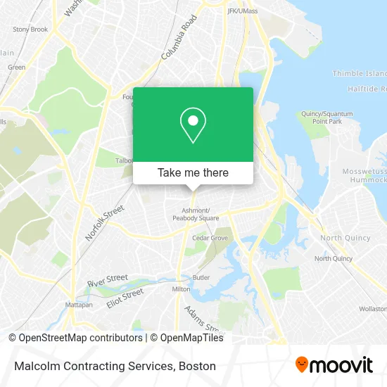
See Malcolm Contracting Services, Boston, on the map
Public Transit to Malcolm Contracting Services in Boston
Wondering how to get to Malcolm Contracting Services in Boston? Moovit helps you find the best way to get to Malcolm Contracting Services with step-by-step directions from the nearest public transit station.
Moovit provides free maps and live directions to help you navigate through your city. View schedules, routes, timetables, and find out how long does it take to get to Malcolm Contracting Services in real time.
Looking for the nearest stop or station to Malcolm Contracting Services? Check out this list of stops closest to your destination: Dorchester Ave @ Shepton St; Dorchester Ave And Mercier St; Ashmont / Peabody Sq.; Talbot Avenue.
Bus: 215, 22, 23, 15, 18, 12, 21, 24, 26.Train: FAIRMOUNT, FRANKLIN/FOXBORO, FAIRMOUNT LINE SHUTTLE, PROVIDENCE/STOUGHTON.Subway: RED LINE.
Want to see if there’s another route that gets you there at an earlier time? Moovit helps you find alternative routes or times. Get directions from and directions to Malcolm Contracting Services easily from the Moovit App or Website.
We make riding to Malcolm Contracting Services easy, which is why over 1.7 million users, including users in Boston, trust Moovit as the best app for public transit. You don’t need to download an individual bus app or train app, Moovit is your all-in-one transit app that helps you find the best bus time or train time available.
For information on prices of subway, bus and train, costs and ride fares to Malcolm Contracting Services, please check the Moovit app.
Use the app to navigate to popular places including to the airport, hospital, stadium, grocery store, mall, coffee shop, school, college, and university.
Malcolm Contracting Services Address: 551 Talbot Ave street in Boston
- Cafe 168,
- Big City Chiropractic,
- MBTA Ashmont / Peabody Square Station,
- The Intersection Dorchester,
- Dorchester Avenue and Fuller Street,
- Nebs Scooter Mechanic,
- Sweet Home Services,
- B & T & Sons,
- Moo Bishop & Co,
- 02124,
- Adams House Condos,
- RGC Renovation,
- Stealth Junk Removal,
- Ashtonia Handy Man Help Fix Anything,
- Superstar Builders,
- Thuy's Hair Salon (Gigi Hair Concepts),
- Via Cannuccia,
- Ashmont St Building 360,
- Boston Public Library - Codman Square Branch,
- American Dry Cleaners
Places Near Malcolm Contracting Services (Boston)
- Leader Bank Pavilion (Leader Bank Pavillion), Boston,
- Seaport District, Boston,
- North End, Boston,
- Mgm Music Hall, Boston,
- Isabella Stewart Gardner Museum, Boston,
- Boston Medical Center, Boston,
- Prudential Center, Boston,
- Museum Of Science, Boston,
- Castle Island, Boston,
- Boston Children's Hospital, Boston,
- Wilbur Theatre, Boston,
- Massachusetts General Hospital, Boston,
- Boston Convention & Exhibition Center, Boston,
- House Of Blues, Boston,
- Quincy Market, Boston,
- Cheers, Boston,
- Td Garden, Boston,
- Wang Theater, Boston,
- Boston Common, Boston,
- Faneuil Hall, Boston
How to get to popular places in Boston with public transit
Get around Boston by public transit!
Traveling around Boston has never been so easy. See step by step directions as you travel to any attraction, street or major public transit station. View bus and train schedules, arrival times, service alerts and detailed routes on a map, so you know exactly how to get to anywhere in Boston.
When traveling to any destination around Boston use Moovit's Live Directions with Get Off Notifications to know exactly where and how far to walk, how long to wait for your line, and how many stops are left. Moovit will alert you when it's time to get off — no need to constantly re-check whether yours is the next stop.
Wondering how to use public transit in Boston or how to pay for public transit in Boston? Moovit public transit app can help you navigate your way with public transit easily, and at minimum cost. It includes public transit fees, ticket prices, and costs. Looking for a map of Boston public transit lines? Moovit public transit app shows all public transit maps in Boston with all Bus, Train, Subway and Ferry routes and stops on an interactive map.
Boston has 4 transit type(s), including: Bus, Train, Subway and Ferry, operated by several transit agencies, including MBTA, Southeastern Regional Transit Authority, MetroWest Regional Transit Authority, Rhode Island Public Transit Authority, WRTA, Lowell Regional Transit Authority, Merrimack Valley Transit, Montachusett Regional Transit Authority, Cape Cod Regional Transit Authority, Brockton Area Transit Authority, Martha's Vineyard Transit Authority, the WAVE - Nantucket Regional Transit Authority, GATRA, Cape Ann Transportation Authority and Massport