Directions to Maldonado Mortgages (Boston) with public transportation
The following transit lines have routes that pass near Maldonado Mortgages
 Bus: G2.
How to get to Maldonado Mortgages by bus?
Click on the bus route to see step by step directions with maps, line arrival times and updated time schedules.
From Polar Park, Worcester
146 minFrom St Vincent Hospital TH Medical, Worcester
145 minFrom Palladium, Worcester
150 minFrom Dcu Center, Worcester
147 minFrom South High Community School, Worcester
241 minFrom Worcester, MA, Worcester
145 minFrom Walmart Supercenter, Worcester
203 minFrom Registry Of Motor Vehicles (Rmv) Branch Office, Worcester
149 min
Bus stop near Maldonado Mortgages in Boston
- Dwight/Putting Green (Opposite), 7 min walk,VIEW
Bus lines to Maldonado Mortgages in Boston
- G2, E Springfield Via Union Station-Mercy,VIEW
What are the closest stations to Maldonado Mortgages?
The closest stations to Maldonado Mortgages are:
- Dwight/Putting Green (Opposite) is 587 yards away, 7 min walk.
Which bus line stops near Maldonado Mortgages?
G2 (Dwight / Benton Via Belmont)
What’s the nearest bus station to Maldonado Mortgages in Boston?
The nearest bus station to Maldonado Mortgages in Boston is Dwight/Putting Green (Opposite). It’s a 7 min walk away.
What time is the first bus to Maldonado Mortgages in Boston?
The G2 is the first bus that goes to Maldonado Mortgages in Boston. It stops nearby at 5:33 AM.
What time is the last bus to Maldonado Mortgages in Boston?
The G2 is the last bus that goes to Maldonado Mortgages in Boston. It stops nearby at 7:54 PM.
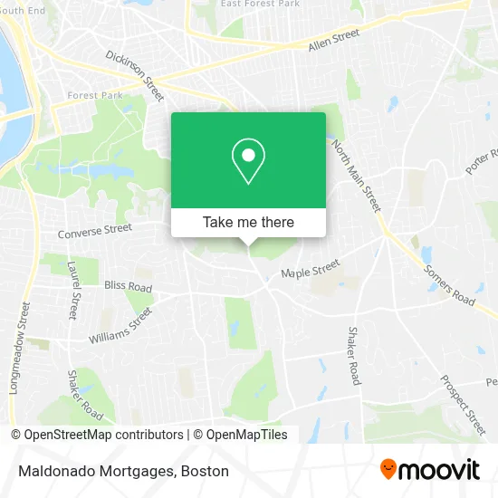
See Maldonado Mortgages, Boston, on the map
Public Transit to Maldonado Mortgages in Boston
Wondering how to get to Maldonado Mortgages in Boston? Moovit helps you find the best way to get to Maldonado Mortgages with step-by-step directions from the nearest public transit station.
Moovit provides free maps and live directions to help you navigate through your city. View schedules, routes, timetables, and find out how long does it take to get to Maldonado Mortgages in real time.
Looking for the nearest stop or station to Maldonado Mortgages? Check out this list of stops closest to your destination: Dwight/Putting Green (Opposite).
Bus: G2.
Want to see if there’s another route that gets you there at an earlier time? Moovit helps you find alternative routes or times. Get directions from and directions to Maldonado Mortgages easily from the Moovit App or Website.
We make riding to Maldonado Mortgages easy, which is why over 1.7 million users, including users in Boston, trust Moovit as the best app for public transit. You don’t need to download an individual bus app or train app, Moovit is your all-in-one transit app that helps you find the best bus time or train time available.
For information on prices of bus, costs and ride fares to Maldonado Mortgages, please check the Moovit app.
Use the app to navigate to popular places including to the airport, hospital, stadium, grocery store, mall, coffee shop, school, college, and university.
Maldonado Mortgages Address: 40 Crane avenue street in Boston
- Ecco,
- Douglas S Spink DDS,
- Recovery Health,
- Hire Aspirations,
- Farmington Psychology,
- William J Bontempi,
- SV Pain Management,
- Tennyson Partners,
- Metamorphosis Massage and Welness,
- Johnson Professional Associates PC,
- James M Freeman MD,
- Grande Meadows Martial Arts Club,
- Liberty Mutual,
- Edward Jones,
- Spirit of Healing,
- Source One Mortgage Services,
- Alston Psychopharmacology Intervention,
- Law Office of Donald J. Anderson,
- United Car Transport,
- Club House Cafe
Places Near Maldonado Mortgages (Boston)
- Leader Bank Pavilion (Leader Bank Pavillion), Boston,
- Td Garden, Boston,
- Castle Island, Boston,
- Wilbur Theatre, Boston,
- Quincy Market, Boston,
- Boston Children's Hospital, Boston,
- North End, Boston,
- Boston Convention & Exhibition Center, Boston,
- Boston Common, Boston,
- Prudential Center, Boston,
- House Of Blues, Boston,
- Isabella Stewart Gardner Museum, Boston,
- Massachusetts General Hospital, Boston,
- Seaport District, Boston,
- Wang Theater, Boston,
- Faneuil Hall, Boston,
- Cheers, Boston,
- Museum Of Science, Boston,
- Mgm Music Hall, Boston,
- Boston Medical Center, Boston
How to get to popular places in Boston with public transit
Get around Boston by public transit!
Traveling around Boston has never been so easy. See step by step directions as you travel to any attraction, street or major public transit station. View bus and train schedules, arrival times, service alerts and detailed routes on a map, so you know exactly how to get to anywhere in Boston.
When traveling to any destination around Boston use Moovit's Live Directions with Get Off Notifications to know exactly where and how far to walk, how long to wait for your line, and how many stops are left. Moovit will alert you when it's time to get off — no need to constantly re-check whether yours is the next stop.
Wondering how to use public transit in Boston or how to pay for public transit in Boston? Moovit public transit app can help you navigate your way with public transit easily, and at minimum cost. It includes public transit fees, ticket prices, and costs. Looking for a map of Boston public transit lines? Moovit public transit app shows all public transit maps in Boston with all Bus, Train, Subway and Ferry routes and stops on an interactive map.
Boston has 4 transit type(s), including: Bus, Train, Subway and Ferry, operated by several transit agencies, including MBTA, Southeastern Regional Transit Authority, MetroWest Regional Transit Authority, Rhode Island Public Transit Authority, WRTA, Lowell Regional Transit Authority, Merrimack Valley Transit, Montachusett Regional Transit Authority, Cape Cod Regional Transit Authority, Brockton Area Transit Authority, Martha's Vineyard Transit Authority, the WAVE - Nantucket Regional Transit Authority, GATRA, Cape Ann Transportation Authority and Massport