Directions to Mamaleh's Kibitz Corner & Events Space (Cambridge) with public transportation
The following transit lines have routes that pass near Mamaleh's Kibitz Corner & Events Space
 Bus: 1, 64, 85, EZRIDE, 69.
- Train: LOWELL.
- Subway: RED LINE, GREEN LINE B, GREEN LINE C, GREEN LINE D, GREEN LINE E.
How to get to Mamaleh's Kibitz Corner & Events Space by bus?
Click on the bus route to see step by step directions with maps, line arrival times and updated time schedules.
From Winchester, MA, Winchester
74 minFrom Watertown, MA, Watertown Town
49 minFrom Stone Zoo, Stoneham
85 minFrom St. Elizabeth's, Boston
51 minFrom Best Western Adams Inn Quincy - Boston, Quincy
94 minFrom Lower Mills, Boston
93 minFrom Faulkner Hospital, Boston
77 minFrom Capo, Boston
68 minFrom Terminal E- Logan International Airport, Boston
37 min
How to get to Mamaleh's Kibitz Corner & Events Space by train?
Click on the train route to see step by step directions with maps, line arrival times and updated time schedules.
How to get to Mamaleh's Kibitz Corner & Events Space by subway?
Click on the subway route to see step by step directions with maps, line arrival times and updated time schedules.
Bus stops near Mamaleh's Kibitz Corner & Events Space in Cambridge
Subway stations near Mamaleh's Kibitz Corner & Events Space in Cambridge
Bus lines to Mamaleh's Kibitz Corner & Events Space in Cambridge
- 69, Lechmere,VIEW
- 85, Ruggles,VIEW
- 64, Kendall/MIT - Oak Square,VIEW
- 68, Kendall/MIT - Harvard,VIEW
- EZRIDE, Outbound Lechemere To Kendall,VIEW
- EZRIDE, Inbound To North Station From Erie St,VIEW
- EZRIDE, Outbound North Station To Erie St Via Lechmere And Kendall,VIEW
- EZRIDE, Inbound Kendall To Lechmere,VIEW
- EZRIDE, Outbound To Erie St From North Station,VIEW
- EZRIDE, Inbound To North Station Via Kendall And Lechmere,VIEW
What are the closest stations to Mamaleh's Kibitz Corner & Events Space?
The closest stations to Mamaleh's Kibitz Corner & Events Space are:
- Cambridge St @ Berkshire St is 200 yards away, 3 min walk.
- Windsor St @ Lincoln St is 382 yards away, 5 min walk.
- Broadway @ Columbia St is 437 yards away, 6 min walk.
- Sixth St. is 686 yards away, 9 min walk.
- Lechmere is 809 yards away, 10 min walk.
- Central is 1118 yards away, 14 min walk.
Which bus lines stop near Mamaleh's Kibitz Corner & Events Space?
These bus lines stop near Mamaleh's Kibitz Corner & Events Space: 1, 64, 85, EZRIDE.
Which train line stops near Mamaleh's Kibitz Corner & Events Space?
LOWELL (#320 | North Station)
Which subway line stops near Mamaleh's Kibitz Corner & Events Space?
RED LINE (Alewife)
What’s the nearest subway station to Mamaleh's Kibitz Corner & Events Space in Cambridge?
The nearest subway station to Mamaleh's Kibitz Corner & Events Space in Cambridge is Lechmere. It’s a 10 min walk away.
What’s the nearest bus station to Mamaleh's Kibitz Corner & Events Space in Cambridge?
The nearest bus station to Mamaleh's Kibitz Corner & Events Space in Cambridge is Cambridge St @ Berkshire St. It’s a 3 min walk away.
What time is the first subway to Mamaleh's Kibitz Corner & Events Space in Cambridge?
The GREEN LINE E is the first subway that goes to Mamaleh's Kibitz Corner & Events Space in Cambridge. It stops nearby at 4:49 AM.
What time is the last subway to Mamaleh's Kibitz Corner & Events Space in Cambridge?
The GREEN LINE E is the last subway that goes to Mamaleh's Kibitz Corner & Events Space in Cambridge. It stops nearby at 2:34 AM.
What time is the first bus to Mamaleh's Kibitz Corner & Events Space in Cambridge?
The 64 is the first bus that goes to Mamaleh's Kibitz Corner & Events Space in Cambridge. It stops nearby at 5:27 AM.
What time is the last bus to Mamaleh's Kibitz Corner & Events Space in Cambridge?
The 69 is the last bus that goes to Mamaleh's Kibitz Corner & Events Space in Cambridge. It stops nearby at 1:09 AM.
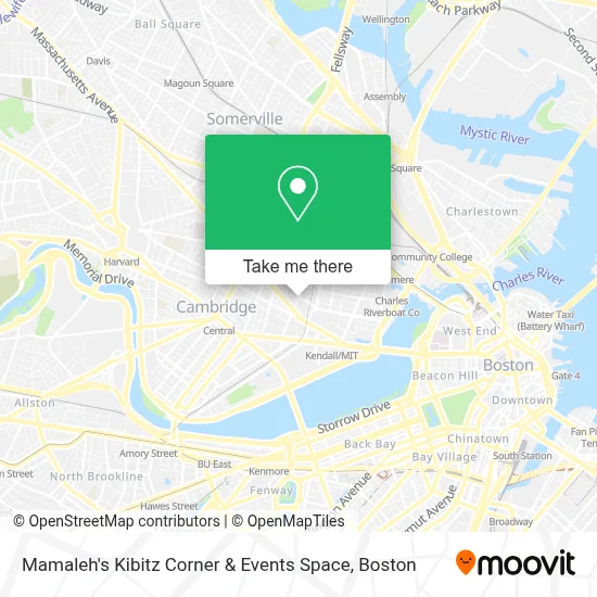
See Mamaleh's Kibitz Corner & Events Space, Cambridge, on the map
Public Transit to Mamaleh's Kibitz Corner & Events Space in Cambridge
Wondering how to get to Mamaleh's Kibitz Corner & Events Space in Cambridge? Moovit helps you find the best way to get to Mamaleh's Kibitz Corner & Events Space with step-by-step directions from the nearest public transit station.
Moovit provides free maps and live directions to help you navigate through your city. View schedules, routes, timetables, and find out how long does it take to get to Mamaleh's Kibitz Corner & Events Space in real time.
Looking for the nearest stop or station to Mamaleh's Kibitz Corner & Events Space? Check out this list of stops closest to your destination: Cambridge St @ Berkshire St; Windsor St @ Lincoln St; Broadway @ Columbia St; Sixth St.; Lechmere; Central.
Bus: 1, 64, 85, EZRIDE, 69, 68.Train: LOWELL.Subway: RED LINE, GREEN LINE B, GREEN LINE C, GREEN LINE D, GREEN LINE E.
Want to see if there’s another route that gets you there at an earlier time? Moovit helps you find alternative routes or times. Get directions from and directions to Mamaleh's Kibitz Corner & Events Space easily from the Moovit App or Website.
We make riding to Mamaleh's Kibitz Corner & Events Space easy, which is why over 1.7 million users, including users in Cambridge, trust Moovit as the best app for public transit. You don’t need to download an individual bus app or train app, Moovit is your all-in-one transit app that helps you find the best bus time or train time available.
For information on prices of bus, subway and train, costs and ride fares to Mamaleh's Kibitz Corner & Events Space, please check the Moovit app.
Use the app to navigate to popular places including to the airport, hospital, stadium, grocery store, mall, coffee shop, school, college, and university.
Mamaleh's Kibitz Corner & Events Space Address: 233 Cardinal Medeiros Ave street in Cambridge
- Rubius Therapeutics (Relay Therapeutics),
- Abcam,
- Dante Alighieri Italian Cultural Center,
- Spit Meter the Reckoning,
- Kendall Square Parking Garage,
- Mamaleh's Delicatessen (Memaleh's Delicatessen Restaurant),
- 100,
- Kendall Square Cinema ,
- Jas Consolidation,
- Hampshire St @ Cardinal Medeiros Ave (Hampshire St @ Portland St),
- Kendall Square,
- MERL,
- Akamai Technologies,
- Radius Health,
- MITSUBISHI Electric Research Laboratories - Merl,
- The Garment District,
- Moderna Therapeutics - Corporate Headquarters,
- Merck & Co. Inc - Cabridge Campus,
- Glaxosmithkline / Astrazeneca,
- The TARDIS
Places Near Mamaleh's Kibitz Corner & Events Space (Cambridge)
- Leader Bank Pavilion (Leader Bank Pavillion), Boston,
- Isabella Stewart Gardner Museum, Boston,
- Prudential Center, Boston,
- Boston Common, Boston,
- Faneuil Hall, Boston,
- Boston Medical Center, Boston,
- Wang Theater, Boston,
- Mgm Music Hall, Boston,
- House Of Blues, Boston,
- Boston Children's Hospital, Boston,
- North End, Boston,
- Quincy Market, Boston,
- Td Garden, Boston,
- Wilbur Theatre, Boston,
- Cheers, Boston,
- Seaport District, Boston,
- Museum Of Science, Boston,
- Boston Convention & Exhibition Center, Boston,
- Massachusetts General Hospital, Boston,
- Castle Island, Boston
How to get to popular places in Boston with public transit
Get around Cambridge by public transit!
Traveling around Cambridge has never been so easy. See step by step directions as you travel to any attraction, street or major public transit station. View bus and train schedules, arrival times, service alerts and detailed routes on a map, so you know exactly how to get to anywhere in Cambridge.
When traveling to any destination around Cambridge use Moovit's Live Directions with Get Off Notifications to know exactly where and how far to walk, how long to wait for your line, and how many stops are left. Moovit will alert you when it's time to get off — no need to constantly re-check whether yours is the next stop.
Wondering how to use public transit in Cambridge or how to pay for public transit in Cambridge? Moovit public transit app can help you navigate your way with public transit easily, and at minimum cost. It includes public transit fees, ticket prices, and costs. Looking for a map of Cambridge public transit lines? Moovit public transit app shows all public transit maps in Cambridge with all Bus, Train, Subway and Ferry routes and stops on an interactive map.
Boston has 4 transit type(s), including: Bus, Train, Subway and Ferry, operated by several transit agencies, including MBTA, Southeastern Regional Transit Authority, MetroWest Regional Transit Authority, Rhode Island Public Transit Authority, WRTA, Lowell Regional Transit Authority, Merrimack Valley Transit, Montachusett Regional Transit Authority, Cape Cod Regional Transit Authority, Brockton Area Transit Authority, Martha's Vineyard Transit Authority, the WAVE - Nantucket Regional Transit Authority, GATRA, Cape Ann Transportation Authority and Massport