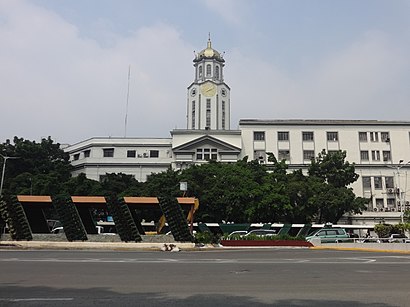
Manila City Hall stop - Sunday schedule
| Line | Direction | Time |
|---|---|---|
| JEEP | Bonifacio Dr, Manila | 8:10 AM |
| JEEP | Bonifacio Dr, Manila | 8:30 AM |
| JEEP | Bonifacio Dr, Manila | 8:50 AM |
| JEEP | Bonifacio Dr, Manila | 9:10 AM |
| JEEP | Bonifacio Dr, Manila | 9:30 AM |
| JEEP | Bonifacio Dr, Manila | 9:50 AM |
| JEEP | Bonifacio Dr, Manila | 10:09 AM |
| JEEP | Bonifacio Dr, Manila | 10:29 AM |
| JEEP | Bonifacio Dr, Manila | 10:49 AM |
| JEEP | Bonifacio Dr, Manila | 11:09 AM |
| JEEP | Bonifacio Dr, Manila | 11:29 AM |
| JEEP | Bonifacio Dr, Manila | 11:49 AM |
| JEEP | Bonifacio Dr, Manila | 12:09 PM |
| JEEP | Bonifacio Dr, Manila | 12:29 PM |
| JEEP | Bonifacio Dr, Manila | 12:49 PM |
| JEEP | Bonifacio Dr, Manila | 1:09 PM |
| JEEP | Bonifacio Dr, Manila | 1:29 PM |
| JEEP | Bonifacio Dr, Manila | 1:49 PM |
| JEEP | Bonifacio Dr, Manila | 2:09 PM |
| JEEP | Bonifacio Dr, Manila | 2:29 PM |
| JEEP | Bonifacio Dr, Manila | 2:49 PM |
| JEEP | Bonifacio Dr, Manila | 3:10 PM |
| JEEP | Bonifacio Dr, Manila | 3:30 PM |
| JEEP | Bonifacio Dr, Manila | 3:50 PM |
| JEEP | Bonifacio Dr, Manila | 4:10 PM |
Directions to Manila City Hall stop with public transit
The following transit lines have routes that pass near Manila City Hall
How to get to Manila City Hall stop by bus?
Click on the bus route to see step by step directions with maps, line arrival times and updated time schedules.
How to get to Manila City Hall stop by train?
Click on the train route to see step by step directions with maps, line arrival times and updated time schedules.
Bus stops near Manila City Hall stop
- Taft Ave, Manila, 2 min walk,
- Padre Burgos St / Taft Ave, Manila, 5 min walk,
- Lawton Uv Express, 6 min walk,
- Lawton, 7 min walk,
- Justice Cecilia Munoz-Palma, Manila, 8 min walk,
Train stations near Manila City Hall station
- Central Terminal Lrt, 17 min walk,
- Recto Lrt, 28 min walk,
Bus lines to Manila City Hall stop
- BUS, Ayala Quiapo via Kamagong Taft,
- BUS, Alabang Lawton via Zapote Coastal Rd,
- BUS, Asturias-Ayala via Buendia Ave, Taft Ave,
- BUS, Alabang Muntinlupa-Lawton via SSH Taft Ave,
- BUS, Pandacan Quiapo,
- BUS, GMA - Plaza Lawton via Ayala, Carmona, SSH,
- BUS, Pandacan Sta Cruz via Quiapo,
- BUS, Moonwalk - Plaza Lawton,
- BUS, Baclaran-SM Fairview via Quezon Ave,
- BUS, Alabang - Plaza Lawton,
- JEEP, Dapitan - Pasay RTDA. Via L. Guinto,
- JEEP, BACLARAN - MCU via MABINI,
- JEEP, Proj. 6 - T.M. Kalaw via Quezon Ave.,
- JEEP, Cubao - Pier South via Espana,
- JEEP, BACLARAN - DAPITAN via TAFT,
- JEEP, PagAsa Pier South via Qave,
- JEEP, FRISCO-REMEDIOS,
- JEEP, Malinta Pier via Monumento,
- JEEP, KAMUNING PIER SOUTH via RODRIGUEZ,
- JEEP, PROJ 2&3-VITO CRUZ MABINI,
What are the closest stations to Manila City Hall?
The closest stations to Manila City Hall are:
- Taft Ave, Manila is 92 meters away, 2 min walk.
- Padre Burgos St / Taft Ave, Manila is 325 meters away, 5 min walk.
- Lawton Uv Express is 388 meters away, 6 min walk.
- Lawton is 535 meters away, 7 min walk.
- Justice Cecilia Munoz-Palma, Manila is 548 meters away, 8 min walk.
- Central Terminal Lrt is 1247 meters away, 17 min walk.
- Recto Lrt is 2132 meters away, 28 min walk.
Which bus lines stop near Manila City Hall?
These bus lines stop near Manila City Hall: BUS, JEEP.
Which train line stops near Manila City Hall?
LRT 1 (Baclaran)
What’s the nearest train station to Manila City Hall?
The nearest train station to Manila City Hall is Central Terminal Lrt. It’s a 17 min walk away.
What’s the nearest bus station to Manila City Hall?
The nearest bus station to Manila City Hall is Taft Ave, Manila. It’s a 2 min walk away.
What time is the first train to Manila City Hall?
The LRT 2 is the first train that goes to Manila City Hall. It stops nearby at 5:00 AM.
What time is the last train to Manila City Hall?
The LRT 1 is the last train that goes to Manila City Hall. It stops nearby at 10:36 PM.
What time is the first bus to Manila City Hall?
The BUS is the first bus that goes to Manila City Hall. It stops nearby at 3:29 AM.
What time is the last bus to Manila City Hall?
The BUS is the last bus that goes to Manila City Hall. It stops nearby at 3:31 AM.
See Manila City Hall stop on the map
Public transit to Manila City Hall stop
Looking for directions to Manila City Hall in Manila, Philippines?
Download the Moovit App to find the current schedule and step-by-step directions for Bus or Train routes that pass through Manila City Hall.
Looking for the nearest stops closest to Manila City Hall ? Check out this list of closest stops to your destination: Taft Ave; Padre Burgos St / Taft Ave; Lawton Uv Express; Lawton; Justice Cecilia Munoz-Palma; Central Terminal Lrt; Recto Lrt.
Bus: BUS, JEEP, UV, UV.Train: LRT 1, LRT 2.
We make riding on public transit to Manila City Hall easy, which is why over 1.5 million users, including users in Manila trust Moovit as the best app for public transit.
Use the app to navigate to popular places including to the airport, hospital, stadium, grocery store, mall, coffee shop, school, college, and university.
The first line to this stop is JEEP, at 8:10 AM, and the last line is JEEP at 1:09 AM.
Padre Burgos Avenue, Philippines
This stop serves LTFRB’s lines
Popular routes from Manila City Hall stop
Bus stops near Manila City Hall stop
Popular public transit stations in Manila
Get around Manila by public transit!
Traveling around Manila has never been so easy. See step by step directions as you travel to any attraction, street or major public transit station. View bus and train schedules, arrival times, service alerts and detailed routes on a map, so you know exactly how to get to anywhere in Manila.
When traveling to any destination around Manila use Moovit's Live Directions with Get Off Notifications to know exactly where and how far to walk, how long to wait for your line, and how many stops are left. Moovit will alert you when it's time to get off — no need to constantly re-check whether yours is the next stop.
Wondering how to use public transit in Manila or how to pay for public transit in Manila? Moovit public transit app can help you navigate your way with public transit easily, and at minimum cost. It includes public transit fees, ticket prices, and costs. Looking for a map of Manila public transit lines? Moovit public transit app shows all public transit maps in Manila with all Bus and Train routes and stops on an interactive map.
Manila has 2 transit type(s), including: Bus and Train, operated by several transit agencies, including LRTA, LTFRB, MRTC, PNR, P2P, UV Express and BGC Bus