Directions to Marchons Avec Christ A Boston (Newton) with public transportation
The following transit lines have routes that pass near Marchons Avec Christ A Boston
 Bus: 52.
- Train: NEEDHAM.
- Subway: GREEN LINE D.
How to get to Marchons Avec Christ A Boston by bus?
Click on the bus route to see step by step directions with maps, line arrival times and updated time schedules.
From Trident Booksellers & Cafe, Boston
61 minFrom Hilton Boston Back Bay, Boston
78 minFrom Newbury Comics, Boston
61 minFrom Costco, Dedham
99 minFrom Brandy Melville, Boston
61 minFrom New England Conservatory of Music, Boston
76 minFrom Brighton, Boston
43 minFrom new hampshire!, Boston
84 minFrom Hyatt Regency Cambridge - Overlooking Boston, Cambridge
58 minFrom Angell Animal Medical Center (Mspca Angell), Boston
66 min
How to get to Marchons Avec Christ A Boston by train?
Click on the train route to see step by step directions with maps, line arrival times and updated time schedules.
How to get to Marchons Avec Christ A Boston by subway?
Click on the subway route to see step by step directions with maps, line arrival times and updated time schedules.
From Trident Booksellers & Cafe, Boston
82 minFrom Hilton Boston Back Bay, Boston
86 minFrom Newbury Comics, Boston
82 minFrom Brandy Melville, Boston
81 minFrom New England Conservatory of Music, Boston
94 minFrom new hampshire!, Boston
105 minFrom Angell Animal Medical Center (Mspca Angell), Boston
92 min
Bus stop near Marchons Avec Christ A Boston in Newton
- Dedham St @ Wiswall Rd, 1 min walk,VIEW
Train station near Marchons Avec Christ A Boston in Newton
- West Roxbury, 38 min walk,VIEW
Subway station near Marchons Avec Christ A Boston in Newton
- Newton Highlands, 48 min walk,VIEW
Bus lines to Marchons Avec Christ A Boston in Newton
- 52, Dedham Mall,VIEW
What are the closest stations to Marchons Avec Christ A Boston?
The closest stations to Marchons Avec Christ A Boston are:
- Dedham St @ Wiswall Rd is 10 yards away, 1 min walk.
- West Roxbury is 3221 yards away, 38 min walk.
- Newton Highlands is 4075 yards away, 48 min walk.
Which bus line stops near Marchons Avec Christ A Boston?
52 (Charles River Loop)
Which train line stops near Marchons Avec Christ A Boston?
NEEDHAM (#625 | Needham Heights)
Which subway line stops near Marchons Avec Christ A Boston?
GREEN LINE D (Riverside)
What’s the nearest bus station to Marchons Avec Christ A Boston in Newton?
The nearest bus station to Marchons Avec Christ A Boston in Newton is Dedham St @ Wiswall Rd. It’s a 1 min walk away.
What time is the first subway to Marchons Avec Christ A Boston in Newton?
The GREEN LINE D is the first subway that goes to Marchons Avec Christ A Boston in Newton. It stops nearby at 4:50 AM.
What time is the last subway to Marchons Avec Christ A Boston in Newton?
The GREEN LINE D is the last subway that goes to Marchons Avec Christ A Boston in Newton. It stops nearby at 2:41 AM.
What time is the first train to Marchons Avec Christ A Boston in Newton?
The NEEDHAM is the first train that goes to Marchons Avec Christ A Boston in Newton. It stops nearby at 7:22 AM.
What time is the last train to Marchons Avec Christ A Boston in Newton?
The NEEDHAM is the last train that goes to Marchons Avec Christ A Boston in Newton. It stops nearby at 6:18 PM.
What time is the first bus to Marchons Avec Christ A Boston in Newton?
The 52 is the first bus that goes to Marchons Avec Christ A Boston in Newton. It stops nearby at 6:35 AM.
What time is the last bus to Marchons Avec Christ A Boston in Newton?
The 52 is the last bus that goes to Marchons Avec Christ A Boston in Newton. It stops nearby at 7:10 PM.
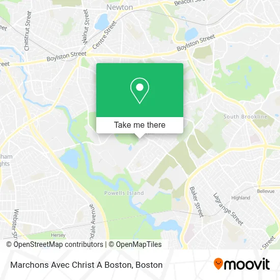
See Marchons Avec Christ A Boston, Newton, on the map
Public Transit to Marchons Avec Christ A Boston in Newton
Wondering how to get to Marchons Avec Christ A Boston in Newton? Moovit helps you find the best way to get to Marchons Avec Christ A Boston with step-by-step directions from the nearest public transit station.
Moovit provides free maps and live directions to help you navigate through your city. View schedules, routes, timetables, and find out how long does it take to get to Marchons Avec Christ A Boston in real time.
Looking for the nearest stop or station to Marchons Avec Christ A Boston? Check out this list of stops closest to your destination: Dedham St @ Wiswall Rd; West Roxbury; Newton Highlands.
Bus: 52.Train: NEEDHAM.Subway: GREEN LINE D.
Want to see if there’s another route that gets you there at an earlier time? Moovit helps you find alternative routes or times. Get directions from and directions to Marchons Avec Christ A Boston easily from the Moovit App or Website.
We make riding to Marchons Avec Christ A Boston easy, which is why over 1.7 million users, including users in Newton, trust Moovit as the best app for public transit. You don’t need to download an individual bus app or train app, Moovit is your all-in-one transit app that helps you find the best bus time or train time available.
For information on prices of bus, subway and train, costs and ride fares to Marchons Avec Christ A Boston, please check the Moovit app.
Use the app to navigate to popular places including to the airport, hospital, stadium, grocery store, mall, coffee shop, school, college, and university.
Marchons Avec Christ A Boston Address: 41 Carlson Ave street in Newton
- Mt Ida Dining,
- Athletic Center,
- RPM Athlete Performance,
- Joy of Flowers,
- Gershov Vladimi,
- Umass Dining,
- Lapides Tennis Academy,
- Newton Destination Imagination,
- Oak Hill Park, Massachusetts,
- Community Veterinary Clinic,
- Mount Ida College,
- Oak Hill (87m),
- University Of Massachusetts Amherst,
- Bank Of America Atm,
- Bank Of America Walk-Up Atm | Umass Mount Ida,
- Nonantum Hill,
- Sasco Industries,
- Boston Bolts,
- Baloka by Maria Mizrahi - Green Jewelry,
- Massachusetts Export Center
Places Near Marchons Avec Christ A Boston (Newton)
- Td Garden, Boston,
- Prudential Center, Boston,
- Boston Medical Center, Boston,
- Quincy Market, Boston,
- Boston Convention & Exhibition Center, Boston,
- Castle Island, Boston,
- Boston Children's Hospital, Boston,
- Faneuil Hall, Boston,
- Seaport District, Boston,
- Leader Bank Pavilion (Leader Bank Pavillion), Boston,
- North End, Boston,
- Mgm Music Hall, Boston,
- Cheers, Boston,
- Wang Theater, Boston,
- Isabella Stewart Gardner Museum, Boston,
- Boston Common, Boston,
- Wilbur Theatre, Boston,
- Massachusetts General Hospital, Boston,
- House Of Blues, Boston,
- Museum Of Science, Boston
How to get to popular places in Boston with public transit
Get around Newton by public transit!
Traveling around Newton has never been so easy. See step by step directions as you travel to any attraction, street or major public transit station. View bus and train schedules, arrival times, service alerts and detailed routes on a map, so you know exactly how to get to anywhere in Newton.
When traveling to any destination around Newton use Moovit's Live Directions with Get Off Notifications to know exactly where and how far to walk, how long to wait for your line, and how many stops are left. Moovit will alert you when it's time to get off — no need to constantly re-check whether yours is the next stop.
Wondering how to use public transit in Newton or how to pay for public transit in Newton? Moovit public transit app can help you navigate your way with public transit easily, and at minimum cost. It includes public transit fees, ticket prices, and costs. Looking for a map of Newton public transit lines? Moovit public transit app shows all public transit maps in Newton with all Bus, Train, Subway and Ferry routes and stops on an interactive map.
Boston has 4 transit type(s), including: Bus, Train, Subway and Ferry, operated by several transit agencies, including MBTA, Southeastern Regional Transit Authority, MetroWest Regional Transit Authority, Rhode Island Public Transit Authority, WRTA, Lowell Regional Transit Authority, Merrimack Valley Transit, Montachusett Regional Transit Authority, Cape Cod Regional Transit Authority, Brockton Area Transit Authority, Martha's Vineyard Transit Authority, the WAVE - Nantucket Regional Transit Authority, GATRA, Cape Ann Transportation Authority and Massport