How to get to Margolis Apartments by bus?
Click on the bus route to see step by step directions with maps, line arrival times and updated time schedules.
From City Hall To Go, Boston
41 minFrom Royal Sonesta, Cambridge
46 minFrom Boston City Hall, Boston
82 minFrom Hewlett Room 32-G882 (MIT Stata Center), Cambridge
65 minFrom Rosie's Place, Boston
57 minFrom Boston Children's Hospital, Boston
99 minFrom UMass Boston Campus Center, Boston
107 minFrom Uphams Corner, Boston
92 minFrom Harvard T.H. Chan School of Public Health, Boston
88 minFrom Newbury Comics, Boston
75 min
How to get to Margolis Apartments by train?
Click on the train route to see step by step directions with maps, line arrival times and updated time schedules.
How to get to Margolis Apartments by subway?
Click on the subway route to see step by step directions with maps, line arrival times and updated time schedules.
From City Hall To Go, Boston
82 minFrom Royal Sonesta, Cambridge
69 minFrom Boston City Hall, Boston
65 minFrom Hewlett Room 32-G882 (MIT Stata Center), Cambridge
69 minFrom Rosie's Place, Boston
69 minFrom Boston Children's Hospital, Boston
82 minFrom UMass Boston Campus Center, Boston
92 minFrom Uphams Corner, Boston
81 minFrom Harvard T.H. Chan School of Public Health, Boston
77 minFrom Newbury Comics, Boston
64 min
Bus stops near Margolis Apartments in Chelsea
Subway station near Margolis Apartments in Chelsea
- Beachmont, 14 min walk,VIEW
Train station near Margolis Apartments in Chelsea
- Chelsea, 25 min walk,VIEW
Bus lines to Margolis Apartments in Chelsea
What are the closest stations to Margolis Apartments?
The closest stations to Margolis Apartments are:
- Broadway @ Beach St is 238 yards away, 3 min walk.
- Beach St @ Wilson St is 306 yards away, 4 min walk.
- Sagamore Ave @ Garfield Ave is 770 yards away, 10 min walk.
- Hillside Ave @ Crest Ave is 853 yards away, 11 min walk.
- Beachmont is 1187 yards away, 14 min walk.
- Chelsea is 2099 yards away, 25 min walk.
Which bus lines stop near Margolis Apartments?
These bus lines stop near Margolis Apartments: 112, 116, SL3.
Which train line stops near Margolis Apartments?
NEWBURYPORT/ROCKPORT (#125 | Newburyport)
Which subway line stops near Margolis Apartments?
BLUE LINE (Wonderland)
What’s the nearest subway station to Margolis Apartments in Chelsea?
The nearest subway station to Margolis Apartments in Chelsea is Beachmont. It’s a 14 min walk away.
What’s the nearest train station to Margolis Apartments in Chelsea?
The nearest train station to Margolis Apartments in Chelsea is Chelsea. It’s a 25 min walk away.
What’s the nearest bus station to Margolis Apartments in Chelsea?
The nearest bus station to Margolis Apartments in Chelsea is Broadway @ Beach St. It’s a 3 min walk away.
What time is the first subway to Margolis Apartments in Chelsea?
The BLUE LINE is the first subway that goes to Margolis Apartments in Chelsea. It stops nearby at 5:08 AM.
What time is the last subway to Margolis Apartments in Chelsea?
The BLUE LINE is the last subway that goes to Margolis Apartments in Chelsea. It stops nearby at 2:06 AM.
What time is the first train to Margolis Apartments in Chelsea?
The NEWBURYPORT/ROCKPORT is the first train that goes to Margolis Apartments in Chelsea. It stops nearby at 5:40 AM.
What time is the last train to Margolis Apartments in Chelsea?
The NEWBURYPORT/ROCKPORT is the last train that goes to Margolis Apartments in Chelsea. It stops nearby at 12:06 AM.
What time is the first bus to Margolis Apartments in Chelsea?
The 116 is the first bus that goes to Margolis Apartments in Chelsea. It stops nearby at 4:29 AM.
What time is the last bus to Margolis Apartments in Chelsea?
The 111 is the last bus that goes to Margolis Apartments in Chelsea. It stops nearby at 2:34 AM.
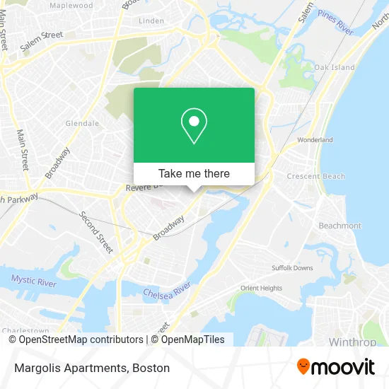
See Margolis Apartments, Chelsea, on the map
Public Transit to Margolis Apartments in Chelsea
Wondering how to get to Margolis Apartments in Chelsea? Moovit helps you find the best way to get to Margolis Apartments with step-by-step directions from the nearest public transit station.
Moovit provides free maps and live directions to help you navigate through your city. View schedules, routes, timetables, and find out how long does it take to get to Margolis Apartments in real time.
Looking for the nearest stop or station to Margolis Apartments? Check out this list of stops closest to your destination: Broadway @ Beach St; Beach St @ Wilson St; Sagamore Ave @ Garfield Ave; Hillside Ave @ Crest Ave; Beachmont; Chelsea.
Bus: 112, 116, SL3, 119, 111.Train: NEWBURYPORT/ROCKPORT.Subway: BLUE LINE.
Want to see if there’s another route that gets you there at an earlier time? Moovit helps you find alternative routes or times. Get directions from and directions to Margolis Apartments easily from the Moovit App or Website.
We make riding to Margolis Apartments easy, which is why over 1.7 million users, including users in Chelsea, trust Moovit as the best app for public transit. You don’t need to download an individual bus app or train app, Moovit is your all-in-one transit app that helps you find the best bus time or train time available.
For information on prices of bus, subway and train, costs and ride fares to Margolis Apartments, please check the Moovit app.
Use the app to navigate to popular places including to the airport, hospital, stadium, grocery store, mall, coffee shop, school, college, and university.
Margolis Apartments Address: 260 Clark Ave street in Chelsea
- Beth Israel Deaconess Medical Center (Narayanaswami Pushpa MD Beth Israel Deaconess Healthcare),
- Bispo Paulo Tenorio Ap Boston,
- Bidhc,
- Beth Israel Deaconess Urgent Care at Chelsea,
- WESTERN UNION,
- Holiday Inn Boston Logan Airport - Chelsea,
- Holiday Inn Boston Logan Airport - Chelsea,
- El Xielo,
- Santander,
- Parkway Plaza Shopping Center,
- P.F.C. Dennis J. Sullivan Bridge,
- Camilas Fashion,
- Family Dollar,
- Cabot St & Revere Beach Pkwy,
- Home Depot Chelsea,Ma,
- The Home Depot,
- Novelty Bias Binding,
- The Transit Museum,
- Chelsea MBTA commuter rail tracks,
- Studentsoftheabyss
Places Near Margolis Apartments (Chelsea)
- Leader Bank Pavilion (Leader Bank Pavillion), Boston,
- Seaport District, Boston,
- Boston Convention & Exhibition Center, Boston,
- Boston Common, Boston,
- Td Garden, Boston,
- Cheers, Boston,
- Quincy Market, Boston,
- North End, Boston,
- Faneuil Hall, Boston,
- Isabella Stewart Gardner Museum, Boston,
- Wang Theater, Boston,
- Museum Of Science, Boston,
- Mgm Music Hall, Boston,
- Boston Children's Hospital, Boston,
- Boston Medical Center, Boston,
- Castle Island, Boston,
- Prudential Center, Boston,
- Wilbur Theatre, Boston,
- Massachusetts General Hospital, Boston,
- House Of Blues, Boston
How to get to popular places in Boston with public transit
Get around Chelsea by public transit!
Traveling around Chelsea has never been so easy. See step by step directions as you travel to any attraction, street or major public transit station. View bus and train schedules, arrival times, service alerts and detailed routes on a map, so you know exactly how to get to anywhere in Chelsea.
When traveling to any destination around Chelsea use Moovit's Live Directions with Get Off Notifications to know exactly where and how far to walk, how long to wait for your line, and how many stops are left. Moovit will alert you when it's time to get off — no need to constantly re-check whether yours is the next stop.
Wondering how to use public transit in Chelsea or how to pay for public transit in Chelsea? Moovit public transit app can help you navigate your way with public transit easily, and at minimum cost. It includes public transit fees, ticket prices, and costs. Looking for a map of Chelsea public transit lines? Moovit public transit app shows all public transit maps in Chelsea with all Bus, Train, Subway and Ferry routes and stops on an interactive map.
Boston has 4 transit type(s), including: Bus, Train, Subway and Ferry, operated by several transit agencies, including MBTA, Southeastern Regional Transit Authority, MetroWest Regional Transit Authority, Rhode Island Public Transit Authority, WRTA, Lowell Regional Transit Authority, Merrimack Valley Transit, Montachusett Regional Transit Authority, Cape Cod Regional Transit Authority, Brockton Area Transit Authority, Martha's Vineyard Transit Authority, the WAVE - Nantucket Regional Transit Authority, GATRA, Cape Ann Transportation Authority and Massport