Directions to Marina del Rey station (Del Rey, La) with public transit
The following transit lines have routes that pass near Marina del Rey
How to get to Marina del Rey station by bus?
Click on the bus route to see step by step directions with maps, line arrival times and updated time schedules.
Bus stops near Marina del Rey in Del Rey, La
- Mindanao WB & Glencoe FS, 2 min walk,
- Mindanao / Glencoe, 2 min walk,
- Mindanao Way & Glencoe Ave (Southbound), 2 min walk,
- Mindanao Wy/Glencoe Ave, 3 min walk,
Bus lines to Marina del Rey station in Del Rey, La
- 16, Playa Del Rey,
- 108, Pico Rivera - Slauson / Passons,
- CE437A, Westbound,
- 7, Fisherman's Village,
What are the closest stations to Marina del Rey?
The closest stations to Marina del Rey are:
- Mindanao WB & Glencoe FS is 63 yards away, 2 min walk.
- Mindanao / Glencoe is 75 yards away, 2 min walk.
- Mindanao Way & Glencoe Ave (Southbound) is 127 yards away, 2 min walk.
- Mindanao Wy/Glencoe Ave is 162 yards away, 3 min walk.
Which bus lines stop near Marina del Rey?
These bus lines stop near Marina del Rey: 108, 16, 3, 7.
What’s the nearest bus station to Marina del Rey in Del Rey, La?
The nearest bus stations to Marina del Rey in Del Rey, La are Mindanao WB & Glencoe FS, Mindanao / Glencoe and Mindanao Way & Glencoe Ave (Southbound). The closest one is a 2 min walk away.
What time is the first bus to Marina del Rey in Del Rey, La?
The 108 is the first bus that goes to Marina del Rey in Del Rey, La. It stops nearby at 5:04 AM.
What time is the last bus to Marina del Rey in Del Rey, La?
The 108 is the last bus that goes to Marina del Rey in Del Rey, La. It stops nearby at 10:16 PM.
See Marina del Rey, Del Rey, La, on the map
Public Transit to Marina del Rey in Del Rey, La
Wondering how to get to Marina del Rey in Del Rey, La, United States? Moovit helps you find the best way to get to Marina del Rey with step-by-step directions from the nearest public transit station.
Moovit provides free maps and live directions to help you navigate through your city. View schedules, routes, timetables, and find out how long does it take to get to Marina del Rey in real time.
Looking for the nearest stop or station to Marina del Rey? Check out this list of stops closest to your destination: Mindanao WB & Glencoe FS; Mindanao / Glencoe; Mindanao Way & Glencoe Ave (Southbound); Mindanao Wy/Glencoe Ave.
Bus: 108, 16, 3, 7, CE437A.
Want to see if there’s another route that gets you there at an earlier time? Moovit helps you find alternative routes or times. Get directions from and directions to Marina del Rey easily from the Moovit App or Website.
We make riding to Marina del Rey easy, which is why over 1.5 million users, including users in Del Rey, La, trust Moovit as the best app for public transit. You don’t need to download an individual bus app or train app, Moovit is your all-in-one transit app that helps you find the best bus time or train time available.
For information on prices of bus, costs and ride fares to Marina del Rey, please check the Moovit app.
Get to Marina del Rey with public transit and pay for the ride in the Moovit app. In addition to all info you may need for your trip to Marina del Rey, including live directions, real-time arrivals and fare prices, you can also buy public transit passes for your rides. No need for cash or paper tickets to get to Marina del Rey - everything you need is accessible in the app with a click of the button.
Use the app to navigate to popular places including to the airport, hospital, stadium, grocery store, mall, coffee shop, school, college, and university.
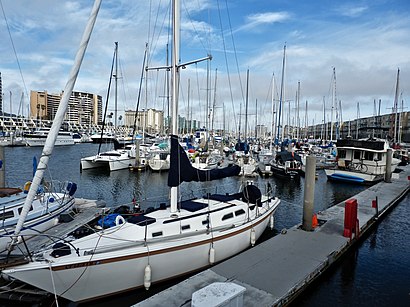
Marina del Rey Address: 13160 Mindanao Way Marina del Rey, CA 90292 street in Del Rey, La
Places Near Marina del Rey (Del Rey, La)
How to get to popular places in Los Angeles with public transit
Get around Del Rey, La by public transit!
Traveling around Del Rey, La has never been so easy. See step by step directions as you travel to any attraction, street or major public transit station. View bus and train schedules, arrival times, service alerts and detailed routes on a map, so you know exactly how to get to anywhere in Del Rey, La.
When traveling to any destination around Del Rey, La use Moovit's Live Directions with Get Off Notifications to know exactly where and how far to walk, how long to wait for your line, and how many stops are left. Moovit will alert you when it's time to get off — no need to constantly re-check whether yours is the next stop.
Wondering how to use public transit in Del Rey, La or how to pay for public transit in Del Rey, La? Moovit public transit app can help you navigate your way with public transit easily, and at minimum cost. It includes public transit fees, ticket prices, and costs. Looking for a map of Del Rey, La public transit lines? Moovit public transit app shows all public transit maps in Del Rey, La with all Bus, Train, Subway, Light Rail, Ferry and Funicular routes and stops on an interactive map.
Los Angeles has 6 transit type(s), including: Bus, Train, Subway, Light Rail, Ferry and Funicular, operated by several transit agencies, including METRO, OCTA, Metrolink Trains, Big Blue Bus, LAX FlyAway, PVPTA, Burbank Bus, Laguna Beach Transit, Thousand Oaks Transit, Amtrak, OMNITRANS, Foothill Transit, Culver City Bus, Glendale Beeline and Long Beach Transit