Directions to Mario's Shoe Service (Boston) with public transportation
The following transit lines have routes that pass near Mario's Shoe Service
 Bus: P20, R10.
- Train: LAKE SHORE LIMITED, VERMONTER, AMTRAK HARTFORD LINE, NORTHEAST REGIONAL, VALLEY FLYER.
How to get to Mario's Shoe Service by bus?
Click on the bus route to see step by step directions with maps, line arrival times and updated time schedules.
From Palladium, Worcester
103 minFrom Registry Of Motor Vehicles (Rmv) Branch Office, Worcester
102 minFrom Worcester, MA, Worcester
98 minFrom Polar Park, Worcester
100 minFrom Foxwoods, Worcester
128 minFrom Walmart Supercenter, Worcester
157 minFrom South High Community School, Worcester
195 minFrom Dcu Center, Worcester
100 min
How to get to Mario's Shoe Service by train?
Click on the train route to see step by step directions with maps, line arrival times and updated time schedules.
Bus stops near Mario's Shoe Service in Boston
Train station near Mario's Shoe Service in Boston
- Springfield, 30 min walk,VIEW
Bus lines to Mario's Shoe Service in Boston
What are the closest stations to Mario's Shoe Service?
The closest stations to Mario's Shoe Service are:
- 201 Westfield St is 10 yards away, 1 min walk.
- Elm / Westfield is 407 yards away, 5 min walk.
- Springfield is 2468 yards away, 30 min walk.
Which bus lines stop near Mario's Shoe Service?
These bus lines stop near Mario's Shoe Service: P20, R10.
Which train lines stop near Mario's Shoe Service?
These train lines stop near Mario's Shoe Service: LAKE SHORE LIMITED, VERMONTER.
What’s the nearest train station to Mario's Shoe Service in Boston?
The nearest train station to Mario's Shoe Service in Boston is Springfield. It’s a 30 min walk away.
What’s the nearest bus station to Mario's Shoe Service in Boston?
The nearest bus station to Mario's Shoe Service in Boston is 201 Westfield St. It’s a 1 min walk away.
What time is the first train to Mario's Shoe Service in Boston?
The NORTHEAST REGIONAL is the first train that goes to Mario's Shoe Service in Boston. It stops nearby at 4:10 AM.
What time is the last train to Mario's Shoe Service in Boston?
The LAKE SHORE LIMITED is the last train that goes to Mario's Shoe Service in Boston. It stops nearby at 6:04 PM.
What time is the first bus to Mario's Shoe Service in Boston?
The R10 is the first bus that goes to Mario's Shoe Service in Boston. It stops nearby at 5:06 AM.
What time is the last bus to Mario's Shoe Service in Boston?
The R10 is the last bus that goes to Mario's Shoe Service in Boston. It stops nearby at 11:15 PM.
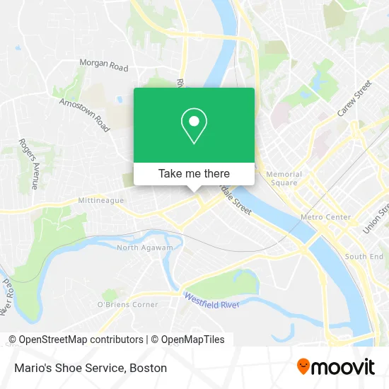
See Mario's Shoe Service, Boston, on the map
Public Transit to Mario's Shoe Service in Boston
Wondering how to get to Mario's Shoe Service in Boston? Moovit helps you find the best way to get to Mario's Shoe Service with step-by-step directions from the nearest public transit station.
Moovit provides free maps and live directions to help you navigate through your city. View schedules, routes, timetables, and find out how long does it take to get to Mario's Shoe Service in real time.
Looking for the nearest stop or station to Mario's Shoe Service? Check out this list of stops closest to your destination: 201 Westfield St; Elm / Westfield; Springfield.
Bus: P20, R10.Train: LAKE SHORE LIMITED, VERMONTER, AMTRAK HARTFORD LINE, NORTHEAST REGIONAL, VALLEY FLYER.
Want to see if there’s another route that gets you there at an earlier time? Moovit helps you find alternative routes or times. Get directions from and directions to Mario's Shoe Service easily from the Moovit App or Website.
We make riding to Mario's Shoe Service easy, which is why over 1.7 million users, including users in Boston, trust Moovit as the best app for public transit. You don’t need to download an individual bus app or train app, Moovit is your all-in-one transit app that helps you find the best bus time or train time available.
For information on prices of bus and train, costs and ride fares to Mario's Shoe Service, please check the Moovit app.
Use the app to navigate to popular places including to the airport, hospital, stadium, grocery store, mall, coffee shop, school, college, and university.
Mario's Shoe Service Address: 211 Elm St street in Boston
- Mario's Clock Repair,
- Mommy and Me Consignment Boutique,
- Business,
- S.T.A.R. Dance Studio,
- Stirlacci Frank,
- Iglesias Cristianas Rey de Mi Vida,
- Instinkt Tattoo Shop,
- Haircutects,
- Cvs,
- Stella's Bones Pet Sitting & Dog Walking,
- United Financial Bancorp,
- Cathy Devinelooks - Workstation for Hair,
- Thathairpainter,
- Centerwell Home Health,
- Giovanni's Pizza,
- Run Ze Acupressure & Reflexology,
- Fullam & Fullam Realty,
- Wendell G Haire Piano Services,
- West Springfield Care Coalition,
- Pioneer Valley Planning Commission
Places Near Mario's Shoe Service (Boston)
- Wang Theater, Boston,
- Massachusetts General Hospital, Boston,
- Cheers, Boston,
- Td Garden, Boston,
- Boston Medical Center, Boston,
- Quincy Market, Boston,
- North End, Boston,
- Seaport District, Boston,
- Faneuil Hall, Boston,
- Isabella Stewart Gardner Museum, Boston,
- Boston Convention & Exhibition Center, Boston,
- Museum Of Science, Boston,
- Boston Common, Boston,
- Leader Bank Pavilion (Leader Bank Pavillion), Boston,
- Wilbur Theatre, Boston,
- Mgm Music Hall, Boston,
- Prudential Center, Boston,
- Castle Island, Boston,
- House Of Blues, Boston,
- Boston Children's Hospital, Boston
How to get to popular places in Boston with public transit
Get around Boston by public transit!
Traveling around Boston has never been so easy. See step by step directions as you travel to any attraction, street or major public transit station. View bus and train schedules, arrival times, service alerts and detailed routes on a map, so you know exactly how to get to anywhere in Boston.
When traveling to any destination around Boston use Moovit's Live Directions with Get Off Notifications to know exactly where and how far to walk, how long to wait for your line, and how many stops are left. Moovit will alert you when it's time to get off — no need to constantly re-check whether yours is the next stop.
Wondering how to use public transit in Boston or how to pay for public transit in Boston? Moovit public transit app can help you navigate your way with public transit easily, and at minimum cost. It includes public transit fees, ticket prices, and costs. Looking for a map of Boston public transit lines? Moovit public transit app shows all public transit maps in Boston with all Bus, Train, Subway and Ferry routes and stops on an interactive map.
Boston has 4 transit type(s), including: Bus, Train, Subway and Ferry, operated by several transit agencies, including MBTA, Southeastern Regional Transit Authority, MetroWest Regional Transit Authority, Rhode Island Public Transit Authority, WRTA, Lowell Regional Transit Authority, Merrimack Valley Transit, Montachusett Regional Transit Authority, Cape Cod Regional Transit Authority, Brockton Area Transit Authority, Martha's Vineyard Transit Authority, the WAVE - Nantucket Regional Transit Authority, GATRA, Cape Ann Transportation Authority and Massport