Directions to Mark Daniel Fleming, Md, Fphil (Boston) with public transportation
The following transit lines have routes that pass near Mark Daniel Fleming, Md, Fphil
 Bus: 39, 47, 85, BB, 28.
- Train: FRAMINGHAM/WORCESTER.
- Subway: GREEN LINE E, ORANGE LINE, GREEN LINE D.
How to get to Mark Daniel Fleming, Md, Fphil by bus?
Click on the bus route to see step by step directions with maps, line arrival times and updated time schedules.
From Melrose Wakefield Hospital, Malden
108 minFrom Malden Catholic High School, Malden
85 minFrom Fort Independence, Boston
67 minFrom Highland Ave Somerville MA, Somerville
59 minFrom Wegmans, Medford
88 minFrom Qea, Quincy
99 minFrom Revere, MA, Revere
94 minFrom Piers Park, Boston
51 minFrom Hilton Boston Logan Airport, Boston
27 minFrom Winthrop, Winthrop Town
116 min
How to get to Mark Daniel Fleming, Md, Fphil by subway?
Click on the subway route to see step by step directions with maps, line arrival times and updated time schedules.
Bus stops near Mark Daniel Fleming, Md, Fphil in Boston
Subway stations near Mark Daniel Fleming, Md, Fphil in Boston
Train station near Mark Daniel Fleming, Md, Fphil in Boston
- Lansdowne, 13 min walk,VIEW
Bus lines to Mark Daniel Fleming, Md, Fphil in Boston
- 28, Ruggles - Mattapan,VIEW
- 39, Back Bay - Forest Hills,VIEW
- 85, Ruggles - Assembly,VIEW
- GREEN LINE E SHUTTLE, Heath Street - Park Street,VIEW
- GREEN LINE E SHUTTLE, Heath Street - Prudential,VIEW
- 9, Kenmore Via Boston Latin,VIEW
- 8, Kenmore via South Bay Center - Harbor Point via South Bay Center,VIEW
- 19, Kenmore - Fields Corner,VIEW
- 60, Kenmore - Chestnut Hill Mall,VIEW
- 65, Kenmore - Brighton Center,VIEW
- 55, West Fenway,VIEW
- 22, Ashmont,VIEW
- 47, Broadway,VIEW
- 57, Watertown Yard,VIEW
What are the closest stations to Mark Daniel Fleming, Md, Fphil?
The closest stations to Mark Daniel Fleming, Md, Fphil are:
- Huntington Ave @ Louis Prang St is 311 yards away, 4 min walk.
- Huntington Ave @ Forsyth Way is 374 yards away, 5 min walk.
- Brookline Ave @ Boylston St is 384 yards away, 5 min walk.
- Ipswich St @ Boylston St is 416 yards away, 5 min walk.
- Ave Louis Pasteur @ the Fenway is 525 yards away, 7 min walk.
- Northeastern University is 851 yards away, 11 min walk.
- Lansdowne is 1049 yards away, 13 min walk.
- Fenway is 1214 yards away, 15 min walk.
Which bus lines stop near Mark Daniel Fleming, Md, Fphil?
These bus lines stop near Mark Daniel Fleming, Md, Fphil: 39, 47, 85, BB.
Which subway lines stop near Mark Daniel Fleming, Md, Fphil?
These subway lines stop near Mark Daniel Fleming, Md, Fphil: GREEN LINE E, ORANGE LINE.
What’s the nearest subway station to Mark Daniel Fleming, Md, Fphil in Boston?
The nearest subway station to Mark Daniel Fleming, Md, Fphil in Boston is Northeastern University. It’s a 11 min walk away.
What’s the nearest train station to Mark Daniel Fleming, Md, Fphil in Boston?
The nearest train station to Mark Daniel Fleming, Md, Fphil in Boston is Lansdowne. It’s a 13 min walk away.
What’s the nearest bus station to Mark Daniel Fleming, Md, Fphil in Boston?
The nearest bus station to Mark Daniel Fleming, Md, Fphil in Boston is Huntington Ave @ Louis Prang St. It’s a 4 min walk away.
What time is the first subway to Mark Daniel Fleming, Md, Fphil in Boston?
The GREEN LINE D is the first subway that goes to Mark Daniel Fleming, Md, Fphil in Boston. It stops nearby at 4:56 AM.
What time is the last subway to Mark Daniel Fleming, Md, Fphil in Boston?
The GREEN LINE D is the last subway that goes to Mark Daniel Fleming, Md, Fphil in Boston. It stops nearby at 2:21 AM.
What time is the first train to Mark Daniel Fleming, Md, Fphil in Boston?
The FRAMINGHAM/WORCESTER is the first train that goes to Mark Daniel Fleming, Md, Fphil in Boston. It stops nearby at 4:55 AM.
What time is the last train to Mark Daniel Fleming, Md, Fphil in Boston?
The FRAMINGHAM/WORCESTER is the last train that goes to Mark Daniel Fleming, Md, Fphil in Boston. It stops nearby at 12:06 AM.
What time is the first bus to Mark Daniel Fleming, Md, Fphil in Boston?
The 60 is the first bus that goes to Mark Daniel Fleming, Md, Fphil in Boston. It stops nearby at 5:22 AM.
What time is the last bus to Mark Daniel Fleming, Md, Fphil in Boston?
The 39 is the last bus that goes to Mark Daniel Fleming, Md, Fphil in Boston. It stops nearby at 1:18 AM.
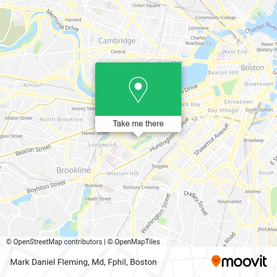
See Mark Daniel Fleming, Md, Fphil, Boston, on the map
Public Transit to Mark Daniel Fleming, Md, Fphil in Boston
Wondering how to get to Mark Daniel Fleming, Md, Fphil in Boston? Moovit helps you find the best way to get to Mark Daniel Fleming, Md, Fphil with step-by-step directions from the nearest public transit station.
Moovit provides free maps and live directions to help you navigate through your city. View schedules, routes, timetables, and find out how long does it take to get to Mark Daniel Fleming, Md, Fphil in real time.
Looking for the nearest stop or station to Mark Daniel Fleming, Md, Fphil? Check out this list of stops closest to your destination: Huntington Ave @ Louis Prang St; Huntington Ave @ Forsyth Way; Brookline Ave @ Boylston St; Ipswich St @ Boylston St; Ave Louis Pasteur @ the Fenway; Northeastern University; Lansdowne; Fenway.
Bus: 39, 47, 85, BB, 28, GREEN LINE E SHUTTLE, GREEN LINE E SHUTTLE, 9, 8, 19, 60, 65.Train: FRAMINGHAM/WORCESTER.Subway: GREEN LINE E, ORANGE LINE, GREEN LINE D.
Want to see if there’s another route that gets you there at an earlier time? Moovit helps you find alternative routes or times. Get directions from and directions to Mark Daniel Fleming, Md, Fphil easily from the Moovit App or Website.
We make riding to Mark Daniel Fleming, Md, Fphil easy, which is why over 1.7 million users, including users in Boston, trust Moovit as the best app for public transit. You don’t need to download an individual bus app or train app, Moovit is your all-in-one transit app that helps you find the best bus time or train time available.
For information on prices of bus and subway, costs and ride fares to Mark Daniel Fleming, Md, Fphil, please check the Moovit app.
Use the app to navigate to popular places including to the airport, hospital, stadium, grocery store, mall, coffee shop, school, college, and university.
Mark Daniel Fleming, Md, Fphil Address: 300 Longwood Avenue, Bader, 1st Floor, Pathology BCH 3027 street in Boston
- Clemente Field,
- Queensbury Street Cond,
- Church of the Cross,
- Boston Temple,
- James P. Kelleher Rose Garden,
- Chfeur - Chauffeur Service,
- The Viridian Garage,
- 1282 Boylston برج العرب,
- Fenway Health Behavioral Health,
- Bluebikes,
- The Baseball Tavern,
- (DC Morgue) Office of The Chief Medical Examiner,
- Back Bay Fens,
- Cava,
- Sojuba,
- Carbon Health Urgent Care Boston - Fenway,
- Shattuck International House,
- Siena at Ink Block,
- The Verb Hotel,
- Harvard M2 Shuttle
Places Near Mark Daniel Fleming, Md, Fphil (Boston)
- North End, Boston,
- Boston Children's Hospital, Boston,
- Cheers, Boston,
- Leader Bank Pavilion (Leader Bank Pavillion), Boston,
- Wang Theater, Boston,
- Prudential Center, Boston,
- Wilbur Theatre, Boston,
- Td Garden, Boston,
- House Of Blues, Boston,
- Boston Medical Center, Boston,
- Boston Convention & Exhibition Center, Boston,
- Mgm Music Hall, Boston,
- Faneuil Hall, Boston,
- Massachusetts General Hospital, Boston,
- Seaport District, Boston,
- Quincy Market, Boston,
- Museum Of Science, Boston,
- Castle Island, Boston,
- Boston Common, Boston,
- Isabella Stewart Gardner Museum, Boston
How to get to popular places in Boston with public transit
Get around Boston by public transit!
Traveling around Boston has never been so easy. See step by step directions as you travel to any attraction, street or major public transit station. View bus and train schedules, arrival times, service alerts and detailed routes on a map, so you know exactly how to get to anywhere in Boston.
When traveling to any destination around Boston use Moovit's Live Directions with Get Off Notifications to know exactly where and how far to walk, how long to wait for your line, and how many stops are left. Moovit will alert you when it's time to get off — no need to constantly re-check whether yours is the next stop.
Wondering how to use public transit in Boston or how to pay for public transit in Boston? Moovit public transit app can help you navigate your way with public transit easily, and at minimum cost. It includes public transit fees, ticket prices, and costs. Looking for a map of Boston public transit lines? Moovit public transit app shows all public transit maps in Boston with all Bus, Train, Subway and Ferry routes and stops on an interactive map.
Boston has 4 transit type(s), including: Bus, Train, Subway and Ferry, operated by several transit agencies, including MBTA, Southeastern Regional Transit Authority, MetroWest Regional Transit Authority, Rhode Island Public Transit Authority, WRTA, Lowell Regional Transit Authority, Merrimack Valley Transit, Montachusett Regional Transit Authority, Cape Cod Regional Transit Authority, Brockton Area Transit Authority, Martha's Vineyard Transit Authority, the WAVE - Nantucket Regional Transit Authority, GATRA, Cape Ann Transportation Authority and Massport