Directions to Market Basket #32 (Chelsea) with public transportation
The following transit lines have routes that pass near Market Basket #32
 Bus: 104, 112, SL3, 114, LOWER MYSTIC LINK.
- Train: NEWBURYPORT/ROCKPORT.
- Subway: BLUE LINE.
How to get to Market Basket #32 by bus?
Click on the bus route to see step by step directions with maps, line arrival times and updated time schedules.
From Andrew Square, Boston
66 minFrom GE Aviation, Lynn
45 minFrom Watertown Mall, Watertown Town
81 minFrom Boston Children's Hospital, Boston
71 minFrom Arsenal Yards, Watertown Town
85 minFrom Samuel Adams Brewery, Boston
88 minFrom Tufts Dental School, Boston
45 minFrom Arsenal Mall, Watertown Town
85 minFrom Sam Adams Boston Brewery Tour, Boston
88 minFrom Beth Israel Deaconess Medical Center, Brookline
101 min
How to get to Market Basket #32 by train?
Click on the train route to see step by step directions with maps, line arrival times and updated time schedules.
How to get to Market Basket #32 by subway?
Click on the subway route to see step by step directions with maps, line arrival times and updated time schedules.
Bus stops near Market Basket #32 in Chelsea
Subway station near Market Basket #32 in Chelsea
- Wood Island, 31 min walk,VIEW
Train station near Market Basket #32 in Chelsea
- Chelsea, 56 min walk,VIEW
Bus lines to Market Basket #32 in Chelsea
What are the closest stations to Market Basket #32?
The closest stations to Market Basket #32 are:
- Commandants Way @ Williams St is 22 yards away, 1 min walk.
- Spruce St @ Everett Ave is 304 yards away, 4 min walk.
- Chelsea is 728 yards away, 10 min walk.
- Market Basket/Chelsea Station is 818 yards away, 10 min walk.
- Wood Island is 2592 yards away, 31 min walk.
Which bus lines stop near Market Basket #32?
These bus lines stop near Market Basket #32: 104, 112, SL3.
Which train line stops near Market Basket #32?
NEWBURYPORT/ROCKPORT (#18 | North Station)
Which subway line stops near Market Basket #32?
BLUE LINE (Wonderland)
What’s the nearest bus station to Market Basket #32 in Chelsea?
The nearest bus station to Market Basket #32 in Chelsea is Commandants Way @ Williams St. It’s a 1 min walk away.
What time is the first subway to Market Basket #32 in Chelsea?
The BLUE LINE is the first subway that goes to Market Basket #32 in Chelsea. It stops nearby at 5:10 AM.
What time is the last subway to Market Basket #32 in Chelsea?
The BLUE LINE is the last subway that goes to Market Basket #32 in Chelsea. It stops nearby at 2:01 AM.
What time is the first train to Market Basket #32 in Chelsea?
The NEWBURYPORT/ROCKPORT is the first train that goes to Market Basket #32 in Chelsea. It stops nearby at 5:40 AM.
What time is the last train to Market Basket #32 in Chelsea?
The NEWBURYPORT/ROCKPORT is the last train that goes to Market Basket #32 in Chelsea. It stops nearby at 12:06 AM.
What time is the first bus to Market Basket #32 in Chelsea?
The 104 is the first bus that goes to Market Basket #32 in Chelsea. It stops nearby at 4:35 AM.
What time is the last bus to Market Basket #32 in Chelsea?
The 104 is the last bus that goes to Market Basket #32 in Chelsea. It stops nearby at 1:24 AM.
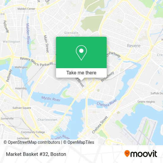
See Market Basket #32, Chelsea, on the map
Public Transit to Market Basket #32 in Chelsea
Wondering how to get to Market Basket #32 in Chelsea? Moovit helps you find the best way to get to Market Basket #32 with step-by-step directions from the nearest public transit station.
Moovit provides free maps and live directions to help you navigate through your city. View schedules, routes, timetables, and find out how long does it take to get to Market Basket #32 in real time.
Looking for the nearest stop or station to Market Basket #32? Check out this list of stops closest to your destination: Commandants Way @ Williams St; Spruce St @ Everett Ave; Chelsea; Market Basket/Chelsea Station; Wood Island.
Bus: 104, 112, SL3, 114, LOWER MYSTIC LINK.Train: NEWBURYPORT/ROCKPORT.Subway: BLUE LINE.
Want to see if there’s another route that gets you there at an earlier time? Moovit helps you find alternative routes or times. Get directions from and directions to Market Basket #32 easily from the Moovit App or Website.
We make riding to Market Basket #32 easy, which is why over 1.7 million users, including users in Chelsea, trust Moovit as the best app for public transit. You don’t need to download an individual bus app or train app, Moovit is your all-in-one transit app that helps you find the best bus time or train time available.
For information on prices of bus, subway and train, costs and ride fares to Market Basket #32, please check the Moovit app.
Use the app to navigate to popular places including to the airport, hospital, stadium, grocery store, mall, coffee shop, school, college, and university.
Location: Chelsea, Boston
- redbox,
- Excellence's Beauty Salon,
- GNC,
- Masshealth Enrollment Centers,
- TSR,
- Principle Broadcast Network,
- Wesx,
- Consulate of Honduras,
- Real Media Group,
- Team Rehab and Wellness Center,
- Auto Accident Chiropractic Treatment,
- Greyhound Bus,
- Spinal Rehab Group - Chelsea,
- Nurtury Family Child Care Administrative Office,
- Hampton Inn Boston Logan Airport Chelsea,
- Mystic Mall,
- HomeGoods (Home Goods),
- Drain Cleaning Plumbing,
- DTZ,
- Gordon, Michelle D
Places Near Market Basket #32 (Chelsea)
- Boston Children's Hospital, Boston,
- Td Garden, Boston,
- Wilbur Theatre, Boston,
- Massachusetts General Hospital, Boston,
- Castle Island, Boston,
- Leader Bank Pavilion (Leader Bank Pavillion), Boston,
- House Of Blues, Boston,
- Seaport District, Boston,
- Museum Of Science, Boston,
- Mgm Music Hall, Boston,
- Wang Theater, Boston,
- Faneuil Hall, Boston,
- Boston Convention & Exhibition Center, Boston,
- North End, Boston,
- Quincy Market, Boston,
- Boston Medical Center, Boston,
- Cheers, Boston,
- Boston Common, Boston,
- Isabella Stewart Gardner Museum, Boston,
- Prudential Center, Boston
How to get to popular places in Boston with public transit
Get around Chelsea by public transit!
Traveling around Chelsea has never been so easy. See step by step directions as you travel to any attraction, street or major public transit station. View bus and train schedules, arrival times, service alerts and detailed routes on a map, so you know exactly how to get to anywhere in Chelsea.
When traveling to any destination around Chelsea use Moovit's Live Directions with Get Off Notifications to know exactly where and how far to walk, how long to wait for your line, and how many stops are left. Moovit will alert you when it's time to get off — no need to constantly re-check whether yours is the next stop.
Wondering how to use public transit in Chelsea or how to pay for public transit in Chelsea? Moovit public transit app can help you navigate your way with public transit easily, and at minimum cost. It includes public transit fees, ticket prices, and costs. Looking for a map of Chelsea public transit lines? Moovit public transit app shows all public transit maps in Chelsea with all Bus, Train, Subway and Ferry routes and stops on an interactive map.
Boston has 4 transit type(s), including: Bus, Train, Subway and Ferry, operated by several transit agencies, including MBTA, Southeastern Regional Transit Authority, MetroWest Regional Transit Authority, Rhode Island Public Transit Authority, WRTA, Lowell Regional Transit Authority, Merrimack Valley Transit, Montachusett Regional Transit Authority, Cape Cod Regional Transit Authority, Brockton Area Transit Authority, Martha's Vineyard Transit Authority, the WAVE - Nantucket Regional Transit Authority, GATRA, Cape Ann Transportation Authority and Massport