Directions to Mass Save (Boston) with public transportation
The following transit lines have routes that pass near Mass Save
 Bus: 24, 33, 716.
- Train: FAIRMOUNT, PROVIDENCE/STOUGHTON, FRANKLIN/FOXBORO, FAIRMOUNT LINE SHUTTLE.
- Subway: MATTAPAN LINE.
How to get to Mass Save by bus?
Click on the bus route to see step by step directions with maps, line arrival times and updated time schedules.
From MBTA Jackson Square Station, Boston
37 minFrom Courtyard Tea Room (The Courtyard Restaurant), Boston
66 minFrom The Friendly Toast, Boston
69 minFrom Brigham and Women's Hospital, Boston
62 minFrom John F. Kennedy Presidential Library And Museum, Boston
72 minFrom The Lenox Hotel, Boston
67 minFrom Fogo De Chão, Boston
65 minFrom Jamaica Plain, Boston
49 minFrom Four Seasons Hotel One Dalton, Boston
63 minFrom The Lenox Hotel - Boston, Boston
67 min
How to get to Mass Save by train?
Click on the train route to see step by step directions with maps, line arrival times and updated time schedules.
From MBTA Jackson Square Station, Boston
91 minFrom Courtyard Tea Room (The Courtyard Restaurant), Boston
57 minFrom The Friendly Toast, Boston
54 minFrom Brigham and Women's Hospital, Boston
83 minFrom John F. Kennedy Presidential Library And Museum, Boston
82 minFrom The Lenox Hotel, Boston
58 minFrom Fogo De Chão, Boston
55 minFrom Jamaica Plain, Boston
126 minFrom Four Seasons Hotel One Dalton, Boston
63 minFrom The Lenox Hotel - Boston, Boston
58 min
How to get to Mass Save by subway?
Click on the subway route to see step by step directions with maps, line arrival times and updated time schedules.
From MBTA Jackson Square Station, Boston
71 minFrom Courtyard Tea Room (The Courtyard Restaurant), Boston
70 minFrom The Friendly Toast, Boston
66 minFrom Brigham and Women's Hospital, Boston
81 minFrom John F. Kennedy Presidential Library And Museum, Boston
71 minFrom The Lenox Hotel, Boston
70 minFrom Fogo De Chão, Boston
70 minFrom Jamaica Plain, Boston
79 minFrom Four Seasons Hotel One Dalton, Boston
79 minFrom The Lenox Hotel - Boston, Boston
70 min
Subway station near Mass Save in Boston
- Mattapan, 1 min walk,VIEW
Bus stops near Mass Save in Boston
Train stations near Mass Save in Boston
Bus lines to Mass Save in Boston
What are the closest stations to Mass Save?
The closest stations to Mass Save are:
- Mattapan is 14 yards away, 1 min walk.
- River St @ Wachusett St is 182 yards away, 3 min walk.
- Blue Hill Ave From Brush Hill Rd To Oak St is 562 yards away, 7 min walk.
- Blue Hill Avenue is 909 yards away, 11 min walk.
- Fairmount is 3916 yards away, 46 min walk.
Which bus lines stop near Mass Save?
These bus lines stop near Mass Save: 24, 33.
Which train lines stop near Mass Save?
These train lines stop near Mass Save: FAIRMOUNT, PROVIDENCE/STOUGHTON.
Which subway line stops near Mass Save?
MATTAPAN LINE (Mattapan)
What’s the nearest subway station to Mass Save in Boston?
The nearest subway station to Mass Save in Boston is Mattapan. It’s a 1 min walk away.
What’s the nearest train station to Mass Save in Boston?
The nearest train station to Mass Save in Boston is Blue Hill Avenue. It’s a 11 min walk away.
What’s the nearest bus station to Mass Save in Boston?
The nearest bus station to Mass Save in Boston is River St @ Wachusett St. It’s a 3 min walk away.
What time is the first subway to Mass Save in Boston?
The MATTAPAN LINE is the first subway that goes to Mass Save in Boston. It stops nearby at 5:00 AM.
What time is the last subway to Mass Save in Boston?
The MATTAPAN LINE is the last subway that goes to Mass Save in Boston. It stops nearby at 2:40 AM.
What time is the first train to Mass Save in Boston?
The FAIRMOUNT is the first train that goes to Mass Save in Boston. It stops nearby at 4:33 AM.
What time is the last train to Mass Save in Boston?
The PROVIDENCE/STOUGHTON is the last train that goes to Mass Save in Boston. It stops nearby at 12:22 AM.
What time is the first bus to Mass Save in Boston?
The 24 is the first bus that goes to Mass Save in Boston. It stops nearby at 5:10 AM.
What time is the last bus to Mass Save in Boston?
The 24 is the last bus that goes to Mass Save in Boston. It stops nearby at 1:17 AM.
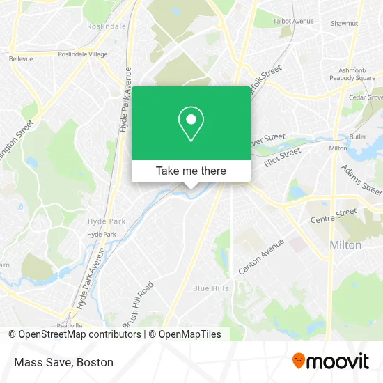
See Mass Save, Boston, on the map
Public Transit to Mass Save in Boston
Wondering how to get to Mass Save in Boston? Moovit helps you find the best way to get to Mass Save with step-by-step directions from the nearest public transit station.
Moovit provides free maps and live directions to help you navigate through your city. View schedules, routes, timetables, and find out how long does it take to get to Mass Save in real time.
Looking for the nearest stop or station to Mass Save? Check out this list of stops closest to your destination: Mattapan; River St @ Wachusett St; Blue Hill Ave From Brush Hill Rd To Oak St; Blue Hill Avenue; Fairmount.
Bus: 24, 33, 716.Train: FAIRMOUNT, PROVIDENCE/STOUGHTON, FRANKLIN/FOXBORO, FAIRMOUNT LINE SHUTTLE.Subway: MATTAPAN LINE.
Want to see if there’s another route that gets you there at an earlier time? Moovit helps you find alternative routes or times. Get directions from and directions to Mass Save easily from the Moovit App or Website.
We make riding to Mass Save easy, which is why over 1.7 million users, including users in Boston, trust Moovit as the best app for public transit. You don’t need to download an individual bus app or train app, Moovit is your all-in-one transit app that helps you find the best bus time or train time available.
For information on prices of bus, subway and train, costs and ride fares to Mass Save, please check the Moovit app.
Use the app to navigate to popular places including to the airport, hospital, stadium, grocery store, mall, coffee shop, school, college, and university.
Location: Boston
- Juliette's Alterations,
- USPS Collection Box - Blue Box,
- Trinistylin,
- Conscientious Auto Glass,
- Daniel Alleyne School of New Beginnings,
- El Rubio General Mechanic,
- Duran Auto Sales,
- Queen of Nails,
- Queen Of Hair Center,
- Price Rite,
- Ecoatm,
- KeyMe,
- Quality Deluxe Construction,
- Burger King,
- Bmc Physical And Occupational Therapy - Hyde Park,
- Litlifeent,
- Price Rite Marketplace,
- Edith Digital Marketing,
- Boston - Hyde Park,
- Metamorphosis Home Care
Places Near Mass Save (Boston)
- Prudential Center, Boston,
- Castle Island, Boston,
- North End, Boston,
- Seaport District, Boston,
- House Of Blues, Boston,
- Boston Convention & Exhibition Center, Boston,
- Quincy Market, Boston,
- Td Garden, Boston,
- Faneuil Hall, Boston,
- Boston Medical Center, Boston,
- Mgm Music Hall, Boston,
- Museum Of Science, Boston,
- Cheers, Boston,
- Leader Bank Pavilion (Leader Bank Pavillion), Boston,
- Wang Theater, Boston,
- Massachusetts General Hospital, Boston,
- Wilbur Theatre, Boston,
- Boston Children's Hospital, Boston,
- Boston Common, Boston,
- Isabella Stewart Gardner Museum, Boston
How to get to popular places in Boston with public transit
Get around Boston by public transit!
Traveling around Boston has never been so easy. See step by step directions as you travel to any attraction, street or major public transit station. View bus and train schedules, arrival times, service alerts and detailed routes on a map, so you know exactly how to get to anywhere in Boston.
When traveling to any destination around Boston use Moovit's Live Directions with Get Off Notifications to know exactly where and how far to walk, how long to wait for your line, and how many stops are left. Moovit will alert you when it's time to get off — no need to constantly re-check whether yours is the next stop.
Wondering how to use public transit in Boston or how to pay for public transit in Boston? Moovit public transit app can help you navigate your way with public transit easily, and at minimum cost. It includes public transit fees, ticket prices, and costs. Looking for a map of Boston public transit lines? Moovit public transit app shows all public transit maps in Boston with all Bus, Train, Subway and Ferry routes and stops on an interactive map.
Boston has 4 transit type(s), including: Bus, Train, Subway and Ferry, operated by several transit agencies, including MBTA, Southeastern Regional Transit Authority, MetroWest Regional Transit Authority, Rhode Island Public Transit Authority, WRTA, Lowell Regional Transit Authority, Merrimack Valley Transit, Montachusett Regional Transit Authority, Cape Cod Regional Transit Authority, Brockton Area Transit Authority, Martha's Vineyard Transit Authority, the WAVE - Nantucket Regional Transit Authority, GATRA, Cape Ann Transportation Authority and Massport