Directions to Massachusetts Gaming (Boston) with public transportation
The following transit lines have routes that pass near Massachusetts Gaming
 Bus: 119, 450, 120, BLUE LINE SHUTTLE, BLUE LINE SHUTTLE.
- Subway: BLUE LINE.
How to get to Massachusetts Gaming by bus?
Click on the bus route to see step by step directions with maps, line arrival times and updated time schedules.
From Revere Hotel Boston Common, Boston
52 minFrom Harvard Upper Busway, Cambridge
89 minFrom Museum Of Fine Arts MBTA Station, Boston
85 minFrom Haymarket Station, Boston
27 minFrom Sweet Cheeks Q, Boston
106 minFrom Sanofi-aventis, Cambridge
53 minFrom MBTA-Museum of Fine Arts, Boston
85 minFrom Davis Sq, Somerville
109 minFrom P.F. Chang's, Boston
51 minFrom Boston Common Visitor Center, Boston
37 min
How to get to Massachusetts Gaming by subway?
Click on the subway route to see step by step directions with maps, line arrival times and updated time schedules.
From Revere Hotel Boston Common, Boston
34 minFrom Harvard Upper Busway, Cambridge
44 minFrom Museum Of Fine Arts MBTA Station, Boston
46 minFrom Haymarket Station, Boston
30 minFrom Sweet Cheeks Q, Boston
52 minFrom Sanofi-aventis, Cambridge
44 minFrom MBTA-Museum of Fine Arts, Boston
46 minFrom Davis Sq, Somerville
50 minFrom P.F. Chang's, Boston
34 minFrom Boston Common Visitor Center, Boston
28 min
Bus stops near Massachusetts Gaming in Boston
Subway station near Massachusetts Gaming in Boston
- Revere Beach, 26 min walk,VIEW
Bus lines to Massachusetts Gaming in Boston
- 120, Orient Heights Via Jeffries Point & Waldemar,VIEW
- BLUE LINE SHUTTLE, Wonderland - Suffolk Downs,VIEW
- BLUE LINE SHUTTLE, Airport - Wonderland,VIEW
- BLUE LINE SHUTTLE, Wonderland - Orient Heights,VIEW
- BLUE LINE SHUTTLE, Maverick - Wonderland,VIEW
- BLUE LINE SHUTTLE, Wonderland - Government Center,VIEW
- BLUE LINE SHUTTLE, Wonderland - Airport (Shuttle),VIEW
- 119, Northgate,VIEW
- 450, Salem Depot,VIEW
What are the closest stations to Massachusetts Gaming?
The closest stations to Massachusetts Gaming are:
- Walley St @ Gladstone St is 9 yards away, 1 min walk.
- Suffolk Downs - Bennington St Opp Leverett Ave is 449 yards away, 6 min walk.
- Tomasello Way is 486 yards away, 6 min walk.
- Revere Beach is 2185 yards away, 26 min walk.
- 41 Lee Burbank Hwy is 3224 yards away, 38 min walk.
Which bus lines stop near Massachusetts Gaming?
These bus lines stop near Massachusetts Gaming: 119, 450.
Which subway line stops near Massachusetts Gaming?
BLUE LINE (Wonderland)
What’s the nearest subway station to Massachusetts Gaming in Boston?
The nearest subway station to Massachusetts Gaming in Boston is Revere Beach. It’s a 26 min walk away.
What’s the nearest bus station to Massachusetts Gaming in Boston?
The nearest bus station to Massachusetts Gaming in Boston is Walley St @ Gladstone St. It’s a 1 min walk away.
What time is the first subway to Massachusetts Gaming in Boston?
The BLUE LINE is the first subway that goes to Massachusetts Gaming in Boston. It stops nearby at 5:08 AM.
What time is the last subway to Massachusetts Gaming in Boston?
The BLUE LINE is the last subway that goes to Massachusetts Gaming in Boston. It stops nearby at 2:10 AM.
What time is the first bus to Massachusetts Gaming in Boston?
The 119 is the first bus that goes to Massachusetts Gaming in Boston. It stops nearby at 5:22 AM.
What time is the last bus to Massachusetts Gaming in Boston?
The 120 is the last bus that goes to Massachusetts Gaming in Boston. It stops nearby at 1:36 AM.
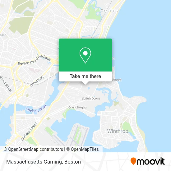
See Massachusetts Gaming, Boston, on the map
Public Transit to Massachusetts Gaming in Boston
Wondering how to get to Massachusetts Gaming in Boston? Moovit helps you find the best way to get to Massachusetts Gaming with step-by-step directions from the nearest public transit station.
Moovit provides free maps and live directions to help you navigate through your city. View schedules, routes, timetables, and find out how long does it take to get to Massachusetts Gaming in real time.
Looking for the nearest stop or station to Massachusetts Gaming? Check out this list of stops closest to your destination: Walley St @ Gladstone St; Suffolk Downs - Bennington St Opp Leverett Ave; Tomasello Way; Revere Beach; 41 Lee Burbank Hwy.
Bus: 119, 450, 120, BLUE LINE SHUTTLE, BLUE LINE SHUTTLE, BLUE LINE SHUTTLE, BLUE LINE SHUTTLE, BLUE LINE SHUTTLE.Subway: BLUE LINE.
Want to see if there’s another route that gets you there at an earlier time? Moovit helps you find alternative routes or times. Get directions from and directions to Massachusetts Gaming easily from the Moovit App or Website.
We make riding to Massachusetts Gaming easy, which is why over 1.7 million users, including users in Boston, trust Moovit as the best app for public transit. You don’t need to download an individual bus app or train app, Moovit is your all-in-one transit app that helps you find the best bus time or train time available.
For information on prices of subway and bus, costs and ride fares to Massachusetts Gaming, please check the Moovit app.
Use the app to navigate to popular places including to the airport, hospital, stadium, grocery store, mall, coffee shop, school, college, and university.
Massachusetts Gaming Address: 525 William F McClellan Hwy street in Boston
- Dog Park at the Track,
- Beachmont Square,
- Suffolk Downs,
- Perfect Granite Stone,
- Cirque Du Soleil Luzia,
- Verizon,
- Russell Cellular,
- Freedom Communications,
- Wwzn,
- Sally Beauty,
- Milan Laser Hair Removal,
- Flaming Grill Buffet,
- Sport Clips,
- Luxury Nail Bar,
- Gnc,
- Tesla,
- Ellen Bright Cleaning Services Inc,
- Suffolk Downs Zone - Transfer To BOS Airport,
- Stop & Shop #011,
- MBTA Suffolk Downs Station
Places Near Massachusetts Gaming (Boston)
- Leader Bank Pavilion (Leader Bank Pavillion), Boston,
- Prudential Center, Boston,
- Faneuil Hall, Boston,
- Quincy Market, Boston,
- Td Garden, Boston,
- Cheers, Boston,
- Mgm Music Hall, Boston,
- Wang Theater, Boston,
- Boston Convention & Exhibition Center, Boston,
- Massachusetts General Hospital, Boston,
- Isabella Stewart Gardner Museum, Boston,
- Boston Children's Hospital, Boston,
- Wilbur Theatre, Boston,
- North End, Boston,
- House Of Blues, Boston,
- Museum Of Science, Boston,
- Boston Medical Center, Boston,
- Boston Common, Boston,
- Castle Island, Boston,
- Seaport District, Boston
How to get to popular places in Boston with public transit
Get around Boston by public transit!
Traveling around Boston has never been so easy. See step by step directions as you travel to any attraction, street or major public transit station. View bus and train schedules, arrival times, service alerts and detailed routes on a map, so you know exactly how to get to anywhere in Boston.
When traveling to any destination around Boston use Moovit's Live Directions with Get Off Notifications to know exactly where and how far to walk, how long to wait for your line, and how many stops are left. Moovit will alert you when it's time to get off — no need to constantly re-check whether yours is the next stop.
Wondering how to use public transit in Boston or how to pay for public transit in Boston? Moovit public transit app can help you navigate your way with public transit easily, and at minimum cost. It includes public transit fees, ticket prices, and costs. Looking for a map of Boston public transit lines? Moovit public transit app shows all public transit maps in Boston with all Bus, Train, Subway and Ferry routes and stops on an interactive map.
Boston has 4 transit type(s), including: Bus, Train, Subway and Ferry, operated by several transit agencies, including MBTA, Southeastern Regional Transit Authority, MetroWest Regional Transit Authority, Rhode Island Public Transit Authority, WRTA, Lowell Regional Transit Authority, Merrimack Valley Transit, Montachusett Regional Transit Authority, Cape Cod Regional Transit Authority, Brockton Area Transit Authority, Martha's Vineyard Transit Authority, the WAVE - Nantucket Regional Transit Authority, GATRA, Cape Ann Transportation Authority and Massport