Directions to Mathematica Policy Research (Cambridge) with public transportation
The following transit lines have routes that pass near Mathematica Policy Research
 Bus: 1, 109, 64, 91, 68.
- Train: FITCHBURG, FRAMINGHAM/WORCESTER.
- Subway: RED LINE, GREEN LINE B, GREEN LINE D, GREEN LINE E.
How to get to Mathematica Policy Research by bus?
Click on the bus route to see step by step directions with maps, line arrival times and updated time schedules.
From Uscis Biometrics Office, Revere
83 minFrom Codman Square, Boston
75 minFrom 7F Everett Street, Revere
82 minFrom VFW Parkway, Boston
69 minFrom Hampton Inn Boston Seaport District (Hampton Inn-Hampton Inn Boston), Boston
56 minFrom Melrose, MA, Melrose
101 minFrom Comfort Inn & Suites Logan International Airport, Revere
85 minFrom Commonwealth Pier, Boston
75 minFrom Hyatt Place Boston Seaport District, Boston
72 minFrom Dorchester, Boston
72 min
How to get to Mathematica Policy Research by train?
Click on the train route to see step by step directions with maps, line arrival times and updated time schedules.
From Codman Square, Boston
111 minFrom VFW Parkway, Boston
113 minFrom Hampton Inn Boston Seaport District (Hampton Inn-Hampton Inn Boston), Boston
84 minFrom Melrose, MA, Melrose
124 minFrom Commonwealth Pier, Boston
82 minFrom Hyatt Place Boston Seaport District, Boston
85 minFrom Dorchester, Boston
114 min
How to get to Mathematica Policy Research by subway?
Click on the subway route to see step by step directions with maps, line arrival times and updated time schedules.
From Uscis Biometrics Office, Revere
57 minFrom Codman Square, Boston
49 minFrom 7F Everett Street, Revere
56 minFrom Hampton Inn Boston Seaport District (Hampton Inn-Hampton Inn Boston), Boston
44 minFrom Comfort Inn & Suites Logan International Airport, Revere
59 minFrom Commonwealth Pier, Boston
43 minFrom Hyatt Place Boston Seaport District, Boston
45 minFrom Dorchester, Boston
52 min
Bus stops near Mathematica Policy Research in Cambridge
Subway stations near Mathematica Policy Research in Cambridge
Bus lines to Mathematica Policy Research in Cambridge
What are the closest stations to Mathematica Policy Research?
The closest stations to Mathematica Policy Research are:
- Broadway @ Ellery St is 326 yards away, 4 min walk.
- Massachusetts Ave @ Bay St is 466 yards away, 6 min walk.
- Western Ave @ Kinnaird St is 632 yards away, 8 min walk.
- Amory Street is 652 yards away, 8 min walk.
- Harvard Square is 1216 yards away, 15 min walk.
- Union Square is 1708 yards away, 20 min walk.
Which bus lines stop near Mathematica Policy Research?
These bus lines stop near Mathematica Policy Research: 1, 109, 64, 91.
Which train lines stop near Mathematica Policy Research?
These train lines stop near Mathematica Policy Research: FITCHBURG, FRAMINGHAM/WORCESTER.
Which subway line stops near Mathematica Policy Research?
RED LINE (Alewife)
What’s the nearest subway station to Mathematica Policy Research in Cambridge?
The nearest subway station to Mathematica Policy Research in Cambridge is Amory Street. It’s a 8 min walk away.
What’s the nearest bus station to Mathematica Policy Research in Cambridge?
The nearest bus station to Mathematica Policy Research in Cambridge is Broadway @ Ellery St. It’s a 4 min walk away.
What time is the first subway to Mathematica Policy Research in Cambridge?
The GREEN LINE E is the first subway that goes to Mathematica Policy Research in Cambridge. It stops nearby at 4:50 AM.
What time is the last subway to Mathematica Policy Research in Cambridge?
The GREEN LINE B is the last subway that goes to Mathematica Policy Research in Cambridge. It stops nearby at 2:18 AM.
What time is the first bus to Mathematica Policy Research in Cambridge?
The 70 is the first bus that goes to Mathematica Policy Research in Cambridge. It stops nearby at 4:27 AM.
What time is the last bus to Mathematica Policy Research in Cambridge?
The 1 is the last bus that goes to Mathematica Policy Research in Cambridge. It stops nearby at 2:33 AM.
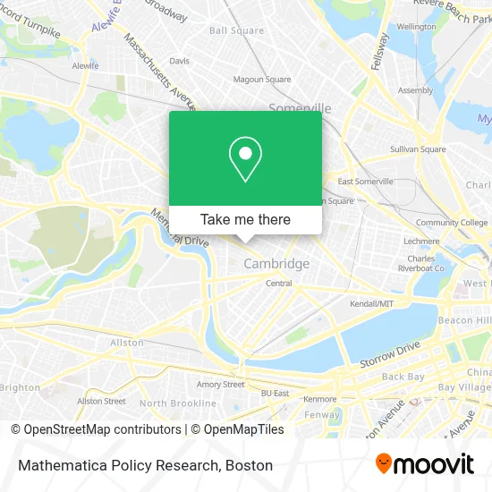
See Mathematica Policy Research, Cambridge, on the map
Public Transit to Mathematica Policy Research in Cambridge
Wondering how to get to Mathematica Policy Research in Cambridge? Moovit helps you find the best way to get to Mathematica Policy Research with step-by-step directions from the nearest public transit station.
Moovit provides free maps and live directions to help you navigate through your city. View schedules, routes, timetables, and find out how long does it take to get to Mathematica Policy Research in real time.
Looking for the nearest stop or station to Mathematica Policy Research? Check out this list of stops closest to your destination: Broadway @ Ellery St; Massachusetts Ave @ Bay St; Western Ave @ Kinnaird St; Amory Street; Harvard Square; Union Square.
Bus: 1, 109, 64, 91, 68, 83, 70.Train: FITCHBURG, FRAMINGHAM/WORCESTER.Subway: RED LINE, GREEN LINE B, GREEN LINE D, GREEN LINE E.
Want to see if there’s another route that gets you there at an earlier time? Moovit helps you find alternative routes or times. Get directions from and directions to Mathematica Policy Research easily from the Moovit App or Website.
We make riding to Mathematica Policy Research easy, which is why over 1.7 million users, including users in Cambridge, trust Moovit as the best app for public transit. You don’t need to download an individual bus app or train app, Moovit is your all-in-one transit app that helps you find the best bus time or train time available.
For information on prices of bus, subway and train, costs and ride fares to Mathematica Policy Research, please check the Moovit app.
Use the app to navigate to popular places including to the airport, hospital, stadium, grocery store, mall, coffee shop, school, college, and university.
Mathematica Policy Research Address: 955 Massachusetts Ave street in Cambridge
- Project Prakash (Gay Men S Domestic Violen Project),
- Dumpling House,
- VSM Services Inc,
- Anisha Guria-Re/Max Destiny,
- Potenza Therapeutics,
- Alden & Harlow,
- Lee St & Mass Ave,
- Progressive Insurance,
- Northstar News,
- Harvard-Faculty-Arts & SCNCS,
- Philip Allen,
- Haigh & Company,
- Hiram Sands House,
- Michael A. Sullivan Square,
- Friends and Family,
- Real Colegio Complutense at Harvard,
- Jan and Kayla Real Estate Team,
- 2a,
- Circus Cooperative Cafe,
- 1030 mass ave
Places Near Mathematica Policy Research (Cambridge)
- Massachusetts General Hospital, Boston,
- Museum Of Science, Boston,
- Td Garden, Boston,
- Wilbur Theatre, Boston,
- Leader Bank Pavilion (Leader Bank Pavillion), Boston,
- North End, Boston,
- Boston Convention & Exhibition Center, Boston,
- Isabella Stewart Gardner Museum, Boston,
- Castle Island, Boston,
- Faneuil Hall, Boston,
- Boston Medical Center, Boston,
- Boston Children's Hospital, Boston,
- Mgm Music Hall, Boston,
- Cheers, Boston,
- House Of Blues, Boston,
- Wang Theater, Boston,
- Seaport District, Boston,
- Boston Common, Boston,
- Prudential Center, Boston,
- Quincy Market, Boston
How to get to popular places in Boston with public transit
Get around Cambridge by public transit!
Traveling around Cambridge has never been so easy. See step by step directions as you travel to any attraction, street or major public transit station. View bus and train schedules, arrival times, service alerts and detailed routes on a map, so you know exactly how to get to anywhere in Cambridge.
When traveling to any destination around Cambridge use Moovit's Live Directions with Get Off Notifications to know exactly where and how far to walk, how long to wait for your line, and how many stops are left. Moovit will alert you when it's time to get off — no need to constantly re-check whether yours is the next stop.
Wondering how to use public transit in Cambridge or how to pay for public transit in Cambridge? Moovit public transit app can help you navigate your way with public transit easily, and at minimum cost. It includes public transit fees, ticket prices, and costs. Looking for a map of Cambridge public transit lines? Moovit public transit app shows all public transit maps in Cambridge with all Bus, Train, Subway and Ferry routes and stops on an interactive map.
Boston has 4 transit type(s), including: Bus, Train, Subway and Ferry, operated by several transit agencies, including MBTA, Southeastern Regional Transit Authority, MetroWest Regional Transit Authority, Rhode Island Public Transit Authority, WRTA, Lowell Regional Transit Authority, Merrimack Valley Transit, Montachusett Regional Transit Authority, Cape Cod Regional Transit Authority, Brockton Area Transit Authority, Martha's Vineyard Transit Authority, the WAVE - Nantucket Regional Transit Authority, GATRA, Cape Ann Transportation Authority and Massport