Directions to Matisse & Merlot Boston with public transportation
The following transit lines have routes that pass near Matisse & Merlot Boston
 Bus: 4, 501, 7, EZRIDE, SL5.
- Train: FITCHBURG, GREENBUSH, NEEDHAM, PROVIDENCE/STOUGHTON.
- Subway: BLUE LINE, GREEN LINE D, GREEN LINE E, ORANGE LINE.
- Ferry: LYNN FERRY.
How to get to Matisse & Merlot Boston by bus?
Click on the bus route to see step by step directions with maps, line arrival times and updated time schedules.
From Boston College (BC)
83 minFrom Boston College
82 minFrom Beth Israel Deaconess Medical Center
64 minFrom Best Western Adams Inn Quincy - Boston
102 minFrom Spaulding Rehab
83 minFrom Alumni Stadium
83 minFrom Highland Ave Somerville MA
45 minFrom Boston City Hall
60 minFrom UMass Boston Campus Center
79 minFrom Conte Forum
84 min
How to get to Matisse & Merlot Boston by train?
Click on the train route to see step by step directions with maps, line arrival times and updated time schedules.
How to get to Matisse & Merlot Boston by subway?
Click on the subway route to see step by step directions with maps, line arrival times and updated time schedules.
From Boston College (BC)
70 minFrom Boston College
69 minFrom Beth Israel Deaconess Medical Center
41 minFrom Best Western Adams Inn Quincy - Boston
51 minFrom Spaulding Rehab
58 minFrom Alumni Stadium
66 minFrom Highland Ave Somerville MA
38 minFrom Boston City Hall
29 minFrom UMass Boston Campus Center
52 minFrom Conte Forum
66 min
Ferry stations near Matisse & Merlot Boston
Bus stops near Matisse & Merlot Boston
- Aquarium - State St Opp Mckinley Sq, 2 min walk,VIEW
- Aquarium - Surface Rd @ State St, 2 min walk,VIEW
- Atlantic Ave @ Atlantic Ave, 3 min walk,VIEW
- North Station, 3 min walk,VIEW
- N Washington St @ Medford St, 4 min walk,VIEW
- Surface Rd @ Hanover St, 6 min walk,VIEW
- Haymarket - Congress St @ Hanover St, 7 min walk,VIEW
- Congress St @ Haymarket Sta, 8 min walk,VIEW
Subway station near Matisse & Merlot Boston
- Aquarium, 2 min walk,VIEW
Bus lines to Matisse & Merlot Boston
- BLUE LINE SHUTTLE, Airport - Government Center (Express),VIEW
- BLUE LINE SHUTTLE, Airport - Government Center via Maverick,VIEW
- BLUE LINE SHUTTLE, Orient Heights - Government Center (Local),VIEW
- BLUE LINE SHUTTLE, Orient Heights - Government Center (Express),VIEW
- BLUE LINE SHUTTLE, Airport - Government Center (Local),VIEW
- BLUE LINE SHUTTLE, Government Center (Shuttle),VIEW
- 4, North Station Via South Station,VIEW
- ORANGE LINE SHUTTLE, State (Shuttle),VIEW
- 92, Sullivan,VIEW
- 93, Sullivan Via Navy Yard,VIEW
- 111, Haymarket,VIEW
- 426, Haymarket Via Cliftondale,VIEW
- 428, Oaklandvale Via Cliftondale (Express),VIEW
- 89/93, Haymarket Via Sullivan,VIEW
- BLUE LINE SHUTTLE, Haymarket (Express Shuttle),VIEW
- BLUE LINE SHUTTLE, Airport (Local Shuttle),VIEW
- 116, Haymarket Via Maverick,VIEW
- 450, Salem Depot,VIEW
- BLUE LINE SHUTTLE, Airport (Shuttle),VIEW
- RED LINE SHUTTLE, Kendall/MIT (Shuttle),VIEW
What are the closest stations to Matisse & Merlot Boston?
The closest stations to Matisse & Merlot Boston are:
- Long Wharf (North) - Gate 5c is 66 yards away, 1 min walk.
- Aquarium - State St Opp Mckinley Sq is 102 yards away, 2 min walk.
- Aquarium is 107 yards away, 2 min walk.
- Aquarium - Surface Rd @ State St is 115 yards away, 2 min walk.
- Atlantic Ave @ Atlantic Ave is 185 yards away, 3 min walk.
- North Station is 240 yards away, 3 min walk.
- Long Wharf North is 272 yards away, 4 min walk.
- N Washington St @ Medford St is 301 yards away, 4 min walk.
- Long Wharf (North) - Gate 5a is 331 yards away, 5 min walk.
- Long Wharf (North) - Gate 5b is 358 yards away, 5 min walk.
- Surface Rd @ Hanover St is 483 yards away, 6 min walk.
- Haymarket - Congress St @ Hanover St is 539 yards away, 7 min walk.
- Congress St @ Haymarket Sta is 609 yards away, 8 min walk.
Which bus lines stop near Matisse & Merlot Boston?
These bus lines stop near Matisse & Merlot Boston: 4, 501, 7, EZRIDE, SL5.
Which train lines stop near Matisse & Merlot Boston?
These train lines stop near Matisse & Merlot Boston: FITCHBURG, GREENBUSH, NEEDHAM, PROVIDENCE/STOUGHTON.
Which subway lines stop near Matisse & Merlot Boston?
These subway lines stop near Matisse & Merlot Boston: BLUE LINE, GREEN LINE D, GREEN LINE E, ORANGE LINE.
What’s the nearest subway station to Matisse & Merlot Boston?
The nearest subway station to Matisse & Merlot Boston is Aquarium. It’s a 2 min walk away.
What’s the nearest bus station to Matisse & Merlot Boston?
The nearest bus stations to Matisse & Merlot Boston are Aquarium - State St Opp Mckinley Sq and Aquarium - Surface Rd @ State St. The closest one is a 2 min walk away.
What’s the nearest ferry station to Matisse & Merlot Boston?
The nearest ferry station to Matisse & Merlot Boston is Long Wharf (North) - Gate 5c. It’s a 1 min walk away.
What time is the first subway to Matisse & Merlot Boston?
The BLUE LINE is the first subway that goes to Matisse & Merlot Boston. It stops nearby at 5:17 AM.
What time is the last subway to Matisse & Merlot Boston?
The BLUE LINE is the last subway that goes to Matisse & Merlot Boston. It stops nearby at 1:54 AM.
What time is the first bus to Matisse & Merlot Boston?
The 111 is the first bus that goes to Matisse & Merlot Boston. It stops nearby at 4:49 AM.
What time is the last bus to Matisse & Merlot Boston?
The 111 is the last bus that goes to Matisse & Merlot Boston. It stops nearby at 2:20 AM.
What time is the first ferry to Matisse & Merlot Boston?
The HINGHAM/HULL FERRY is the first ferry that goes to Matisse & Merlot Boston. It stops nearby at 6:25 AM.
What time is the last ferry to Matisse & Merlot Boston?
The HINGHAM/HULL FERRY is the last ferry that goes to Matisse & Merlot Boston. It stops nearby at 9:55 PM.
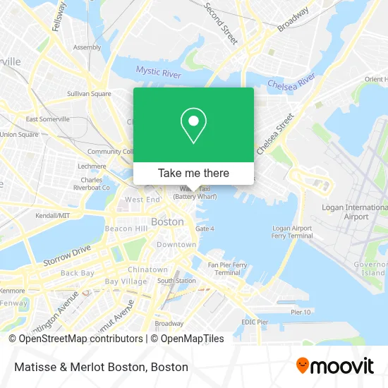
See Matisse & Merlot Boston on the map
Public Transportation to Matisse & Merlot Boston
Wondering how to get to Matisse & Merlot Boston? Moovit helps you find the best way to get to Matisse & Merlot Boston with step-by-step directions from the nearest public transit station.
Moovit provides free maps and live directions to help you navigate through your city. View schedules, routes, timetables, and find out how long does it take to get to Matisse & Merlot Boston in real time.
Looking for the nearest stop or station to Matisse & Merlot Boston? Check out this list of stops closest to your destination: Long Wharf (North) - Gate 5c; Aquarium - State St Opp Mckinley Sq; Aquarium; Aquarium - Surface Rd @ State St; Atlantic Ave @ Atlantic Ave; North Station; Long Wharf North; N Washington St @ Medford St; Long Wharf (North) - Gate 5a; Long Wharf (North) - Gate 5b; Surface Rd @ Hanover St; Haymarket - Congress St @ Hanover St; Congress St @ Haymarket Sta.
Bus: 4, 501, 7, EZRIDE, SL5, BLUE LINE SHUTTLE, BLUE LINE SHUTTLE, BLUE LINE SHUTTLE, BLUE LINE SHUTTLE, BLUE LINE SHUTTLE, BLUE LINE SHUTTLE, ORANGE LINE SHUTTLE.Train: FITCHBURG, GREENBUSH, NEEDHAM, PROVIDENCE/STOUGHTON.Subway: BLUE LINE, GREEN LINE D, GREEN LINE E, ORANGE LINE.Ferry: LYNN FERRY.
Want to see if there’s another route that gets you there at an earlier time? Moovit helps you find alternative routes or times. Get directions from and directions to Matisse & Merlot Boston easily from the Moovit App or Website.
We make riding to Matisse & Merlot Boston easy, which is why over 1.7 million users, including users in Boston, trust Moovit as the best app for public transit. You don’t need to download an individual bus app or train app, Moovit is your all-in-one transit app that helps you find the best bus time or train time available.
For information on prices of subway, bus and train, costs and ride fares to Matisse & Merlot Boston, please check the Moovit app.
Use the app to navigate to popular places including to the airport, hospital, stadium, grocery store, mall, coffee shop, school, college, and university.
Matisse & Merlot Boston Address: 300 Commercial St street in Boston
- Massachusetts Bankruptcy Center,
- Flamingo,
- Sargent's Wharf Parking,
- Boston Sports Institutes (Boston Institute of Football),
- Cape Cod Office,
- Boston Bottle,
- Denis Construction,
- Boston's Little Italy,
- Lewis Wharf Parking,
- Strega Ristorante,
- Battery Wharf Hotel,
- Paul Revere Statue,
- Table,
- All Saints Way,
- North Street Grille,
- Giacomo's Ristorante,
- Giacomo's,
- North St & Sun Court St,
- Paul Revere House,
- Eliot School
Places Near Matisse & Merlot Boston
- North End, Boston,
- Prudential Center, Boston,
- Leader Bank Pavilion (Leader Bank Pavillion), Boston,
- Cheers, Boston,
- Wang Theater, Boston,
- Massachusetts General Hospital, Boston,
- Museum Of Science, Boston,
- Faneuil Hall, Boston,
- Mgm Music Hall, Boston,
- Boston Children's Hospital, Boston,
- House Of Blues, Boston,
- Boston Common, Boston,
- Seaport District, Boston,
- Td Garden, Boston,
- Isabella Stewart Gardner Museum, Boston,
- Wilbur Theatre, Boston,
- Quincy Market, Boston,
- Boston Medical Center, Boston,
- Boston Convention & Exhibition Center, Boston,
- Castle Island, Boston
How to get to popular places in Boston with public transit
Get around Boston by public transit!
Traveling around Boston has never been so easy. See step by step directions as you travel to any attraction, street or major public transit station. View bus and train schedules, arrival times, service alerts and detailed routes on a map, so you know exactly how to get to anywhere in Boston.
When traveling to any destination around Boston use Moovit's Live Directions with Get Off Notifications to know exactly where and how far to walk, how long to wait for your line, and how many stops are left. Moovit will alert you when it's time to get off — no need to constantly re-check whether yours is the next stop.
Wondering how to use public transit in Boston or how to pay for public transit in Boston? Moovit public transit app can help you navigate your way with public transit easily, and at minimum cost. It includes public transit fees, ticket prices, and costs. Looking for a map of Boston public transit lines? Moovit public transit app shows all public transit maps in Boston with all Bus, Train, Subway and Ferry routes and stops on an interactive map.
Boston has 4 transit type(s), including: Bus, Train, Subway and Ferry, operated by several transit agencies, including MBTA, Southeastern Regional Transit Authority, MetroWest Regional Transit Authority, Rhode Island Public Transit Authority, WRTA, Lowell Regional Transit Authority, Merrimack Valley Transit, Montachusett Regional Transit Authority, Cape Cod Regional Transit Authority, Brockton Area Transit Authority, Martha's Vineyard Transit Authority, the WAVE - Nantucket Regional Transit Authority, GATRA, Cape Ann Transportation Authority and Massport