Directions to Mckay's Christmas Trees (Boston) with public transportation
The following transit lines have routes that pass near Mckay's Christmas Trees
 Bus: 64, 86, 70.
- Train: FRAMINGHAM/WORCESTER.
- Subway: GREEN LINE B.
How to get to Mckay's Christmas Trees by bus?
Click on the bus route to see step by step directions with maps, line arrival times and updated time schedules.
From Edic Pier, Boston
72 minFrom Centre St, Boston
82 minFrom PwC, Boston
63 minFrom Orpheum Theatre (Orpheum Theatre Boston), Boston
53 minFrom Tufts University, Boston
46 minFrom Leader Bank Pavilion (Leader Bank Pavillion), Boston
72 minFrom Hampton Inn Boston Logan Airport Chelsea, Chelsea
87 minFrom Roslindale, Boston
67 minFrom Yankee Lobster, Boston
68 minFrom Sunrise Shuttle Pick Up, Boston
72 min
How to get to Mckay's Christmas Trees by train?
Click on the train route to see step by step directions with maps, line arrival times and updated time schedules.
How to get to Mckay's Christmas Trees by subway?
Click on the subway route to see step by step directions with maps, line arrival times and updated time schedules.
From Edic Pier, Boston
95 minFrom Centre St, Boston
78 minFrom PwC, Boston
82 minFrom Orpheum Theatre (Orpheum Theatre Boston), Boston
62 minFrom Tufts University, Boston
64 minFrom Sunrise Shuttle Pick Up, Boston
79 minFrom Leader Bank Pavilion (Leader Bank Pavillion), Boston
95 minFrom Roslindale, Boston
96 minFrom Yankee Lobster, Boston
95 min
Bus stops near Mckay's Christmas Trees in Boston
Subway station near Mckay's Christmas Trees in Boston
- Washington Street, 20 min walk,VIEW
What are the closest stations to Mckay's Christmas Trees?
The closest stations to Mckay's Christmas Trees are:
- N Beacon St @ Vineland St is 207 yards away, 3 min walk.
- Arsenal St @ Talcott Ave is 219 yards away, 3 min walk.
- Washington Street is 1658 yards away, 20 min walk.
Which bus lines stop near Mckay's Christmas Trees?
These bus lines stop near Mckay's Christmas Trees: 64, 86.
Which train line stops near Mckay's Christmas Trees?
FRAMINGHAM/WORCESTER (#525 | Worcester)
Which subway line stops near Mckay's Christmas Trees?
GREEN LINE B (Boston College)
What’s the nearest subway station to Mckay's Christmas Trees in Boston?
The nearest subway station to Mckay's Christmas Trees in Boston is Washington Street. It’s a 20 min walk away.
What’s the nearest bus station to Mckay's Christmas Trees in Boston?
The nearest bus stations to Mckay's Christmas Trees in Boston are N Beacon St @ Vineland St and Arsenal St @ Talcott Ave. The closest one is a 3 min walk away.
What time is the first subway to Mckay's Christmas Trees in Boston?
The GREEN LINE B is the first subway that goes to Mckay's Christmas Trees in Boston. It stops nearby at 5:07 AM.
What time is the last subway to Mckay's Christmas Trees in Boston?
The GREEN LINE B is the last subway that goes to Mckay's Christmas Trees in Boston. It stops nearby at 2:33 AM.
What time is the first bus to Mckay's Christmas Trees in Boston?
The 70 is the first bus that goes to Mckay's Christmas Trees in Boston. It stops nearby at 4:35 AM.
What time is the last bus to Mckay's Christmas Trees in Boston?
The 64 is the last bus that goes to Mckay's Christmas Trees in Boston. It stops nearby at 1:25 AM.
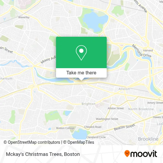
See Mckay's Christmas Trees, Boston, on the map
Public Transit to Mckay's Christmas Trees in Boston
Wondering how to get to Mckay's Christmas Trees in Boston? Moovit helps you find the best way to get to Mckay's Christmas Trees with step-by-step directions from the nearest public transit station.
Moovit provides free maps and live directions to help you navigate through your city. View schedules, routes, timetables, and find out how long does it take to get to Mckay's Christmas Trees in real time.
Looking for the nearest stop or station to Mckay's Christmas Trees? Check out this list of stops closest to your destination: N Beacon St @ Vineland St; Arsenal St @ Talcott Ave; Washington Street.
Bus: 64, 86, 70.Train: FRAMINGHAM/WORCESTER.Subway: GREEN LINE B.
Want to see if there’s another route that gets you there at an earlier time? Moovit helps you find alternative routes or times. Get directions from and directions to Mckay's Christmas Trees easily from the Moovit App or Website.
We make riding to Mckay's Christmas Trees easy, which is why over 1.7 million users, including users in Boston, trust Moovit as the best app for public transit. You don’t need to download an individual bus app or train app, Moovit is your all-in-one transit app that helps you find the best bus time or train time available.
For information on prices of bus, subway and train, costs and ride fares to Mckay's Christmas Trees, please check the Moovit app.
Use the app to navigate to popular places including to the airport, hospital, stadium, grocery store, mall, coffee shop, school, college, and university.
Mckay's Christmas Trees Address: 1850 Soldiers Field Rd street in Boston
- Brighton / Allston Swimming and Wading Pool,
- US-20 & Dr Paul Dudley White Bike Path,
- Kingdom Hall Of Jehovah's Witnesses,
- Arsenal Yards,
- Ulta Beauty,
- Arsenal Mall,
- The Home Depot,
- The Majestic 7,
- Roche Bros (Roche Brothers),
- Watertown Residence Inn,
- Residence Inn by Marriott Boston Watertown,
- Watertown Mall,
- Hampton Inn & Suites-Hampton Watertown Boston ,
- Harvard Vanguard Medical Associates, Watertown,
- Arsenal Mall,
- DMV Watertown,
- Watertown RMV Service Center,
- Target,
- Boston Granite Countertops (Watertown Countertops),
- Community Rowing
Places Near Mckay's Christmas Trees (Boston)
- Wilbur Theatre, Boston,
- Massachusetts General Hospital, Boston,
- Mgm Music Hall, Boston,
- Seaport District, Boston,
- Faneuil Hall, Boston,
- Isabella Stewart Gardner Museum, Boston,
- Leader Bank Pavilion (Leader Bank Pavillion), Boston,
- Boston Children's Hospital, Boston,
- House Of Blues, Boston,
- Boston Medical Center, Boston,
- Boston Convention & Exhibition Center, Boston,
- Castle Island, Boston,
- Td Garden, Boston,
- Quincy Market, Boston,
- Cheers, Boston,
- Boston Common, Boston,
- Museum Of Science, Boston,
- Wang Theater, Boston,
- North End, Boston,
- Prudential Center, Boston
How to get to popular places in Boston with public transit
Get around Boston by public transit!
Traveling around Boston has never been so easy. See step by step directions as you travel to any attraction, street or major public transit station. View bus and train schedules, arrival times, service alerts and detailed routes on a map, so you know exactly how to get to anywhere in Boston.
When traveling to any destination around Boston use Moovit's Live Directions with Get Off Notifications to know exactly where and how far to walk, how long to wait for your line, and how many stops are left. Moovit will alert you when it's time to get off — no need to constantly re-check whether yours is the next stop.
Wondering how to use public transit in Boston or how to pay for public transit in Boston? Moovit public transit app can help you navigate your way with public transit easily, and at minimum cost. It includes public transit fees, ticket prices, and costs. Looking for a map of Boston public transit lines? Moovit public transit app shows all public transit maps in Boston with all Bus, Train, Subway and Ferry routes and stops on an interactive map.
Boston has 4 transit type(s), including: Bus, Train, Subway and Ferry, operated by several transit agencies, including MBTA, Southeastern Regional Transit Authority, MetroWest Regional Transit Authority, Rhode Island Public Transit Authority, WRTA, Lowell Regional Transit Authority, Merrimack Valley Transit, Montachusett Regional Transit Authority, Cape Cod Regional Transit Authority, Brockton Area Transit Authority, Martha's Vineyard Transit Authority, the WAVE - Nantucket Regional Transit Authority, GATRA, Cape Ann Transportation Authority and Massport