Directions to Mcphs Career Development Center (Boston) with public transportation
The following transit lines have routes that pass near Mcphs Career Development Center
 Bus: 39, 66, 35, GREEN LINE E SHUTTLE, GREEN LINE E SHUTTLE.
- Train: FRAMINGHAM/WORCESTER, PROVIDENCE/STOUGHTON.
- Subway: GREEN LINE E.
How to get to Mcphs Career Development Center by bus?
Click on the bus route to see step by step directions with maps, line arrival times and updated time schedules.
From Georgetown, Massachusetts, Boston
60 minFrom Six Flags New England, Newton
53 minFrom Arlington, MA, Arlington
92 minFrom MBTA Alewife Station, Cambridge
85 minFrom Academy Of the Pacific Rim Charter Public School, Boston
59 minFrom Fort Independence, Boston
65 minFrom Cruiseport Boston's Black Falcon Cruise Terminal, Boston
51 minFrom SharkNinja Operating LLC, Needham
88 minFrom Sheraton-Needham Hotel (Sheraton Boston Needham Hotel), Needham
84 minFrom Boston College, Boston
50 min
How to get to Mcphs Career Development Center by train?
Click on the train route to see step by step directions with maps, line arrival times and updated time schedules.
How to get to Mcphs Career Development Center by subway?
Click on the subway route to see step by step directions with maps, line arrival times and updated time schedules.
Subway station near Mcphs Career Development Center in Boston
- Museum Of Fine Arts, 1 min walk,VIEW
Bus stops near Mcphs Career Development Center in Boston
Bus lines to Mcphs Career Development Center in Boston
- 35, Dedham Mall,VIEW
- 39, Wolcott Square Via Forest Hills,VIEW
- 66, Nubian Via Allston,VIEW
- GREEN LINE E SHUTTLE, Park Street (Shuttle),VIEW
- GREEN LINE E SHUTTLE, Prudential (Shuttle),VIEW
- 19, Gallivan Blvd,VIEW
- 85, Ruggles,VIEW
- 8, Ruggles,VIEW
- 9, Kenmore Via Boston Latin,VIEW
- 47, Broadway,VIEW
- CT3, Beth Israel (Limited Stops),VIEW
- 28, Mattapan,VIEW
- 22, Ashmont,VIEW
- 57, Watertown Yard,VIEW
What are the closest stations to Mcphs Career Development Center?
The closest stations to Mcphs Career Development Center are:
- Museum Of Fine Arts is 13 yards away, 1 min walk.
- Huntington Ave @ Fenwood Rd is 54 yards away, 1 min walk.
- Tremont St @ Tobin Community Center is 272 yards away, 4 min walk.
- Huntington Ave @ Longwood Ave is 462 yards away, 6 min walk.
- Ave Louis Pasteur @ Longwood Ave is 478 yards away, 6 min walk.
Which bus lines stop near Mcphs Career Development Center?
These bus lines stop near Mcphs Career Development Center: 39, 66.
Which train lines stop near Mcphs Career Development Center?
These train lines stop near Mcphs Career Development Center: FRAMINGHAM/WORCESTER, PROVIDENCE/STOUGHTON.
Which subway line stops near Mcphs Career Development Center?
GREEN LINE E (Heath Street)
What’s the nearest subway station to Mcphs Career Development Center in Boston?
The nearest subway station to Mcphs Career Development Center in Boston is Museum Of Fine Arts. It’s a 1 min walk away.
What’s the nearest bus station to Mcphs Career Development Center in Boston?
The nearest bus station to Mcphs Career Development Center in Boston is Huntington Ave @ Fenwood Rd. It’s a 1 min walk away.
What time is the first subway to Mcphs Career Development Center in Boston?
The GREEN LINE E is the first subway that goes to Mcphs Career Development Center in Boston. It stops nearby at 5:23 AM.
What time is the last subway to Mcphs Career Development Center in Boston?
The GREEN LINE E is the last subway that goes to Mcphs Career Development Center in Boston. It stops nearby at 2:04 AM.
What time is the first bus to Mcphs Career Development Center in Boston?
The 39 is the first bus that goes to Mcphs Career Development Center in Boston. It stops nearby at 4:49 AM.
What time is the last bus to Mcphs Career Development Center in Boston?
The 66 is the last bus that goes to Mcphs Career Development Center in Boston. It stops nearby at 2:25 AM.
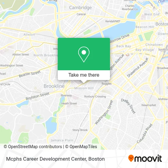
See Mcphs Career Development Center, Boston, on the map
Public Transit to Mcphs Career Development Center in Boston
Wondering how to get to Mcphs Career Development Center in Boston? Moovit helps you find the best way to get to Mcphs Career Development Center with step-by-step directions from the nearest public transit station.
Moovit provides free maps and live directions to help you navigate through your city. View schedules, routes, timetables, and find out how long does it take to get to Mcphs Career Development Center in real time.
Looking for the nearest stop or station to Mcphs Career Development Center? Check out this list of stops closest to your destination: Museum Of Fine Arts; Huntington Ave @ Fenwood Rd; Tremont St @ Tobin Community Center; Huntington Ave @ Longwood Ave; Ave Louis Pasteur @ Longwood Ave.
Bus: 39, 66, 35, GREEN LINE E SHUTTLE, GREEN LINE E SHUTTLE, 19, 85, 28, 8, 9, 47, CT3.Train: FRAMINGHAM/WORCESTER, PROVIDENCE/STOUGHTON.Subway: GREEN LINE E.
Want to see if there’s another route that gets you there at an earlier time? Moovit helps you find alternative routes or times. Get directions from and directions to Mcphs Career Development Center easily from the Moovit App or Website.
We make riding to Mcphs Career Development Center easy, which is why over 1.7 million users, including users in Boston, trust Moovit as the best app for public transit. You don’t need to download an individual bus app or train app, Moovit is your all-in-one transit app that helps you find the best bus time or train time available.
For information on prices of bus, subway and train, costs and ride fares to Mcphs Career Development Center, please check the Moovit app.
Use the app to navigate to popular places including to the airport, hospital, stadium, grocery store, mall, coffee shop, school, college, and university.
Mcphs Career Development Center Address: 670 Huntington Ave street in Boston
- Massachusetts College Of Pharmacy And Health Science,
- MCPHS University,
- Harvard T.H. Chan School of Public Health,
- Global Luxury Suites at Longwood,
- Jvue at the Lma,
- Harvard Medical School Quad Parking Garage (Med School Quad Garage),
- Yi, Anna - Harvard School of Dental Medicine,
- Harvard Medical School,
- Countway Library of Medicine (Harvard Medical School Countway Library),
- The Longwood,
- Oakley,
- MCPHS,
- Mission Hill,
- MCPHS University-Boston,
- Sully's Barber & Styling Shop,
- Kennedy Building - Massart,
- TGI Friday's (T G I F),
- Peter Bent Brigham Building,
- Mission Hill Link Bus,
- Brigham & Women's Hospital
Places Near Mcphs Career Development Center (Boston)
- Leader Bank Pavilion (Leader Bank Pavillion), Boston,
- Td Garden, Boston,
- Castle Island, Boston,
- Wilbur Theatre, Boston,
- Quincy Market, Boston,
- Boston Children's Hospital, Boston,
- North End, Boston,
- Boston Convention & Exhibition Center, Boston,
- Boston Common, Boston,
- Prudential Center, Boston,
- House Of Blues, Boston,
- Isabella Stewart Gardner Museum, Boston,
- Massachusetts General Hospital, Boston,
- Seaport District, Boston,
- Wang Theater, Boston,
- Faneuil Hall, Boston,
- Cheers, Boston,
- Museum Of Science, Boston,
- Mgm Music Hall, Boston,
- Boston Medical Center, Boston
How to get to popular places in Boston with public transit
Get around Boston by public transit!
Traveling around Boston has never been so easy. See step by step directions as you travel to any attraction, street or major public transit station. View bus and train schedules, arrival times, service alerts and detailed routes on a map, so you know exactly how to get to anywhere in Boston.
When traveling to any destination around Boston use Moovit's Live Directions with Get Off Notifications to know exactly where and how far to walk, how long to wait for your line, and how many stops are left. Moovit will alert you when it's time to get off — no need to constantly re-check whether yours is the next stop.
Wondering how to use public transit in Boston or how to pay for public transit in Boston? Moovit public transit app can help you navigate your way with public transit easily, and at minimum cost. It includes public transit fees, ticket prices, and costs. Looking for a map of Boston public transit lines? Moovit public transit app shows all public transit maps in Boston with all Bus, Train, Subway and Ferry routes and stops on an interactive map.
Boston has 4 transit type(s), including: Bus, Train, Subway and Ferry, operated by several transit agencies, including MBTA, Southeastern Regional Transit Authority, MetroWest Regional Transit Authority, Rhode Island Public Transit Authority, WRTA, Lowell Regional Transit Authority, Merrimack Valley Transit, Montachusett Regional Transit Authority, Cape Cod Regional Transit Authority, Brockton Area Transit Authority, Martha's Vineyard Transit Authority, the WAVE - Nantucket Regional Transit Authority, GATRA, Cape Ann Transportation Authority and Massport