Directions to Melanie Chartier (Boston) with public transportation
The following transit lines have routes that pass near Melanie Chartier
 Bus: 1, 80, R, 76.
- Train: PROVIDENCE/STOUGHTON, FOXBORO EVENT SERVICE.
How to get to Melanie Chartier by bus?
Click on the bus route to see step by step directions with maps, line arrival times and updated time schedules.
How to get to Melanie Chartier by train?
Click on the train route to see step by step directions with maps, line arrival times and updated time schedules.
Bus stops near Melanie Chartier in Boston
Train stations near Melanie Chartier in Boston
Bus lines to Melanie Chartier in Boston
What are the closest stations to Melanie Chartier?
The closest stations to Melanie Chartier are:
- Walcott Before Arlington is 25 yards away, 1 min walk.
- Underwood After Walcott is 118 yards away, 2 min walk.
- Opposite Slater Mill (Roosevelt & Main) is 316 yards away, 5 min walk.
- Broadway Before Blackstone is 443 yards away, 6 min walk.
- Roosevelt Avenue is 724 yards away, 9 min walk.
- South Attleboro is 3696 yards away, 43 min walk.
- Pawtucket/Central Falls is 4475 yards away, 53 min walk.
Which bus lines stop near Melanie Chartier?
These bus lines stop near Melanie Chartier: 1, 80, R.
Which train line stops near Melanie Chartier?
PROVIDENCE/STOUGHTON (#824 | South Station)
What’s the nearest bus station to Melanie Chartier in Boston?
The nearest bus station to Melanie Chartier in Boston is Walcott Before Arlington. It’s a 1 min walk away.
What time is the first train to Melanie Chartier in Boston?
The PROVIDENCE/STOUGHTON is the first train that goes to Melanie Chartier in Boston. It stops nearby at 4:16 AM.
What time is the last train to Melanie Chartier in Boston?
The PROVIDENCE/STOUGHTON is the last train that goes to Melanie Chartier in Boston. It stops nearby at 12:56 AM.
What time is the first bus to Melanie Chartier in Boston?
The 78 is the first bus that goes to Melanie Chartier in Boston. It stops nearby at 5:10 AM.
What time is the last bus to Melanie Chartier in Boston?
The R is the last bus that goes to Melanie Chartier in Boston. It stops nearby at 1:01 AM.
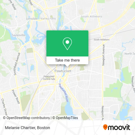
See Melanie Chartier, Boston, on the map
Public Transit to Melanie Chartier in Boston
Wondering how to get to Melanie Chartier in Boston? Moovit helps you find the best way to get to Melanie Chartier with step-by-step directions from the nearest public transit station.
Moovit provides free maps and live directions to help you navigate through your city. View schedules, routes, timetables, and find out how long does it take to get to Melanie Chartier in real time.
Looking for the nearest stop or station to Melanie Chartier? Check out this list of stops closest to your destination: Walcott Before Arlington; Underwood After Walcott; Opposite Slater Mill (Roosevelt & Main); Broadway Before Blackstone; Roosevelt Avenue; South Attleboro; Pawtucket/Central Falls.
Bus: 1, 80, R, 76.Train: PROVIDENCE/STOUGHTON, FOXBORO EVENT SERVICE.
Want to see if there’s another route that gets you there at an earlier time? Moovit helps you find alternative routes or times. Get directions from and directions to Melanie Chartier easily from the Moovit App or Website.
We make riding to Melanie Chartier easy, which is why over 1.7 million users, including users in Boston, trust Moovit as the best app for public transit. You don’t need to download an individual bus app or train app, Moovit is your all-in-one transit app that helps you find the best bus time or train time available.
For information on prices of bus and train, costs and ride fares to Melanie Chartier, please check the Moovit app.
Use the app to navigate to popular places including to the airport, hospital, stadium, grocery store, mall, coffee shop, school, college, and university.
Melanie Chartier Address: 80 Fountain St street in Boston
- Patti Doyle Communications, Inc.,
- Rhode Island Maker Mill,
- Dev Hero,
- Ideal Grain,
- TI Adoro Jewelry,
- Illuminated Advisors,
- True Romantic Jewel Co,
- Art League Ri,
- Motion Center Yoga,
- Cambridge Orthotics,
- Studio Without Walls,
- Base Station VR,
- James Polisky Silkscreen Art,
- Pawtucket Armory Arts Center (Pawtucket Armory Association),
- A K Custom Painting,
- American Products, Inc,
- Timeless by Shannon Leigh,
- Bergeron Painting and Wallpaper,
- Milos Frank J Jr Esq.,
- Garage Door Repair Pawtucket
Places Near Melanie Chartier (Boston)
- Boston Convention & Exhibition Center, Boston,
- Mgm Music Hall, Boston,
- Boston Medical Center, Boston,
- Prudential Center, Boston,
- Wang Theater, Boston,
- Boston Children's Hospital, Boston,
- Massachusetts General Hospital, Boston,
- Leader Bank Pavilion (Leader Bank Pavillion), Boston,
- North End, Boston,
- Wilbur Theatre, Boston,
- Td Garden, Boston,
- Cheers, Boston,
- House Of Blues, Boston,
- Faneuil Hall, Boston,
- Quincy Market, Boston,
- Castle Island, Boston,
- Boston Common, Boston,
- Isabella Stewart Gardner Museum, Boston,
- Museum Of Science, Boston,
- Seaport District, Boston
How to get to popular places in Boston with public transit
Get around Boston by public transit!
Traveling around Boston has never been so easy. See step by step directions as you travel to any attraction, street or major public transit station. View bus and train schedules, arrival times, service alerts and detailed routes on a map, so you know exactly how to get to anywhere in Boston.
When traveling to any destination around Boston use Moovit's Live Directions with Get Off Notifications to know exactly where and how far to walk, how long to wait for your line, and how many stops are left. Moovit will alert you when it's time to get off — no need to constantly re-check whether yours is the next stop.
Wondering how to use public transit in Boston or how to pay for public transit in Boston? Moovit public transit app can help you navigate your way with public transit easily, and at minimum cost. It includes public transit fees, ticket prices, and costs. Looking for a map of Boston public transit lines? Moovit public transit app shows all public transit maps in Boston with all Bus, Train, Subway and Ferry routes and stops on an interactive map.
Boston has 4 transit type(s), including: Bus, Train, Subway and Ferry, operated by several transit agencies, including MBTA, Southeastern Regional Transit Authority, MetroWest Regional Transit Authority, Rhode Island Public Transit Authority, WRTA, Lowell Regional Transit Authority, Merrimack Valley Transit, Montachusett Regional Transit Authority, Cape Cod Regional Transit Authority, Brockton Area Transit Authority, Martha's Vineyard Transit Authority, the WAVE - Nantucket Regional Transit Authority, GATRA, Cape Ann Transportation Authority and Massport