Directions to Michael L Alosco, Phd (Boston) with public transportation
The following transit lines have routes that pass near Michael L Alosco, Phd
 Bus: 1, 10, SL4, SL5, 8.
- Train: FAIRMOUNT, FRANKLIN/FOXBORO, PROVIDENCE/STOUGHTON.
- Subway: ORANGE LINE, RED LINE, GREEN LINE E.
How to get to Michael L Alosco, Phd by bus?
Click on the bus route to see step by step directions with maps, line arrival times and updated time schedules.
From Hampton Inn Boston Logan Airport, Revere
56 minFrom Medford Square, Medford
74 minFrom Uscis Biometrics Office, Revere
62 minFrom Malden, MA, Malden
93 minFrom Comfort Inn & Suites Logan International Airport, Revere
64 minFrom Boda Borg, Malden
97 minFrom 7F Everett Street, Revere
63 minFrom Belle Isle Lobster & Seafood, Winthrop Town
86 minFrom Bow Market, Somerville
44 minFrom Medford, MA, Medford
78 min
How to get to Michael L Alosco, Phd by subway?
Click on the subway route to see step by step directions with maps, line arrival times and updated time schedules.
From Hampton Inn Boston Logan Airport, Revere
66 minFrom Medford Square, Medford
76 minFrom Uscis Biometrics Office, Revere
61 minFrom Malden, MA, Malden
52 minFrom Comfort Inn & Suites Logan International Airport, Revere
62 minFrom Boda Borg, Malden
48 minFrom 7F Everett Street, Revere
59 minFrom Belle Isle Lobster & Seafood, Winthrop Town
59 minFrom Bow Market, Somerville
55 minFrom Medford, MA, Medford
69 min
Bus stops near Michael L Alosco, Phd in Boston
Subway stations near Michael L Alosco, Phd in Boston
Train station near Michael L Alosco, Phd in Boston
- Newmarket, 18 min walk,VIEW
Bus lines to Michael L Alosco, Phd in Boston
- 8, Harbor Point Via South Bay Center,VIEW
- 10, Arlington Via South Bay Center,VIEW
- 171, Logan Airport Via Andrew,VIEW
- CT3, Avenue Louis Pasteur (Limited Stops),VIEW
- 47, Broadway,VIEW
- ALBANY/E NEWTON STREET, Student Residence (815 Albany St),VIEW
- 1 BU (CHARLES RIVER-MEDICAL CAMPUS), Comm Ave @ Buick St,VIEW
- 1, Harvard,VIEW
What are the closest stations to Michael L Alosco, Phd?
The closest stations to Michael L Alosco, Phd are:
- 91 E Concord St is 67 yards away, 1 min walk.
- Albany St Opp E Concord St is 175 yards away, 3 min walk.
- Talbot Green is 183 yards away, 3 min walk.
- BU Medical Campus (710 Albany) is 224 yards away, 3 min walk.
- Massachusetts Ave @ Harrison Ave is 313 yards away, 4 min walk.
- Andrew is 1347 yards away, 16 min walk.
- Massachusetts Ave. is 1371 yards away, 17 min walk.
- Newmarket is 1484 yards away, 18 min walk.
- Prudential is 1563 yards away, 19 min walk.
Which bus lines stop near Michael L Alosco, Phd?
These bus lines stop near Michael L Alosco, Phd: 1, 10, SL4, SL5.
Which subway line stops near Michael L Alosco, Phd?
ORANGE LINE (Forest Hills)
What’s the nearest subway station to Michael L Alosco, Phd in Boston?
The nearest subway station to Michael L Alosco, Phd in Boston is Andrew. It’s a 16 min walk away.
What’s the nearest train station to Michael L Alosco, Phd in Boston?
The nearest train station to Michael L Alosco, Phd in Boston is Newmarket. It’s a 18 min walk away.
What’s the nearest bus station to Michael L Alosco, Phd in Boston?
The nearest bus station to Michael L Alosco, Phd in Boston is 91 E Concord St. It’s a 1 min walk away.
What time is the first subway to Michael L Alosco, Phd in Boston?
The GREEN LINE E is the first subway that goes to Michael L Alosco, Phd in Boston. It stops nearby at 5:16 AM.
What time is the last subway to Michael L Alosco, Phd in Boston?
The GREEN LINE E is the last subway that goes to Michael L Alosco, Phd in Boston. It stops nearby at 2:10 AM.
What time is the first train to Michael L Alosco, Phd in Boston?
The FAIRMOUNT is the first train that goes to Michael L Alosco, Phd in Boston. It stops nearby at 4:49 AM.
What time is the last train to Michael L Alosco, Phd in Boston?
The FAIRMOUNT is the last train that goes to Michael L Alosco, Phd in Boston. It stops nearby at 11:55 PM.
What time is the first bus to Michael L Alosco, Phd in Boston?
The 171 is the first bus that goes to Michael L Alosco, Phd in Boston. It stops nearby at 3:54 AM.
What time is the last bus to Michael L Alosco, Phd in Boston?
The 1 is the last bus that goes to Michael L Alosco, Phd in Boston. It stops nearby at 2:39 AM.
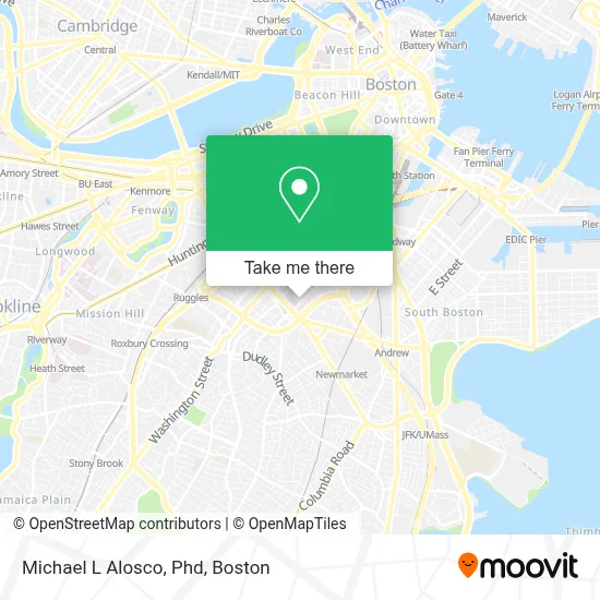
See Michael L Alosco, Phd, Boston, on the map
Public Transit to Michael L Alosco, Phd in Boston
Wondering how to get to Michael L Alosco, Phd in Boston? Moovit helps you find the best way to get to Michael L Alosco, Phd with step-by-step directions from the nearest public transit station.
Moovit provides free maps and live directions to help you navigate through your city. View schedules, routes, timetables, and find out how long does it take to get to Michael L Alosco, Phd in real time.
Looking for the nearest stop or station to Michael L Alosco, Phd? Check out this list of stops closest to your destination: 91 E Concord St; Albany St Opp E Concord St; Talbot Green; BU Medical Campus (710 Albany); Massachusetts Ave @ Harrison Ave; Andrew; Massachusetts Ave.; Newmarket; Prudential.
Bus: 1, 10, SL4, SL5, 8, 171, CT3, 47.Train: FAIRMOUNT, FRANKLIN/FOXBORO, PROVIDENCE/STOUGHTON.Subway: ORANGE LINE, RED LINE, GREEN LINE E.
Want to see if there’s another route that gets you there at an earlier time? Moovit helps you find alternative routes or times. Get directions from and directions to Michael L Alosco, Phd easily from the Moovit App or Website.
We make riding to Michael L Alosco, Phd easy, which is why over 1.7 million users, including users in Boston, trust Moovit as the best app for public transit. You don’t need to download an individual bus app or train app, Moovit is your all-in-one transit app that helps you find the best bus time or train time available.
For information on prices of bus and subway, costs and ride fares to Michael L Alosco, Phd, please check the Moovit app.
Use the app to navigate to popular places including to the airport, hospital, stadium, grocery store, mall, coffee shop, school, college, and university.
Michael L Alosco, Phd Address: 725 Albany Street, 7th Floor, Suite 7B street in Boston
- Shapiro Center,
- Shapiro Ambulatory Care Center At Boston Medical Center,
- Boston Medical Center / Shapiro Center,
- Boston University Medical Campus,
- BMC ER Ambulance Bay,
- BU School of Public Health,
- Dr Lindsay A Farrer, MD,
- Felicia E Patch, MD,
- Boston University School of Medicine,
- Barbara McInnis House (McInnis Health Group),
- MBTA Bus Stop - Albany St. at Boston Medical Center,
- Boston Health Care For The Homeless Program,
- MBTA Bus Stop - Massachusetts Ave And Albany St,
- Peter C Everett, MD (Frances R Blevins, Pa-C),
- Yawkey,
- Woods Mullen Shelter - BPHC,
- Amanda E Deloureiro, MD, MPH,
- Boston University Henry M. Goldman School of Dental Medicine,
- Boston Medical Center,
- Auta R Almeida, LMHC
Places Near Michael L Alosco, Phd (Boston)
- Leader Bank Pavilion (Leader Bank Pavillion), Boston,
- Seaport District, Boston,
- North End, Boston,
- Mgm Music Hall, Boston,
- Isabella Stewart Gardner Museum, Boston,
- Boston Medical Center, Boston,
- Prudential Center, Boston,
- Museum Of Science, Boston,
- Castle Island, Boston,
- Boston Children's Hospital, Boston,
- Wilbur Theatre, Boston,
- Massachusetts General Hospital, Boston,
- Boston Convention & Exhibition Center, Boston,
- House Of Blues, Boston,
- Quincy Market, Boston,
- Cheers, Boston,
- Td Garden, Boston,
- Wang Theater, Boston,
- Boston Common, Boston,
- Faneuil Hall, Boston
How to get to popular places in Boston with public transit
Get around Boston by public transit!
Traveling around Boston has never been so easy. See step by step directions as you travel to any attraction, street or major public transit station. View bus and train schedules, arrival times, service alerts and detailed routes on a map, so you know exactly how to get to anywhere in Boston.
When traveling to any destination around Boston use Moovit's Live Directions with Get Off Notifications to know exactly where and how far to walk, how long to wait for your line, and how many stops are left. Moovit will alert you when it's time to get off — no need to constantly re-check whether yours is the next stop.
Wondering how to use public transit in Boston or how to pay for public transit in Boston? Moovit public transit app can help you navigate your way with public transit easily, and at minimum cost. It includes public transit fees, ticket prices, and costs. Looking for a map of Boston public transit lines? Moovit public transit app shows all public transit maps in Boston with all Bus, Train, Subway and Ferry routes and stops on an interactive map.
Boston has 4 transit type(s), including: Bus, Train, Subway and Ferry, operated by several transit agencies, including MBTA, Southeastern Regional Transit Authority, MetroWest Regional Transit Authority, Rhode Island Public Transit Authority, WRTA, Lowell Regional Transit Authority, Merrimack Valley Transit, Montachusett Regional Transit Authority, Cape Cod Regional Transit Authority, Brockton Area Transit Authority, Martha's Vineyard Transit Authority, the WAVE - Nantucket Regional Transit Authority, GATRA, Cape Ann Transportation Authority and Massport