Directions to Michelle Davis, Md (Boston) with public transportation
The following transit lines have routes that pass near Michelle Davis, Md
 Bus: 39, 47, 85, CT3, 60.
- Train: PROVIDENCE/STOUGHTON.
- Subway: GREEN LINE E, GREEN LINE D.
How to get to Michelle Davis, Md by bus?
Click on the bus route to see step by step directions with maps, line arrival times and updated time schedules.
From Hampton Inn Boston Logan Airport Chelsea, Chelsea
73 minFrom Element Boston Seaport, Boston
53 minFrom Malden, MA, Malden
86 minFrom Wollaston Beach, Quincy
112 minFrom Georgetown, Massachusetts, Boston
65 minFrom Milton Academy, Milton
87 minFrom Yotel, Boston
48 minFrom Academy Of the Pacific Rim Charter Public School, Boston
64 minFrom Bunker Hill, Boston
58 min
How to get to Michelle Davis, Md by train?
Click on the train route to see step by step directions with maps, line arrival times and updated time schedules.
How to get to Michelle Davis, Md by subway?
Click on the subway route to see step by step directions with maps, line arrival times and updated time schedules.
Bus stops near Michelle Davis, Md in Boston
Subway stations near Michelle Davis, Md in Boston
Bus lines to Michelle Davis, Md in Boston
- 60, Kenmore - Chestnut Hill Mall,VIEW
- 65, Kenmore - Brighton Center,VIEW
- 35, Dedham Mall,VIEW
- 39, Wolcott Square Via Forest Hills,VIEW
- 66, Franklin Park Via Nubian,VIEW
- GREEN LINE E SHUTTLE, Park Street (Shuttle),VIEW
- GREEN LINE E SHUTTLE, Heath Street (Shuttle),VIEW
- GREEN LINE D SHUTTLE, Riverside - Kenmore (Shuttle),VIEW
- GREEN LINE D SHUTTLE, Reservoir - Fenway,VIEW
- GREEN LINE D SHUTTLE, Reservoir - Kenmore,VIEW
- GREEN LINE D SHUTTLE, Newton Highlands - Kenmore,VIEW
- GREEN LINE D SHUTTLE, Riverside - Kenmore via Saint Mary's Street,VIEW
- GREEN LINE D SHUTTLE, Newton Highlands - Fenway,VIEW
- GREEN LINE D SHUTTLE, Riverside - Fenway,VIEW
- GREEN LINE D SHUTTLE, Brookline Hills - Kenmore,VIEW
- GREEN LINE D SHUTTLE, Newton Highlands - Kenmore via Saint Mary's Street,VIEW
- GREEN LINE D SHUTTLE, Riverside - Kenmore,VIEW
- GREEN LINE D SHUTTLE, Brookline Hills - Back Bay (Shuttle),VIEW
- 8, Kenmore via South Bay Center - Harbor Point via South Bay Center,VIEW
- 9, Copley - City Point,VIEW
What are the closest stations to Michelle Davis, Md?
The closest stations to Michelle Davis, Md are:
- Brookline Ave @ Francis St is 266 yards away, 4 min walk.
- Huntington Ave @ Fenwood Rd is 352 yards away, 5 min walk.
- Brookline Ave @ Deaconess Rd is 381 yards away, 5 min walk.
- Brigham Circle is 439 yards away, 6 min walk.
- Longwood Ave @ Binney St is 469 yards away, 6 min walk.
- Ave Louis Pasteur @ Longwood Ave is 471 yards away, 6 min walk.
- Chapel St, Colchester St is 979 yards away, 12 min walk.
Which bus lines stop near Michelle Davis, Md?
These bus lines stop near Michelle Davis, Md: 39, 47, 85, CT3.
Which train line stops near Michelle Davis, Md?
PROVIDENCE/STOUGHTON (#825 | Providence)
Which subway line stops near Michelle Davis, Md?
GREEN LINE E (Heath Street)
What’s the nearest subway station to Michelle Davis, Md in Boston?
The nearest subway station to Michelle Davis, Md in Boston is Brigham Circle. It’s a 6 min walk away.
What’s the nearest bus station to Michelle Davis, Md in Boston?
The nearest bus station to Michelle Davis, Md in Boston is Brookline Ave @ Francis St. It’s a 4 min walk away.
What time is the first subway to Michelle Davis, Md in Boston?
The GREEN LINE D is the first subway that goes to Michelle Davis, Md in Boston. It stops nearby at 4:55 AM.
What time is the last subway to Michelle Davis, Md in Boston?
The GREEN LINE D is the last subway that goes to Michelle Davis, Md in Boston. It stops nearby at 2:22 AM.
What time is the first bus to Michelle Davis, Md in Boston?
The 39 is the first bus that goes to Michelle Davis, Md in Boston. It stops nearby at 4:49 AM.
What time is the last bus to Michelle Davis, Md in Boston?
The 66 is the last bus that goes to Michelle Davis, Md in Boston. It stops nearby at 2:24 AM.
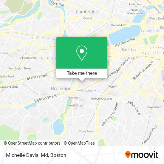
See Michelle Davis, Md, Boston, on the map
Public Transit to Michelle Davis, Md in Boston
Wondering how to get to Michelle Davis, Md in Boston? Moovit helps you find the best way to get to Michelle Davis, Md with step-by-step directions from the nearest public transit station.
Moovit provides free maps and live directions to help you navigate through your city. View schedules, routes, timetables, and find out how long does it take to get to Michelle Davis, Md in real time.
Looking for the nearest stop or station to Michelle Davis, Md? Check out this list of stops closest to your destination: Brookline Ave @ Francis St; Huntington Ave @ Fenwood Rd; Brookline Ave @ Deaconess Rd; Brigham Circle; Longwood Ave @ Binney St; Ave Louis Pasteur @ Longwood Ave; Chapel St.
Bus: 39, 47, 85, CT3, 60, 65, 35, 66, GREEN LINE E SHUTTLE, GREEN LINE E SHUTTLE, GREEN LINE D SHUTTLE, GREEN LINE D SHUTTLE, GREEN LINE D SHUTTLE, GREEN LINE D SHUTTLE, GREEN LINE D SHUTTLE, 8, 9, 19.Train: PROVIDENCE/STOUGHTON.Subway: GREEN LINE E, GREEN LINE D.
Want to see if there’s another route that gets you there at an earlier time? Moovit helps you find alternative routes or times. Get directions from and directions to Michelle Davis, Md easily from the Moovit App or Website.
We make riding to Michelle Davis, Md easy, which is why over 1.7 million users, including users in Boston, trust Moovit as the best app for public transit. You don’t need to download an individual bus app or train app, Moovit is your all-in-one transit app that helps you find the best bus time or train time available.
For information on prices of bus, subway and train, costs and ride fares to Michelle Davis, Md, please check the Moovit app.
Use the app to navigate to popular places including to the airport, hospital, stadium, grocery store, mall, coffee shop, school, college, and university.
Michelle Davis, Md Address: 75 Francis St street in Boston
- Harvard School of Dental Medicine (HSDM),
- Jimmy fund auditorium,
- Jane Carrie Weeks MD,
- Boston Air Conditioning Contractors,
- Peter A Banks MD,
- Carter Katharine,
- Brigham Medical Specialties,
- Replace Lost Keys,
- Kelly Edward,
- Benjamin Peterson, MD,
- Dr. Brian Whang,
- Bolman Morton R,
- Charles A Hergrueter MD (Vacanti, Charles A, MD - Brigham & Women's Hospital),
- Eric Bluman,
- Brent T Shoji MD,
- Sarah Gale, Licsw,
- Developmental Endoscopy,
- John Michael McWilliams,
- Koenraad Max Mortele,
- Mitchell Vivian Gonzalez MD
Places Near Michelle Davis, Md (Boston)
- Isabella Stewart Gardner Museum, Boston,
- Cheers, Boston,
- Seaport District, Boston,
- House Of Blues, Boston,
- Boston Common, Boston,
- Wilbur Theatre, Boston,
- Leader Bank Pavilion (Leader Bank Pavillion), Boston,
- Faneuil Hall, Boston,
- Boston Medical Center, Boston,
- Quincy Market, Boston,
- Boston Children's Hospital, Boston,
- Massachusetts General Hospital, Boston,
- North End, Boston,
- Boston Convention & Exhibition Center, Boston,
- Museum Of Science, Boston,
- Mgm Music Hall, Boston,
- Wang Theater, Boston,
- Castle Island, Boston,
- Prudential Center, Boston,
- Td Garden, Boston
How to get to popular places in Boston with public transit
Get around Boston by public transit!
Traveling around Boston has never been so easy. See step by step directions as you travel to any attraction, street or major public transit station. View bus and train schedules, arrival times, service alerts and detailed routes on a map, so you know exactly how to get to anywhere in Boston.
When traveling to any destination around Boston use Moovit's Live Directions with Get Off Notifications to know exactly where and how far to walk, how long to wait for your line, and how many stops are left. Moovit will alert you when it's time to get off — no need to constantly re-check whether yours is the next stop.
Wondering how to use public transit in Boston or how to pay for public transit in Boston? Moovit public transit app can help you navigate your way with public transit easily, and at minimum cost. It includes public transit fees, ticket prices, and costs. Looking for a map of Boston public transit lines? Moovit public transit app shows all public transit maps in Boston with all Bus, Train, Subway and Ferry routes and stops on an interactive map.
Boston has 4 transit type(s), including: Bus, Train, Subway and Ferry, operated by several transit agencies, including MBTA, Southeastern Regional Transit Authority, MetroWest Regional Transit Authority, Rhode Island Public Transit Authority, WRTA, Lowell Regional Transit Authority, Merrimack Valley Transit, Montachusett Regional Transit Authority, Cape Cod Regional Transit Authority, Brockton Area Transit Authority, Martha's Vineyard Transit Authority, the WAVE - Nantucket Regional Transit Authority, GATRA, Cape Ann Transportation Authority and Massport