Directions to Mida (Boston) with public transportation
The following transit lines have routes that pass near Mida
 Bus: 47, 60, 8, 9, 19.
- Train: FRAMINGHAM/WORCESTER.
- Subway: GREEN LINE D, GREEN LINE C, GREEN LINE B.
How to get to Mida by bus?
Click on the bus route to see step by step directions with maps, line arrival times and updated time schedules.
From MBTA Suffolk Downs Station, Boston
85 minFrom Massport Bus 77 Chelsea Employee Parking, Chelsea
76 minFrom Hampton Inn Boston Logan Airport, Revere
68 minFrom Milton, MA, Milton
83 minFrom Suffolk Downs, Boston
82 minFrom Conte Forum, Boston
45 minFrom John F. Kennedy Presidential Library And Museum, Boston
62 minFrom Fresh Pond Mall, Cambridge
59 minFrom Doubletree-Boston Bayside, Boston
53 min
How to get to Mida by train?
Click on the train route to see step by step directions with maps, line arrival times and updated time schedules.
How to get to Mida by subway?
Click on the subway route to see step by step directions with maps, line arrival times and updated time schedules.
From MBTA Suffolk Downs Station, Boston
43 minFrom Massport Bus 77 Chelsea Employee Parking, Chelsea
54 minFrom Hampton Inn Boston Logan Airport, Revere
65 minFrom Milton, MA, Milton
89 minFrom Suffolk Downs, Boston
55 minFrom Conte Forum, Boston
37 minFrom John F. Kennedy Presidential Library And Museum, Boston
63 minFrom Fresh Pond Mall, Cambridge
58 minFrom Doubletree-Boston Bayside, Boston
45 min
Bus stops near Mida in Boston
Subway stations near Mida in Boston
Train station near Mida in Boston
- Lansdowne, 6 min walk,VIEW
Bus lines to Mida in Boston
- 8, Kenmore via South Bay Center - Harbor Point via South Bay Center,VIEW
- 9, Copley - City Point,VIEW
- 19, Kenmore - Fields Corner,VIEW
- 60, Kenmore - Chestnut Hill Mall,VIEW
- 65, Kenmore - Brighton Center,VIEW
- 47, Broadway,VIEW
- 85, Ruggles,VIEW
- 55, West Fenway,VIEW
- GREEN LINE D SHUTTLE, Riverside - Kenmore (Shuttle),VIEW
- GREEN LINE D SHUTTLE, Reservoir - Fenway,VIEW
- GREEN LINE D SHUTTLE, Reservoir - Kenmore,VIEW
- GREEN LINE D SHUTTLE, Riverside - Kenmore via Saint Mary's Street,VIEW
- GREEN LINE D SHUTTLE, Newton Highlands - Kenmore,VIEW
- GREEN LINE D SHUTTLE, Riverside - Fenway,VIEW
- GREEN LINE D SHUTTLE, Newton Highlands - Fenway,VIEW
- GREEN LINE D SHUTTLE, Brookline Hills - Kenmore,VIEW
- GREEN LINE D SHUTTLE, Newton Highlands - Kenmore via Saint Mary's Street,VIEW
- GREEN LINE D SHUTTLE, Brookline Hills - Back Bay (Shuttle),VIEW
- GREEN LINE D SHUTTLE, Riverside - Kenmore,VIEW
- GREEN LINE C SHUTTLE, Back Bay (Shuttle),VIEW
What are the closest stations to Mida?
The closest stations to Mida are:
- 132 Brookline Ave Opp Fullerton St is 16 yards away, 1 min walk.
- Brookline Ave @ Pilgrim Rd / Fenway Campus is 68 yards away, 1 min walk.
- Queensberry St @ Jersey St is 270 yards away, 4 min walk.
- Fenway is 357 yards away, 5 min walk.
- Lansdowne is 417 yards away, 6 min walk.
- Park Dr @ Fenway Station SB is 455 yards away, 6 min walk.
- Fenway - Beacon St @ Park Dr is 516 yards away, 7 min walk.
- Park Dr @ Fenway Station NB is 522 yards away, 7 min walk.
- Saint Marys Street is 723 yards away, 9 min walk.
- Blandford Street is 740 yards away, 9 min walk.
Which bus lines stop near Mida?
These bus lines stop near Mida: 47, 60, 8.
Which train line stops near Mida?
FRAMINGHAM/WORCESTER (#525 | Worcester)
Which subway line stops near Mida?
GREEN LINE D (Riverside)
What’s the nearest subway station to Mida in Boston?
The nearest subway station to Mida in Boston is Fenway. It’s a 5 min walk away.
What’s the nearest train station to Mida in Boston?
The nearest train station to Mida in Boston is Lansdowne. It’s a 6 min walk away.
What’s the nearest bus station to Mida in Boston?
The nearest bus stations to Mida in Boston are 132 Brookline Ave Opp Fullerton St and Brookline Ave @ Pilgrim Rd / Fenway Campus. The closest one is a 1 min walk away.
What time is the first subway to Mida in Boston?
The GREEN LINE D is the first subway that goes to Mida in Boston. It stops nearby at 4:56 AM.
What time is the last subway to Mida in Boston?
The GREEN LINE D is the last subway that goes to Mida in Boston. It stops nearby at 2:21 AM.
What time is the first train to Mida in Boston?
The FRAMINGHAM/WORCESTER is the first train that goes to Mida in Boston. It stops nearby at 4:55 AM.
What time is the last train to Mida in Boston?
The FRAMINGHAM/WORCESTER is the last train that goes to Mida in Boston. It stops nearby at 12:06 AM.
What time is the first bus to Mida in Boston?
The 60 is the first bus that goes to Mida in Boston. It stops nearby at 5:22 AM.
What time is the last bus to Mida in Boston?
The 47 is the last bus that goes to Mida in Boston. It stops nearby at 1:09 AM.
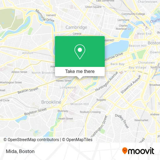
See Mida, Boston, on the map
Public Transit to Mida in Boston
Wondering how to get to Mida in Boston? Moovit helps you find the best way to get to Mida with step-by-step directions from the nearest public transit station.
Moovit provides free maps and live directions to help you navigate through your city. View schedules, routes, timetables, and find out how long does it take to get to Mida in real time.
Looking for the nearest stop or station to Mida? Check out this list of stops closest to your destination: 132 Brookline Ave Opp Fullerton St; Brookline Ave @ Pilgrim Rd / Fenway Campus; Queensberry St @ Jersey St; Fenway; Lansdowne; Park Dr @ Fenway Station SB; Fenway - Beacon St @ Park Dr; Park Dr @ Fenway Station NB; Saint Marys Street; Blandford Street.
Bus: 47, 60, 8, 9, 19, 65, 85.Train: FRAMINGHAM/WORCESTER.Subway: GREEN LINE D, GREEN LINE C, GREEN LINE B.
Want to see if there’s another route that gets you there at an earlier time? Moovit helps you find alternative routes or times. Get directions from and directions to Mida easily from the Moovit App or Website.
We make riding to Mida easy, which is why over 1.7 million users, including users in Boston, trust Moovit as the best app for public transit. You don’t need to download an individual bus app or train app, Moovit is your all-in-one transit app that helps you find the best bus time or train time available.
For information on prices of subway, bus and train, costs and ride fares to Mida, please check the Moovit app.
Use the app to navigate to popular places including to the airport, hospital, stadium, grocery store, mall, coffee shop, school, college, and university.
Mida Address: 1391 Boylston St street in Boston
- 5 Wits,
- Pierce Boston,
- Cb2,
- Fenway Triangle Trilogy Garage,
- Sonder at Pierce Boston ,
- 200 Brookline,
- Sweet Cheeks Q,
- Boston Children's Hospital Trust,
- Star Market (Shaw's),
- Regal Cinemas Fenway 13 & RPX,
- The Green,
- BED BATH & BEYOND - Fenway Park,
- Suffolk Construction,
- Verb Hotel,
- Chroma Medicine,
- Table Caffe Timeout Market,
- Mamaleh's Delicatessen,
- Kured,
- Greek Street,
- Peter Ungar
Places Near Mida (Boston)
- Boston Convention & Exhibition Center, Boston,
- Wilbur Theatre, Boston,
- House Of Blues, Boston,
- North End, Boston,
- Isabella Stewart Gardner Museum, Boston,
- Mgm Music Hall, Boston,
- Boston Medical Center, Boston,
- Castle Island, Boston,
- Td Garden, Boston,
- Quincy Market, Boston,
- Leader Bank Pavilion (Leader Bank Pavillion), Boston,
- Museum Of Science, Boston,
- Prudential Center, Boston,
- Boston Children's Hospital, Boston,
- Faneuil Hall, Boston,
- Massachusetts General Hospital, Boston,
- Wang Theater, Boston,
- Seaport District, Boston,
- Boston Common, Boston,
- Cheers, Boston
How to get to popular places in Boston with public transit
Get around Boston by public transit!
Traveling around Boston has never been so easy. See step by step directions as you travel to any attraction, street or major public transit station. View bus and train schedules, arrival times, service alerts and detailed routes on a map, so you know exactly how to get to anywhere in Boston.
When traveling to any destination around Boston use Moovit's Live Directions with Get Off Notifications to know exactly where and how far to walk, how long to wait for your line, and how many stops are left. Moovit will alert you when it's time to get off — no need to constantly re-check whether yours is the next stop.
Wondering how to use public transit in Boston or how to pay for public transit in Boston? Moovit public transit app can help you navigate your way with public transit easily, and at minimum cost. It includes public transit fees, ticket prices, and costs. Looking for a map of Boston public transit lines? Moovit public transit app shows all public transit maps in Boston with all Bus, Train, Subway and Ferry routes and stops on an interactive map.
Boston has 4 transit type(s), including: Bus, Train, Subway and Ferry, operated by several transit agencies, including MBTA, Southeastern Regional Transit Authority, MetroWest Regional Transit Authority, Rhode Island Public Transit Authority, WRTA, Lowell Regional Transit Authority, Merrimack Valley Transit, Montachusett Regional Transit Authority, Cape Cod Regional Transit Authority, Brockton Area Transit Authority, Martha's Vineyard Transit Authority, the WAVE - Nantucket Regional Transit Authority, GATRA, Cape Ann Transportation Authority and Massport