Directions to Mit Eecs Department (Cambridge) with public transportation
The following transit lines have routes that pass near Mit Eecs Department
 Bus: 1, 19, 85, EZRIDE, 64.
- Train: FRAMINGHAM/WORCESTER, NEEDHAM.
- Subway: RED LINE, GREEN LINE B, GREEN LINE C, GREEN LINE D.
How to get to Mit Eecs Department by bus?
Click on the bus route to see step by step directions with maps, line arrival times and updated time schedules.
From Washington St, Boston
53 minFrom Boston Scientific, Quincy
154 minFrom Four Points by Sheraton Boston Logan Airport, Revere
94 minFrom Flynn Cruiseport Boston, Boston
56 minFrom The Strand Theater, Boston
53 minFrom Market Basket, Revere
93 minFrom VFW Parkway, Boston
72 minFrom West Roxbury, Boston
71 minFrom Rino's Place, Boston
61 min
How to get to Mit Eecs Department by train?
Click on the train route to see step by step directions with maps, line arrival times and updated time schedules.
How to get to Mit Eecs Department by subway?
Click on the subway route to see step by step directions with maps, line arrival times and updated time schedules.
Subway stations near Mit Eecs Department in Cambridge
Bus stops near Mit Eecs Department in Cambridge
Bus lines to Mit Eecs Department in Cambridge
- 85, Ruggles,VIEW
- EZRIDE, Outbound Lechemere To Kendall,VIEW
- EZRIDE, Outbound North Station To Erie St Via Lechmere And Kendall,VIEW
- EZRIDE, Outbound To Erie St From North Station,VIEW
- 1, Harvard,VIEW
- 64, Oak Square,VIEW
- 68, Harvard,VIEW
- EZRIDE, Inbound To North Station Via Kendall And Lechmere,VIEW
- EZRIDE, Inbound To North Station From Erie St,VIEW
- EZRIDE, Inbound Kendall To Lechmere,VIEW
What are the closest stations to Mit Eecs Department?
The closest stations to Mit Eecs Department are:
- Central is 57 yards away, 1 min walk.
- Hynes Convention Center is 393 yards away, 5 min walk.
- Ames St @ Main St is 467 yards away, 6 min walk.
- Massachusetts Ave @ Albany St is 499 yards away, 6 min walk.
- Main St @ Galileo Way is 500 yards away, 7 min walk.
- Albany St./Osborn St. is 530 yards away, 7 min walk.
- Galileo Way @ Main St is 620 yards away, 8 min walk.
Which bus lines stop near Mit Eecs Department?
These bus lines stop near Mit Eecs Department: 1, 19, 85, EZRIDE.
Which train lines stop near Mit Eecs Department?
These train lines stop near Mit Eecs Department: FRAMINGHAM/WORCESTER, NEEDHAM.
Which subway line stops near Mit Eecs Department?
RED LINE (Alewife)
What’s the nearest subway station to Mit Eecs Department in Cambridge?
The nearest subway station to Mit Eecs Department in Cambridge is Central. It’s a 1 min walk away.
What’s the nearest bus station to Mit Eecs Department in Cambridge?
The nearest bus stations to Mit Eecs Department in Cambridge are Ames St @ Main St and Massachusetts Ave @ Albany St. The closest one is a 6 min walk away.
What time is the first subway to Mit Eecs Department in Cambridge?
The GREEN LINE D is the first subway that goes to Mit Eecs Department in Cambridge. It stops nearby at 5:00 AM.
What time is the last subway to Mit Eecs Department in Cambridge?
The GREEN LINE D is the last subway that goes to Mit Eecs Department in Cambridge. It stops nearby at 2:18 AM.
What time is the first bus to Mit Eecs Department in Cambridge?
The 1 is the first bus that goes to Mit Eecs Department in Cambridge. It stops nearby at 4:54 AM.
What time is the last bus to Mit Eecs Department in Cambridge?
The 1 is the last bus that goes to Mit Eecs Department in Cambridge. It stops nearby at 2:28 AM.
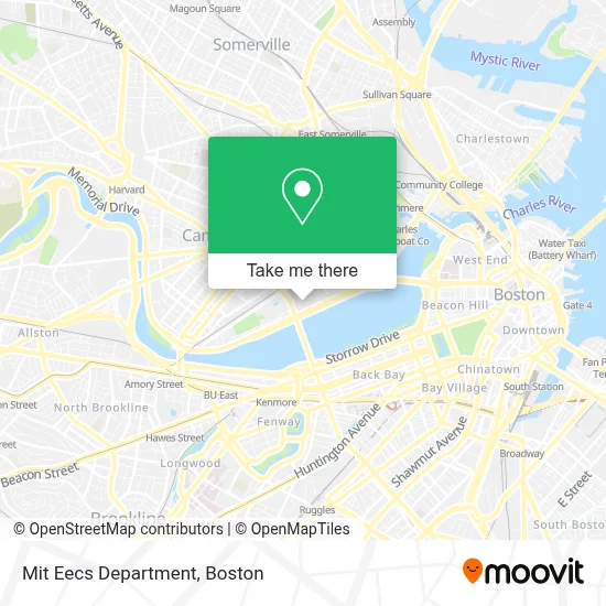
See Mit Eecs Department, Cambridge, on the map
Public Transit to Mit Eecs Department in Cambridge
Wondering how to get to Mit Eecs Department in Cambridge? Moovit helps you find the best way to get to Mit Eecs Department with step-by-step directions from the nearest public transit station.
Moovit provides free maps and live directions to help you navigate through your city. View schedules, routes, timetables, and find out how long does it take to get to Mit Eecs Department in real time.
Looking for the nearest stop or station to Mit Eecs Department? Check out this list of stops closest to your destination: Central; Hynes Convention Center; Ames St @ Main St; Massachusetts Ave @ Albany St; Main St @ Galileo Way; Albany St./Osborn St.; Galileo Way @ Main St.
Bus: 1, 19, 85, EZRIDE, 64, 68.Train: FRAMINGHAM/WORCESTER, NEEDHAM.Subway: RED LINE, GREEN LINE B, GREEN LINE C, GREEN LINE D.
Want to see if there’s another route that gets you there at an earlier time? Moovit helps you find alternative routes or times. Get directions from and directions to Mit Eecs Department easily from the Moovit App or Website.
We make riding to Mit Eecs Department easy, which is why over 1.7 million users, including users in Cambridge, trust Moovit as the best app for public transit. You don’t need to download an individual bus app or train app, Moovit is your all-in-one transit app that helps you find the best bus time or train time available.
For information on prices of bus, subway and train, costs and ride fares to Mit Eecs Department, please check the Moovit app.
Use the app to navigate to popular places including to the airport, hospital, stadium, grocery store, mall, coffee shop, school, college, and university.
Mit Eecs Department Address: Massachusetts Institute of Tech, 77 Massachusetts Ave street in Cambridge
- MIT Killian Court,
- MIT Math Major Lounge (4-174),
- MIT 10-250 (Huntington Hall),
- MIT Barker Engineering Library (10-500),
- Hart Nautical Gallery (Hart Nautical Galleries at Mit),
- Mit Department of Materials Science and Engineering (Dmse),
- M.I.T.,
- MIT Rotch Library of Architecture & Planning (7-238),
- MIT Tunnels,
- MIT MBTA Bus Stop,
- MIT Elizabeth Parks Killian Hall (14W-111),
- Mit Campus Map,
- MIT,
- Meche Fish Bowl Lounge,
- MIT Lobdell Dining Hall (W20-208),
- MIT Aero/Astro Lab (33-116),
- MIT Stratton Student Center (Building W20),
- MIT Building 37 (McNair Building),
- MIT Copytech (W20-102),
- MIT Kresge Oval
Places Near Mit Eecs Department (Cambridge)
- Wang Theater, Boston,
- Museum Of Science, Boston,
- Massachusetts General Hospital, Boston,
- Isabella Stewart Gardner Museum, Boston,
- Seaport District, Boston,
- Boston Common, Boston,
- Wilbur Theatre, Boston,
- Boston Medical Center, Boston,
- Td Garden, Boston,
- House Of Blues, Boston,
- Boston Convention & Exhibition Center, Boston,
- Leader Bank Pavilion (Leader Bank Pavillion), Boston,
- North End, Boston,
- Castle Island, Boston,
- Cheers, Boston,
- Prudential Center, Boston,
- Mgm Music Hall, Boston,
- Faneuil Hall, Boston,
- Quincy Market, Boston,
- Boston Children's Hospital, Boston
How to get to popular places in Boston with public transit
Get around Cambridge by public transit!
Traveling around Cambridge has never been so easy. See step by step directions as you travel to any attraction, street or major public transit station. View bus and train schedules, arrival times, service alerts and detailed routes on a map, so you know exactly how to get to anywhere in Cambridge.
When traveling to any destination around Cambridge use Moovit's Live Directions with Get Off Notifications to know exactly where and how far to walk, how long to wait for your line, and how many stops are left. Moovit will alert you when it's time to get off — no need to constantly re-check whether yours is the next stop.
Wondering how to use public transit in Cambridge or how to pay for public transit in Cambridge? Moovit public transit app can help you navigate your way with public transit easily, and at minimum cost. It includes public transit fees, ticket prices, and costs. Looking for a map of Cambridge public transit lines? Moovit public transit app shows all public transit maps in Cambridge with all Bus, Train, Subway and Ferry routes and stops on an interactive map.
Boston has 4 transit type(s), including: Bus, Train, Subway and Ferry, operated by several transit agencies, including MBTA, Southeastern Regional Transit Authority, MetroWest Regional Transit Authority, Rhode Island Public Transit Authority, WRTA, Lowell Regional Transit Authority, Merrimack Valley Transit, Montachusett Regional Transit Authority, Cape Cod Regional Transit Authority, Brockton Area Transit Authority, Martha's Vineyard Transit Authority, the WAVE - Nantucket Regional Transit Authority, GATRA, Cape Ann Transportation Authority and Massport