Directions to Mix-Ins (Dedham) with public transportation
The following transit lines have routes that pass near Mix-Ins
 Bus: 33, 34, 34E, 40.
- Train: FRANKLIN/FOXBORO, PROVIDENCE/STOUGHTON, FAIRMOUNT.
How to get to Mix-Ins by bus?
Click on the bus route to see step by step directions with maps, line arrival times and updated time schedules.
How to get to Mix-Ins by train?
Click on the train route to see step by step directions with maps, line arrival times and updated time schedules.
From MBTA-Windsor Gardens, Norwood
44 minFrom Hebrew Rehab Center, Boston
124 minFrom Dorchester, Boston
88 minFrom Mission Hill, Boston
83 minFrom Faulkner Hospital, Boston
123 minFrom Jamaica Plain, Boston
124 minFrom Arnold Arboretum, Boston
112 minFrom Windsor Gardens MBTA Commuter Rail, Norwood
43 minFrom The Monument, Boston
116 min
Bus stops near Mix-Ins in Dedham
Train stations near Mix-Ins in Dedham
- Readville, 28 min walk,VIEW
What are the closest stations to Mix-Ins?
The closest stations to Mix-Ins are:
- River St @ Milton St is 911 yards away, 12 min walk.
- 136 Georgetowne Pl is 1964 yards away, 24 min walk.
- Readville is 2247 yards away, 28 min walk.
Which bus lines stop near Mix-Ins?
These bus lines stop near Mix-Ins: 33, 34, 34E.
Which train lines stop near Mix-Ins?
These train lines stop near Mix-Ins: FRANKLIN/FOXBORO, PROVIDENCE/STOUGHTON.
What’s the nearest train station to Mix-Ins in Dedham?
The nearest train station to Mix-Ins in Dedham is Readville. It’s a 28 min walk away.
What’s the nearest bus station to Mix-Ins in Dedham?
The nearest bus station to Mix-Ins in Dedham is River St @ Milton St. It’s a 12 min walk away.
What time is the first train to Mix-Ins in Dedham?
The PROVIDENCE/STOUGHTON is the first train that goes to Mix-Ins in Dedham. It stops nearby at 5:05 AM.
What time is the last train to Mix-Ins in Dedham?
The PROVIDENCE/STOUGHTON is the last train that goes to Mix-Ins in Dedham. It stops nearby at 12:20 AM.
What time is the first bus to Mix-Ins in Dedham?
The 40 is the first bus that goes to Mix-Ins in Dedham. It stops nearby at 5:33 AM.
What time is the last bus to Mix-Ins in Dedham?
The 40 is the last bus that goes to Mix-Ins in Dedham. It stops nearby at 9:35 PM.
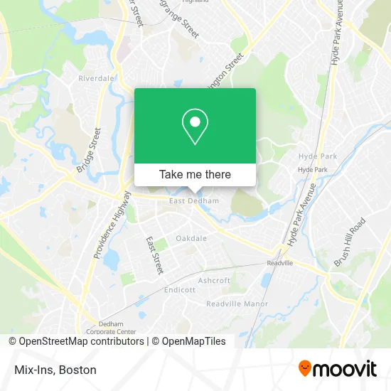
See Mix-Ins, Dedham, on the map
Public Transit to Mix-Ins in Dedham
Wondering how to get to Mix-Ins in Dedham? Moovit helps you find the best way to get to Mix-Ins with step-by-step directions from the nearest public transit station.
Moovit provides free maps and live directions to help you navigate through your city. View schedules, routes, timetables, and find out how long does it take to get to Mix-Ins in real time.
Looking for the nearest stop or station to Mix-Ins? Check out this list of stops closest to your destination: River St @ Milton St; 136 Georgetowne Pl; Readville.
Bus: 33, 34, 34E, 40.Train: FRANKLIN/FOXBORO, PROVIDENCE/STOUGHTON, FAIRMOUNT.
Want to see if there’s another route that gets you there at an earlier time? Moovit helps you find alternative routes or times. Get directions from and directions to Mix-Ins easily from the Moovit App or Website.
We make riding to Mix-Ins easy, which is why over 1.7 million users, including users in Dedham, trust Moovit as the best app for public transit. You don’t need to download an individual bus app or train app, Moovit is your all-in-one transit app that helps you find the best bus time or train time available.
For information on prices of bus, train and subway, costs and ride fares to Mix-Ins, please check the Moovit app.
Use the app to navigate to popular places including to the airport, hospital, stadium, grocery store, mall, coffee shop, school, college, and university.
Mix-Ins Address: 248 Bussey St street in Dedham
- Amazon Locker-Virginia,
- P & S Complete Cleaning Service,
- William B. Gould Park,
- Euro Glam,
- Atlant Car Keys,
- Boston Metro Real Estate Expert,
- B.A. Perazim,
- Dedham High School Track,
- Noco PDR Solutions,
- Juju's Pool- Dedham,
- Ardlin Fire Protection,
- Stuart Glass Inc,
- 24 Hour Emergency Locksmith A,
- Cellarmaster Wines,
- 12 Mt Vernon St,
- Dedham Emergency Plumbing,
- Jmi Investment Properties,
- Harvard Community Health Plan,
- Fountain of Grace Church - Food Distribution Center,
- Blue Hills Bank
Places Near Mix-Ins (Dedham)
- Castle Island, Boston,
- House Of Blues, Boston,
- Leader Bank Pavilion (Leader Bank Pavillion), Boston,
- Mgm Music Hall, Boston,
- Seaport District, Boston,
- Boston Common, Boston,
- Museum Of Science, Boston,
- Prudential Center, Boston,
- North End, Boston,
- Quincy Market, Boston,
- Isabella Stewart Gardner Museum, Boston,
- Faneuil Hall, Boston,
- Boston Medical Center, Boston,
- Wilbur Theatre, Boston,
- Boston Convention & Exhibition Center, Boston,
- Massachusetts General Hospital, Boston,
- Cheers, Boston,
- Wang Theater, Boston,
- Boston Children's Hospital, Boston,
- Td Garden, Boston
How to get to popular places in Boston with public transit
Get around Dedham by public transit!
Traveling around Dedham has never been so easy. See step by step directions as you travel to any attraction, street or major public transit station. View bus and train schedules, arrival times, service alerts and detailed routes on a map, so you know exactly how to get to anywhere in Dedham.
When traveling to any destination around Dedham use Moovit's Live Directions with Get Off Notifications to know exactly where and how far to walk, how long to wait for your line, and how many stops are left. Moovit will alert you when it's time to get off — no need to constantly re-check whether yours is the next stop.
Wondering how to use public transit in Dedham or how to pay for public transit in Dedham? Moovit public transit app can help you navigate your way with public transit easily, and at minimum cost. It includes public transit fees, ticket prices, and costs. Looking for a map of Dedham public transit lines? Moovit public transit app shows all public transit maps in Dedham with all Bus, Train, Subway and Ferry routes and stops on an interactive map.
Boston has 4 transit type(s), including: Bus, Train, Subway and Ferry, operated by several transit agencies, including MBTA, Southeastern Regional Transit Authority, MetroWest Regional Transit Authority, Rhode Island Public Transit Authority, WRTA, Lowell Regional Transit Authority, Merrimack Valley Transit, Montachusett Regional Transit Authority, Cape Cod Regional Transit Authority, Brockton Area Transit Authority, Martha's Vineyard Transit Authority, the WAVE - Nantucket Regional Transit Authority, GATRA, Cape Ann Transportation Authority and Massport