Directions to Mobil (Boston) with public transportation
The following transit lines have routes that pass near Mobil
 Bus: 28, 31, 716, 24, 29.
- Train: FAIRMOUNT, FRANKLIN/FOXBORO, PROVIDENCE/STOUGHTON.
- Subway: MATTAPAN LINE.
How to get to Mobil by bus?
Click on the bus route to see step by step directions with maps, line arrival times and updated time schedules.
From VFW Parkway, Boston
41 minFrom Godfrey Hotel Boston, Boston
61 minFrom Boston Tea Party - Ships And Museum, Boston
73 minFrom DCR Hatch Memorial Shell, Boston
65 minFrom VA Hospital, Boston
43 minFrom St. Cecilia's Catholic Church, Boston
52 minFrom South Boston, Boston
66 minFrom Hyatt Place Boston Seaport District, Boston
83 minFrom Seaport Hotel, Boston
81 min
How to get to Mobil by train?
Click on the train route to see step by step directions with maps, line arrival times and updated time schedules.
From Godfrey Hotel Boston, Boston
40 minFrom Boston Tea Party - Ships And Museum, Boston
36 minFrom DCR Hatch Memorial Shell, Boston
57 minFrom VA Hospital, Boston
77 minFrom St. Cecilia's Catholic Church, Boston
52 minFrom South Boston, Boston
48 minFrom Hyatt Place Boston Seaport District, Boston
54 minFrom Seaport Hotel, Boston
48 min
How to get to Mobil by subway?
Click on the subway route to see step by step directions with maps, line arrival times and updated time schedules.
From Godfrey Hotel Boston, Boston
38 minFrom Boston Tea Party - Ships And Museum, Boston
42 minFrom DCR Hatch Memorial Shell, Boston
54 minFrom St. Cecilia's Catholic Church, Boston
57 minFrom South Boston, Boston
43 minFrom Hyatt Place Boston Seaport District, Boston
60 minFrom Seaport Hotel, Boston
55 min
Train stations near Mobil in Boston
Subway station near Mobil in Boston
- Valley Road, 25 min walk,VIEW
Bus lines to Mobil in Boston
- 24, Wakefield Ave,VIEW
- 28, Avenue Louis Pasteur Via Ruggles,VIEW
- 29, Jackson Square,VIEW
- 30, Forest Hills,VIEW
- 31, Mattapan,VIEW
- 33, River St & Milton St,VIEW
- 716, Mattapan,VIEW
- 15, Haymarket Via Fields Corner & Nubian,VIEW
- 245, Quincy Center Via Brook Rd & Alleyne St,VIEW
- MATTAPAN LINE SHUTTLE, Ashmont (Shuttle),VIEW
- MATTAPAN LINE SHUTTLE, Mattapan (Shuttle),VIEW
- RED/MATTAPAN LINE SHUTTLE, JFK (Shuttle),VIEW
What are the closest stations to Mobil?
The closest stations to Mobil are:
- Blue Hills Pkwy @ River St is 283 yards away, 4 min walk.
- Mattapan is 475 yards away, 6 min walk.
- Morton Street is 1023 yards away, 12 min walk.
- Blue Hill Avenue is 2013 yards away, 24 min walk.
- Valley Road is 2129 yards away, 25 min walk.
Which bus lines stop near Mobil?
These bus lines stop near Mobil: 28, 31, 716.
Which train line stops near Mobil?
FAIRMOUNT (#1619 | Fairmount)
Which subway line stops near Mobil?
MATTAPAN LINE (Mattapan)
What’s the nearest subway station to Mobil in Boston?
The nearest subway station to Mobil in Boston is Valley Road. It’s a 25 min walk away.
What’s the nearest train station to Mobil in Boston?
The nearest train station to Mobil in Boston is Morton Street. It’s a 12 min walk away.
What’s the nearest bus station to Mobil in Boston?
The nearest bus station to Mobil in Boston is Blue Hills Pkwy @ River St. It’s a 4 min walk away.
What time is the first subway to Mobil in Boston?
The MATTAPAN LINE is the first subway that goes to Mobil in Boston. It stops nearby at 5:00 AM.
What time is the last subway to Mobil in Boston?
The MATTAPAN LINE is the last subway that goes to Mobil in Boston. It stops nearby at 2:40 AM.
What time is the first train to Mobil in Boston?
The FAIRMOUNT is the first train that goes to Mobil in Boston. It stops nearby at 4:36 AM.
What time is the last train to Mobil in Boston?
The FAIRMOUNT is the last train that goes to Mobil in Boston. It stops nearby at 12:08 AM.
What time is the first bus to Mobil in Boston?
The 28 is the first bus that goes to Mobil in Boston. It stops nearby at 3:10 AM.
What time is the last bus to Mobil in Boston?
The 28 is the last bus that goes to Mobil in Boston. It stops nearby at 2:34 AM.
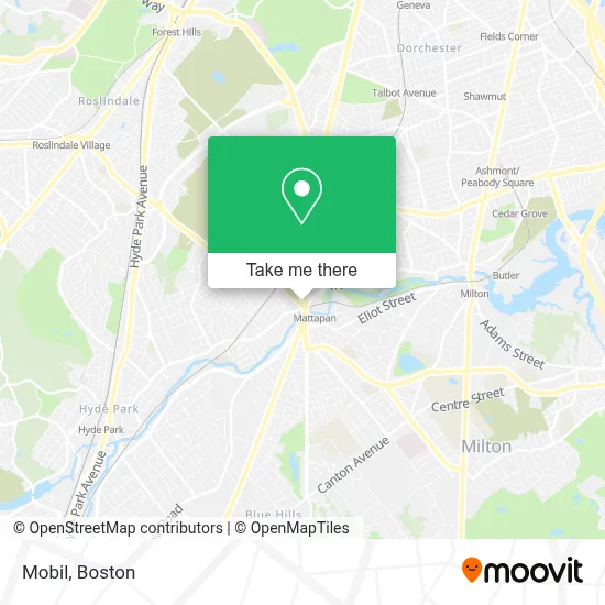
See Mobil, Boston, on the map
Public Transit to Mobil in Boston
Wondering how to get to Mobil in Boston? Moovit helps you find the best way to get to Mobil with step-by-step directions from the nearest public transit station.
Moovit provides free maps and live directions to help you navigate through your city. View schedules, routes, timetables, and find out how long does it take to get to Mobil in real time.
Looking for the nearest stop or station to Mobil? Check out this list of stops closest to your destination: Blue Hills Pkwy @ River St; Mattapan; Morton Street; Blue Hill Avenue; Valley Road.
Bus: 28, 31, 716, 24, 29, 30, 15, 245, MATTAPAN LINE SHUTTLE, MATTAPAN LINE SHUTTLE, RED/MATTAPAN LINE SHUTTLE.Train: FAIRMOUNT, FRANKLIN/FOXBORO, PROVIDENCE/STOUGHTON.Subway: MATTAPAN LINE.
Want to see if there’s another route that gets you there at an earlier time? Moovit helps you find alternative routes or times. Get directions from and directions to Mobil easily from the Moovit App or Website.
We make riding to Mobil easy, which is why over 1.7 million users, including users in Boston, trust Moovit as the best app for public transit. You don’t need to download an individual bus app or train app, Moovit is your all-in-one transit app that helps you find the best bus time or train time available.
For information on prices of bus, subway and train, costs and ride fares to Mobil, please check the Moovit app.
Use the app to navigate to popular places including to the airport, hospital, stadium, grocery store, mall, coffee shop, school, college, and university.
Mobil Address: 1663 Blue Hill Ave street in Boston
- Committee To Elect Rob Consalvo,
- 365 Days of Locks,
- Howard Mobile Locksmith,
- Jakes Locksmith Services,
- Mattapan Square,
- Ostendorf Law Group,
- WESTERN UNION,
- Roy Neblett Tax,
- Peña Tax & Services,
- Itiahaiti,
- Andrade & Associates,
- Roberts,
- Brother's Deli,
- Church Of the Holy Spirit,
- Snipes USA,
- Sams Market,
- Living Word Church,
- Caribbean Choice and Varieties,
- Garland Local Locksmih,
- Boston-Mattapan Square
Places Near Mobil (Boston)
- Leader Bank Pavilion (Leader Bank Pavillion), Boston,
- Boston Common, Boston,
- House Of Blues, Boston,
- Wilbur Theatre, Boston,
- Massachusetts General Hospital, Boston,
- Quincy Market, Boston,
- Boston Children's Hospital, Boston,
- Mgm Music Hall, Boston,
- Faneuil Hall, Boston,
- Prudential Center, Boston,
- Wang Theater, Boston,
- North End, Boston,
- Museum Of Science, Boston,
- Boston Medical Center, Boston,
- Boston Convention & Exhibition Center, Boston,
- Castle Island, Boston,
- Td Garden, Boston,
- Cheers, Boston,
- Seaport District, Boston,
- Isabella Stewart Gardner Museum, Boston
How to get to popular places in Boston with public transit
Get around Boston by public transit!
Traveling around Boston has never been so easy. See step by step directions as you travel to any attraction, street or major public transit station. View bus and train schedules, arrival times, service alerts and detailed routes on a map, so you know exactly how to get to anywhere in Boston.
When traveling to any destination around Boston use Moovit's Live Directions with Get Off Notifications to know exactly where and how far to walk, how long to wait for your line, and how many stops are left. Moovit will alert you when it's time to get off — no need to constantly re-check whether yours is the next stop.
Wondering how to use public transit in Boston or how to pay for public transit in Boston? Moovit public transit app can help you navigate your way with public transit easily, and at minimum cost. It includes public transit fees, ticket prices, and costs. Looking for a map of Boston public transit lines? Moovit public transit app shows all public transit maps in Boston with all Bus, Train, Subway and Ferry routes and stops on an interactive map.
Boston has 4 transit type(s), including: Bus, Train, Subway and Ferry, operated by several transit agencies, including MBTA, Southeastern Regional Transit Authority, MetroWest Regional Transit Authority, Rhode Island Public Transit Authority, WRTA, Lowell Regional Transit Authority, Merrimack Valley Transit, Montachusett Regional Transit Authority, Cape Cod Regional Transit Authority, Brockton Area Transit Authority, Martha's Vineyard Transit Authority, the WAVE - Nantucket Regional Transit Authority, GATRA, Cape Ann Transportation Authority and Massport