How to get to Mobil by bus?
Click on the bus route to see step by step directions with maps, line arrival times and updated time schedules.
How to get to Mobil by train?
Click on the train route to see step by step directions with maps, line arrival times and updated time schedules.
From Lowell, MA, Lowell
161 minFrom Parque de las ardillas, Lawrence
73 minFrom Lawrence, MA, Lawrence
69 minFrom Andover, MA, Andover
49 minFrom Lawrence, Massachusetts, Lawrence
72 minFrom Middlesex Community College, Lowell
167 minFrom Wilmington, MA, Wilmington
134 minFrom Phillips Academy Andover, Andover
70 min
Train station near Mobil in Boston
- Ballardvale, 61 min walk,VIEW
What are the closest stations to Mobil?
The closest stations to Mobil are:
- Ballardvale is 5194 yards away, 61 min walk.
Which bus line stops near Mobil?
12 (Kennedy Center)
Which train line stops near Mobil?
HAVERHILL (#224 | North Station)
What time is the first train to Mobil in Boston?
The HAVERHILL is the first train that goes to Mobil in Boston. It stops nearby at 5:03 AM.
What time is the last train to Mobil in Boston?
The HAVERHILL is the last train that goes to Mobil in Boston. It stops nearby at 12:26 AM.
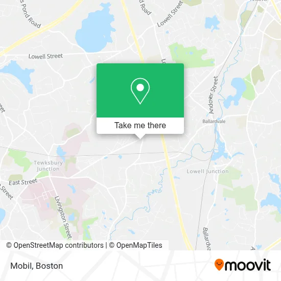
See Mobil, Boston, on the map
Public Transit to Mobil in Boston
Wondering how to get to Mobil in Boston? Moovit helps you find the best way to get to Mobil with step-by-step directions from the nearest public transit station.
Moovit provides free maps and live directions to help you navigate through your city. View schedules, routes, timetables, and find out how long does it take to get to Mobil in real time.
Looking for the nearest stop or station to Mobil? Check out this list of stops closest to your destination: Ballardvale.
Bus: 12.Train: HAVERHILL.
Want to see if there’s another route that gets you there at an earlier time? Moovit helps you find alternative routes or times. Get directions from and directions to Mobil easily from the Moovit App or Website.
We make riding to Mobil easy, which is why over 1.7 million users, including users in Boston, trust Moovit as the best app for public transit. You don’t need to download an individual bus app or train app, Moovit is your all-in-one transit app that helps you find the best bus time or train time available.
For information on prices of bus and train, costs and ride fares to Mobil, please check the Moovit app.
Use the app to navigate to popular places including to the airport, hospital, stadium, grocery store, mall, coffee shop, school, college, and university.
Mobil Address: 1700 Shawsheen St street in Boston
- Restaurant Depot,
- Rossino Plumbing,
- Mbt Worldwide Inc,
- Ballard Truck Center Of Tewksbury,
- Mcdevitt Peterbilt Of Boston,
- Iron Mountain,
- North Shore Vipers Hockey,
- New England Art And Framing,
- Turf Time,
- Teamsters,
- Sweeney Performance Training,
- Boston Hockey Academy,
- Building Wreckers Local,
- Keys Behavioral Health,
- New England Studios Of Deven Main Office,
- Northeast Trp,
- Jafco Foods, Inc.,
- New England Home Medical Equipment Llc,
- Mte Equipment Solutions,
- Flint Farm
Places Near Mobil (Boston)
- Td Garden, Boston,
- Wang Theater, Boston,
- Museum Of Science, Boston,
- North End, Boston,
- Isabella Stewart Gardner Museum, Boston,
- Faneuil Hall, Boston,
- Boston Medical Center, Boston,
- Wilbur Theatre, Boston,
- Prudential Center, Boston,
- Cheers, Boston,
- Boston Common, Boston,
- Mgm Music Hall, Boston,
- House Of Blues, Boston,
- Massachusetts General Hospital, Boston,
- Quincy Market, Boston,
- Boston Children's Hospital, Boston,
- Boston Convention & Exhibition Center, Boston,
- Seaport District, Boston,
- Leader Bank Pavilion (Leader Bank Pavillion), Boston,
- Castle Island, Boston
How to get to popular places in Boston with public transit
Get around Boston by public transit!
Traveling around Boston has never been so easy. See step by step directions as you travel to any attraction, street or major public transit station. View bus and train schedules, arrival times, service alerts and detailed routes on a map, so you know exactly how to get to anywhere in Boston.
When traveling to any destination around Boston use Moovit's Live Directions with Get Off Notifications to know exactly where and how far to walk, how long to wait for your line, and how many stops are left. Moovit will alert you when it's time to get off — no need to constantly re-check whether yours is the next stop.
Wondering how to use public transit in Boston or how to pay for public transit in Boston? Moovit public transit app can help you navigate your way with public transit easily, and at minimum cost. It includes public transit fees, ticket prices, and costs. Looking for a map of Boston public transit lines? Moovit public transit app shows all public transit maps in Boston with all Bus, Train, Subway and Ferry routes and stops on an interactive map.
Boston has 4 transit type(s), including: Bus, Train, Subway and Ferry, operated by several transit agencies, including MBTA, Southeastern Regional Transit Authority, MetroWest Regional Transit Authority, Rhode Island Public Transit Authority, WRTA, Lowell Regional Transit Authority, Merrimack Valley Transit, Montachusett Regional Transit Authority, Cape Cod Regional Transit Authority, Brockton Area Transit Authority, Martha's Vineyard Transit Authority, the WAVE - Nantucket Regional Transit Authority, GATRA, Cape Ann Transportation Authority and Massport