See Montclair Station, Montclair, Nj, on the map
Directions to Montclair Station (Montclair, Nj) with public transportation
The following transit lines have routes that pass near Montclair Station
 Bus:
Bus: - Train:
How to get to Montclair Station by bus?
Click on the bus route to see step by step directions with maps, line arrival times and updated time schedules.
How to get to Montclair Station by train?
Click on the train route to see step by step directions with maps, line arrival times and updated time schedules.
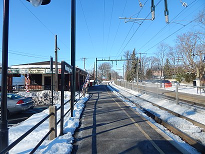
Train stations near Montclair Station in Montclair, Nj
- Walnut Street ,4 min walk,
Bus stations near Montclair Station in Montclair, Nj
- Bloomfield Ave At Hartley St,14 min walk,
Bus lines to Montclair Station in Montclair, Nj
- 11,Wayne Willowbrook,
- 28,Montclair St_U Willowbrook,
- 29,Bloomfield Ave Montclair,
What are the closest stations to Montclair Station?
The closest stations to Montclair Station are:
- Walnut Street is 322 yards away, 4 min walk.
- Bloomfield Ave At Hartley St is 1125 yards away, 14 min walk.
Which bus lines stop near Montclair Station?
These bus lines stop near Montclair Station: 11, 28.
Which train line stops near Montclair Station?
ML
What’s the nearest train station to Montclair Station in Montclair, Nj?
The nearest train station to Montclair Station in Montclair, Nj is Walnut Street. It’s a 4 min walk away.
What’s the nearest bus stop to Montclair Station in Montclair, Nj?
The nearest bus stop to Montclair Station in Montclair, Nj is Bloomfield Ave At Hartley St. It’s a 14 min walk away.
See Montclair Station, Montclair, Nj, on the map
Public Transit to Montclair Station in Montclair, Nj
Wondering how to get to Montclair Station in Montclair, Nj, United States? Moovit helps you find the best way to get to Montclair Station with step-by-step directions from the nearest public transit station.
Moovit provides free maps and live directions to help you navigate through your city. View schedules, routes, timetables, and find out how long does it take to get to Montclair Station in real time.
Looking for the nearest stop or station to Montclair Station? Check out this list of stops closest to your destination: Walnut Street ; Bloomfield Ave At Hartley St.
Bus:Train:
Want to see if there’s another route that gets you there at an earlier time? Moovit helps you find alternative routes or times. Get directions from and directions to Montclair Station easily from the Moovit App or Website.
We make riding to Montclair Station easy, which is why over 1.5 million users, including users in Montclair, Nj, trust Moovit as the best app for public transit. You don’t need to download an individual bus app or train app, Moovit is your all-in-one transit app that helps you find the best bus time or train time available.
For information on prices of train, bus, light rail and subway, costs and ride fares to Montclair Station, please check the Moovit app.
Use the app to navigate to popular places including to the airport, hospital, stadium, grocery store, mall, coffee shop, school, college, and university.
Location: Montclair, Nj, New York - New Jersey
Attractions near Montclair Station
Vozza Agency,Walnut St (walnut st greenwood),Valy Studio Gallery,Verto Taxi,Peace Action,Walnut & Green,Magic Circle Printing Inc,Little Kids Rock,Lform Design,Ashley's Soccer Camp Inc,0 0 24 Hour 7 Day A Emergency Locksmith,The Perfect Gift Company,Bees Knees Cafe,Mezoco Mexican Taqueria,Montclair Volunteer Ambulance Unit,De Camp,Depot Square Bar & Restaurant - Walnut Street Train Station,Walnut Street,Montclair Ambulance,KawayanHow to get to popular attractions in Montclair, Nj with public transit
Secaucus, NJ, Secaucus, Nj,LIRR - Babylon Station, Babylon, Ny,Shake Shack, Manhattan,J.G. Melon, Manhattan,Atlantic City, NJ, Atlantic City, Nj,Mission Dolores,Cookshop, Manhattan,Caesars Atlantic City Hotel and Casino, Atlantic City, Nj,MTA Subway - Fulton St (A / C/J / Z/2 / 3/4 / 5), Manhattan,Bubba Gump Shrimp Co., Manhattan,High Line, Manhattan,Rubirosa Ristorante, Manhattan,Clinton St. Baking Co. & Restaurant, Manhattan,Hotel Chantelle, Manhattan,Peter Luger Steak House,Jing Fong Restaurant 金豐大酒樓, Manhattan,Nan Xiang Xiao Long Bao, Queens,Time Life, Manhattan,Roberta's Pizza,Lombardi's Coal Oven Pizza, ManhattanGet around Montclair, Nj by public transit!
Traveling around Montclair, Nj has never been so easy. See step by step directions as you travel to any attraction, street or major public transit station. View bus and train schedules, arrival times, service alerts and detailed routes on a map, so you know exactly how to get to anywhere in Montclair, Nj.
When traveling to any destination around Montclair, Nj use Moovit's Live Directions with Get Off Notifications to know exactly where and how far to walk, how long to wait for your line, and how many stops are left. Moovit will alert you when it's time to get off — no need to constantly re-check whether yours is the next stop.
Wondering how to use public transit in Montclair, Nj or how to pay for public transit in Montclair, Nj? Moovit public transit app can help you navigate your way with public transit easily, and at minimum cost. It includes public transit fees, ticket prices, and costs. Looking for a map of Montclair, Nj public transit lines? Moovit public transit app shows all public transit maps in Montclair, Nj with all train, bus, light rail or subway routes and stops on an interactive map.
Montclair, Nj has 4 transit type(s), including: train, bus, light rail or subway, operated by several transit agencies, including MTA Subway, Metro-North Railroad, LIRR, PATH, Shore Line East, MTA Bus Company, MTA New York City Transit - Express routes, MTA Bus, NJ Transit, NYC Ferry, NICE bus, Bee-Line Bus, NJ Transit Rail, NJ Transit Rail and Norwalk Transit District