Directions to Mousetrap Science Assembly (Cambridge) with public transportation
The following transit lines have routes that pass near Mousetrap Science Assembly
 Bus: 109, 19, 64, 69, 83.
- Train: LOWELL.
- Subway: GREEN LINE D, RED LINE, GREEN LINE E, GREEN LINE B, GREEN LINE C.
How to get to Mousetrap Science Assembly by bus?
Click on the bus route to see step by step directions with maps, line arrival times and updated time schedules.
From Jamaica Plain, Boston
63 minFrom Revere Beach, Revere
96 minFrom Brighton, Boston
45 minFrom Dana Farber Cancer Institute, Boston
78 minFrom Washington St, Boston
76 minFrom Marina Bay, Quincy
167 minFrom Bentley University, Waltham
84 minFrom Black Falcon Cruise Terminal, Boston
78 minFrom Winchester, MA, Winchester
71 min
How to get to Mousetrap Science Assembly by train?
Click on the train route to see step by step directions with maps, line arrival times and updated time schedules.
How to get to Mousetrap Science Assembly by subway?
Click on the subway route to see step by step directions with maps, line arrival times and updated time schedules.
Bus stops near Mousetrap Science Assembly in Cambridge
Subway stations near Mousetrap Science Assembly in Cambridge
Bus lines to Mousetrap Science Assembly in Cambridge
What are the closest stations to Mousetrap Science Assembly?
The closest stations to Mousetrap Science Assembly are:
- Prospect St @ Gardner Rd is 209 yards away, 3 min walk.
- Columbia St @ Cambridge St is 299 yards away, 4 min walk.
- Cambridge St @ Columbia St is 329 yards away, 4 min walk.
- Kendall/MIT is 714 yards away, 9 min walk.
- Union Square is 891 yards away, 11 min walk.
- East Somerville Station is 1857 yards away, 22 min walk.
Which bus lines stop near Mousetrap Science Assembly?
These bus lines stop near Mousetrap Science Assembly: 109, 19, 64, 69, 83, 85, 91.
Which train line stops near Mousetrap Science Assembly?
LOWELL (#320 | North Station)
Which subway lines stop near Mousetrap Science Assembly?
These subway lines stop near Mousetrap Science Assembly: GREEN LINE D, RED LINE.
What’s the nearest subway station to Mousetrap Science Assembly in Cambridge?
The nearest subway station to Mousetrap Science Assembly in Cambridge is Kendall/MIT. It’s a 9 min walk away.
What’s the nearest bus station to Mousetrap Science Assembly in Cambridge?
The nearest bus station to Mousetrap Science Assembly in Cambridge is Prospect St @ Gardner Rd. It’s a 3 min walk away.
What time is the first subway to Mousetrap Science Assembly in Cambridge?
The GREEN LINE E is the first subway that goes to Mousetrap Science Assembly in Cambridge. It stops nearby at 4:49 AM.
What time is the last subway to Mousetrap Science Assembly in Cambridge?
The GREEN LINE E is the last subway that goes to Mousetrap Science Assembly in Cambridge. It stops nearby at 2:36 AM.
What time is the first bus to Mousetrap Science Assembly in Cambridge?
The 83 is the first bus that goes to Mousetrap Science Assembly in Cambridge. It stops nearby at 5:22 AM.
What time is the last bus to Mousetrap Science Assembly in Cambridge?
The 69 is the last bus that goes to Mousetrap Science Assembly in Cambridge. It stops nearby at 1:26 AM.
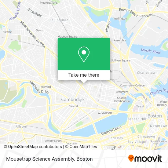
See Mousetrap Science Assembly, Cambridge, on the map
Public Transit to Mousetrap Science Assembly in Cambridge
Wondering how to get to Mousetrap Science Assembly in Cambridge? Moovit helps you find the best way to get to Mousetrap Science Assembly with step-by-step directions from the nearest public transit station.
Moovit provides free maps and live directions to help you navigate through your city. View schedules, routes, timetables, and find out how long does it take to get to Mousetrap Science Assembly in real time.
Looking for the nearest stop or station to Mousetrap Science Assembly? Check out this list of stops closest to your destination: Prospect St @ Gardner Rd; Columbia St @ Cambridge St; Cambridge St @ Columbia St; Kendall/MIT; Union Square; East Somerville Station.
Bus: 109, 19, 64, 69, 83, 85, 91.Train: LOWELL.Subway: GREEN LINE D, RED LINE, GREEN LINE E, GREEN LINE B, GREEN LINE C.
Want to see if there’s another route that gets you there at an earlier time? Moovit helps you find alternative routes or times. Get directions from and directions to Mousetrap Science Assembly easily from the Moovit App or Website.
We make riding to Mousetrap Science Assembly easy, which is why over 1.7 million users, including users in Cambridge, trust Moovit as the best app for public transit. You don’t need to download an individual bus app or train app, Moovit is your all-in-one transit app that helps you find the best bus time or train time available.
For information on prices of bus, subway and train, costs and ride fares to Mousetrap Science Assembly, please check the Moovit app.
Use the app to navigate to popular places including to the airport, hospital, stadium, grocery store, mall, coffee shop, school, college, and university.
Mousetrap Science Assembly Address: 1210 Cambridge St street in Cambridge
- CITY PAINT & SUPPLY CO. INC 02,
- Youthbuild Just A Start ,
- Pickle Robot,
- Pino Brothers Ink,
- Inman Square,
- Filomena's Beauty and Hair Salon (Johnny's Hair Salon),
- gather here,
- Cambridge Mosque,
- The Lily Pad,
- Druid,
- Inman Sq,
- Pita Cambridge,
- Oleana Restaurant,
- Joel Sawady, MD,
- Inman Oasis,
- St Mary Rd / Prospect St,
- Nicks Foreign Car Center,
- Veritas Tax Business and Consulting Services,
- cha shuttle,
- MBTA Bus Route 91 | Newton Street Stop
Places Near Mousetrap Science Assembly (Cambridge)
- House Of Blues, Boston,
- Isabella Stewart Gardner Museum, Boston,
- North End, Boston,
- Prudential Center, Boston,
- Td Garden, Boston,
- Mgm Music Hall, Boston,
- Wilbur Theatre, Boston,
- Boston Common, Boston,
- Boston Medical Center, Boston,
- Boston Children's Hospital, Boston,
- Wang Theater, Boston,
- Massachusetts General Hospital, Boston,
- Castle Island, Boston,
- Faneuil Hall, Boston,
- Boston Convention & Exhibition Center, Boston,
- Seaport District, Boston,
- Cheers, Boston,
- Museum Of Science, Boston,
- Quincy Market, Boston,
- Leader Bank Pavilion (Leader Bank Pavillion), Boston
How to get to popular places in Boston with public transit
Get around Cambridge by public transit!
Traveling around Cambridge has never been so easy. See step by step directions as you travel to any attraction, street or major public transit station. View bus and train schedules, arrival times, service alerts and detailed routes on a map, so you know exactly how to get to anywhere in Cambridge.
When traveling to any destination around Cambridge use Moovit's Live Directions with Get Off Notifications to know exactly where and how far to walk, how long to wait for your line, and how many stops are left. Moovit will alert you when it's time to get off — no need to constantly re-check whether yours is the next stop.
Wondering how to use public transit in Cambridge or how to pay for public transit in Cambridge? Moovit public transit app can help you navigate your way with public transit easily, and at minimum cost. It includes public transit fees, ticket prices, and costs. Looking for a map of Cambridge public transit lines? Moovit public transit app shows all public transit maps in Cambridge with all Bus, Train, Subway and Ferry routes and stops on an interactive map.
Boston has 4 transit type(s), including: Bus, Train, Subway and Ferry, operated by several transit agencies, including MBTA, Southeastern Regional Transit Authority, MetroWest Regional Transit Authority, Rhode Island Public Transit Authority, WRTA, Lowell Regional Transit Authority, Merrimack Valley Transit, Montachusett Regional Transit Authority, Cape Cod Regional Transit Authority, Brockton Area Transit Authority, Martha's Vineyard Transit Authority, the WAVE - Nantucket Regional Transit Authority, GATRA, Cape Ann Transportation Authority and Massport