Directions to Multiloja - Colombo with public transportation
The following transit lines have routes that pass near Multiloja - Colombo
How to get to Multiloja - Colombo by bus?
Click on the bus route to see step by step directions with maps, line arrival times and updated time schedules.
From Pontifícia Universidade Católica do Paraná (PUCPR)
50 minFrom Jardim Paulista
25 minFrom Centro
82 minFrom Terminal Boa Vista
49 minFrom Depósito da Receita Federal
43 minFrom Rua Tv Particular II (VL ARAUJO)
82 minFrom Congregação Cristã no Brasil - Eugenia Maria
82 minFrom Rua Bolsão dos Papagaios
115 minFrom Avenida Maringá
40 minFrom Mega Centro Logístico Curitiba
45 min
Bus stops near Multiloja - Colombo
Bus lines to Multiloja - Colombo
- U11 ITAJACURU / SANTA GEMA (IMBUIAL), ITAJACURU / SANTA GEMA (IMBUIAL),VIEW
- B18 ROSEIRA, ROSEIRA,VIEW
- B24 COLÔNIA FARIA, COLÔNIA FARIA,VIEW
- B33 BOCAIÚVA DO SUL, BOCAIÚVA DO SUL,VIEW
- I33 JARDIM PAULISTA / GUARAITUBA, JARDIM PAULISTA / GUARAITUBA,VIEW
- B37 VALE DAS FLORES, VALE DAS FLORES,VIEW
- B38 SÃO DIMAS, SÃO DIMAS,VIEW
- B46 COLÔNIA FARIA / VALE DAS FLORES, COLÔNIA FARIA / VALE DAS FLORES,VIEW
- B69 MAD. CURITIBA / SÃO DIMAS, MAD. CURITIBA / SÃO DIMAS,VIEW
- B90 PALOMA / COLÔNIA FARIA, PALOMA / COLÔNIA FARIA,VIEW
- B91 VALE DAS FLORES / ROSEIRA, VALE DAS FLORES / ROSEIRA,VIEW
- Y99 TUNAS DO PARANÁ / GUADALUPE, TUNAS DO PARANÁ / GUADALUPE,VIEW
- 0950-500 CURITIBA / ADRIANÓPOLIS (VIA TUNAS DO PARANÁ), CURITIBA / ADRIANÓPOLIS (via TUNAS DO PARANÁ),VIEW
- B22 PALOMA, Belo Rincão / Paloma → Terminal Guaraituba,VIEW
- B28 VILA MARIA DO ROSÁRIO, Vila Maria Do Rosário → Terminal Guaraituba,VIEW
What are the closest stations to Multiloja - Colombo?
The closest stations to Multiloja - Colombo are:
- Rodovia Br 476 (Estrada Da Ribeira) is 20 meters away, 1 min walk.
- Rua Roseli Pansolin Alberti, 109 is 989 meters away, 13 min walk.
Which bus lines stop near Multiloja - Colombo?
These bus lines stop near Multiloja - Colombo: B18 ROSEIRA, B33 BOCAIÚVA DO SUL, I33 JARDIM PAULISTA / GUARAITUBA.
What’s the nearest bus station to Multiloja - Colombo?
The nearest bus station to Multiloja - Colombo is Rodovia Br 476 (Estrada Da Ribeira). It’s a 1 min walk away.
What time is the first bus to Multiloja - Colombo?
The B69 MAD. CURITIBA / SÃO DIMAS is the first bus that goes to Multiloja - Colombo. It stops nearby at 3:54 AM.
What time is the last bus to Multiloja - Colombo?
The B69 MAD. CURITIBA / SÃO DIMAS is the last bus that goes to Multiloja - Colombo. It stops nearby at 2:17 AM.
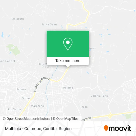
See Multiloja - Colombo on the map
Public Transportation to Multiloja - Colombo
Wondering how to get to Multiloja - Colombo? Moovit helps you find the best way to get to Multiloja - Colombo with step-by-step directions from the nearest public transit station.
Moovit provides free maps and live directions to help you navigate through your city. View schedules, routes, timetables, and find out how long does it take to get to Multiloja - Colombo in real time.
Looking for the nearest stop or station to Multiloja - Colombo? Check out this list of stops closest to your destination: Rodovia Br 476 (Estrada Da Ribeira); Rua Roseli Pansolin Alberti.
Bus: B18 ROSEIRA, B33 BOCAIÚVA DO SUL, I33 JARDIM PAULISTA / GUARAITUBA, U11 ITAJACURU / SANTA GEMA (IMBUIAL), B24 COLÔNIA FARIA, B22 PALOMA, B28 VILA MARIA DO ROSÁRIO.
Want to see if there’s another route that gets you there at an earlier time? Moovit helps you find alternative routes or times. Get directions from and directions to Multiloja - Colombo easily from the Moovit App or Website.
We make riding to Multiloja - Colombo easy, which is why over 1.5 million users, including users in Colombo, trust Moovit as the best app for public transit. You don’t need to download an individual bus app or train app, Moovit is your all-in-one transit app that helps you find the best bus time or train time available.
For information on prices of bus, costs and ride fares to Multiloja - Colombo, please check the Moovit app.
Use the app to navigate to popular places including to the airport, hospital, stadium, grocery store, mall, coffee shop, school, college, and university.
Multiloja - Colombo Address: BR-476, Guaraituba Colombo-PR 83418-000 street in Colombo
- Posto Ribeira,
- Tintas Darka Ltda,
- Baita Brick Comercio de Moveis,
- Petrobras,
- Sao Dimas Alimentos,
- Sul Prime Express,
- Ciclon Comercio Atacadista de Cosméticos,
- Devisa Comercial,
- Chacara Atenas,
- Ótica Bela Vista Extrema,
- Igreja Do Evangelho Quadrangular,
- Pedrinha,
- Elaine Cristina Ceccon,
- Parque Industrial Guaraituba,
- Jardim Aurora,
- Chácara João de Barro,
- Rua Lindolfo Alves das Neves 2-252,
- Mercearia Pao de Mel,
- Guaraituba Policlínica,
- Materiais De Construção Cavallari
Places Near Multiloja - Colombo
- Pontifícia Universidade Católica do Paraná (PUCPR), Prado Velho,
- Hospital do Rocio, Campo,
- Rua General Mário Tourinho, Campina Do Siqueira,
- Hospital Universitário Evangélico de Curitiba, Bigorrilho,
- Rua Martim Afonso 558, Mercês,
- Park Shopping Barigüi, Mossunguê,
- Hospital Madalena Sofia, Bairro Alto,
- Hospital Nossa Senhora Das Graças, Mercês,
- Shopping Palladium, Portão,
- Hhhhh, Fazendinha,
- Hospital Da Cruz Vermelha, Batel,
- Campo Largo, Campo,
- Parque Barigui, Mercês,
- Hospital de Clínicas (HC - UFPR), Centro,
- Jockey Plaza Shopping Center, Tarumã,
- Hospital Angelina Caron, Campina Grande Do Sul,
- Shopping Estação, Rebouças,
- Hospital Erasto Gaertner, Jardim Das Américas,
- Arena Da Baixada - Curitiba,
- Jardim Botânico de Curitiba PR, Centro
How to get to popular places in Curitiba Region with public transit
Get around Colombo by public transit!
Traveling around Colombo has never been so easy. See step by step directions as you travel to any attraction, street or major public transit station. View bus and train schedules, arrival times, service alerts and detailed routes on a map, so you know exactly how to get to anywhere in Colombo.
When traveling to any destination around Colombo use Moovit's Live Directions with Get Off Notifications to know exactly where and how far to walk, how long to wait for your line, and how many stops are left. Moovit will alert you when it's time to get off — no need to constantly re-check whether yours is the next stop.
Wondering how to use public transit in Colombo or how to pay for public transit in Colombo? Moovit public transit app can help you navigate your way with public transit easily, and at minimum cost. It includes public transit fees, ticket prices, and costs. Looking for a map of Colombo public transit lines? Moovit public transit app shows all public transit maps in Colombo with all Bus and Cable Car routes and stops on an interactive map.
Curitiba Region has 2 transit type(s), including: Bus and Cable Car, operated by several transit agencies, including Sistema Integrado de Mobilidade (URBS), Sistema Integrado de Mobilidade (AMEP), URBS (Cartões bancários e Dinheiro), URBS (Cartões bancários / Cartão URBS), AMEP (Cartões bancários / Cartão MetroCard), AMEP (Cartões bancários / Cartão MetroCard / Dinheiro), Viação Colombo (Dinheiro), TRIAR (Cartão TRIAR / Dinheiro), Empresa Curitiba Cerro Azul (Dinheiro), Expresso Nossa Senhora da Penha (Dinheiro), Empresa Campo Alto Tijucas (Dinheiro), Auto Viação São José (Cartão VEM / Dinheiro), BRT S/A (Cartão VEM / Dinheiro), TransPiedade (Cartão Cidadão / Dinheiro) and Oceânica Sul (Cartão Transporte / Dinheiro)