Directions to Muroff Hospitality Group (Newton) with public transportation
The following transit lines have routes that pass near Muroff Hospitality Group
 Bus: 52.
- Train: NEEDHAM.
- Subway: GREEN LINE D.
How to get to Muroff Hospitality Group by bus?
Click on the bus route to see step by step directions with maps, line arrival times and updated time schedules.
From MCPHS University-Boston, Boston
79 minFrom The Wilbur, Boston
73 minFrom Warren St, Boston
52 minFrom Allston, Boston
45 minFrom Lower Mills, Boston
82 minFrom The 'Quin House, Boston
48 minFrom Agganis Arena, Boston
50 minFrom 1010 MASS AVE, Boston
85 minFrom Harvard Club Of Boston, Boston
62 minFrom Boston Marriott Copley Place, Boston
45 min
How to get to Muroff Hospitality Group by train?
Click on the train route to see step by step directions with maps, line arrival times and updated time schedules.
Train station near Muroff Hospitality Group in Newton
- West Roxbury, 6 min walk,VIEW
Subway station near Muroff Hospitality Group in Newton
- Chestnut Hill, 8 min walk,VIEW
Bus stop near Muroff Hospitality Group in Newton
- Wiswall Rd @ Mccarthy Rd, 8 min walk,VIEW
Bus lines to Muroff Hospitality Group in Newton
- 52, Dedham Mall,VIEW
What are the closest stations to Muroff Hospitality Group?
The closest stations to Muroff Hospitality Group are:
- West Roxbury is 434 yards away, 6 min walk.
- Chestnut Hill is 622 yards away, 8 min walk.
- Wiswall Rd @ Mccarthy Rd is 669 yards away, 8 min walk.
Which bus line stops near Muroff Hospitality Group?
52 (Watertown Yard)
Which train line stops near Muroff Hospitality Group?
NEEDHAM (#625 | Needham Heights)
What’s the nearest subway station to Muroff Hospitality Group in Newton?
The nearest subway station to Muroff Hospitality Group in Newton is Chestnut Hill. It’s a 8 min walk away.
What’s the nearest train station to Muroff Hospitality Group in Newton?
The nearest train station to Muroff Hospitality Group in Newton is West Roxbury. It’s a 6 min walk away.
What’s the nearest bus station to Muroff Hospitality Group in Newton?
The nearest bus station to Muroff Hospitality Group in Newton is Wiswall Rd @ Mccarthy Rd. It’s a 8 min walk away.
What time is the first subway to Muroff Hospitality Group in Newton?
The GREEN LINE D is the first subway that goes to Muroff Hospitality Group in Newton. It stops nearby at 4:50 AM.
What time is the last subway to Muroff Hospitality Group in Newton?
The GREEN LINE D is the last subway that goes to Muroff Hospitality Group in Newton. It stops nearby at 2:41 AM.
What time is the first train to Muroff Hospitality Group in Newton?
The NEEDHAM is the first train that goes to Muroff Hospitality Group in Newton. It stops nearby at 7:22 AM.
What time is the last train to Muroff Hospitality Group in Newton?
The NEEDHAM is the last train that goes to Muroff Hospitality Group in Newton. It stops nearby at 6:18 PM.
What time is the first bus to Muroff Hospitality Group in Newton?
The 52 is the first bus that goes to Muroff Hospitality Group in Newton. It stops nearby at 6:35 AM.
What time is the last bus to Muroff Hospitality Group in Newton?
The 52 is the last bus that goes to Muroff Hospitality Group in Newton. It stops nearby at 7:09 PM.
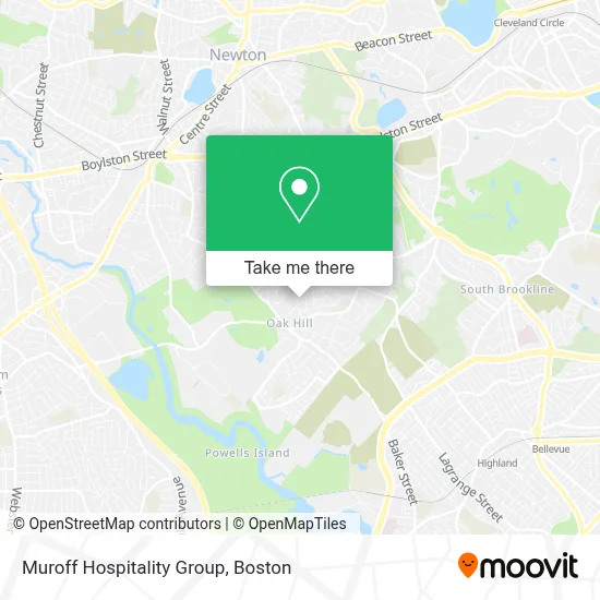
See Muroff Hospitality Group, Newton, on the map
Public Transit to Muroff Hospitality Group in Newton
Wondering how to get to Muroff Hospitality Group in Newton? Moovit helps you find the best way to get to Muroff Hospitality Group with step-by-step directions from the nearest public transit station.
Moovit provides free maps and live directions to help you navigate through your city. View schedules, routes, timetables, and find out how long does it take to get to Muroff Hospitality Group in real time.
Looking for the nearest stop or station to Muroff Hospitality Group? Check out this list of stops closest to your destination: West Roxbury; Chestnut Hill; Wiswall Rd @ Mccarthy Rd.
Bus: 52.Train: NEEDHAM.Subway: GREEN LINE D.
Want to see if there’s another route that gets you there at an earlier time? Moovit helps you find alternative routes or times. Get directions from and directions to Muroff Hospitality Group easily from the Moovit App or Website.
We make riding to Muroff Hospitality Group easy, which is why over 1.7 million users, including users in Newton, trust Moovit as the best app for public transit. You don’t need to download an individual bus app or train app, Moovit is your all-in-one transit app that helps you find the best bus time or train time available.
For information on prices of bus, train and subway, costs and ride fares to Muroff Hospitality Group, please check the Moovit app.
Use the app to navigate to popular places including to the airport, hospital, stadium, grocery store, mall, coffee shop, school, college, and university.
Muroff Hospitality Group Address: 69 Ober Rd street in Newton
- Oak Hill (87m),
- Lipton Properties,
- Joy of Flowers,
- Gershov Vladimi,
- Mt Ida Dining,
- Athletic Center,
- RPM Athlete Performance,
- Nonantum Hill,
- Newton Destination Imagination,
- Brown Middle School,
- Oak Hill Park, Massachusetts,
- Umass Dining,
- Lapides Tennis Academy,
- Brimmer & May Orr Fields,
- Community Veterinary Clinic,
- Bigelow Middle School,
- Mount Ida College,
- Oak Hill School Park,
- Baloka by Maria Mizrahi - Green Jewelry,
- Sasco Industries
Places Near Muroff Hospitality Group (Newton)
- Seaport District, Boston,
- House Of Blues, Boston,
- North End, Boston,
- Boston Medical Center, Boston,
- Boston Children's Hospital, Boston,
- Prudential Center, Boston,
- Cheers, Boston,
- Td Garden, Boston,
- Quincy Market, Boston,
- Boston Convention & Exhibition Center, Boston,
- Wilbur Theatre, Boston,
- Boston Common, Boston,
- Leader Bank Pavilion (Leader Bank Pavillion), Boston,
- Museum Of Science, Boston,
- Faneuil Hall, Boston,
- Wang Theater, Boston,
- Isabella Stewart Gardner Museum, Boston,
- Mgm Music Hall, Boston,
- Castle Island, Boston,
- Massachusetts General Hospital, Boston
How to get to popular places in Boston with public transit
Get around Newton by public transit!
Traveling around Newton has never been so easy. See step by step directions as you travel to any attraction, street or major public transit station. View bus and train schedules, arrival times, service alerts and detailed routes on a map, so you know exactly how to get to anywhere in Newton.
When traveling to any destination around Newton use Moovit's Live Directions with Get Off Notifications to know exactly where and how far to walk, how long to wait for your line, and how many stops are left. Moovit will alert you when it's time to get off — no need to constantly re-check whether yours is the next stop.
Wondering how to use public transit in Newton or how to pay for public transit in Newton? Moovit public transit app can help you navigate your way with public transit easily, and at minimum cost. It includes public transit fees, ticket prices, and costs. Looking for a map of Newton public transit lines? Moovit public transit app shows all public transit maps in Newton with all Bus, Train, Subway and Ferry routes and stops on an interactive map.
Boston has 4 transit type(s), including: Bus, Train, Subway and Ferry, operated by several transit agencies, including MBTA, Southeastern Regional Transit Authority, MetroWest Regional Transit Authority, Rhode Island Public Transit Authority, WRTA, Lowell Regional Transit Authority, Merrimack Valley Transit, Montachusett Regional Transit Authority, Cape Cod Regional Transit Authority, Brockton Area Transit Authority, Martha's Vineyard Transit Authority, the WAVE - Nantucket Regional Transit Authority, GATRA, Cape Ann Transportation Authority and Massport