Directions to Museum Hack Boston with public transportation
The following transit lines have routes that pass near Museum Hack Boston
 Bus: 39, 8, 85, BB, CT3.
- Train: FRANKLIN/FOXBORO, NEEDHAM, ORANGE LINE, PROVIDENCE/STOUGHTON.
- Subway: GREEN LINE E, ORANGE LINE.
How to get to Museum Hack Boston by bus?
Click on the bus route to see step by step directions with maps, line arrival times and updated time schedules.
How to get to Museum Hack Boston by subway?
Click on the subway route to see step by step directions with maps, line arrival times and updated time schedules.
Subway station near Museum Hack Boston
- Symphony, 2 min walk,VIEW
Bus stops near Museum Hack Boston
Train station near Museum Hack Boston
- Ruggles, 13 min walk,VIEW
Bus lines to Museum Hack Boston
- 55, West Fenway,VIEW
- 39, Haymarket Via Forest Hills,VIEW
- 85, Ruggles,VIEW
- GREEN LINE E SHUTTLE, Prudential (Shuttle),VIEW
- GREEN LINE E SHUTTLE, Park Street (Shuttle),VIEW
- 28, Avenue Louis Pasteur Via Ruggles,VIEW
- 8, Ruggles,VIEW
- 19, Gallivan Blvd,VIEW
- 47, Broadway,VIEW
- CT3, Avenue Louis Pasteur (Limited Stops),VIEW
- 9, Kenmore Via Boston Latin,VIEW
- 22, Ashmont,VIEW
- 57, Watertown Yard,VIEW
What are the closest stations to Museum Hack Boston?
The closest stations to Museum Hack Boston are:
- Symphony is 117 yards away, 2 min walk.
- Queensberry St @ Jersey St is 245 yards away, 3 min walk.
- Huntington Ave @ Longwood Ave is 384 yards away, 5 min walk.
- Huntington Ave @ Louis Prang St is 388 yards away, 5 min walk.
- Ruggles St @ Huntington Ave is 443 yards away, 6 min walk.
- Huntington Ave @ Forsyth Way is 447 yards away, 6 min walk.
- Ave Louis Pasteur @ the Fenway is 559 yards away, 8 min walk.
- Ruggles is 1041 yards away, 13 min walk.
Which bus lines stop near Museum Hack Boston?
These bus lines stop near Museum Hack Boston: 39, 8, 85, BB, CT3.
Which subway lines stop near Museum Hack Boston?
These subway lines stop near Museum Hack Boston: GREEN LINE E, ORANGE LINE.
What’s the nearest subway station to Museum Hack Boston?
The nearest subway station to Museum Hack Boston is Symphony. It’s a 2 min walk away.
What’s the nearest train station to Museum Hack Boston?
The nearest train station to Museum Hack Boston is Ruggles. It’s a 13 min walk away.
What’s the nearest bus station to Museum Hack Boston?
The nearest bus station to Museum Hack Boston is Queensberry St @ Jersey St. It’s a 3 min walk away.
What time is the first subway to Museum Hack Boston?
The GREEN LINE E is the first subway that goes to Museum Hack Boston. It stops nearby at 5:18 AM.
What time is the last subway to Museum Hack Boston?
The GREEN LINE E is the last subway that goes to Museum Hack Boston. It stops nearby at 2:09 AM.
What time is the first train to Museum Hack Boston?
The PROVIDENCE/STOUGHTON is the first train that goes to Museum Hack Boston. It stops nearby at 4:28 AM.
What time is the last train to Museum Hack Boston?
The PROVIDENCE/STOUGHTON is the last train that goes to Museum Hack Boston. It stops nearby at 12:34 AM.
What time is the first bus to Museum Hack Boston?
The 39 is the first bus that goes to Museum Hack Boston. It stops nearby at 4:50 AM.
What time is the last bus to Museum Hack Boston?
The 39 is the last bus that goes to Museum Hack Boston. It stops nearby at 1:18 AM.
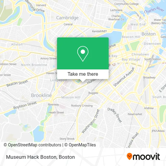
See Museum Hack Boston on the map
Public Transportation to Museum Hack Boston
Wondering how to get to Museum Hack Boston? Moovit helps you find the best way to get to Museum Hack Boston with step-by-step directions from the nearest public transit station.
Moovit provides free maps and live directions to help you navigate through your city. View schedules, routes, timetables, and find out how long does it take to get to Museum Hack Boston in real time.
Looking for the nearest stop or station to Museum Hack Boston? Check out this list of stops closest to your destination: Symphony; Queensberry St @ Jersey St; Huntington Ave @ Longwood Ave; Huntington Ave @ Louis Prang St; Ruggles St @ Huntington Ave; Huntington Ave @ Forsyth Way; Ave Louis Pasteur @ the Fenway; Ruggles.
Bus: 39, 8, 85, BB, CT3, 55, 28, GREEN LINE E SHUTTLE, GREEN LINE E SHUTTLE, 9.Train: FRANKLIN/FOXBORO, NEEDHAM, ORANGE LINE, PROVIDENCE/STOUGHTON.Subway: GREEN LINE E, ORANGE LINE.
Want to see if there’s another route that gets you there at an earlier time? Moovit helps you find alternative routes or times. Get directions from and directions to Museum Hack Boston easily from the Moovit App or Website.
We make riding to Museum Hack Boston easy, which is why over 1.7 million users, including users in Boston, trust Moovit as the best app for public transit. You don’t need to download an individual bus app or train app, Moovit is your all-in-one transit app that helps you find the best bus time or train time available.
For information on prices of subway, bus and train, costs and ride fares to Museum Hack Boston, please check the Moovit app.
Use the app to navigate to popular places including to the airport, hospital, stadium, grocery store, mall, coffee shop, school, college, and university.
Museum Hack Boston Address: 465 Huntington Ave street in Boston
- Museum of Fine Arts Linde Family Wing For Contemporary Art,
- MFA Bookstore & Shop,
- Norma-Jean Calderwood Courtyard,
- Museum of Fine Arts (MFA),
- Elizabeth Gardiner Museum,
- (DC Morgue) Office of The Chief Medical Examiner,
- Museum of Fine Arts-Fenway Lot,
- MFA Offices,
- School of the Museum of Fine Arts,
- Inbound,
- Museum Of Fine Arts MBTA Station,
- MBTA-Museum of Fine Arts,
- Huntington Avenue & Ruggles Street,
- Wentworth MBTA Bus Stop,
- James P. Kelleher Rose Garden,
- The Pit,
- Wentworth Institute Of Technology,
- Clemente Field,
- Willis Hall Sand Volleyball Court,
- Annunciation Cathedral
Places Near Museum Hack Boston
- Quincy Market, Boston,
- Museum Of Science, Boston,
- Cheers, Boston,
- North End, Boston,
- Castle Island, Boston,
- Seaport District, Boston,
- Wilbur Theatre, Boston,
- Td Garden, Boston,
- Mgm Music Hall, Boston,
- Isabella Stewart Gardner Museum, Boston,
- Boston Children's Hospital, Boston,
- Boston Medical Center, Boston,
- Wang Theater, Boston,
- House Of Blues, Boston,
- Prudential Center, Boston,
- Faneuil Hall, Boston,
- Leader Bank Pavilion (Leader Bank Pavillion), Boston,
- Boston Common, Boston,
- Massachusetts General Hospital, Boston,
- Boston Convention & Exhibition Center, Boston
How to get to popular places in Boston with public transit
Get around Boston by public transit!
Traveling around Boston has never been so easy. See step by step directions as you travel to any attraction, street or major public transit station. View bus and train schedules, arrival times, service alerts and detailed routes on a map, so you know exactly how to get to anywhere in Boston.
When traveling to any destination around Boston use Moovit's Live Directions with Get Off Notifications to know exactly where and how far to walk, how long to wait for your line, and how many stops are left. Moovit will alert you when it's time to get off — no need to constantly re-check whether yours is the next stop.
Wondering how to use public transit in Boston or how to pay for public transit in Boston? Moovit public transit app can help you navigate your way with public transit easily, and at minimum cost. It includes public transit fees, ticket prices, and costs. Looking for a map of Boston public transit lines? Moovit public transit app shows all public transit maps in Boston with all Bus, Train, Subway and Ferry routes and stops on an interactive map.
Boston has 4 transit type(s), including: Bus, Train, Subway and Ferry, operated by several transit agencies, including MBTA, Southeastern Regional Transit Authority, MetroWest Regional Transit Authority, Rhode Island Public Transit Authority, WRTA, Lowell Regional Transit Authority, Merrimack Valley Transit, Montachusett Regional Transit Authority, Cape Cod Regional Transit Authority, Brockton Area Transit Authority, Martha's Vineyard Transit Authority, the WAVE - Nantucket Regional Transit Authority, GATRA, Cape Ann Transportation Authority and Massport