Directions to NE Soul Line Dance Network (Boston) with public transportation
The following transit lines have routes that pass near NE Soul Line Dance Network
 Bus: 14, 21, 28, 31, 29.
- Train: FAIRMOUNT, FRANKLIN/FOXBORO, NEEDHAM, FAIRMOUNT LINE SHUTTLE, PROVIDENCE/STOUGHTON.
- Subway: ORANGE LINE.
How to get to NE Soul Line Dance Network by bus?
Click on the bus route to see step by step directions with maps, line arrival times and updated time schedules.
From The Schrafft Center, Boston
101 minFrom South Shore Plaza Mbta Bus Stop, Braintree Town
73 minFrom City Winery Boston, Boston
62 minFrom Dana Farber Cancer Institute, Boston
81 minFrom Jordan Hall, Boston
44 minFrom Mount Auburn, Cambridge
80 minFrom Legacy Place, Dedham
54 minFrom West Roxbury, Boston
29 minFrom Boston University Track and Tennis Center, Boston
66 minFrom Boston Logan International Airport (Bos), Boston
61 min
How to get to NE Soul Line Dance Network by train?
Click on the train route to see step by step directions with maps, line arrival times and updated time schedules.
How to get to NE Soul Line Dance Network by subway?
Click on the subway route to see step by step directions with maps, line arrival times and updated time schedules.
Bus stops near NE Soul Line Dance Network in Boston
Train stations near NE Soul Line Dance Network in Boston
- Talbot Avenue, 14 min walk,VIEW
Bus lines to NE Soul Line Dance Network in Boston
What are the closest stations to NE Soul Line Dance Network?
The closest stations to NE Soul Line Dance Network are:
- Blue Hill Ave Opp Health Ctr is 178 yards away, 3 min walk.
- Blue Hill Ave @ American Legion Hwy is 308 yards away, 4 min walk.
- Morton St @ Canterbury St is 349 yards away, 5 min walk.
- American Legion Hwy @ Franklin Hill Ave is 665 yards away, 8 min walk.
- Talbot Avenue is 1184 yards away, 14 min walk.
Which bus lines stop near NE Soul Line Dance Network?
These bus lines stop near NE Soul Line Dance Network: 14, 21, 28, 31.
Which train lines stop near NE Soul Line Dance Network?
These train lines stop near NE Soul Line Dance Network: FAIRMOUNT, FRANKLIN/FOXBORO, NEEDHAM.
Which subway line stops near NE Soul Line Dance Network?
ORANGE LINE (Forest Hills)
What’s the nearest train station to NE Soul Line Dance Network in Boston?
The nearest train station to NE Soul Line Dance Network in Boston is Talbot Avenue. It’s a 14 min walk away.
What’s the nearest bus station to NE Soul Line Dance Network in Boston?
The nearest bus station to NE Soul Line Dance Network in Boston is Blue Hill Ave Opp Health Ctr. It’s a 3 min walk away.
What time is the first train to NE Soul Line Dance Network in Boston?
The FAIRMOUNT is the first train that goes to NE Soul Line Dance Network in Boston. It stops nearby at 4:38 AM.
What time is the last train to NE Soul Line Dance Network in Boston?
The FAIRMOUNT is the last train that goes to NE Soul Line Dance Network in Boston. It stops nearby at 12:06 AM.
What time is the first bus to NE Soul Line Dance Network in Boston?
The 28 is the first bus that goes to NE Soul Line Dance Network in Boston. It stops nearby at 3:13 AM.
What time is the last bus to NE Soul Line Dance Network in Boston?
The 28 is the last bus that goes to NE Soul Line Dance Network in Boston. It stops nearby at 2:19 AM.
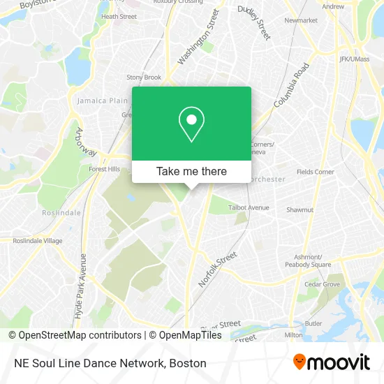
See NE Soul Line Dance Network, Boston, on the map
Public Transit to NE Soul Line Dance Network in Boston
Wondering how to get to NE Soul Line Dance Network in Boston? Moovit helps you find the best way to get to NE Soul Line Dance Network with step-by-step directions from the nearest public transit station.
Moovit provides free maps and live directions to help you navigate through your city. View schedules, routes, timetables, and find out how long does it take to get to NE Soul Line Dance Network in real time.
Looking for the nearest stop or station to NE Soul Line Dance Network? Check out this list of stops closest to your destination: Blue Hill Ave Opp Health Ctr; Blue Hill Ave @ American Legion Hwy; Morton St @ Canterbury St; American Legion Hwy @ Franklin Hill Ave; Talbot Avenue.
Bus: 14, 21, 28, 31, 29, 22.Train: FAIRMOUNT, FRANKLIN/FOXBORO, NEEDHAM, FAIRMOUNT LINE SHUTTLE, PROVIDENCE/STOUGHTON.Subway: ORANGE LINE.
Want to see if there’s another route that gets you there at an earlier time? Moovit helps you find alternative routes or times. Get directions from and directions to NE Soul Line Dance Network easily from the Moovit App or Website.
We make riding to NE Soul Line Dance Network easy, which is why over 1.7 million users, including users in Boston, trust Moovit as the best app for public transit. You don’t need to download an individual bus app or train app, Moovit is your all-in-one transit app that helps you find the best bus time or train time available.
For information on prices of bus, subway and train, costs and ride fares to NE Soul Line Dance Network, please check the Moovit app.
Use the app to navigate to popular places including to the airport, hospital, stadium, grocery store, mall, coffee shop, school, college, and university.
NE Soul Line Dance Network Address: 150 American Legion Hwy street in Boston
- Lena Park Community Center,
- Brooke Charter Schools Mattapan,
- Wayne at Franklin Hill,
- John B Cruz Construction Co.,
- Brooke High School,
- Franklin Hill Ave Building 30,
- Greater Mass Home Improvement,
- Dys,
- Franklin Hill Boys & Girls Club,
- Garage Door Springs Repair Garage Door,
- USPS Collection Box - Blue Box,
- Massachusetts Chiropractic Center,
- DDC Nadine Unisex Beauty Salon,
- Melvia Wright Patten Scholarship Fund,
- Rubyglo SBBQ,
- Best Design Studio,
- Sportsmen's Tennis Club (Sportsmen's Tennis & Enrichment Center),
- Franklin Field,
- Dmi Auto & Alarm (D M I Auto & Alarm Serv & Accessary of Boston),
- Free Pentecostal Church of God's Youth Group
Places Near NE Soul Line Dance Network (Boston)
- North End, Boston,
- Castle Island, Boston,
- Prudential Center, Boston,
- Wilbur Theatre, Boston,
- Faneuil Hall, Boston,
- Quincy Market, Boston,
- House Of Blues, Boston,
- Boston Common, Boston,
- Cheers, Boston,
- Td Garden, Boston,
- Seaport District, Boston,
- Isabella Stewart Gardner Museum, Boston,
- Boston Convention & Exhibition Center, Boston,
- Boston Medical Center, Boston,
- Leader Bank Pavilion (Leader Bank Pavillion), Boston,
- Massachusetts General Hospital, Boston,
- Boston Children's Hospital, Boston,
- Mgm Music Hall, Boston,
- Museum Of Science, Boston,
- Wang Theater, Boston
How to get to popular places in Boston with public transit
Get around Boston by public transit!
Traveling around Boston has never been so easy. See step by step directions as you travel to any attraction, street or major public transit station. View bus and train schedules, arrival times, service alerts and detailed routes on a map, so you know exactly how to get to anywhere in Boston.
When traveling to any destination around Boston use Moovit's Live Directions with Get Off Notifications to know exactly where and how far to walk, how long to wait for your line, and how many stops are left. Moovit will alert you when it's time to get off — no need to constantly re-check whether yours is the next stop.
Wondering how to use public transit in Boston or how to pay for public transit in Boston? Moovit public transit app can help you navigate your way with public transit easily, and at minimum cost. It includes public transit fees, ticket prices, and costs. Looking for a map of Boston public transit lines? Moovit public transit app shows all public transit maps in Boston with all Bus, Train, Subway and Ferry routes and stops on an interactive map.
Boston has 4 transit type(s), including: Bus, Train, Subway and Ferry, operated by several transit agencies, including MBTA, Southeastern Regional Transit Authority, MetroWest Regional Transit Authority, Rhode Island Public Transit Authority, WRTA, Lowell Regional Transit Authority, Merrimack Valley Transit, Montachusett Regional Transit Authority, Cape Cod Regional Transit Authority, Brockton Area Transit Authority, Martha's Vineyard Transit Authority, the WAVE - Nantucket Regional Transit Authority, GATRA, Cape Ann Transportation Authority and Massport