NQS - Calle 38a Sur station - Thursday schedule
| Line | Direction | Time |
|---|---|---|
| F26 | Portal De Las Américas | 5:00 |
| G47 | Portal Del Sur - JFK Cooperativa Financiera | 5:03 |
| 4 | Portal Del Sur - JFK Cooperativa Financiera | 5:08 |
| F26 | Portal De Las Américas | 5:09 |
| M47 | Museo Nacional | 5:11 |
| F26 | Portal De Las Américas | 5:16 |
| G47 | Portal Del Sur - JFK Cooperativa Financiera | 5:18 |
| 4 | Portal Del Sur - JFK Cooperativa Financiera | 5:23 |
| F26 | Portal De Las Américas | 5:24 |
| M47 | Museo Nacional | 5:26 |
| F26 | Portal De Las Américas | 5:31 |
| G47 | Portal Del Sur - JFK Cooperativa Financiera | 5:33 |
| G30 | Portal Del Sur - JFK Cooperativa Financiera | 5:33 |
| F26 | Portal De Las Américas | 5:39 |
| 4 | Portal Del Sur - JFK Cooperativa Financiera | 5:40 |
| M47 | Museo Nacional | 5:41 |
| F26 | Portal De Las Américas | 5:46 |
| G47 | Portal Del Sur - JFK Cooperativa Financiera | 5:48 |
| G30 | Portal Del Sur - JFK Cooperativa Financiera | 5:48 |
| F26 | Portal De Las Américas | 5:54 |
| 4 | Portal Del Sur - JFK Cooperativa Financiera | 5:55 |
| M47 | Museo Nacional | 5:56 |
| F26 | Portal De Las Américas | 6:01 |
| G47 | Portal Del Sur - JFK Cooperativa Financiera | 6:03 |
| G30 | Portal Del Sur - JFK Cooperativa Financiera | 6:03 |
Directions to NQS - Calle 38a Sur station (Antonio Nariño) with public transit
The following transit lines have routes that pass near NQS - Calle 38a Sur
How to get to NQS - Calle 38a Sur station by bus?
Click on the bus route to see step by step directions with maps, line arrival times and updated time schedules.
How to get to NQS - Calle 38a Sur station by cable car?
Click on the cable car route to see step by step directions with maps, line arrival times and updated time schedules.
Bus stops near NQS - Calle 38a Sur stop in Antonio Nariño
- Br. Villa Mayor Antigua (Auto Sur - Cl 38 Bis Sur), 1 min walk,
- Estación NQS - Calle 38 Sur (Auto Sur - Dg 38a Sur), 2 min walk,
- Br. Arboleda Del Rey (Kr 50 - Auto Sur), 6 min walk,
- Urbanización Villa Sonia (Ak 50 - Cl 39a Sur), 6 min walk,
- Br. Villa Mayor Oriental (Dg 39a Sur - Kr 39a), 7 min walk,
- Urbanización Villa Sonia (Ak 50 - Cl 38b Sur), 7 min walk,
- Br. San Luis (Ak 50 - Cl 37 Sur), 8 min walk,
- Br. Autopista Sur (Ak 50 - Cl 38b Sur), 9 min walk,
- Br. Villa Mayor (Dg 39a Sur - Tv 40), 9 min walk,
- Centro Comercial Centro Mayor (Dg 39a Sur - Tv 38a), 10 min walk,
Cable Car stations near NQS - Calle 38a Sur station in Antonio Nariño
- Calle 40 Sur, 11 min walk,
- NQS - Calle 30 Sur, 21 min walk,
- Venecia, 27 min walk,
- General Santander, 32 min walk,
Bus lines to NQS - Calle 38a Sur station in Antonio Nariño
- T26, Country Club,
- T163, Calle 222,
- H639, Arborizadora Alta,
- A643, Paloquemao,
- K715, Corferias,
- A018, Estación Comuneros,
- G018, Estación NQS Calle 38a Sur,
- T26, Palermo Sur,
- T163, Perdomo,
- H643, San Joaquín,
- H715, El Uval,
- 599, Bosa San Diego,
- H601, Perdomo,
- H617, Perdomo,
- H636, Rincón De Venecia,
- H726, Estación General Santander,
- G543, Timiza,
- 579, Marly,
- H543, Estación General Santander,
- H604, Sierra Morena ⇄ Estación General Santander,
What are the closest stations to NQS - Calle 38a Sur?
The closest stations to NQS - Calle 38a Sur are:
- Br. Villa Mayor Antigua (Auto Sur - Cl 38 Bis Sur) is 54 meters away, 1 min walk.
- Estación NQS - Calle 38 Sur (Auto Sur - Dg 38a Sur) is 95 meters away, 2 min walk.
- Br. Arboleda Del Rey (Kr 50 - Auto Sur) is 424 meters away, 6 min walk.
- Urbanización Villa Sonia (Ak 50 - Cl 39a Sur) is 427 meters away, 6 min walk.
- Br. Villa Mayor Oriental (Dg 39a Sur - Kr 39a) is 485 meters away, 7 min walk.
- Urbanización Villa Sonia (Ak 50 - Cl 38b Sur) is 505 meters away, 7 min walk.
- Br. San Luis (Ak 50 - Cl 37 Sur) is 548 meters away, 8 min walk.
- Br. Autopista Sur (Ak 50 - Cl 38b Sur) is 664 meters away, 9 min walk.
- Br. Villa Mayor (Dg 39a Sur - Tv 40) is 671 meters away, 9 min walk.
- Centro Comercial Centro Mayor (Dg 39a Sur - Tv 38a) is 722 meters away, 10 min walk.
- Calle 40 Sur is 799 meters away, 11 min walk.
- NQS - Calle 30 Sur is 1602 meters away, 21 min walk.
- Venecia is 2062 meters away, 27 min walk.
- General Santander is 2504 meters away, 32 min walk.
Which bus lines stop near NQS - Calle 38a Sur?
These bus lines stop near NQS - Calle 38a Sur: 579, G018, H601, H643, T163, T26.
Which cable car lines stop near NQS - Calle 38a Sur?
These cable car lines stop near NQS - Calle 38a Sur: 4, G30, G47.
What’s the nearest bus station to NQS - Calle 38a Sur in Antonio Nariño?
The nearest bus station to NQS - Calle 38a Sur in Antonio Nariño is Br. Villa Mayor Antigua (Auto Sur - Cl 38 Bis Sur). It’s a 1 min walk away.
What’s the nearest cable car station to NQS - Calle 38a Sur in Antonio Nariño?
The nearest cable car station to NQS - Calle 38a Sur in Antonio Nariño is Calle 40 Sur. It’s a 11 min walk away.
What time is the first bus to NQS - Calle 38a Sur in Antonio Nariño?
The H604 is the first bus that goes to NQS - Calle 38a Sur in Antonio Nariño. It stops nearby at 3:00 AM.
What time is the last bus to NQS - Calle 38a Sur in Antonio Nariño?
The 7-2 is the last bus that goes to NQS - Calle 38a Sur in Antonio Nariño. It stops nearby at 12:41 AM.
What time is the first cable car to NQS - Calle 38a Sur in Antonio Nariño?
The C15 is the first cable car that goes to NQS - Calle 38a Sur in Antonio Nariño. It stops nearby at 4:05 AM.
What time is the last cable car to NQS - Calle 38a Sur in Antonio Nariño?
The 4 is the last cable car that goes to NQS - Calle 38a Sur in Antonio Nariño. It stops nearby at 11:45 PM.
See NQS - Calle 38a Sur station, Antonio Nariño, on the map
Public transit to NQS - Calle 38a Sur station (ID: TM0092 - Zona G) in Antonio Nariño
Looking for directions to NQS - Calle 38a Sur in Antonio Nariño, Colombia?
Download the Moovit App to find the current schedule and step-by-step directions for Cable Car or Bus routes that pass through NQS - Calle 38a Sur.
Looking for the nearest stops closest to NQS - Calle 38a Sur ? Check out this list of closest stops to your destination: Br. Villa Mayor Antigua (Auto Sur - Cl 38 Bis Sur); Estación NQS - Calle 38 Sur (Auto Sur - Dg 38a Sur); Br. Arboleda Del Rey (Kr 50 - Auto Sur); Urbanización Villa Sonia (Ak 50 - Cl 39a Sur); Br. Villa Mayor Oriental (Dg 39a Sur - Kr 39a); Urbanización Villa Sonia (Ak 50 - Cl 38b Sur); Br. San Luis (Ak 50 - Cl 37 Sur); Br. Autopista Sur (Ak 50 - Cl 38b Sur); Br. Villa Mayor (Dg 39a Sur - Tv 40); Centro Comercial Centro Mayor (Dg 39a Sur - Tv 38a); Calle 40 Sur; NQS - Calle 30 Sur; Venecia; General Santander.
Bus: 579, G018, H601, H643, T163, T26, H639, A643, K715, A018, 599, H617, H636, H726, G543, H543, H604, H632.Cable Car: 4, G30, G47, 3, 3, B13, H13, C15.
We make riding on public transit to NQS - Calle 38a Sur easy, which is why over 1.5 million users, including users in Antonio Nariño trust Moovit as the best app for public transit.
Use the app to navigate to popular places including to the airport, hospital, stadium, grocery store, mall, coffee shop, school, college, and university.
The station has the following entrances: Av. Cdad. De Quito and Tv. 35 Bis
NQS - Calle 38a Sur station’s code is TM0092 - Zona G
The first line to this station is F26, at 5:00, and the last line is M47 at 4:54.
This station serves Buses Troncales’s lines
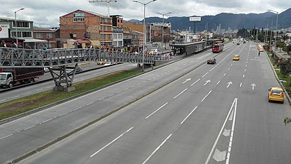
The simple station NQS Calle 38 A Sur is part of the TransMilenio mass-transit system of Bogotá, Colombia, opened in the year 2000.Wiki
Bus stops near NQS - Calle 38a Sur stop
Cable Car stations near NQS - Calle 38a Sur station
Popular public transit stations in Antonio Nariño
Get around Antonio Nariño by public transit!
Traveling around Antonio Nariño has never been so easy. See step by step directions as you travel to any attraction, street or major public transit station. View bus and train schedules, arrival times, service alerts and detailed routes on a map, so you know exactly how to get to anywhere in Antonio Nariño.
When traveling to any destination around Antonio Nariño use Moovit's Live Directions with Get Off Notifications to know exactly where and how far to walk, how long to wait for your line, and how many stops are left. Moovit will alert you when it's time to get off — no need to constantly re-check whether yours is the next stop.
Wondering how to use public transit in Antonio Nariño or how to pay for public transit in Antonio Nariño? Moovit public transit app can help you navigate your way with public transit easily, and at minimum cost. It includes public transit fees, ticket prices, and costs. Looking for a map of Antonio Nariño public transit lines? Moovit public transit app shows all public transit maps in Antonio Nariño with all Bus, Cable Car and Funicular routes and stops on an interactive map.
Bogota has 3 transit type(s), including: Bus, Cable Car and Funicular, operated by several transit agencies, including Buses Troncales, TransMiZonal, Cerro de Monserrate, Aeropuerto El Dorado, TransMiCable, Flota Chia Ltda., Auto Servicio Chía Ltda. and Cootranscajicá Ltda.