How to get to Nabat Tax Service by bus?
Click on the bus route to see step by step directions with maps, line arrival times and updated time schedules.
From Somerville, MA, Somerville
74 minFrom Fresh Pond Mall, Cambridge
104 minFrom Astrazeneca Hope Lodge, Boston
80 minFrom Wachusett mountain, Boston
81 minFrom Theatre District, Boston
35 minFrom Jamaica Plain VA Medical Center (VA Hospital), Boston
81 minFrom VA Medical Center, Boston (Jamaica Plain), Boston
82 minFrom davio's, Boston
34 minFrom Regina Pizzeria, Boston
85 minFrom Eataly Boston, Boston
59 min
How to get to Nabat Tax Service by subway?
Click on the subway route to see step by step directions with maps, line arrival times and updated time schedules.
From Somerville, MA, Somerville
55 minFrom Fresh Pond Mall, Cambridge
69 minFrom Astrazeneca Hope Lodge, Boston
63 minFrom Wachusett mountain, Boston
67 minFrom Theatre District, Boston
38 minFrom Eataly Boston, Boston
47 minFrom Jamaica Plain VA Medical Center (VA Hospital), Boston
64 minFrom VA Medical Center, Boston (Jamaica Plain), Boston
64 minFrom davio's, Boston
39 minFrom Regina Pizzeria, Boston
73 min
Bus stops near Nabat Tax Service in Boston
Subway station near Nabat Tax Service in Boston
- Wood Island, 24 min walk,VIEW
Train station near Nabat Tax Service in Boston
- Chelsea, 60 min walk,VIEW
Bus lines to Nabat Tax Service in Boston
What are the closest stations to Nabat Tax Service?
The closest stations to Nabat Tax Service are:
- Bennington St @ Byron St is 367 yards away, 5 min walk.
- Chelsea St Opp Curtis St is 1068 yards away, 13 min walk.
- Mcclellan Highway @ Addison St is 1155 yards away, 14 min walk.
- 270 Central Ave - Chelsea Garage is 1499 yards away, 18 min walk.
- 245 Central Ave is 1526 yards away, 18 min walk.
- Eastern Avenue is 1556 yards away, 19 min walk.
- Wood Island is 2035 yards away, 24 min walk.
- Chelsea is 5137 yards away, 60 min walk.
Which bus lines stop near Nabat Tax Service?
These bus lines stop near Nabat Tax Service: 104, 450, 88, SL3.
Which subway line stops near Nabat Tax Service?
BLUE LINE (Wonderland)
What’s the nearest subway station to Nabat Tax Service in Boston?
The nearest subway station to Nabat Tax Service in Boston is Wood Island. It’s a 24 min walk away.
What’s the nearest bus station to Nabat Tax Service in Boston?
The nearest bus station to Nabat Tax Service in Boston is Bennington St @ Byron St. It’s a 5 min walk away.
What time is the first subway to Nabat Tax Service in Boston?
The BLUE LINE is the first subway that goes to Nabat Tax Service in Boston. It stops nearby at 5:08 AM.
What time is the last subway to Nabat Tax Service in Boston?
The BLUE LINE is the last subway that goes to Nabat Tax Service in Boston. It stops nearby at 2:04 AM.
What time is the first train to Nabat Tax Service in Boston?
The NEWBURYPORT/ROCKPORT is the first train that goes to Nabat Tax Service in Boston. It stops nearby at 5:40 AM.
What time is the last train to Nabat Tax Service in Boston?
The NEWBURYPORT/ROCKPORT is the last train that goes to Nabat Tax Service in Boston. It stops nearby at 11:26 PM.
What time is the first bus to Nabat Tax Service in Boston?
The 771 is the first bus that goes to Nabat Tax Service in Boston. It stops nearby at 3:00 AM.
What time is the last bus to Nabat Tax Service in Boston?
The 771 is the last bus that goes to Nabat Tax Service in Boston. It stops nearby at 3:20 AM.
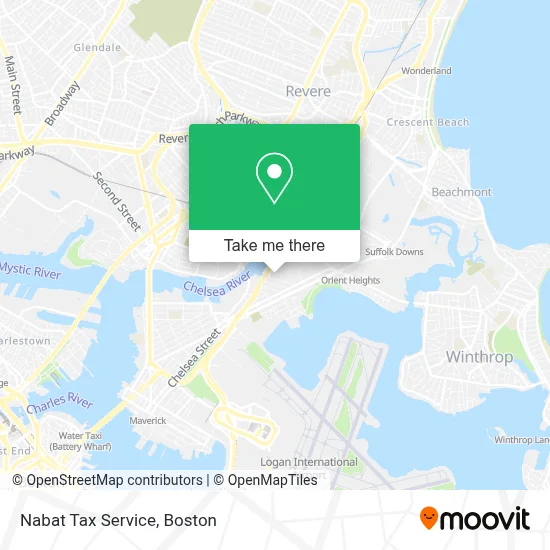
See Nabat Tax Service, Boston, on the map
Public Transit to Nabat Tax Service in Boston
Wondering how to get to Nabat Tax Service in Boston? Moovit helps you find the best way to get to Nabat Tax Service with step-by-step directions from the nearest public transit station.
Moovit provides free maps and live directions to help you navigate through your city. View schedules, routes, timetables, and find out how long does it take to get to Nabat Tax Service in real time.
Looking for the nearest stop or station to Nabat Tax Service? Check out this list of stops closest to your destination: Bennington St @ Byron St; Chelsea St Opp Curtis St; Mcclellan Highway @ Addison St; 270 Central Ave - Chelsea Garage; 245 Central Ave; Eastern Avenue; Wood Island; Chelsea.
Bus: 104, 450, 88, SL3, 120, 112, 771, 772, 773.Train: NEWBURYPORT/ROCKPORT.Subway: BLUE LINE.
Want to see if there’s another route that gets you there at an earlier time? Moovit helps you find alternative routes or times. Get directions from and directions to Nabat Tax Service easily from the Moovit App or Website.
We make riding to Nabat Tax Service easy, which is why over 1.7 million users, including users in Boston, trust Moovit as the best app for public transit. You don’t need to download an individual bus app or train app, Moovit is your all-in-one transit app that helps you find the best bus time or train time available.
For information on prices of subway and bus, costs and ride fares to Nabat Tax Service, please check the Moovit app.
Use the app to navigate to popular places including to the airport, hospital, stadium, grocery store, mall, coffee shop, school, college, and university.
Nabat Tax Service Address: 175 William F McClellan Hwy street in Boston
- Hdh Boston Courier,
- Vrocc,
- Parlor Skis,
- Iglesia Nueva Vision Cenvi,
- Hispanic American Institute,
- The Future Lab , Anti Gallery,
- Pei Wei Asian Diner,
- Bright Home Solutions,
- Clothes Encounters,
- Amerka Travel - Cruise Holidays,
- Studio East,
- Stars Apparel,
- Fidelity Sportswear,
- Maverick Mills,
- Kendall Press,
- New Home Realty Llc,
- Carnaval Dia Del Salvadoreño,
- El Mundo Boston,
- Gerardi Performance,
- Mm Enterprise Plus
Places Near Nabat Tax Service (Boston)
- Boston Medical Center, Boston,
- North End, Boston,
- Seaport District, Boston,
- House Of Blues, Boston,
- Cheers, Boston,
- Castle Island, Boston,
- Wang Theater, Boston,
- Isabella Stewart Gardner Museum, Boston,
- Quincy Market, Boston,
- Wilbur Theatre, Boston,
- Massachusetts General Hospital, Boston,
- Td Garden, Boston,
- Boston Children's Hospital, Boston,
- Leader Bank Pavilion (Leader Bank Pavillion), Boston,
- Faneuil Hall, Boston,
- Museum Of Science, Boston,
- Boston Convention & Exhibition Center, Boston,
- Boston Common, Boston,
- Prudential Center, Boston,
- Mgm Music Hall, Boston
How to get to popular places in Boston with public transit
Get around Boston by public transit!
Traveling around Boston has never been so easy. See step by step directions as you travel to any attraction, street or major public transit station. View bus and train schedules, arrival times, service alerts and detailed routes on a map, so you know exactly how to get to anywhere in Boston.
When traveling to any destination around Boston use Moovit's Live Directions with Get Off Notifications to know exactly where and how far to walk, how long to wait for your line, and how many stops are left. Moovit will alert you when it's time to get off — no need to constantly re-check whether yours is the next stop.
Wondering how to use public transit in Boston or how to pay for public transit in Boston? Moovit public transit app can help you navigate your way with public transit easily, and at minimum cost. It includes public transit fees, ticket prices, and costs. Looking for a map of Boston public transit lines? Moovit public transit app shows all public transit maps in Boston with all Bus, Train, Subway and Ferry routes and stops on an interactive map.
Boston has 4 transit type(s), including: Bus, Train, Subway and Ferry, operated by several transit agencies, including MBTA, Southeastern Regional Transit Authority, MetroWest Regional Transit Authority, Rhode Island Public Transit Authority, WRTA, Lowell Regional Transit Authority, Merrimack Valley Transit, Montachusett Regional Transit Authority, Cape Cod Regional Transit Authority, Brockton Area Transit Authority, Martha's Vineyard Transit Authority, the WAVE - Nantucket Regional Transit Authority, GATRA, Cape Ann Transportation Authority and Massport