Directions to Nanny Poppins (Boston) with public transportation
The following transit lines have routes that pass near Nanny Poppins
 Bus: 28, 30, 31, 29, FAIRMOUNT LINE SHUTTLE.
- Train: FAIRMOUNT, FRANKLIN/FOXBORO, PROVIDENCE/STOUGHTON.
- Subway: MATTAPAN LINE.
How to get to Nanny Poppins by bus?
Click on the bus route to see step by step directions with maps, line arrival times and updated time schedules.
From John Hancock Tower (200 Clarendon), Boston
58 minFrom Residence Inn by Marriott Boston Back Bay/Fenway, Boston
62 minFrom Aloft Boston Seaport, Boston
96 minFrom Yankee Lobster, Boston
88 minFrom Orpheum Theatre, Boston
66 minFrom PwC, Boston
82 minFrom Massachusetts Institute of Technology (MIT), Cambridge
70 minFrom Old Town Trolley Tours of Boston, Boston
62 minFrom Legal Harborside, Boston
87 minFrom 200 Seaport Blvd, Boston
87 min
How to get to Nanny Poppins by train?
Click on the train route to see step by step directions with maps, line arrival times and updated time schedules.
From John Hancock Tower (200 Clarendon), Boston
38 minFrom Residence Inn by Marriott Boston Back Bay/Fenway, Boston
48 minFrom Aloft Boston Seaport, Boston
48 minFrom Yankee Lobster, Boston
51 minFrom Orpheum Theatre, Boston
36 minFrom PwC, Boston
41 minFrom Old Town Trolley Tours of Boston, Boston
44 minFrom Legal Harborside, Boston
49 minFrom 200 Seaport Blvd, Boston
45 min
How to get to Nanny Poppins by subway?
Click on the subway route to see step by step directions with maps, line arrival times and updated time schedules.
From John Hancock Tower (200 Clarendon), Boston
57 minFrom Residence Inn by Marriott Boston Back Bay/Fenway, Boston
72 minFrom Aloft Boston Seaport, Boston
61 minFrom Yankee Lobster, Boston
68 minFrom Orpheum Theatre, Boston
46 minFrom PwC, Boston
59 minFrom Massachusetts Institute of Technology (MIT), Cambridge
65 minFrom Old Town Trolley Tours of Boston, Boston
60 minFrom Legal Harborside, Boston
66 minFrom 200 Seaport Blvd, Boston
62 min
Bus stops near Nanny Poppins in Boston
Subway station near Nanny Poppins in Boston
- Mattapan, 4 min walk,VIEW
Train station near Nanny Poppins in Boston
- Blue Hill Avenue, 9 min walk,VIEW
Bus lines to Nanny Poppins in Boston
What are the closest stations to Nanny Poppins?
The closest stations to Nanny Poppins are:
- Blue Hill Ave @ Mattapan Sq is 58 yards away, 1 min walk.
- Cummins Hwy @ Fairway St is 213 yards away, 3 min walk.
- Mattapan is 277 yards away, 4 min walk.
- Blue Hill Avenue is 435 yards away, 6 min walk.
- River St @ Violante St is 1053 yards away, 13 min walk.
Which bus lines stop near Nanny Poppins?
These bus lines stop near Nanny Poppins: 28, 30, 31.
Which train line stops near Nanny Poppins?
FAIRMOUNT (#1619 | Fairmount)
Which subway line stops near Nanny Poppins?
MATTAPAN LINE (Mattapan)
What’s the nearest subway station to Nanny Poppins in Boston?
The nearest subway station to Nanny Poppins in Boston is Mattapan. It’s a 4 min walk away.
What’s the nearest train station to Nanny Poppins in Boston?
The nearest train station to Nanny Poppins in Boston is Blue Hill Avenue. It’s a 9 min walk away.
What’s the nearest bus station to Nanny Poppins in Boston?
The nearest bus station to Nanny Poppins in Boston is Blue Hill Ave @ Mattapan Sq. It’s a 1 min walk away.
What time is the first subway to Nanny Poppins in Boston?
The MATTAPAN LINE is the first subway that goes to Nanny Poppins in Boston. It stops nearby at 5:00 AM.
What time is the last subway to Nanny Poppins in Boston?
The MATTAPAN LINE is the last subway that goes to Nanny Poppins in Boston. It stops nearby at 2:40 AM.
What time is the first train to Nanny Poppins in Boston?
The FAIRMOUNT is the first train that goes to Nanny Poppins in Boston. It stops nearby at 4:36 AM.
What time is the last train to Nanny Poppins in Boston?
The FAIRMOUNT is the last train that goes to Nanny Poppins in Boston. It stops nearby at 12:08 AM.
What time is the first bus to Nanny Poppins in Boston?
The 28 is the first bus that goes to Nanny Poppins in Boston. It stops nearby at 3:10 AM.
What time is the last bus to Nanny Poppins in Boston?
The 28 is the last bus that goes to Nanny Poppins in Boston. It stops nearby at 2:30 AM.
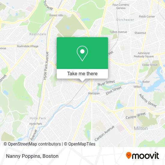
See Nanny Poppins, Boston, on the map
Public Transit to Nanny Poppins in Boston
Wondering how to get to Nanny Poppins in Boston? Moovit helps you find the best way to get to Nanny Poppins with step-by-step directions from the nearest public transit station.
Moovit provides free maps and live directions to help you navigate through your city. View schedules, routes, timetables, and find out how long does it take to get to Nanny Poppins in real time.
Looking for the nearest stop or station to Nanny Poppins? Check out this list of stops closest to your destination: Blue Hill Ave @ Mattapan Sq; Cummins Hwy @ Fairway St; Mattapan; Blue Hill Avenue; River St @ Violante St.
Bus: 28, 30, 31, 29, FAIRMOUNT LINE SHUTTLE, 24, 33.Train: FAIRMOUNT, FRANKLIN/FOXBORO, PROVIDENCE/STOUGHTON.Subway: MATTAPAN LINE.
Want to see if there’s another route that gets you there at an earlier time? Moovit helps you find alternative routes or times. Get directions from and directions to Nanny Poppins easily from the Moovit App or Website.
We make riding to Nanny Poppins easy, which is why over 1.7 million users, including users in Boston, trust Moovit as the best app for public transit. You don’t need to download an individual bus app or train app, Moovit is your all-in-one transit app that helps you find the best bus time or train time available.
For information on prices of bus, subway and train, costs and ride fares to Nanny Poppins, please check the Moovit app.
Use the app to navigate to popular places including to the airport, hospital, stadium, grocery store, mall, coffee shop, school, college, and university.
Nanny Poppins Address: 800 Cummins Hwy street in Boston
- Alsy Store,
- Howard Sinclair & Son,
- Emma L Christie,
- Immediate Access by Car,
- Morton Station,
- Pokemon Bar,
- Frantzworld Personal Trainer & Nutrition,
- United Air Conditioning and Heating,
- Fields Jerry,
- Sisters of the Eucharistic Heart of Jesus,
- Twin Rivers Casino,
- Blue, House of Coffee,
- Youth Corner,
- 1st Call Response Locksmith,
- Citibank,
- WM E Carter Ameri Legion Post,
- Kwench Juice Cafe,
- Daily Table,
- MC Appliance Services and Repairs,
- Multi Cultural Counseling Service
Places Near Nanny Poppins (Boston)
- Wang Theater, Boston,
- Isabella Stewart Gardner Museum, Boston,
- Td Garden, Boston,
- Faneuil Hall, Boston,
- Seaport District, Boston,
- Boston Medical Center, Boston,
- North End, Boston,
- Wilbur Theatre, Boston,
- Mgm Music Hall, Boston,
- Castle Island, Boston,
- Quincy Market, Boston,
- Boston Children's Hospital, Boston,
- House Of Blues, Boston,
- Prudential Center, Boston,
- Boston Common, Boston,
- Boston Convention & Exhibition Center, Boston,
- Leader Bank Pavilion (Leader Bank Pavillion), Boston,
- Massachusetts General Hospital, Boston,
- Cheers, Boston,
- Museum Of Science, Boston
How to get to popular places in Boston with public transit
Get around Boston by public transit!
Traveling around Boston has never been so easy. See step by step directions as you travel to any attraction, street or major public transit station. View bus and train schedules, arrival times, service alerts and detailed routes on a map, so you know exactly how to get to anywhere in Boston.
When traveling to any destination around Boston use Moovit's Live Directions with Get Off Notifications to know exactly where and how far to walk, how long to wait for your line, and how many stops are left. Moovit will alert you when it's time to get off — no need to constantly re-check whether yours is the next stop.
Wondering how to use public transit in Boston or how to pay for public transit in Boston? Moovit public transit app can help you navigate your way with public transit easily, and at minimum cost. It includes public transit fees, ticket prices, and costs. Looking for a map of Boston public transit lines? Moovit public transit app shows all public transit maps in Boston with all Bus, Train, Subway and Ferry routes and stops on an interactive map.
Boston has 4 transit type(s), including: Bus, Train, Subway and Ferry, operated by several transit agencies, including MBTA, Southeastern Regional Transit Authority, MetroWest Regional Transit Authority, Rhode Island Public Transit Authority, WRTA, Lowell Regional Transit Authority, Merrimack Valley Transit, Montachusett Regional Transit Authority, Cape Cod Regional Transit Authority, Brockton Area Transit Authority, Martha's Vineyard Transit Authority, the WAVE - Nantucket Regional Transit Authority, GATRA, Cape Ann Transportation Authority and Massport