Directions to Nba Arenas (Boston) with public transportation
The following transit lines have routes that pass near Nba Arenas
 Bus: G1, X92, T1, T2, T5.
- Train: LAKE SHORE LIMITED, VERMONTER, AMTRAK HARTFORD LINE, NORTHEAST REGIONAL, VALLEY FLYER.
How to get to Nba Arenas by bus?
Click on the bus route to see step by step directions with maps, line arrival times and updated time schedules.
From South High Community School, Worcester
199 minFrom Foxwoods, Worcester
132 minFrom Walmart Supercenter, Worcester
161 minFrom Dcu Center, Worcester
104 minFrom Registry Of Motor Vehicles (Rmv) Branch Office, Worcester
106 minFrom Palladium, Worcester
107 minFrom Worcester, MA, Worcester
102 minFrom Polar Park, Worcester
104 min
How to get to Nba Arenas by train?
Click on the train route to see step by step directions with maps, line arrival times and updated time schedules.
Bus stops near Nba Arenas in Boston
Train station near Nba Arenas in Boston
- Springfield, 47 min walk,VIEW
Bus lines to Nba Arenas in Boston
What are the closest stations to Nba Arenas?
The closest stations to Nba Arenas are:
- Main/Stockbridge is 142 yards away, 2 min walk.
- Main / Margaret is 184 yards away, 3 min walk.
- Springfield is 3904 yards away, 47 min walk.
Which bus lines stop near Nba Arenas?
These bus lines stop near Nba Arenas: G1, X92.
Which train lines stop near Nba Arenas?
These train lines stop near Nba Arenas: LAKE SHORE LIMITED, VERMONTER.
What’s the nearest bus station to Nba Arenas in Boston?
The nearest bus station to Nba Arenas in Boston is Main/Stockbridge. It’s a 2 min walk away.
What time is the first train to Nba Arenas in Boston?
The NORTHEAST REGIONAL is the first train that goes to Nba Arenas in Boston. It stops nearby at 4:10 AM.
What time is the last train to Nba Arenas in Boston?
The LAKE SHORE LIMITED is the last train that goes to Nba Arenas in Boston. It stops nearby at 6:04 PM.
What time is the first bus to Nba Arenas in Boston?
The G2 is the first bus that goes to Nba Arenas in Boston. It stops nearby at 5:22 AM.
What time is the last bus to Nba Arenas in Boston?
The G2 is the last bus that goes to Nba Arenas in Boston. It stops nearby at 10:04 PM.
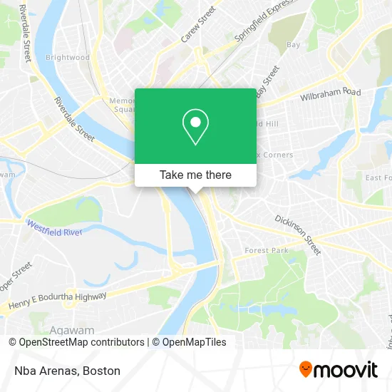
See Nba Arenas, Boston, on the map
Public Transit to Nba Arenas in Boston
Wondering how to get to Nba Arenas in Boston? Moovit helps you find the best way to get to Nba Arenas with step-by-step directions from the nearest public transit station.
Moovit provides free maps and live directions to help you navigate through your city. View schedules, routes, timetables, and find out how long does it take to get to Nba Arenas in real time.
Looking for the nearest stop or station to Nba Arenas? Check out this list of stops closest to your destination: Main/Stockbridge; Main / Margaret; Springfield.
Bus: G1, X92, T1, T2, T5, T92, G2.Train: LAKE SHORE LIMITED, VERMONTER, AMTRAK HARTFORD LINE, NORTHEAST REGIONAL, VALLEY FLYER.
Want to see if there’s another route that gets you there at an earlier time? Moovit helps you find alternative routes or times. Get directions from and directions to Nba Arenas easily from the Moovit App or Website.
We make riding to Nba Arenas easy, which is why over 1.7 million users, including users in Boston, trust Moovit as the best app for public transit. You don’t need to download an individual bus app or train app, Moovit is your all-in-one transit app that helps you find the best bus time or train time available.
For information on prices of bus and train, costs and ride fares to Nba Arenas, please check the Moovit app.
Use the app to navigate to popular places including to the airport, hospital, stadium, grocery store, mall, coffee shop, school, college, and university.
Nba Arenas Address: 1000 W Columbus Ave street in Boston
- Cold Stone Creamery,
- Hoop Hall Dreams Camp,
- Naismith Mem'l Basketball Hall Fame,
- Naismith Memorial Basketball Hof,
- SUBWAY,
- Nicholas Stoddard at Comparion Insurance Agency,
- Comparion Insurance Agency,
- Bryan Punderson at Comparion Insurance Agency,
- Solemar Mercedes at Comparion Insurance Agency,
- Matthew Hastings at Comparion Insurance Agency,
- David Fesko at Comparion Insurance Agency,
- Luzed Guzman Romano at Comparion Insurance Agency,
- Kristen Fiore at Comparion Insurance Agency,
- Glen Gauthier at Comparion Insurance Agency,
- Christopher Bergquist at Comparion Insurance Agency,
- Amber Barnes at Comparion Insurance Agency,
- Greg Quimby at Comparion Insurance Agency,
- Cumulus Media,
- Patriot Living Cabinets & Stonework,
- Epilepsy Foundation New England Donation Center
Places Near Nba Arenas (Boston)
- Seaport District, Boston,
- Museum Of Science, Boston,
- Boston Children's Hospital, Boston,
- Faneuil Hall, Boston,
- Leader Bank Pavilion (Leader Bank Pavillion), Boston,
- Wilbur Theatre, Boston,
- House Of Blues, Boston,
- North End, Boston,
- Boston Medical Center, Boston,
- Castle Island, Boston,
- Boston Convention & Exhibition Center, Boston,
- Quincy Market, Boston,
- Boston Common, Boston,
- Td Garden, Boston,
- Wang Theater, Boston,
- Massachusetts General Hospital, Boston,
- Cheers, Boston,
- Mgm Music Hall, Boston,
- Prudential Center, Boston,
- Isabella Stewart Gardner Museum, Boston
How to get to popular places in Boston with public transit
Get around Boston by public transit!
Traveling around Boston has never been so easy. See step by step directions as you travel to any attraction, street or major public transit station. View bus and train schedules, arrival times, service alerts and detailed routes on a map, so you know exactly how to get to anywhere in Boston.
When traveling to any destination around Boston use Moovit's Live Directions with Get Off Notifications to know exactly where and how far to walk, how long to wait for your line, and how many stops are left. Moovit will alert you when it's time to get off — no need to constantly re-check whether yours is the next stop.
Wondering how to use public transit in Boston or how to pay for public transit in Boston? Moovit public transit app can help you navigate your way with public transit easily, and at minimum cost. It includes public transit fees, ticket prices, and costs. Looking for a map of Boston public transit lines? Moovit public transit app shows all public transit maps in Boston with all Bus, Train, Subway and Ferry routes and stops on an interactive map.
Boston has 4 transit type(s), including: Bus, Train, Subway and Ferry, operated by several transit agencies, including MBTA, Southeastern Regional Transit Authority, MetroWest Regional Transit Authority, Rhode Island Public Transit Authority, WRTA, Lowell Regional Transit Authority, Merrimack Valley Transit, Montachusett Regional Transit Authority, Cape Cod Regional Transit Authority, Brockton Area Transit Authority, Martha's Vineyard Transit Authority, the WAVE - Nantucket Regional Transit Authority, GATRA, Cape Ann Transportation Authority and Massport