Directions to Nenavit Modas (São Lourenço) with public transportation
The following transit lines have routes that pass near Nenavit Modas
How to get to Nenavit Modas by bus?
Click on the bus route to see step by step directions with maps, line arrival times and updated time schedules.
From Terminal Do Carmo, Hauer
44 minFrom RH Nossa, Rebouças
32 minFrom Hauer, Hauer
47 minFrom Estação Tubo Silva Jardim, Água Verde
35 minFrom Cemitério Vertical, Tarumã
49 minFrom João Bettega, 736 - Portão, Portão
53 minFrom Terminal Pinhais, Pinhais
51 minFrom Rua Omilio Monteiro Soares, Fanny
53 minFrom Rua Doutor Pedrosa, Centro
32 minFrom I20 - Colombo/São José, Pinhais
51 min
Bus stops near Nenavit Modas in São Lourenço
Bus lines to Nenavit Modas in São Lourenço
- K01 ITAPERUÇU / GUADALUPE (TAMANDARÉ / MINÉRIOS), Itaperuçu → Terminal Guadalupe,VIEW
- A06 TAMANDARÉ / GUADALUPE (MINÉRIOS), Terminal Guadalupe → Terminal Tamandaré,VIEW
- 020 INTERBAIRROS II (HORÁRIO), Campina do Siqueira → Cabral,VIEW
- 177 CABRAL / PARQUE TANGUÁ, Terminal Cabral → Parque Tanguá,VIEW
- 181 MATEUS LEME, Praça Tiradentes → Capela São Francisco Xavier,VIEW
- 182 ABRANCHES, Praça Tiradentes → Terminal Barreirinha,VIEW
- 183 JARDIM CHAPARRAL, Jardim Chaparral → Praça Tiradentes,VIEW
- 184 VILA SUÍÇA, Praça Tiradentes → Vila Suíça,VIEW
- 189 MAD. ABRANCHES, Praça Rui Barbosa ↺ Abranches (Circular),VIEW
- A07 TAMANDARÉ / PRAÇA 19 (LAMENHA), (Reforço) Praça 19 → Kabel,VIEW
- K71 ITAPERUÇU / PRAÇA 19, Praça 19 → Campo Grande,VIEW
- L71 RIO BRANCO / PRAÇA 19, Praça 19 → Itaperuçu → Rio Branco (Madrugueiro),VIEW
- A72 JARDIM PARAÍSO / PRAÇA 19, Jardim Paraíso → Praça 19,VIEW
- K72 ITAPERUÇU / PRAÇA 19 (DIRETO), Itaperuçu → Praça 19,VIEW
- L72 RIO BRANCO / PRAÇA 19 (DIRETO), Palmeirinhas → Praça 19,VIEW
- A73 JARDIM MARROCOS / PRAÇA 19, Praça 19 → Jardim Marrocos,VIEW
- L79 RIO BRANCO / PRAÇA 19 (VIA TAMANDARÉ), Nossa Senhora de Fátima → Praça 19,VIEW
- 1560-500, Cerro Azul → Curitiba,VIEW
- 979 TURISMO / TOURISM LINE, Rua 24 Horas ↺ Linha Turismo (Circular),VIEW
- 021 INTERBAIRROS II (ANTI-HORÁRIO), Cabral → Campina do Siqueira,VIEW
What are the closest stations to Nenavit Modas?
The closest stations to Nenavit Modas are:
- R. Mateus Leme, 4300 is 30 meters away, 1 min walk.
- R. Mateus Leme, 4557 is 178 meters away, 3 min walk.
- R. Professor Nilo Brandão, 542 (Parque São Lourenço) is 354 meters away, 5 min walk.
- R. Antônio Correa Bittencourt, 517 is 770 meters away, 10 min walk.
Which bus lines stop near Nenavit Modas?
These bus lines stop near Nenavit Modas: 182 ABRANCHES, A06 TAMANDARÉ / GUADALUPE (MINÉRIOS), K71 ITAPERUÇU / PRAÇA 19, L71 RIO BRANCO / PRAÇA 19.
What’s the nearest bus station to Nenavit Modas in São Lourenço?
The nearest bus station to Nenavit Modas in São Lourenço is R. Mateus Leme, 4300. It’s a 1 min walk away.
What time is the first bus to Nenavit Modas in São Lourenço?
The 189 MAD. ABRANCHES is the first bus that goes to Nenavit Modas in São Lourenço. It stops nearby at 3:11 AM.
What time is the last bus to Nenavit Modas in São Lourenço?
The K71 ITAPERUÇU / PRAÇA 19 is the last bus that goes to Nenavit Modas in São Lourenço. It stops nearby at 4:06 AM.
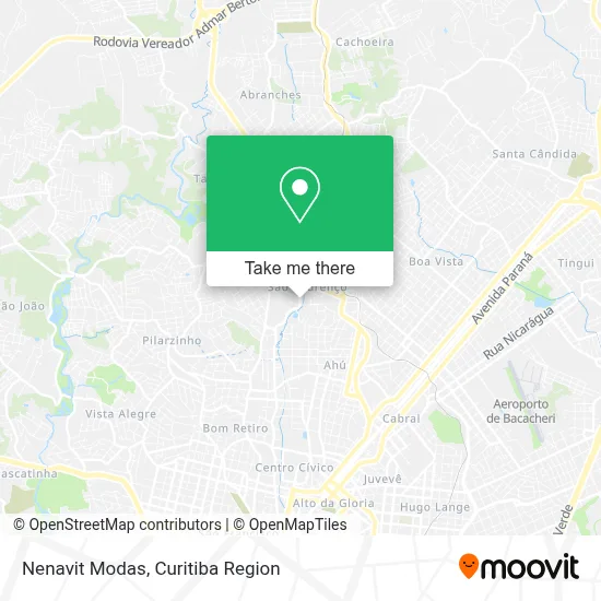
See Nenavit Modas, São Lourenço, on the map
Public Transit to Nenavit Modas in São Lourenço
Wondering how to get to Nenavit Modas in São Lourenço? Moovit helps you find the best way to get to Nenavit Modas with step-by-step directions from the nearest public transit station.
Moovit provides free maps and live directions to help you navigate through your city. View schedules, routes, timetables, and find out how long does it take to get to Nenavit Modas in real time.
Looking for the nearest stop or station to Nenavit Modas? Check out this list of stops closest to your destination: R. Mateus Leme; R. Mateus Leme; R. Professor Nilo Brandão; R. Antônio Correa Bittencourt.
Bus: 182 ABRANCHES, A06 TAMANDARÉ / GUADALUPE (MINÉRIOS), K71 ITAPERUÇU / PRAÇA 19, L71 RIO BRANCO / PRAÇA 19, K01 ITAPERUÇU / GUADALUPE (TAMANDARÉ / MINÉRIOS), 020 INTERBAIRROS II (HORÁRIO), 177 CABRAL / PARQUE TANGUÁ, 181 MATEUS LEME, 979 TURISMO / TOURISM LINE, 021 INTERBAIRROS II (ANTI-HORÁRIO), 260 MARECHAL HERMES / SANTA EFIGÊNIA.
Want to see if there’s another route that gets you there at an earlier time? Moovit helps you find alternative routes or times. Get directions from and directions to Nenavit Modas easily from the Moovit App or Website.
We make riding to Nenavit Modas easy, which is why over 1.5 million users, including users in São Lourenço, trust Moovit as the best app for public transit. You don’t need to download an individual bus app or train app, Moovit is your all-in-one transit app that helps you find the best bus time or train time available.
For information on prices of bus, costs and ride fares to Nenavit Modas, please check the Moovit app.
Use the app to navigate to popular places including to the airport, hospital, stadium, grocery store, mall, coffee shop, school, college, and university.
Nenavit Modas Address: Rua Mateus Leme, 4298 São Lourenço Curitiba-PR 82200-000 street in São Lourenço
- Rdp Energia,
- Vitaya Alimentos,
- Integral Trading,
- H6 Participacoes Ltda,
- Rua Mateus Leme 4360,
- Eagle Bike Shop Comércio de Bicicletas,
- Rua João Guariza 632,
- Kumon,
- Rejaile Engenharia,
- Jose Américo Reisa Vie,
- Paes e Doces Royal Park,
- bicicletaria bike tour,
- Grupo de Comunicação Curitiba News,
- Arte Em Pintura,
- Pablo Fernando,
- Royal Palace Bingo Diversoes,
- Ipiranga,
- Posto Ópera de Arame,
- Osvaldo Joao Krindges Júnior Contabilidade,
- Guilherme Trojan
Places Near Nenavit Modas (São Lourenço)
- Campo Largo, Campo,
- Hospital Nossa Senhora Das Graças, Mercês,
- Rua General Mário Tourinho, Campina Do Siqueira,
- Parque Barigui, Mercês,
- Hospital Erasto Gaertner, Jardim Das Américas,
- Hospital Madalena Sofia, Bairro Alto,
- Shopping Palladium, Portão,
- Hhhhh, Fazendinha,
- Shopping Estação, Rebouças,
- Hospital Angelina Caron, Campina Grande Do Sul,
- Jardim Botânico de Curitiba PR, Centro,
- Hospital do Rocio, Campo,
- Park Shopping Barigüi, Mossunguê,
- Jockey Plaza Shopping Center, Tarumã,
- Rua Martim Afonso 558, Mercês,
- Hospital de Clínicas (HC - UFPR), Centro,
- Hospital Universitário Evangélico de Curitiba, Bigorrilho,
- Pontifícia Universidade Católica do Paraná (PUCPR), Prado Velho,
- Arena Da Baixada - Curitiba,
- Hospital Da Cruz Vermelha, Batel
How to get to popular places in Curitiba Region with public transit
Get around São Lourenço by public transit!
Traveling around São Lourenço has never been so easy. See step by step directions as you travel to any attraction, street or major public transit station. View bus and train schedules, arrival times, service alerts and detailed routes on a map, so you know exactly how to get to anywhere in São Lourenço.
When traveling to any destination around São Lourenço use Moovit's Live Directions with Get Off Notifications to know exactly where and how far to walk, how long to wait for your line, and how many stops are left. Moovit will alert you when it's time to get off — no need to constantly re-check whether yours is the next stop.
Wondering how to use public transit in São Lourenço or how to pay for public transit in São Lourenço? Moovit public transit app can help you navigate your way with public transit easily, and at minimum cost. It includes public transit fees, ticket prices, and costs. Looking for a map of São Lourenço public transit lines? Moovit public transit app shows all public transit maps in São Lourenço with all Bus and Cable Car routes and stops on an interactive map.
Curitiba Region has 2 transit type(s), including: Bus and Cable Car, operated by several transit agencies, including Sistema Integrado de Mobilidade (URBS), Sistema Integrado de Mobilidade (AMEP), URBS (Cartões bancários e Dinheiro), URBS (Cartões bancários / Cartão URBS), AMEP (Cartões bancários / Cartão MetroCard), AMEP (Cartões bancários / Cartão MetroCard / Dinheiro), Viação Colombo (Dinheiro), TRIAR (Cartão TRIAR / Dinheiro), Empresa Curitiba Cerro Azul (Dinheiro), Expresso Nossa Senhora da Penha (Dinheiro), Empresa Campo Alto Tijucas (Dinheiro), Auto Viação São José (Cartão VEM / Dinheiro), BRT S/A (Cartão VEM / Dinheiro), TransPiedade (Cartão Cidadão / Dinheiro) and Oceânica Sul (Cartão Transporte / Dinheiro)