How to get to Neutaconkanut Hill Conservancy by bus?
Click on the bus route to see step by step directions with maps, line arrival times and updated time schedules.
Bus stops near Neutaconkanut Hill Conservancy in Boston
Bus lines to Neutaconkanut Hill Conservancy in Boston
What are the closest stations to Neutaconkanut Hill Conservancy?
The closest stations to Neutaconkanut Hill Conservancy are:
- Opposite 928 Plainfield is 308 yards away, 4 min walk.
- Pocasset After Sophia is 319 yards away, 4 min walk.
Which bus line stops near Neutaconkanut Hill Conservancy?
19 (Walmart (Cranston))
What’s the nearest bus station to Neutaconkanut Hill Conservancy in Boston?
The nearest bus stations to Neutaconkanut Hill Conservancy in Boston are Opposite 928 Plainfield and Pocasset After Sophia. The closest one is a 4 min walk away.
What time is the first bus to Neutaconkanut Hill Conservancy in Boston?
The 19 is the first bus that goes to Neutaconkanut Hill Conservancy in Boston. It stops nearby at 5:49 AM.
What time is the last bus to Neutaconkanut Hill Conservancy in Boston?
The 19 is the last bus that goes to Neutaconkanut Hill Conservancy in Boston. It stops nearby at 11:25 PM.
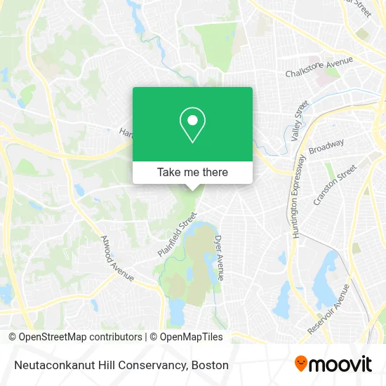
See Neutaconkanut Hill Conservancy, Boston, on the map
Public Transit to Neutaconkanut Hill Conservancy in Boston
Wondering how to get to Neutaconkanut Hill Conservancy in Boston? Moovit helps you find the best way to get to Neutaconkanut Hill Conservancy with step-by-step directions from the nearest public transit station.
Moovit provides free maps and live directions to help you navigate through your city. View schedules, routes, timetables, and find out how long does it take to get to Neutaconkanut Hill Conservancy in real time.
Looking for the nearest stop or station to Neutaconkanut Hill Conservancy? Check out this list of stops closest to your destination: Opposite 928 Plainfield; Pocasset After Sophia.
Bus: 19, 17.
Want to see if there’s another route that gets you there at an earlier time? Moovit helps you find alternative routes or times. Get directions from and directions to Neutaconkanut Hill Conservancy easily from the Moovit App or Website.
We make riding to Neutaconkanut Hill Conservancy easy, which is why over 1.7 million users, including users in Boston, trust Moovit as the best app for public transit. You don’t need to download an individual bus app or train app, Moovit is your all-in-one transit app that helps you find the best bus time or train time available.
For information on prices of bus and train, costs and ride fares to Neutaconkanut Hill Conservancy, please check the Moovit app.
Use the app to navigate to popular places including to the airport, hospital, stadium, grocery store, mall, coffee shop, school, college, and university.
Neutaconkanut Hill Conservancy Address: 120 Killingly St street in Boston
- Al Magno Pool at Neutaconkanut Recreation Center,
- City of Providence Recreation Dept,
- Jee's Shack,
- Fish on Poker & Stuff,
- RBF Fitness & Nutrition,
- Empire Masonry,
- Eddys Container Company,
- Town of Providence Prov Water Supply Board,
- Rossi Electric,
- Manny's Mechanics,
- Iglesia Pentecostal Lirio de los Valles,
- A 24 Hour Emerg Locksmith,
- Paul Logan Services,
- A & A A A Locksmith,
- Crest & Berry,
- Jackie Cleaning and Services,
- LMG Auto Repair,
- Gemma's Bar,
- Robert's Polishing Co.,
- In the Cut Barbershop & Salon
Places Near Neutaconkanut Hill Conservancy (Boston)
- Isabella Stewart Gardner Museum, Boston,
- Wang Theater, Boston,
- House Of Blues, Boston,
- Cheers, Boston,
- Faneuil Hall, Boston,
- Leader Bank Pavilion (Leader Bank Pavillion), Boston,
- Td Garden, Boston,
- Castle Island, Boston,
- Massachusetts General Hospital, Boston,
- Mgm Music Hall, Boston,
- Prudential Center, Boston,
- North End, Boston,
- Museum Of Science, Boston,
- Seaport District, Boston,
- Boston Children's Hospital, Boston,
- Quincy Market, Boston,
- Boston Common, Boston,
- Boston Medical Center, Boston,
- Boston Convention & Exhibition Center, Boston,
- Wilbur Theatre, Boston
How to get to popular places in Boston with public transit
Get around Boston by public transit!
Traveling around Boston has never been so easy. See step by step directions as you travel to any attraction, street or major public transit station. View bus and train schedules, arrival times, service alerts and detailed routes on a map, so you know exactly how to get to anywhere in Boston.
When traveling to any destination around Boston use Moovit's Live Directions with Get Off Notifications to know exactly where and how far to walk, how long to wait for your line, and how many stops are left. Moovit will alert you when it's time to get off — no need to constantly re-check whether yours is the next stop.
Wondering how to use public transit in Boston or how to pay for public transit in Boston? Moovit public transit app can help you navigate your way with public transit easily, and at minimum cost. It includes public transit fees, ticket prices, and costs. Looking for a map of Boston public transit lines? Moovit public transit app shows all public transit maps in Boston with all Bus, Train, Subway and Ferry routes and stops on an interactive map.
Boston has 4 transit type(s), including: Bus, Train, Subway and Ferry, operated by several transit agencies, including MBTA, Southeastern Regional Transit Authority, MetroWest Regional Transit Authority, Rhode Island Public Transit Authority, WRTA, Lowell Regional Transit Authority, Merrimack Valley Transit, Montachusett Regional Transit Authority, Cape Cod Regional Transit Authority, Brockton Area Transit Authority, Martha's Vineyard Transit Authority, the WAVE - Nantucket Regional Transit Authority, GATRA, Cape Ann Transportation Authority and Massport