Directions to New Town (Watertown Town) with public transportation
The following transit lines have routes that pass near New Town
 Bus: 504, 57, 52, 59, 70.
- Train: FRAMINGHAM/WORCESTER, FITCHBURG.
- Subway: GREEN LINE B, GREEN LINE D.
How to get to New Town by bus?
Click on the bus route to see step by step directions with maps, line arrival times and updated time schedules.
From Residence Inn by Marriott Boston Downtown/South End, Boston
40 minFrom Wilbur Theatre, Boston
25 minFrom Courtyard Marriott Lobby, Boston
26 minFrom Paradise Rock Club, Boston
27 minFrom Moxy Hotel, Boston
25 minFrom AMC Theatres-Boston Common 19, Boston
27 minFrom Endicott College Boston, Boston
25 minFrom Northeastern University, Boston
33 minFrom Matthews Arena, Boston
31 minFrom Hotel Commonwealth, Boston
33 min
How to get to New Town by train?
Click on the train route to see step by step directions with maps, line arrival times and updated time schedules.
From Residence Inn by Marriott Boston Downtown/South End, Boston
140 minFrom Wilbur Theatre, Boston
60 minFrom Courtyard Marriott Lobby, Boston
61 minFrom Moxy Hotel, Boston
60 minFrom Endicott College Boston, Boston
61 minFrom Northeastern University, Boston
61 minFrom Matthews Arena, Boston
136 minFrom Hotel Commonwealth, Boston
49 min
How to get to New Town by subway?
Click on the subway route to see step by step directions with maps, line arrival times and updated time schedules.
From Residence Inn by Marriott Boston Downtown/South End, Boston
116 minFrom Wilbur Theatre, Boston
93 minFrom Courtyard Marriott Lobby, Boston
94 minFrom Paradise Rock Club, Boston
71 minFrom Moxy Hotel, Boston
93 minFrom AMC Theatres-Boston Common 19, Boston
89 minFrom Endicott College Boston, Boston
91 minFrom Northeastern University, Boston
91 minFrom Matthews Arena, Boston
94 minFrom Hotel Commonwealth, Boston
80 min
Bus stops near New Town in Watertown Town
Subway stations near New Town in Watertown Town
Train stations near New Town in Watertown Town
Bus lines to New Town in Watertown Town
- 52, Dedham Mall,VIEW
- 57, Haymarket Via Kenmore,VIEW
- 504, Downtown Via Copley (Express),VIEW
- 59, Watertown Square via Needham St - Needham Junction via Needham St,VIEW
- 70, University Park - Market Place Dr,VIEW
- 71, Harvard - Watertown Square,VIEW
- 501, Brighton Via Copley (Express),VIEW
- 553, Newton Corner,VIEW
- 554, Waverley,VIEW
- 556, Waltham Highlands,VIEW
- 558, Riverside,VIEW
What are the closest stations to New Town?
The closest stations to New Town are:
- Galen St @ Maple St is 203 yards away, 3 min walk.
- Watertown Square is 493 yards away, 6 min walk.
- 400 Centre St - East is 573 yards away, 7 min walk.
- Washington St @ Bacon St is 634 yards away, 8 min walk.
- Boston College is 1300 yards away, 16 min walk.
- Newtonville is 2231 yards away, 27 min walk.
- Newton Centre is 4303 yards away, 51 min walk.
- Waverley is 4949 yards away, 58 min walk.
Which bus lines stop near New Town?
These bus lines stop near New Town: 504, 57.
Which train line stops near New Town?
FRAMINGHAM/WORCESTER (#530 | South Station)
Which subway lines stop near New Town?
These subway lines stop near New Town: GREEN LINE B, GREEN LINE D.
What’s the nearest subway station to New Town in Watertown Town?
The nearest subway station to New Town in Watertown Town is Boston College. It’s a 16 min walk away.
What’s the nearest train station to New Town in Watertown Town?
The nearest train station to New Town in Watertown Town is Newtonville. It’s a 27 min walk away.
What’s the nearest bus station to New Town in Watertown Town?
The nearest bus station to New Town in Watertown Town is Galen St @ Maple St. It’s a 3 min walk away.
What time is the first subway to New Town in Watertown Town?
The GREEN LINE D is the first subway that goes to New Town in Watertown Town. It stops nearby at 4:54 AM.
What time is the last subway to New Town in Watertown Town?
The GREEN LINE B is the last subway that goes to New Town in Watertown Town. It stops nearby at 2:39 AM.
What time is the first train to New Town in Watertown Town?
The FRAMINGHAM/WORCESTER is the first train that goes to New Town in Watertown Town. It stops nearby at 5:25 AM.
What time is the last train to New Town in Watertown Town?
The FRAMINGHAM/WORCESTER is the last train that goes to New Town in Watertown Town. It stops nearby at 12:17 AM.
What time is the first bus to New Town in Watertown Town?
The 57 is the first bus that goes to New Town in Watertown Town. It stops nearby at 4:30 AM.
What time is the last bus to New Town in Watertown Town?
The 57 is the last bus that goes to New Town in Watertown Town. It stops nearby at 2:34 AM.
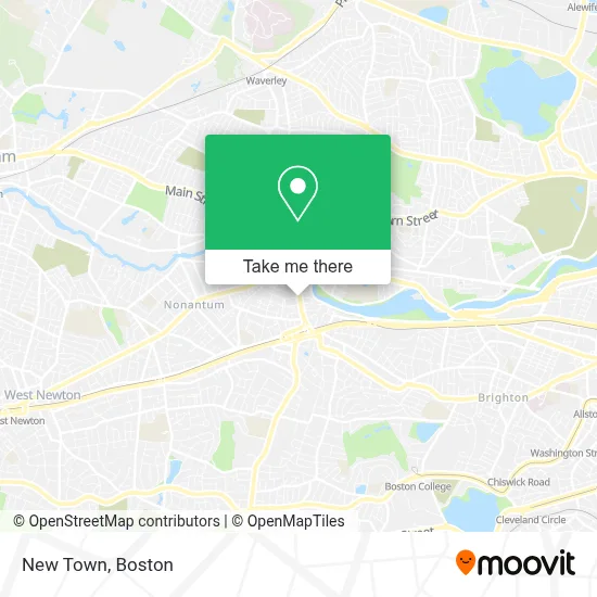
See New Town, Watertown Town, on the map
Public Transit to New Town in Watertown Town
Wondering how to get to New Town in Watertown Town? Moovit helps you find the best way to get to New Town with step-by-step directions from the nearest public transit station.
Moovit provides free maps and live directions to help you navigate through your city. View schedules, routes, timetables, and find out how long does it take to get to New Town in real time.
Looking for the nearest stop or station to New Town? Check out this list of stops closest to your destination: Galen St @ Maple St; Watertown Square; 400 Centre St - East; Washington St @ Bacon St; Boston College; Newtonville; Newton Centre; Waverley.
Bus: 504, 57, 52, 59, 70, 71.Train: FRAMINGHAM/WORCESTER, FITCHBURG.Subway: GREEN LINE B, GREEN LINE D.
Want to see if there’s another route that gets you there at an earlier time? Moovit helps you find alternative routes or times. Get directions from and directions to New Town easily from the Moovit App or Website.
We make riding to New Town easy, which is why over 1.7 million users, including users in Watertown Town, trust Moovit as the best app for public transit. You don’t need to download an individual bus app or train app, Moovit is your all-in-one transit app that helps you find the best bus time or train time available.
For information on prices of bus, subway and train, costs and ride fares to New Town, please check the Moovit app.
Use the app to navigate to popular places including to the airport, hospital, stadium, grocery store, mall, coffee shop, school, college, and university.
New Town Address: 123 GALEN ST street in Watertown Town
- Vows Bridal Outlet,
- Vows Bridal Outlet & Bridepower,
- Brigham and Women's at Newton Corner (Brigham & Womens-Newton Corner - Harley A Simeone MD),
- Newton Corner,
- I-90 Mass Pike, Exit 17,
- MBTA Bus Route 502,
- MBTA Watertown Yard,
- Buff's Pub,
- Parker Building,
- Healing Roots Acupuncture,
- FOUR POINTS BY SHERATON Boston Newton,
- Jeanne Hubbuch, Md,
- Watertown Food Pantry,
- Acumed Acupuncture And Herbs,
- Soleil Concepts,
- Vitality Bowls,
- The Vac,
- FedEx,
- Nanotemper Technologies,
- Reit Management
Places Near New Town (Watertown Town)
- Seaport District, Boston,
- Prudential Center, Boston,
- Boston Children's Hospital, Boston,
- North End, Boston,
- Boston Medical Center, Boston,
- Mgm Music Hall, Boston,
- Cheers, Boston,
- Boston Convention & Exhibition Center, Boston,
- Faneuil Hall, Boston,
- Wang Theater, Boston,
- Massachusetts General Hospital, Boston,
- Museum Of Science, Boston,
- House Of Blues, Boston,
- Isabella Stewart Gardner Museum, Boston,
- Boston Common, Boston,
- Wilbur Theatre, Boston,
- Leader Bank Pavilion (Leader Bank Pavillion), Boston,
- Td Garden, Boston,
- Castle Island, Boston,
- Quincy Market, Boston
How to get to popular places in Boston with public transit
Get around Watertown Town by public transit!
Traveling around Watertown Town has never been so easy. See step by step directions as you travel to any attraction, street or major public transit station. View bus and train schedules, arrival times, service alerts and detailed routes on a map, so you know exactly how to get to anywhere in Watertown Town.
When traveling to any destination around Watertown Town use Moovit's Live Directions with Get Off Notifications to know exactly where and how far to walk, how long to wait for your line, and how many stops are left. Moovit will alert you when it's time to get off — no need to constantly re-check whether yours is the next stop.
Wondering how to use public transit in Watertown Town or how to pay for public transit in Watertown Town? Moovit public transit app can help you navigate your way with public transit easily, and at minimum cost. It includes public transit fees, ticket prices, and costs. Looking for a map of Watertown Town public transit lines? Moovit public transit app shows all public transit maps in Watertown Town with all Bus, Train, Subway and Ferry routes and stops on an interactive map.
Boston has 4 transit type(s), including: Bus, Train, Subway and Ferry, operated by several transit agencies, including MBTA, Southeastern Regional Transit Authority, MetroWest Regional Transit Authority, Rhode Island Public Transit Authority, WRTA, Lowell Regional Transit Authority, Merrimack Valley Transit, Montachusett Regional Transit Authority, Cape Cod Regional Transit Authority, Brockton Area Transit Authority, Martha's Vineyard Transit Authority, the WAVE - Nantucket Regional Transit Authority, GATRA, Cape Ann Transportation Authority and Massport