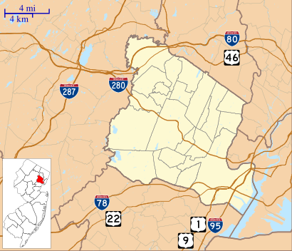
See North 15th Street, Bloomfield, Nj, on the map
Directions to North 15th Street (Bloomfield, Nj) with public transportation
The following transit lines have routes that pass near North 15th Street
 Bus:
Bus: - Train:
How to get to North 15th Street by bus?
Click on the bus route to see step by step directions with maps, line arrival times and updated time schedules.
How to get to North 15th Street by train?
Click on the train route to see step by step directions with maps, line arrival times and updated time schedules.
Bus stations near North 15th Street in Bloomfield, Nj
- 1st Ave At North 16th St,2 min walk,
Bus lines to North 15th Street in Bloomfield, Nj
- 34,34p Newark Penn Station,
What are the closest stations to North 15th Street?
The closest stations to North 15th Street are:
- 1st Ave At North 16th St is 155 yards away, 2 min walk.
Which bus lines stop near North 15th Street?
These bus lines stop near North 15th Street: 34, 90, GO28.
Which train line stops near North 15th Street?
ML
What’s the nearest bus stop to North 15th Street in Bloomfield, Nj?
The nearest bus stop to North 15th Street in Bloomfield, Nj is 1st Ave At North 16th St. It’s a 2 min walk away.
See North 15th Street, Bloomfield, Nj, on the map
Public Transit to North 15th Street in Bloomfield, Nj
Wondering how to get to North 15th Street in Bloomfield, Nj, United States? Moovit helps you find the best way to get to North 15th Street with step-by-step directions from the nearest public transit station.
Moovit provides free maps and live directions to help you navigate through your city. View schedules, routes, timetables, and find out how long does it take to get to North 15th Street in real time.
Looking for the nearest stop or station to North 15th Street? Check out this list of stops closest to your destination: 1st Ave At North 16th St.
Bus:Train:
Want to see if there’s another route that gets you there at an earlier time? Moovit helps you find alternative routes or times. Get directions from and directions to North 15th Street easily from the Moovit App or Website.
We make riding to North 15th Street easy, which is why over 1.5 million users, including users in Bloomfield, Nj, trust Moovit as the best app for public transit. You don’t need to download an individual bus app or train app, Moovit is your all-in-one transit app that helps you find the best bus time or train time available.
For information on prices of bus and train, costs and ride fares to North 15th Street, please check the Moovit app.
Use the app to navigate to popular places including to the airport, hospital, stadium, grocery store, mall, coffee shop, school, college, and university.
Location: Bloomfield, Nj, New York - New Jersey
Attractions near North 15th Street
Living Inside My Love,Pole Delight,Hubster's Cave,41 N 15th St,Linda's Lounge,Tropical Bliss Restaurant,Mon Boudoir,25,N 15th St N 15th St,My Comp Room,In My Cabrio,Moon Palace,15 N 15th St ,Kitchen without A Cook,La Divas Den,N 15th St (15th lawton),15th Lawton,Vanitys Cakes,49 Lawton St,93 North 13th St,Light Hand Tattoo ShopHow to get to popular attractions in Bloomfield, Nj with public transit
Roberta's Pizza,Nathan's Famous,Caesars Atlantic City Hotel and Casino, Atlantic City, Nj,Grimaldi's Pizzeria,Shake Shack, Manhattan,SoHo, Manhattan,The Kunjip, Manhattan,Boat Basin Cafe, Manhattan,Time Life, Manhattan,24 Hour Fitness, Manhattan,Atlantic City, NJ, Atlantic City, Nj,Lombardi's Coal Oven Pizza, Manhattan,Wingate by Wyndham Manhattan Midtown, Manhattan,Harrah's Resort Hotel & Casino, Atlantic City, Nj,Freehold Raceway Mall, Freehold Township,Ferrara Bakery, Manhattan,Hill Country Chicken, Manhattan,Stamford Transportation Center : Bus / Train (STM) Metro North & Amtrak, Stamford, Ct,Fette Sau,Ulysses Folk House, ManhattanGet around Bloomfield, Nj by public transit!
Traveling around Bloomfield, Nj has never been so easy. See step by step directions as you travel to any attraction, street or major public transit station. View bus and train schedules, arrival times, service alerts and detailed routes on a map, so you know exactly how to get to anywhere in Bloomfield, Nj.
When traveling to any destination around Bloomfield, Nj use Moovit's Live Directions with Get Off Notifications to know exactly where and how far to walk, how long to wait for your line, and how many stops are left. Moovit will alert you when it's time to get off — no need to constantly re-check whether yours is the next stop.
Wondering how to use public transit in Bloomfield, Nj or how to pay for public transit in Bloomfield, Nj? Moovit public transit app can help you navigate your way with public transit easily, and at minimum cost. It includes public transit fees, ticket prices, and costs. Looking for a map of Bloomfield, Nj public transit lines? Moovit public transit app shows all public transit maps in Bloomfield, Nj with all bus or train routes and stops on an interactive map.
Bloomfield, Nj has 2 transit type(s), including: bus or train, operated by several transit agencies, including MTA Subway, Metro-North Railroad, LIRR, PATH, Shore Line East, MTA Bus Company, MTA New York City Transit - Express routes, MTA Bus, NJ Transit, NYC Ferry, NICE bus, Bee-Line Bus, NJ Transit Rail, NJ Transit Rail and Norwalk Transit District