Directions to North East Security Solutions (Boston) with public transportation
The following transit lines have routes that pass near North East Security Solutions
 Bus: 1, 80, R, 76, 71.
- Train: PROVIDENCE/STOUGHTON, FOXBORO EVENT SERVICE.
How to get to North East Security Solutions by bus?
Click on the bus route to see step by step directions with maps, line arrival times and updated time schedules.
How to get to North East Security Solutions by train?
Click on the train route to see step by step directions with maps, line arrival times and updated time schedules.
Bus stops near North East Security Solutions in Boston
Train station near North East Security Solutions in Boston
- Pawtucket/Central Falls, 7 min walk,VIEW
Bus lines to North East Security Solutions in Boston
What are the closest stations to North East Security Solutions?
The closest stations to North East Security Solutions are:
- Exchange at Tolman High School is 136 yards away, 2 min walk.
- Opposite Slater Mill (Roosevelt & Main) is 207 yards away, 3 min walk.
- Dexter Before Bayley is 385 yards away, 5 min walk.
- Roosevelt Avenue is 404 yards away, 5 min walk.
- Dexter Opposite Andrew Ferland is 437 yards away, 6 min walk.
- Pawtucket/Central Falls is 519 yards away, 7 min walk.
Which bus lines stop near North East Security Solutions?
These bus lines stop near North East Security Solutions: 1, 80, R.
Which train line stops near North East Security Solutions?
PROVIDENCE/STOUGHTON (#825 | Providence)
What’s the nearest train station to North East Security Solutions in Boston?
The nearest train station to North East Security Solutions in Boston is Pawtucket/Central Falls. It’s a 7 min walk away.
What’s the nearest bus station to North East Security Solutions in Boston?
The nearest bus station to North East Security Solutions in Boston is Exchange at Tolman High School. It’s a 2 min walk away.
What time is the first train to North East Security Solutions in Boston?
The PROVIDENCE/STOUGHTON is the first train that goes to North East Security Solutions in Boston. It stops nearby at 4:16 AM.
What time is the last train to North East Security Solutions in Boston?
The PROVIDENCE/STOUGHTON is the last train that goes to North East Security Solutions in Boston. It stops nearby at 12:56 AM.
What time is the first bus to North East Security Solutions in Boston?
The 78 is the first bus that goes to North East Security Solutions in Boston. It stops nearby at 5:09 AM.
What time is the last bus to North East Security Solutions in Boston?
The R is the last bus that goes to North East Security Solutions in Boston. It stops nearby at 1:01 AM.
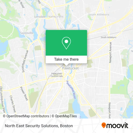
See North East Security Solutions, Boston, on the map
Public Transit to North East Security Solutions in Boston
Wondering how to get to North East Security Solutions in Boston? Moovit helps you find the best way to get to North East Security Solutions with step-by-step directions from the nearest public transit station.
Moovit provides free maps and live directions to help you navigate through your city. View schedules, routes, timetables, and find out how long does it take to get to North East Security Solutions in real time.
Looking for the nearest stop or station to North East Security Solutions? Check out this list of stops closest to your destination: Exchange at Tolman High School; Opposite Slater Mill (Roosevelt & Main); Dexter Before Bayley; Roosevelt Avenue; Dexter Opposite Andrew Ferland; Pawtucket/Central Falls.
Bus: 1, 80, R, 76, 71, 78, 72, 75.Train: PROVIDENCE/STOUGHTON, FOXBORO EVENT SERVICE.
Want to see if there’s another route that gets you there at an earlier time? Moovit helps you find alternative routes or times. Get directions from and directions to North East Security Solutions easily from the Moovit App or Website.
We make riding to North East Security Solutions easy, which is why over 1.7 million users, including users in Boston, trust Moovit as the best app for public transit. You don’t need to download an individual bus app or train app, Moovit is your all-in-one transit app that helps you find the best bus time or train time available.
For information on prices of bus and train, costs and ride fares to North East Security Solutions, please check the Moovit app.
Use the app to navigate to popular places including to the airport, hospital, stadium, grocery store, mall, coffee shop, school, college, and university.
North East Security Solutions Address: 69 Montgomery St Ste 4 street in Boston
- Gifts Galore,
- Picerne Management Corp.,
- Church of God Peniel,
- USPS COLLECTION BOX - BLUE BOX,
- All Nations Revival Center,
- Bileau Built,
- Latin Mom,
- Premier Wireless,
- Nutry Zone,
- Salon 45,
- New Life International Ministries,
- Liquor Palace,
- Ccap Learn To Earn,
- Cacd,
- Sullivan's American Kenpo,
- Time Machine Studio,
- Fogarty Manor,
- Asd,
- Mi Esperanza Beauty Salon,
- Property Management Franchise
Places Near North East Security Solutions (Boston)
- Boston Convention & Exhibition Center, Boston,
- Castle Island, Boston,
- Museum Of Science, Boston,
- Wilbur Theatre, Boston,
- Seaport District, Boston,
- Quincy Market, Boston,
- House Of Blues, Boston,
- Cheers, Boston,
- Prudential Center, Boston,
- Massachusetts General Hospital, Boston,
- Isabella Stewart Gardner Museum, Boston,
- Boston Common, Boston,
- Boston Children's Hospital, Boston,
- North End, Boston,
- Td Garden, Boston,
- Wang Theater, Boston,
- Faneuil Hall, Boston,
- Mgm Music Hall, Boston,
- Boston Medical Center, Boston,
- Leader Bank Pavilion (Leader Bank Pavillion), Boston
How to get to popular places in Boston with public transit
Get around Boston by public transit!
Traveling around Boston has never been so easy. See step by step directions as you travel to any attraction, street or major public transit station. View bus and train schedules, arrival times, service alerts and detailed routes on a map, so you know exactly how to get to anywhere in Boston.
When traveling to any destination around Boston use Moovit's Live Directions with Get Off Notifications to know exactly where and how far to walk, how long to wait for your line, and how many stops are left. Moovit will alert you when it's time to get off — no need to constantly re-check whether yours is the next stop.
Wondering how to use public transit in Boston or how to pay for public transit in Boston? Moovit public transit app can help you navigate your way with public transit easily, and at minimum cost. It includes public transit fees, ticket prices, and costs. Looking for a map of Boston public transit lines? Moovit public transit app shows all public transit maps in Boston with all Bus, Train, Subway and Ferry routes and stops on an interactive map.
Boston has 4 transit type(s), including: Bus, Train, Subway and Ferry, operated by several transit agencies, including MBTA, Southeastern Regional Transit Authority, MetroWest Regional Transit Authority, Rhode Island Public Transit Authority, WRTA, Lowell Regional Transit Authority, Merrimack Valley Transit, Montachusett Regional Transit Authority, Cape Cod Regional Transit Authority, Brockton Area Transit Authority, Martha's Vineyard Transit Authority, the WAVE - Nantucket Regional Transit Authority, GATRA, Cape Ann Transportation Authority and Massport