Directions to North Pole (Boston) with public transportation
The following transit lines have routes that pass near North Pole
 Bus: 47, 60, 65, 8, 85.
- Train: FRAMINGHAM/WORCESTER.
- Subway: GREEN LINE D, GREEN LINE B, GREEN LINE C.
How to get to North Pole by bus?
Click on the bus route to see step by step directions with maps, line arrival times and updated time schedules.
From VA Hospital, Boston
66 minFrom Milton Academy, Milton
109 minFrom Best Western Adams Inn Quincy - Boston, Quincy
84 minFrom Malden Catholic High School, Malden
76 minFrom Revere, MA, Revere
85 minFrom Milton, MA, Milton
86 minFrom Faulkner Hospital, Boston
45 minFrom Sommerville Theatre, Somerville
55 minFrom Fort Independence, Boston
77 min
How to get to North Pole by train?
Click on the train route to see step by step directions with maps, line arrival times and updated time schedules.
How to get to North Pole by subway?
Click on the subway route to see step by step directions with maps, line arrival times and updated time schedules.
Bus stops near North Pole in Boston
Subway stations near North Pole in Boston
Train station near North Pole in Boston
- Lansdowne, 9 min walk,VIEW
Bus lines to North Pole in Boston
- 8, Kenmore via South Bay Center - Harbor Point via South Bay Center,VIEW
- 9, Copley - City Point,VIEW
- 19, Kenmore - Fields Corner,VIEW
- 60, Kenmore - Chestnut Hill Mall,VIEW
- 65, Kenmore - Brighton Center,VIEW
- 55, West Fenway,VIEW
- 47, Broadway,VIEW
- 85, Ruggles,VIEW
- GREEN LINE D SHUTTLE, Riverside - Kenmore (Shuttle),VIEW
- GREEN LINE D SHUTTLE, Reservoir - Fenway,VIEW
- GREEN LINE D SHUTTLE, Reservoir - Kenmore,VIEW
- GREEN LINE D SHUTTLE, Riverside - Kenmore via Saint Mary's Street,VIEW
- GREEN LINE D SHUTTLE, Newton Highlands - Kenmore,VIEW
- GREEN LINE D SHUTTLE, Riverside - Fenway,VIEW
- GREEN LINE D SHUTTLE, Newton Highlands - Fenway,VIEW
- GREEN LINE D SHUTTLE, Brookline Hills - Kenmore,VIEW
- GREEN LINE D SHUTTLE, Newton Highlands - Kenmore via Saint Mary's Street,VIEW
- GREEN LINE D SHUTTLE, Brookline Hills - Back Bay (Shuttle),VIEW
- GREEN LINE D SHUTTLE, Riverside - Kenmore,VIEW
- 57, Watertown Yard,VIEW
What are the closest stations to North Pole?
The closest stations to North Pole are:
- 132 Brookline Ave Opp Fullerton St is 37 yards away, 1 min walk.
- Boston Univ. East is 87 yards away, 2 min walk.
- Kilmarnock St @ Peterborough St is 231 yards away, 3 min walk.
- Brookline Ave @ the Fenway is 373 yards away, 5 min walk.
- Park Dr @ Fenway Station SB is 490 yards away, 6 min walk.
- Park Dr @ Fenway Station NB is 515 yards away, 7 min walk.
- Lansdowne is 725 yards away, 9 min walk.
- Saint Marys Street is 747 yards away, 9 min walk.
- Fenway - Beacon St @ Park Dr is 840 yards away, 11 min walk.
- Fenway is 955 yards away, 12 min walk.
Which bus lines stop near North Pole?
These bus lines stop near North Pole: 47, 60, 65, 8, 85.
Which train line stops near North Pole?
FRAMINGHAM/WORCESTER (#525 | Worcester)
Which subway line stops near North Pole?
GREEN LINE D (Government Center)
What’s the nearest subway station to North Pole in Boston?
The nearest subway station to North Pole in Boston is Boston Univ. East. It’s a 2 min walk away.
What’s the nearest train station to North Pole in Boston?
The nearest train station to North Pole in Boston is Lansdowne. It’s a 9 min walk away.
What’s the nearest bus station to North Pole in Boston?
The nearest bus station to North Pole in Boston is 132 Brookline Ave Opp Fullerton St. It’s a 1 min walk away.
What time is the first subway to North Pole in Boston?
The GREEN LINE D is the first subway that goes to North Pole in Boston. It stops nearby at 4:56 AM.
What time is the last subway to North Pole in Boston?
The GREEN LINE D is the last subway that goes to North Pole in Boston. It stops nearby at 2:21 AM.
What time is the first train to North Pole in Boston?
The FRAMINGHAM/WORCESTER is the first train that goes to North Pole in Boston. It stops nearby at 4:55 AM.
What time is the last train to North Pole in Boston?
The FRAMINGHAM/WORCESTER is the last train that goes to North Pole in Boston. It stops nearby at 12:06 AM.
What time is the first bus to North Pole in Boston?
The 60 is the first bus that goes to North Pole in Boston. It stops nearby at 5:21 AM.
What time is the last bus to North Pole in Boston?
The 47 is the last bus that goes to North Pole in Boston. It stops nearby at 1:08 AM.
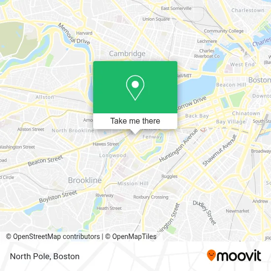
See North Pole, Boston, on the map
Public Transit to North Pole in Boston
Wondering how to get to North Pole in Boston? Moovit helps you find the best way to get to North Pole with step-by-step directions from the nearest public transit station.
Moovit provides free maps and live directions to help you navigate through your city. View schedules, routes, timetables, and find out how long does it take to get to North Pole in real time.
Looking for the nearest stop or station to North Pole? Check out this list of stops closest to your destination: 132 Brookline Ave Opp Fullerton St; Boston Univ. East; Kilmarnock St @ Peterborough St; Brookline Ave @ the Fenway; Park Dr @ Fenway Station SB; Park Dr @ Fenway Station NB; Lansdowne; Saint Marys Street; Fenway - Beacon St @ Park Dr; Fenway.
Bus: 47, 60, 65, 8, 85, 9, 19, 55.Train: FRAMINGHAM/WORCESTER.Subway: GREEN LINE D, GREEN LINE B, GREEN LINE C.
Want to see if there’s another route that gets you there at an earlier time? Moovit helps you find alternative routes or times. Get directions from and directions to North Pole easily from the Moovit App or Website.
We make riding to North Pole easy, which is why over 1.7 million users, including users in Boston, trust Moovit as the best app for public transit. You don’t need to download an individual bus app or train app, Moovit is your all-in-one transit app that helps you find the best bus time or train time available.
For information on prices of bus, subway and train, costs and ride fares to North Pole, please check the Moovit app.
Use the app to navigate to popular places including to the airport, hospital, stadium, grocery store, mall, coffee shop, school, college, and university.
North Pole Address: North Pole street in Boston
- Bita Tabesh M.D.,
- D'Entremont,
- Cleaning Charm,
- au bon pain,
- Matthew W Gillman MD SM,
- Medically Home,
- Progressive Insurance,
- James Garland Dr,
- Harvard Vanguard - Kenmore,
- Endoscopy Center at Harvard Vanguard Kenmore,
- Beth Israel Deaconess Medical Center (Beth Israel Deaconess Med CENTER),
- Harvard Vanguard Medical Associates - Kenmore,
- Residence Inn Boston Back Bay / Fenway,
- Residence Inn by Marriott Boston Back Bay / Fenway,
- Grand Residences by Marriott-Boston Back Bay,
- Marshalls Department Store,
- Wahlburgers Boston,
- Yard House (Yard House - Boston-Fenway),
- Wahlburgers,
- Fenway Health Development Office
Places Near North Pole (Boston)
- Museum Of Science, Boston,
- Massachusetts General Hospital, Boston,
- Td Garden, Boston,
- Cheers, Boston,
- House Of Blues, Boston,
- Leader Bank Pavilion (Leader Bank Pavillion), Boston,
- Isabella Stewart Gardner Museum, Boston,
- Boston Children's Hospital, Boston,
- North End, Boston,
- Wilbur Theatre, Boston,
- Seaport District, Boston,
- Boston Medical Center, Boston,
- Boston Common, Boston,
- Wang Theater, Boston,
- Castle Island, Boston,
- Mgm Music Hall, Boston,
- Boston Convention & Exhibition Center, Boston,
- Prudential Center, Boston,
- Faneuil Hall, Boston,
- Quincy Market, Boston
How to get to popular places in Boston with public transit
Get around Boston by public transit!
Traveling around Boston has never been so easy. See step by step directions as you travel to any attraction, street or major public transit station. View bus and train schedules, arrival times, service alerts and detailed routes on a map, so you know exactly how to get to anywhere in Boston.
When traveling to any destination around Boston use Moovit's Live Directions with Get Off Notifications to know exactly where and how far to walk, how long to wait for your line, and how many stops are left. Moovit will alert you when it's time to get off — no need to constantly re-check whether yours is the next stop.
Wondering how to use public transit in Boston or how to pay for public transit in Boston? Moovit public transit app can help you navigate your way with public transit easily, and at minimum cost. It includes public transit fees, ticket prices, and costs. Looking for a map of Boston public transit lines? Moovit public transit app shows all public transit maps in Boston with all Bus, Train, Subway and Ferry routes and stops on an interactive map.
Boston has 4 transit type(s), including: Bus, Train, Subway and Ferry, operated by several transit agencies, including MBTA, Southeastern Regional Transit Authority, MetroWest Regional Transit Authority, Rhode Island Public Transit Authority, WRTA, Lowell Regional Transit Authority, Merrimack Valley Transit, Montachusett Regional Transit Authority, Cape Cod Regional Transit Authority, Brockton Area Transit Authority, Martha's Vineyard Transit Authority, the WAVE - Nantucket Regional Transit Authority, GATRA, Cape Ann Transportation Authority and Massport