Directions to Northeastern Realty (Milton) with public transportation
The following transit lines have routes that pass near Northeastern Realty
 Bus: 716, 24.
- Train: FAIRMOUNT, PROVIDENCE/STOUGHTON, FRANKLIN/FOXBORO, FAIRMOUNT LINE SHUTTLE.
- Subway: MATTAPAN LINE.
How to get to Northeastern Realty by bus?
Click on the bus route to see step by step directions with maps, line arrival times and updated time schedules.
From Beth Israel Deaconess Medical Center, West Campus - Farr Building, Boston
80 minFrom crown Colony Shuttle, Quincy
95 minFrom Beth Israel Deaconess Medical Center West Campus, Boston
80 minFrom Rosie's Place, Boston
69 minFrom MSPCA Angell Animal Medical Center, Boston
51 minFrom VFW Parkway, Boston
71 minFrom Rosenberg Building Bidmc, Boston
80 minFrom South Bay Center, Boston
69 minFrom Joseph B Martin Conference Center, Boston
80 minFrom 98 Binney St, Boston
82 min
How to get to Northeastern Realty by train?
Click on the train route to see step by step directions with maps, line arrival times and updated time schedules.
From Beth Israel Deaconess Medical Center, West Campus - Farr Building, Boston
89 minFrom Beth Israel Deaconess Medical Center West Campus, Boston
89 minFrom Rosie's Place, Boston
64 minFrom VFW Parkway, Boston
135 minFrom Rosenberg Building Bidmc, Boston
89 minFrom South Bay Center, Boston
52 minFrom Joseph B Martin Conference Center, Boston
87 minFrom 98 Binney St, Boston
87 min
How to get to Northeastern Realty by subway?
Click on the subway route to see step by step directions with maps, line arrival times and updated time schedules.
From Beth Israel Deaconess Medical Center, West Campus - Farr Building, Boston
97 minFrom crown Colony Shuttle, Quincy
91 minFrom Beth Israel Deaconess Medical Center West Campus, Boston
97 minFrom Rosie's Place, Boston
87 minFrom MSPCA Angell Animal Medical Center, Boston
97 minFrom Rosenberg Building Bidmc, Boston
98 minFrom South Bay Center, Boston
71 minFrom Joseph B Martin Conference Center, Boston
93 minFrom 98 Binney St, Boston
95 min
Subway station near Northeastern Realty in Milton
- Mattapan, 5 min walk,VIEW
Train stations near Northeastern Realty in Milton
Bus stops near Northeastern Realty in Milton
What are the closest stations to Northeastern Realty?
The closest stations to Northeastern Realty are:
- Mattapan is 371 yards away, 5 min walk.
- Blue Hill Avenue is 1008 yards away, 12 min walk.
- Blue Hill Ave @ Pagoda St is 1170 yards away, 14 min walk.
- Metropolitan Ave @ Highland St is 1598 yards away, 19 min walk.
- Fairmount is 3004 yards away, 35 min walk.
Which bus line stops near Northeastern Realty?
716 (Canton Village Shoppes)
Which train lines stop near Northeastern Realty?
These train lines stop near Northeastern Realty: FAIRMOUNT, PROVIDENCE/STOUGHTON.
Which subway line stops near Northeastern Realty?
MATTAPAN LINE (Mattapan)
What’s the nearest subway station to Northeastern Realty in Milton?
The nearest subway station to Northeastern Realty in Milton is Mattapan. It’s a 5 min walk away.
What’s the nearest train station to Northeastern Realty in Milton?
The nearest train station to Northeastern Realty in Milton is Blue Hill Avenue. It’s a 12 min walk away.
What’s the nearest bus station to Northeastern Realty in Milton?
The nearest bus station to Northeastern Realty in Milton is Blue Hill Ave @ Pagoda St. It’s a 14 min walk away.
What time is the first subway to Northeastern Realty in Milton?
The MATTAPAN LINE is the first subway that goes to Northeastern Realty in Milton. It stops nearby at 5:00 AM.
What time is the last subway to Northeastern Realty in Milton?
The MATTAPAN LINE is the last subway that goes to Northeastern Realty in Milton. It stops nearby at 2:40 AM.
What time is the first train to Northeastern Realty in Milton?
The FAIRMOUNT is the first train that goes to Northeastern Realty in Milton. It stops nearby at 4:33 AM.
What time is the last train to Northeastern Realty in Milton?
The PROVIDENCE/STOUGHTON is the last train that goes to Northeastern Realty in Milton. It stops nearby at 12:22 AM.
What time is the first bus to Northeastern Realty in Milton?
The 24 is the first bus that goes to Northeastern Realty in Milton. It stops nearby at 5:49 AM.
What time is the last bus to Northeastern Realty in Milton?
The 24 is the last bus that goes to Northeastern Realty in Milton. It stops nearby at 1:28 AM.
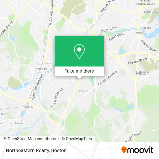
See Northeastern Realty, Milton, on the map
Public Transit to Northeastern Realty in Milton
Wondering how to get to Northeastern Realty in Milton? Moovit helps you find the best way to get to Northeastern Realty with step-by-step directions from the nearest public transit station.
Moovit provides free maps and live directions to help you navigate through your city. View schedules, routes, timetables, and find out how long does it take to get to Northeastern Realty in real time.
Looking for the nearest stop or station to Northeastern Realty? Check out this list of stops closest to your destination: Mattapan; Blue Hill Avenue; Blue Hill Ave @ Pagoda St; Metropolitan Ave @ Highland St; Fairmount.
Bus: 716, 24.Train: FAIRMOUNT, PROVIDENCE/STOUGHTON, FRANKLIN/FOXBORO, FAIRMOUNT LINE SHUTTLE.Subway: MATTAPAN LINE.
Want to see if there’s another route that gets you there at an earlier time? Moovit helps you find alternative routes or times. Get directions from and directions to Northeastern Realty easily from the Moovit App or Website.
We make riding to Northeastern Realty easy, which is why over 1.7 million users, including users in Milton, trust Moovit as the best app for public transit. You don’t need to download an individual bus app or train app, Moovit is your all-in-one transit app that helps you find the best bus time or train time available.
For information on prices of bus, subway and train, costs and ride fares to Northeastern Realty, please check the Moovit app.
Use the app to navigate to popular places including to the airport, hospital, stadium, grocery store, mall, coffee shop, school, college, and university.
Northeastern Realty Address: 520 Blue Hill Ave street in Milton
- Monalisa Handmade,
- Folan Pressure Washing,
- Like Family Caregivers,
- Qualified Plumbing Service,
- Kimsmith Design,
- Kern Guy,
- Tighe James Custom Build,
- Tapwater Designs,
- Dancy Shenia Law Firm,
- Blue Hills Pkwy & Canton Ave,
- Rosa Design Construction,
- Sarno Glass,
- Paladin Personnel,
- Ampm Locksmith,
- Church Of God In Christ,
- JAX Group,
- Fairmount Hill Hyde Park,
- Sun Pizza,
- Brush Hill Historic District,
- Piatelli Field-Milton Nat'l Little League
Places Near Northeastern Realty (Milton)
- Castle Island, Boston,
- Boston Children's Hospital, Boston,
- House Of Blues, Boston,
- Prudential Center, Boston,
- Boston Medical Center, Boston,
- Leader Bank Pavilion (Leader Bank Pavillion), Boston,
- Isabella Stewart Gardner Museum, Boston,
- Museum Of Science, Boston,
- Quincy Market, Boston,
- Mgm Music Hall, Boston,
- Td Garden, Boston,
- Wang Theater, Boston,
- Massachusetts General Hospital, Boston,
- Boston Common, Boston,
- Cheers, Boston,
- North End, Boston,
- Seaport District, Boston,
- Faneuil Hall, Boston,
- Boston Convention & Exhibition Center, Boston,
- Wilbur Theatre, Boston
How to get to popular places in Boston with public transit
Get around Milton by public transit!
Traveling around Milton has never been so easy. See step by step directions as you travel to any attraction, street or major public transit station. View bus and train schedules, arrival times, service alerts and detailed routes on a map, so you know exactly how to get to anywhere in Milton.
When traveling to any destination around Milton use Moovit's Live Directions with Get Off Notifications to know exactly where and how far to walk, how long to wait for your line, and how many stops are left. Moovit will alert you when it's time to get off — no need to constantly re-check whether yours is the next stop.
Wondering how to use public transit in Milton or how to pay for public transit in Milton? Moovit public transit app can help you navigate your way with public transit easily, and at minimum cost. It includes public transit fees, ticket prices, and costs. Looking for a map of Milton public transit lines? Moovit public transit app shows all public transit maps in Milton with all Bus, Train, Subway and Ferry routes and stops on an interactive map.
Boston has 4 transit type(s), including: Bus, Train, Subway and Ferry, operated by several transit agencies, including MBTA, Southeastern Regional Transit Authority, MetroWest Regional Transit Authority, Rhode Island Public Transit Authority, WRTA, Lowell Regional Transit Authority, Merrimack Valley Transit, Montachusett Regional Transit Authority, Cape Cod Regional Transit Authority, Brockton Area Transit Authority, Martha's Vineyard Transit Authority, the WAVE - Nantucket Regional Transit Authority, GATRA, Cape Ann Transportation Authority and Massport