Directions to Northwest Industrial (Portland) with public transportation
The following transit lines have routes that pass near Northwest Industrial
How to get to Northwest Industrial by bus?
Click on the bus route to see step by step directions with maps, line arrival times and updated time schedules.
Bus stops near Northwest Industrial in Portland
- 3900 Block NW Yeon Frontage Rd (East), 2 min walk,
- 4500 Block NW Front (East), 26 min walk,
Streetcar station near Northwest Industrial in Portland
- NW 23rd & Marshall (South), 6 min walk,
Bus lines to Northwest Industrial in Portland
- 15, Gateway TC (Drop Off Only Stop),
- 16, NW Gillihan Rd & Sauvie Island,
What are the closest stations to Northwest Industrial?
The closest stations to Northwest Industrial are:
- 3900 Block NW Yeon Frontage Rd (East) is 74 yards away, 2 min walk.
- NW 23rd & Marshall (South) is 441 yards away, 6 min walk.
- 4500 Block NW Front (East) is 2188 yards away, 26 min walk.
Which bus line stops near Northwest Industrial?
15
What’s the nearest bus station to Northwest Industrial in Portland?
The nearest bus station to Northwest Industrial in Portland is 3900 Block NW Yeon Frontage Rd (East). It’s a 2 min walk away.
What’s the nearest Streetcar station to Northwest Industrial in Portland?
The nearest Streetcar station to Northwest Industrial in Portland is NW 23rd & Marshall (South). It’s a 6 min walk away.
What time is the first bus to Northwest Industrial in Portland?
The 15 is the first bus that goes to Northwest Industrial in Portland. It stops nearby at 5:12 AM.
What time is the last bus to Northwest Industrial in Portland?
The 15 is the last bus that goes to Northwest Industrial in Portland. It stops nearby at 12:13 AM.
What time is the first Streetcar to Northwest Industrial in Portland?
The NS is the first Streetcar that goes to Northwest Industrial in Portland. It stops nearby at 5:46 AM.
What time is the last Streetcar to Northwest Industrial in Portland?
The NS is the last Streetcar that goes to Northwest Industrial in Portland. It stops nearby at 12:04 AM.
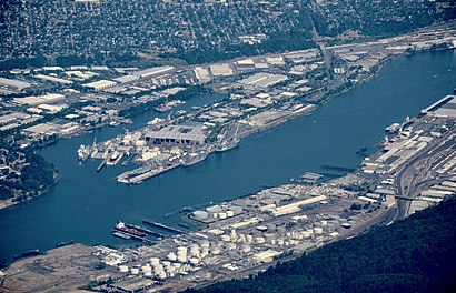
See Northwest Industrial, Portland, on the map
Public Transit to Northwest Industrial in Portland
Wondering how to get to Northwest Industrial in Portland, United States? Moovit helps you find the best way to get to Northwest Industrial with step-by-step directions from the nearest public transit station.
Moovit provides free maps and live directions to help you navigate through your city. View schedules, routes, timetables, and find out how long does it take to get to Northwest Industrial in real time.
Looking for the nearest stop or station to Northwest Industrial? Check out this list of stops closest to your destination: 3900 Block NW Yeon Frontage Rd (East); NW 23rd & Marshall (South); 4500 Block NW Front (East).
Bus: 15, 16.Streetcar: NS.
Want to see if there’s another route that gets you there at an earlier time? Moovit helps you find alternative routes or times. Get directions from and directions to Northwest Industrial easily from the Moovit App or Website.
We make riding to Northwest Industrial easy, which is why over 1.5 million users, including users in Portland, trust Moovit as the best app for public transit. You don’t need to download an individual bus app or train app, Moovit is your all-in-one transit app that helps you find the best bus time or train time available.
For information on prices of bus and light rail, costs and ride fares to Northwest Industrial, please check the Moovit app.
Use the app to navigate to popular places including to the airport, hospital, stadium, grocery store, mall, coffee shop, school, college, and university.
Northwest Industrial Address: Northwest Yeon Avenue street in Portland
Places Near Northwest Industrial (Portland)
How to get to popular places in Portland, OR with public transit
Get around Portland by public transit!
Traveling around Portland has never been so easy. See step by step directions as you travel to any attraction, street or major public transit station. View bus and train schedules, arrival times, service alerts and detailed routes on a map, so you know exactly how to get to anywhere in Portland.
When traveling to any destination around Portland use Moovit's Live Directions with Get Off Notifications to know exactly where and how far to walk, how long to wait for your line, and how many stops are left. Moovit will alert you when it's time to get off — no need to constantly re-check whether yours is the next stop.
Wondering how to use public transit in Portland or how to pay for public transit in Portland? Moovit public transit app can help you navigate your way with public transit easily, and at minimum cost. It includes public transit fees, ticket prices, and costs. Looking for a map of Portland public transit lines? Moovit public transit app shows all public transit maps in Portland with all Bus, Train, Light Rail, Ferry, Streetcar and Gondola routes and stops on an interactive map.
Portland, OR has 6 transit type(s), including: Bus, Train, Light Rail, Ferry, Streetcar and Gondola, operated by several transit agencies, including TriMet, TriMet , Portland Aerial Tram, Multnomah County Transit, TriMet , C-TRAN, Portland Streetcar, Washington Park Shuttle, Canby Area Transit, SMART, South Clackamas Transportation District, Columbia County Rider, Sunset Empire Transportation District, The Wave and Oregon POINT