Directions to Nunez Mini Mart (Boston) with public transportation
The following transit lines have routes that pass near Nunez Mini Mart
 Bus: 1, 10, 15, 23, 28.
- Train: PROVIDENCE/STOUGHTON, FAIRMOUNT, FRANKLIN/FOXBORO, NEEDHAM.
- Subway: ORANGE LINE, RED LINE.
How to get to Nunez Mini Mart by bus?
Click on the bus route to see step by step directions with maps, line arrival times and updated time schedules.
From Georgetown, Massachusetts, Boston
68 minFrom Fort Independence, Boston
57 minFrom Hampton Inn Boston Logan Airport, Revere
71 minFrom Academy Of the Pacific Rim Charter Public School, Boston
68 minFrom Milton, MA, Milton
78 minFrom Costco Wholesale, Everett
98 minFrom Inman Square, Cambridge
53 minFrom USS Constitution, Boston
69 minFrom Mount Ida College, Newton
87 minFrom Hyatt Place Medford, Medford
60 min
How to get to Nunez Mini Mart by train?
Click on the train route to see step by step directions with maps, line arrival times and updated time schedules.
How to get to Nunez Mini Mart by subway?
Click on the subway route to see step by step directions with maps, line arrival times and updated time schedules.
Bus stops near Nunez Mini Mart in Boston
Subway station near Nunez Mini Mart in Boston
- Roxbury Crossing, 8 min walk,VIEW
Bus lines to Nunez Mini Mart in Boston
What are the closest stations to Nunez Mini Mart?
The closest stations to Nunez Mini Mart are:
- Dudley St @ Adams St is 273 yards away, 4 min walk.
- Warren St @ Kearsarge Ave is 285 yards away, 4 min walk.
- Albany St Opp Randall St is 288 yards away, 4 min walk.
- Newmarket is 483 yards away, 6 min walk.
- Roxbury Crossing is 671 yards away, 8 min walk.
- Ruggles is 886 yards away, 11 min walk.
Which bus lines stop near Nunez Mini Mart?
These bus lines stop near Nunez Mini Mart: 1, 10, 15, 23, 28, 41, 42, 45.
Which train line stops near Nunez Mini Mart?
PROVIDENCE/STOUGHTON (#824 | South Station)
Which subway lines stop near Nunez Mini Mart?
These subway lines stop near Nunez Mini Mart: ORANGE LINE, RED LINE.
What’s the nearest subway station to Nunez Mini Mart in Boston?
The nearest subway station to Nunez Mini Mart in Boston is Roxbury Crossing. It’s a 8 min walk away.
What’s the nearest train station to Nunez Mini Mart in Boston?
The nearest train station to Nunez Mini Mart in Boston is Newmarket. It’s a 6 min walk away.
What’s the nearest bus station to Nunez Mini Mart in Boston?
The nearest bus stations to Nunez Mini Mart in Boston are Dudley St @ Adams St, Warren St @ Kearsarge Ave and Albany St Opp Randall St. The closest one is a 4 min walk away.
What time is the first subway to Nunez Mini Mart in Boston?
The ORANGE LINE is the first subway that goes to Nunez Mini Mart in Boston. It stops nearby at 5:22 AM.
What time is the last subway to Nunez Mini Mart in Boston?
The ORANGE LINE is the last subway that goes to Nunez Mini Mart in Boston. It stops nearby at 1:51 AM.
What time is the first train to Nunez Mini Mart in Boston?
The PROVIDENCE/STOUGHTON is the first train that goes to Nunez Mini Mart in Boston. It stops nearby at 4:28 AM.
What time is the last train to Nunez Mini Mart in Boston?
The PROVIDENCE/STOUGHTON is the last train that goes to Nunez Mini Mart in Boston. It stops nearby at 12:34 AM.
What time is the first bus to Nunez Mini Mart in Boston?
The 28 is the first bus that goes to Nunez Mini Mart in Boston. It stops nearby at 3:19 AM.
What time is the last bus to Nunez Mini Mart in Boston?
The 1 is the last bus that goes to Nunez Mini Mart in Boston. It stops nearby at 2:40 AM.
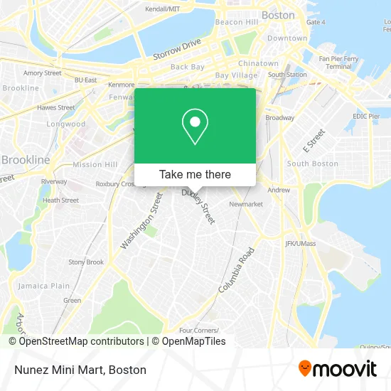
See Nunez Mini Mart, Boston, on the map
Public Transit to Nunez Mini Mart in Boston
Wondering how to get to Nunez Mini Mart in Boston? Moovit helps you find the best way to get to Nunez Mini Mart with step-by-step directions from the nearest public transit station.
Moovit provides free maps and live directions to help you navigate through your city. View schedules, routes, timetables, and find out how long does it take to get to Nunez Mini Mart in real time.
Looking for the nearest stop or station to Nunez Mini Mart? Check out this list of stops closest to your destination: Dudley St @ Adams St; Warren St @ Kearsarge Ave; Albany St Opp Randall St; Newmarket; Roxbury Crossing; Ruggles.
Bus: 1, 10, 15, 23, 28, 41, 42, 45, 14, 19, 47.Train: PROVIDENCE/STOUGHTON, FAIRMOUNT, FRANKLIN/FOXBORO, NEEDHAM.Subway: ORANGE LINE, RED LINE.
Want to see if there’s another route that gets you there at an earlier time? Moovit helps you find alternative routes or times. Get directions from and directions to Nunez Mini Mart easily from the Moovit App or Website.
We make riding to Nunez Mini Mart easy, which is why over 1.7 million users, including users in Boston, trust Moovit as the best app for public transit. You don’t need to download an individual bus app or train app, Moovit is your all-in-one transit app that helps you find the best bus time or train time available.
For information on prices of bus, subway and train, costs and ride fares to Nunez Mini Mart, please check the Moovit app.
Use the app to navigate to popular places including to the airport, hospital, stadium, grocery store, mall, coffee shop, school, college, and university.
Nunez Mini Mart Address: 305 Dudley St street in Boston
- First Stop Laundromat,
- Shop Funny Teacher T-Shirts,
- Vine Street Community Center Council,
- Inspired Fitness,
- Orchard Gardens School,
- Barley Pop,
- Mount Pleasant Historic District,
- Trinity Financial,
- Flying Embers Brewery & Social Club,
- Long Live Roxbury,
- Holistic Life Baptist Church Ministries,
- Orchard Gardens Pilot School ,
- F.W. Webb Company - Boston,
- Allianza Hispana,
- Winslow St Building 8,
- Quarter Block Studios,
- Republic Services,
- St Michael Ethiopian Orthodox Tewahedo Church,
- Adam Affordable Locksmith,
- Yes
Places Near Nunez Mini Mart (Boston)
- Cheers, Boston,
- Museum Of Science, Boston,
- House Of Blues, Boston,
- Seaport District, Boston,
- Boston Children's Hospital, Boston,
- Wang Theater, Boston,
- Massachusetts General Hospital, Boston,
- Leader Bank Pavilion (Leader Bank Pavillion), Boston,
- Boston Convention & Exhibition Center, Boston,
- Td Garden, Boston,
- Prudential Center, Boston,
- Boston Common, Boston,
- Mgm Music Hall, Boston,
- Wilbur Theatre, Boston,
- Quincy Market, Boston,
- Isabella Stewart Gardner Museum, Boston,
- Castle Island, Boston,
- Boston Medical Center, Boston,
- North End, Boston,
- Faneuil Hall, Boston
How to get to popular places in Boston with public transit
Get around Boston by public transit!
Traveling around Boston has never been so easy. See step by step directions as you travel to any attraction, street or major public transit station. View bus and train schedules, arrival times, service alerts and detailed routes on a map, so you know exactly how to get to anywhere in Boston.
When traveling to any destination around Boston use Moovit's Live Directions with Get Off Notifications to know exactly where and how far to walk, how long to wait for your line, and how many stops are left. Moovit will alert you when it's time to get off — no need to constantly re-check whether yours is the next stop.
Wondering how to use public transit in Boston or how to pay for public transit in Boston? Moovit public transit app can help you navigate your way with public transit easily, and at minimum cost. It includes public transit fees, ticket prices, and costs. Looking for a map of Boston public transit lines? Moovit public transit app shows all public transit maps in Boston with all Bus, Train, Subway and Ferry routes and stops on an interactive map.
Boston has 4 transit type(s), including: Bus, Train, Subway and Ferry, operated by several transit agencies, including MBTA, Southeastern Regional Transit Authority, MetroWest Regional Transit Authority, Rhode Island Public Transit Authority, WRTA, Lowell Regional Transit Authority, Merrimack Valley Transit, Montachusett Regional Transit Authority, Cape Cod Regional Transit Authority, Brockton Area Transit Authority, Martha's Vineyard Transit Authority, the WAVE - Nantucket Regional Transit Authority, GATRA, Cape Ann Transportation Authority and Massport