Directions to Oak Square Ymca (Boston) with public transportation
The following transit lines have routes that pass near Oak Square Ymca
 Bus: 57, 501, 64.
- Train: FRAMINGHAM/WORCESTER.
- Subway: GREEN LINE B.
How to get to Oak Square Ymca by bus?
Click on the bus route to see step by step directions with maps, line arrival times and updated time schedules.
From J.J. Foley's Cafe, Boston
30 minFrom Amazon Boston, Boston
55 minFrom 415 Summer Street, Boston
56 minFrom Bos21 - Amazon, Boston
55 minFrom Macy's, Boston
32 minFrom Cheers Beacon Hill, Boston
29 minFrom Boston University, Boston
24 minFrom Seaport District, Boston
55 minFrom Fogo De Chão, Boston
19 minFrom Fan Pier, Boston
53 min
How to get to Oak Square Ymca by train?
Click on the train route to see step by step directions with maps, line arrival times and updated time schedules.
From J.J. Foley's Cafe, Boston
64 minFrom Amazon Boston, Boston
69 minFrom 415 Summer Street, Boston
69 minFrom Bos21 - Amazon, Boston
69 minFrom Macy's, Boston
63 minFrom Cheers Beacon Hill, Boston
65 minFrom Boston University, Boston
57 minFrom Seaport District, Boston
69 minFrom Fogo De Chão, Boston
54 minFrom Fan Pier, Boston
69 min
How to get to Oak Square Ymca by subway?
Click on the subway route to see step by step directions with maps, line arrival times and updated time schedules.
From J.J. Foley's Cafe, Boston
82 minFrom Amazon Boston, Boston
91 minFrom 415 Summer Street, Boston
91 minFrom Bos21 - Amazon, Boston
91 minFrom Macy's, Boston
74 minFrom Cheers Beacon Hill, Boston
72 minFrom Boston University, Boston
57 minFrom Seaport District, Boston
91 minFrom Fogo De Chão, Boston
65 minFrom Fan Pier, Boston
92 min
Bus stops near Oak Square Ymca in Boston
Subway station near Oak Square Ymca in Boston
- Chiswick Road, 36 min walk,VIEW
Bus lines to Oak Square Ymca in Boston
What are the closest stations to Oak Square Ymca?
The closest stations to Oak Square Ymca are:
- Washington St @ Oak Square Ave is 229 yards away, 3 min walk.
- Faneuil St @ Brooks St is 514 yards away, 7 min walk.
- Chiswick Road is 3026 yards away, 36 min walk.
Which bus line stops near Oak Square Ymca?
57 (Kenmore)
Which train line stops near Oak Square Ymca?
FRAMINGHAM/WORCESTER (#521 | Worcester)
Which subway line stops near Oak Square Ymca?
GREEN LINE B (Boston College)
What’s the nearest bus station to Oak Square Ymca in Boston?
The nearest bus station to Oak Square Ymca in Boston is Washington St @ Oak Square Ave. It’s a 3 min walk away.
What time is the first subway to Oak Square Ymca in Boston?
The GREEN LINE B is the first subway that goes to Oak Square Ymca in Boston. It stops nearby at 5:01 AM.
What time is the last subway to Oak Square Ymca in Boston?
The GREEN LINE B is the last subway that goes to Oak Square Ymca in Boston. It stops nearby at 2:39 AM.
What time is the first bus to Oak Square Ymca in Boston?
The 57 is the first bus that goes to Oak Square Ymca in Boston. It stops nearby at 4:34 AM.
What time is the last bus to Oak Square Ymca in Boston?
The 57 is the last bus that goes to Oak Square Ymca in Boston. It stops nearby at 2:30 AM.
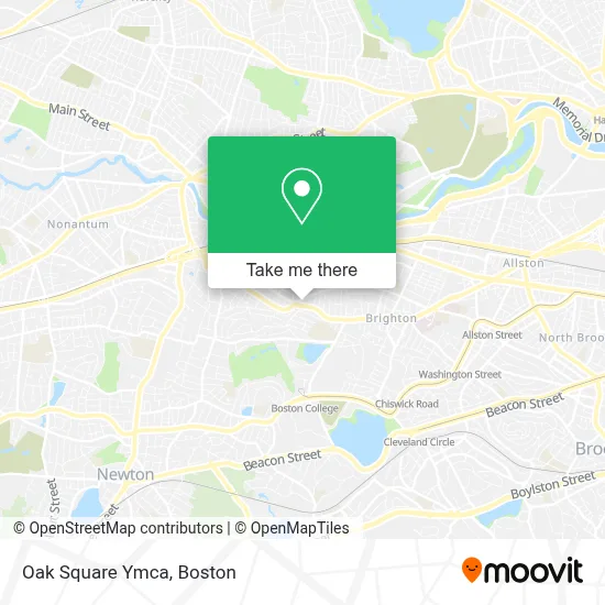
See Oak Square Ymca, Boston, on the map
Public Transit to Oak Square Ymca in Boston
Wondering how to get to Oak Square Ymca in Boston? Moovit helps you find the best way to get to Oak Square Ymca with step-by-step directions from the nearest public transit station.
Moovit provides free maps and live directions to help you navigate through your city. View schedules, routes, timetables, and find out how long does it take to get to Oak Square Ymca in real time.
Looking for the nearest stop or station to Oak Square Ymca? Check out this list of stops closest to your destination: Washington St @ Oak Square Ave; Faneuil St @ Brooks St; Chiswick Road.
Bus: 57, 501, 64.Train: FRAMINGHAM/WORCESTER.Subway: GREEN LINE B.
Want to see if there’s another route that gets you there at an earlier time? Moovit helps you find alternative routes or times. Get directions from and directions to Oak Square Ymca easily from the Moovit App or Website.
We make riding to Oak Square Ymca easy, which is why over 1.7 million users, including users in Boston, trust Moovit as the best app for public transit. You don’t need to download an individual bus app or train app, Moovit is your all-in-one transit app that helps you find the best bus time or train time available.
For information on prices of bus, subway and train, costs and ride fares to Oak Square Ymca, please check the Moovit app.
Use the app to navigate to popular places including to the airport, hospital, stadium, grocery store, mall, coffee shop, school, college, and university.
Oak Square Ymca Address: 615 Washington St street in Boston
- MBTA Bus Stop | Oak Square,
- Walgreens,
- Washington St,
- MBTA Bus Route 57,
- Perthshire House,
- Ef Boston,
- EvGateway,
- EF laundry,
- Blunt Kush-Weed Delivery,
- MBTA Bus Stop | Washington St (at Brock St),
- EF Reception,
- Hult International Business,
- Park Center Plaza,
- Akhundlu,
- GNC,
- Flying Prince House Cleaning,
- Rockland Trust,
- Newton Commonwealth Golf Course,
- Master of Arts Ministry PRGRM for Lty,
- The Seminary of Our Lady of Providence
Places Near Oak Square Ymca (Boston)
- Seaport District, Boston,
- Museum Of Science, Boston,
- Boston Convention & Exhibition Center, Boston,
- Boston Children's Hospital, Boston,
- Quincy Market, Boston,
- Cheers, Boston,
- Castle Island, Boston,
- Boston Medical Center, Boston,
- Faneuil Hall, Boston,
- North End, Boston,
- Wang Theater, Boston,
- Boston Common, Boston,
- Massachusetts General Hospital, Boston,
- Prudential Center, Boston,
- Mgm Music Hall, Boston,
- Isabella Stewart Gardner Museum, Boston,
- Leader Bank Pavilion (Leader Bank Pavillion), Boston,
- Wilbur Theatre, Boston,
- Td Garden, Boston,
- House Of Blues, Boston
How to get to popular places in Boston with public transit
Get around Boston by public transit!
Traveling around Boston has never been so easy. See step by step directions as you travel to any attraction, street or major public transit station. View bus and train schedules, arrival times, service alerts and detailed routes on a map, so you know exactly how to get to anywhere in Boston.
When traveling to any destination around Boston use Moovit's Live Directions with Get Off Notifications to know exactly where and how far to walk, how long to wait for your line, and how many stops are left. Moovit will alert you when it's time to get off — no need to constantly re-check whether yours is the next stop.
Wondering how to use public transit in Boston or how to pay for public transit in Boston? Moovit public transit app can help you navigate your way with public transit easily, and at minimum cost. It includes public transit fees, ticket prices, and costs. Looking for a map of Boston public transit lines? Moovit public transit app shows all public transit maps in Boston with all Bus, Train, Subway and Ferry routes and stops on an interactive map.
Boston has 4 transit type(s), including: Bus, Train, Subway and Ferry, operated by several transit agencies, including MBTA, Southeastern Regional Transit Authority, MetroWest Regional Transit Authority, Rhode Island Public Transit Authority, WRTA, Lowell Regional Transit Authority, Merrimack Valley Transit, Montachusett Regional Transit Authority, Cape Cod Regional Transit Authority, Brockton Area Transit Authority, Martha's Vineyard Transit Authority, the WAVE - Nantucket Regional Transit Authority, GATRA, Cape Ann Transportation Authority and Massport