Directions to Ocean State Archery Indoor Range (Boston) with public transportation
The following transit lines have routes that pass near Ocean State Archery Indoor Range
 Bus: 1, 72, R, 75, 73.
- Train: PROVIDENCE/STOUGHTON, FOXBORO EVENT SERVICE.
How to get to Ocean State Archery Indoor Range by bus?
Click on the bus route to see step by step directions with maps, line arrival times and updated time schedules.
How to get to Ocean State Archery Indoor Range by train?
Click on the train route to see step by step directions with maps, line arrival times and updated time schedules.
Bus stops near Ocean State Archery Indoor Range in Boston
- Weeden & Lonsdale (After Carpenter), 4 min walk,VIEW
- Dexter & Barton (Before Court), 4 min walk,VIEW
- Mineral Spring After Main, 8 min walk,VIEW
- Collyer Park, 8 min walk,VIEW
- Pawtucket/Central Falls, 11 min walk,VIEW
- Pawtucket-Central Falls Transit Center (Stop B), 11 min walk,VIEW
- Pawtucket-Central Falls Transit Center (Stop A), 11 min walk,VIEW
Train stations near Ocean State Archery Indoor Range in Boston
Bus lines to Ocean State Archery Indoor Range in Boston
- 72, Hospital District (Providence),VIEW
- 75, Pawtucket Transit Center,VIEW
- 73, Pawtucket Transit Center,VIEW
- R, M7 Tailgate Lot/Pawtucket Transit Center,VIEW
- PROVIDENCE LINE SHUTTLE, Attleboro (Local Shuttle),VIEW
- PROVIDENCE LINE SHUTTLE, Providence (Shuttle),VIEW
- 1, Shaw's (Warwick),VIEW
- 71, Stop&Shop (Cumberland),VIEW
- 76, Benefit & Thurber,VIEW
- 80, Slater Park (Armistice Blvd),VIEW
- 78, Kennedy Plaza Via Beverage Hill Ave,VIEW
What are the closest stations to Ocean State Archery Indoor Range?
The closest stations to Ocean State Archery Indoor Range are:
- Weeden & Lonsdale (After Carpenter) is 254 yards away, 4 min walk.
- Dexter & Barton (Before Court) is 326 yards away, 4 min walk.
- Mineral Spring After Main is 591 yards away, 8 min walk.
- Collyer Park is 600 yards away, 8 min walk.
- Pawtucket/Central Falls is 814 yards away, 11 min walk.
- Pawtucket-Central Falls Transit Center (Stop B) is 814 yards away, 11 min walk.
- Pawtucket-Central Falls Transit Center (Stop A) is 814 yards away, 11 min walk.
- South Attleboro is 1738 yards away, 21 min walk.
Which bus lines stop near Ocean State Archery Indoor Range?
These bus lines stop near Ocean State Archery Indoor Range: 1, 72, R.
Which train line stops near Ocean State Archery Indoor Range?
PROVIDENCE/STOUGHTON (#825 | Providence)
What’s the nearest train station to Ocean State Archery Indoor Range in Boston?
The nearest train station to Ocean State Archery Indoor Range in Boston is South Attleboro. It’s a 21 min walk away.
What’s the nearest bus station to Ocean State Archery Indoor Range in Boston?
The nearest bus stations to Ocean State Archery Indoor Range in Boston are Weeden & Lonsdale (After Carpenter) and Dexter & Barton (Before Court). The closest one is a 4 min walk away.
What time is the first train to Ocean State Archery Indoor Range in Boston?
The PROVIDENCE/STOUGHTON is the first train that goes to Ocean State Archery Indoor Range in Boston. It stops nearby at 4:16 AM.
What time is the last train to Ocean State Archery Indoor Range in Boston?
The PROVIDENCE/STOUGHTON is the last train that goes to Ocean State Archery Indoor Range in Boston. It stops nearby at 12:56 AM.
What time is the first bus to Ocean State Archery Indoor Range in Boston?
The 78 is the first bus that goes to Ocean State Archery Indoor Range in Boston. It stops nearby at 5:08 AM.
What time is the last bus to Ocean State Archery Indoor Range in Boston?
The R is the last bus that goes to Ocean State Archery Indoor Range in Boston. It stops nearby at 12:57 AM.
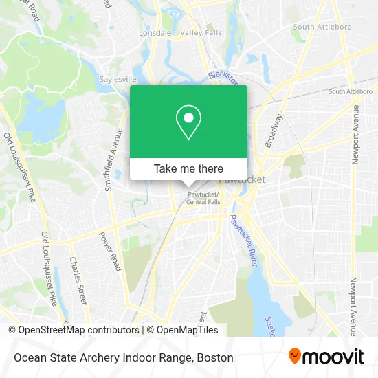
See Ocean State Archery Indoor Range, Boston, on the map
Public Transit to Ocean State Archery Indoor Range in Boston
Wondering how to get to Ocean State Archery Indoor Range in Boston? Moovit helps you find the best way to get to Ocean State Archery Indoor Range with step-by-step directions from the nearest public transit station.
Moovit provides free maps and live directions to help you navigate through your city. View schedules, routes, timetables, and find out how long does it take to get to Ocean State Archery Indoor Range in real time.
Looking for the nearest stop or station to Ocean State Archery Indoor Range? Check out this list of stops closest to your destination: Weeden & Lonsdale (After Carpenter); Dexter & Barton (Before Court); Mineral Spring After Main; Collyer Park; Pawtucket/Central Falls; Pawtucket-Central Falls Transit Center (Stop B); Pawtucket-Central Falls Transit Center (Stop A); South Attleboro.
Bus: 1, 72, R, 75, 73.Train: PROVIDENCE/STOUGHTON, FOXBORO EVENT SERVICE.
Want to see if there’s another route that gets you there at an earlier time? Moovit helps you find alternative routes or times. Get directions from and directions to Ocean State Archery Indoor Range easily from the Moovit App or Website.
We make riding to Ocean State Archery Indoor Range easy, which is why over 1.7 million users, including users in Boston, trust Moovit as the best app for public transit. You don’t need to download an individual bus app or train app, Moovit is your all-in-one transit app that helps you find the best bus time or train time available.
For information on prices of bus and train, costs and ride fares to Ocean State Archery Indoor Range, please check the Moovit app.
Use the app to navigate to popular places including to the airport, hospital, stadium, grocery store, mall, coffee shop, school, college, and university.
Ocean State Archery Indoor Range Address: 179 Conant St street in Boston
- A1fitnessjg,
- Working Man Distillers,
- Renewable Energy Solutions,
- Mullins & Crum Moving & Storage,
- Anny House,
- Church of Jesus Christ Missnr,
- Intuitive Arts Guild,
- Shop Almost Anything,
- Adelino da Graca,
- Family Savers,
- Smoke and Talk,
- Saint Josephs Health Services Our Lady of Fatima Hospital,
- Keyme Locksmiths,
- Coinstar,
- Cell Hut,
- 99 Cents Plus Bargain,
- Vem E Vê.,
- Bank St Soap,
- GPS-Gil's Property Services,
- R Teto Motor Sales
Places Near Ocean State Archery Indoor Range (Boston)
- Td Garden, Boston,
- Prudential Center, Boston,
- Boston Medical Center, Boston,
- Quincy Market, Boston,
- Boston Convention & Exhibition Center, Boston,
- Castle Island, Boston,
- Boston Children's Hospital, Boston,
- Faneuil Hall, Boston,
- Seaport District, Boston,
- Leader Bank Pavilion (Leader Bank Pavillion), Boston,
- North End, Boston,
- Mgm Music Hall, Boston,
- Cheers, Boston,
- Wang Theater, Boston,
- Isabella Stewart Gardner Museum, Boston,
- Boston Common, Boston,
- Wilbur Theatre, Boston,
- Massachusetts General Hospital, Boston,
- House Of Blues, Boston,
- Museum Of Science, Boston
How to get to popular places in Boston with public transit
Get around Boston by public transit!
Traveling around Boston has never been so easy. See step by step directions as you travel to any attraction, street or major public transit station. View bus and train schedules, arrival times, service alerts and detailed routes on a map, so you know exactly how to get to anywhere in Boston.
When traveling to any destination around Boston use Moovit's Live Directions with Get Off Notifications to know exactly where and how far to walk, how long to wait for your line, and how many stops are left. Moovit will alert you when it's time to get off — no need to constantly re-check whether yours is the next stop.
Wondering how to use public transit in Boston or how to pay for public transit in Boston? Moovit public transit app can help you navigate your way with public transit easily, and at minimum cost. It includes public transit fees, ticket prices, and costs. Looking for a map of Boston public transit lines? Moovit public transit app shows all public transit maps in Boston with all Bus, Train, Subway and Ferry routes and stops on an interactive map.
Boston has 4 transit type(s), including: Bus, Train, Subway and Ferry, operated by several transit agencies, including MBTA, Southeastern Regional Transit Authority, MetroWest Regional Transit Authority, Rhode Island Public Transit Authority, WRTA, Lowell Regional Transit Authority, Merrimack Valley Transit, Montachusett Regional Transit Authority, Cape Cod Regional Transit Authority, Brockton Area Transit Authority, Martha's Vineyard Transit Authority, the WAVE - Nantucket Regional Transit Authority, GATRA, Cape Ann Transportation Authority and Massport