Directions to One Call Insurance (Boston) with public transportation
The following transit lines have routes that pass near One Call Insurance
 Bus: 57, 501, 64.
- Train: FRAMINGHAM/WORCESTER.
- Subway: GREEN LINE B.
How to get to One Call Insurance by bus?
Click on the bus route to see step by step directions with maps, line arrival times and updated time schedules.
From Boston Tea Party - Ships And Museum, Boston
36 minFrom Rose Kennedy Greenway, Boston
40 minFrom Gateway Center, Everett
86 minFrom The Beehive, Boston
26 minFrom Intercontinental Boston, Boston
40 minFrom Berklee College of Music, Boston
25 minFrom USS Constitution, Boston
66 minFrom Washington St, Boston
72 minFrom Downtown, Boston
28 minFrom 100 Cambridge Street Garage, Boston
43 min
How to get to One Call Insurance by train?
Click on the train route to see step by step directions with maps, line arrival times and updated time schedules.
From Boston Tea Party - Ships And Museum, Boston
69 minFrom Rose Kennedy Greenway, Boston
74 minFrom The Beehive, Boston
65 minFrom Intercontinental Boston, Boston
69 minFrom Berklee College of Music, Boston
70 minFrom Washington St, Boston
101 minFrom Downtown, Boston
69 minFrom 100 Cambridge Street Garage, Boston
79 min
How to get to One Call Insurance by subway?
Click on the subway route to see step by step directions with maps, line arrival times and updated time schedules.
From Boston Tea Party - Ships And Museum, Boston
86 minFrom Rose Kennedy Greenway, Boston
84 minFrom Gateway Center, Everett
105 minFrom The Beehive, Boston
80 minFrom Intercontinental Boston, Boston
86 minFrom Berklee College of Music, Boston
67 minFrom USS Constitution, Boston
100 minFrom Washington St, Boston
98 minFrom Downtown, Boston
76 minFrom 100 Cambridge Street Garage, Boston
79 min
Bus stops near One Call Insurance in Boston
Subway station near One Call Insurance in Boston
- Boston College, 8 min walk,VIEW
Bus lines to One Call Insurance in Boston
What are the closest stations to One Call Insurance?
The closest stations to One Call Insurance are:
- Washington St @ Breck Ave is 274 yards away, 4 min walk.
- Faneuil St @ Oak Square is 439 yards away, 6 min walk.
- Boston College is 626 yards away, 8 min walk.
Which bus line stops near One Call Insurance?
57 (Kenmore)
Which train line stops near One Call Insurance?
FRAMINGHAM/WORCESTER (#521 | Worcester)
Which subway line stops near One Call Insurance?
GREEN LINE B (Boston College)
What’s the nearest subway station to One Call Insurance in Boston?
The nearest subway station to One Call Insurance in Boston is Boston College. It’s a 8 min walk away.
What’s the nearest bus station to One Call Insurance in Boston?
The nearest bus station to One Call Insurance in Boston is Washington St @ Breck Ave. It’s a 4 min walk away.
What time is the first subway to One Call Insurance in Boston?
The GREEN LINE B is the first subway that goes to One Call Insurance in Boston. It stops nearby at 5:01 AM.
What time is the last subway to One Call Insurance in Boston?
The GREEN LINE B is the last subway that goes to One Call Insurance in Boston. It stops nearby at 2:39 AM.
What time is the first bus to One Call Insurance in Boston?
The 57 is the first bus that goes to One Call Insurance in Boston. It stops nearby at 4:33 AM.
What time is the last bus to One Call Insurance in Boston?
The 57 is the last bus that goes to One Call Insurance in Boston. It stops nearby at 2:31 AM.
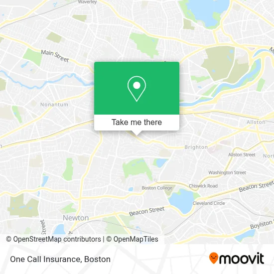
See One Call Insurance, Boston, on the map
Public Transit to One Call Insurance in Boston
Wondering how to get to One Call Insurance in Boston? Moovit helps you find the best way to get to One Call Insurance with step-by-step directions from the nearest public transit station.
Moovit provides free maps and live directions to help you navigate through your city. View schedules, routes, timetables, and find out how long does it take to get to One Call Insurance in real time.
Looking for the nearest stop or station to One Call Insurance? Check out this list of stops closest to your destination: Washington St @ Breck Ave; Faneuil St @ Oak Square; Boston College.
Bus: 57, 501, 64.Train: FRAMINGHAM/WORCESTER.Subway: GREEN LINE B.
Want to see if there’s another route that gets you there at an earlier time? Moovit helps you find alternative routes or times. Get directions from and directions to One Call Insurance easily from the Moovit App or Website.
We make riding to One Call Insurance easy, which is why over 1.7 million users, including users in Boston, trust Moovit as the best app for public transit. You don’t need to download an individual bus app or train app, Moovit is your all-in-one transit app that helps you find the best bus time or train time available.
For information on prices of bus, subway and train, costs and ride fares to One Call Insurance, please check the Moovit app.
Use the app to navigate to popular places including to the airport, hospital, stadium, grocery store, mall, coffee shop, school, college, and university.
One Call Insurance Address: 121 Tremont St street in Boston
- General Plumbing & Heating,
- MBTA Bus Stop | Oak Square,
- Perthshire House,
- Walgreens,
- Daly Rink,
- 501 Express Bus,
- Akhundlu,
- Washington St,
- David Barry Plumbing & Gas Fitting,
- Newton Commonwealth Golf Course,
- Flying Prince House Cleaning,
- Charles Haskell House,
- MBTA Bus Route 57,
- Daly Field,
- Daly Field,
- EvGateway,
- Ef Boston,
- EF laundry,
- Community Rowing,
- Blunt Kush-Weed Delivery
Places Near One Call Insurance (Boston)
- Td Garden, Boston,
- Museum Of Science, Boston,
- Massachusetts General Hospital, Boston,
- Cheers, Boston,
- Quincy Market, Boston,
- Boston Children's Hospital, Boston,
- Boston Convention & Exhibition Center, Boston,
- Isabella Stewart Gardner Museum, Boston,
- Wilbur Theatre, Boston,
- Leader Bank Pavilion (Leader Bank Pavillion), Boston,
- North End, Boston,
- Mgm Music Hall, Boston,
- Boston Medical Center, Boston,
- Seaport District, Boston,
- Faneuil Hall, Boston,
- Castle Island, Boston,
- Wang Theater, Boston,
- House Of Blues, Boston,
- Prudential Center, Boston,
- Boston Common, Boston
How to get to popular places in Boston with public transit
Get around Boston by public transit!
Traveling around Boston has never been so easy. See step by step directions as you travel to any attraction, street or major public transit station. View bus and train schedules, arrival times, service alerts and detailed routes on a map, so you know exactly how to get to anywhere in Boston.
When traveling to any destination around Boston use Moovit's Live Directions with Get Off Notifications to know exactly where and how far to walk, how long to wait for your line, and how many stops are left. Moovit will alert you when it's time to get off — no need to constantly re-check whether yours is the next stop.
Wondering how to use public transit in Boston or how to pay for public transit in Boston? Moovit public transit app can help you navigate your way with public transit easily, and at minimum cost. It includes public transit fees, ticket prices, and costs. Looking for a map of Boston public transit lines? Moovit public transit app shows all public transit maps in Boston with all Bus, Train, Subway and Ferry routes and stops on an interactive map.
Boston has 4 transit type(s), including: Bus, Train, Subway and Ferry, operated by several transit agencies, including MBTA, Southeastern Regional Transit Authority, MetroWest Regional Transit Authority, Rhode Island Public Transit Authority, WRTA, Lowell Regional Transit Authority, Merrimack Valley Transit, Montachusett Regional Transit Authority, Cape Cod Regional Transit Authority, Brockton Area Transit Authority, Martha's Vineyard Transit Authority, the WAVE - Nantucket Regional Transit Authority, GATRA, Cape Ann Transportation Authority and Massport