Directions to One Way Development (Boston) with public transportation
The following transit lines have routes that pass near One Way Development
 Bus: 1, 15, 41, 45, 8.
- Train: FAIRMOUNT, NEEDHAM, FRANKLIN/FOXBORO, ORANGE LINE, PROVIDENCE/STOUGHTON.
- Subway: RED LINE.
How to get to One Way Development by bus?
Click on the bus route to see step by step directions with maps, line arrival times and updated time schedules.
From Quincy Center Station, Quincy
89 minFrom West Roxbury, Boston
54 minFrom Quincy, MA, Quincy
92 minFrom AC Hotel Boston Cambridge, Cambridge
86 minFrom Revere, MA, Revere
84 minFrom Medford, MA, Medford
84 minFrom West Roxbury VA Medical Center, Boston
59 minFrom Washington St, Boston
54 minFrom Target, Somerville
51 minFrom Lower Mills, Boston
50 min
How to get to One Way Development by train?
Click on the train route to see step by step directions with maps, line arrival times and updated time schedules.
How to get to One Way Development by subway?
Click on the subway route to see step by step directions with maps, line arrival times and updated time schedules.
Bus stops near One Way Development in Boston
Train stations near One Way Development in Boston
Subway station near One Way Development in Boston
- Andrew, 25 min walk,VIEW
Bus lines to One Way Development in Boston
What are the closest stations to One Way Development?
The closest stations to One Way Development are:
- Dudley St @ Adams St is 25 yards away, 1 min walk.
- Ruggles is 206 yards away, 3 min walk.
- Massachusetts Ave @ Island St is 521 yards away, 7 min walk.
- Massachusetts Ave Opp Magazine St is 522 yards away, 7 min walk.
- Albany St Opp Randall St is 665 yards away, 8 min walk.
- Newmarket is 1413 yards away, 17 min walk.
- Andrew is 2102 yards away, 25 min walk.
Which bus lines stop near One Way Development?
These bus lines stop near One Way Development: 1, 15, 41, 45, 8, CT3, SL4.
Which train lines stop near One Way Development?
These train lines stop near One Way Development: FAIRMOUNT, NEEDHAM.
Which subway line stops near One Way Development?
RED LINE (Alewife)
What’s the nearest subway station to One Way Development in Boston?
The nearest subway station to One Way Development in Boston is Andrew. It’s a 25 min walk away.
What’s the nearest train station to One Way Development in Boston?
The nearest train station to One Way Development in Boston is Ruggles. It’s a 3 min walk away.
What’s the nearest bus station to One Way Development in Boston?
The nearest bus station to One Way Development in Boston is Dudley St @ Adams St. It’s a 1 min walk away.
What time is the first subway to One Way Development in Boston?
The ORANGE LINE is the first subway that goes to One Way Development in Boston. It stops nearby at 5:23 AM.
What time is the last subway to One Way Development in Boston?
The RED LINE is the last subway that goes to One Way Development in Boston. It stops nearby at 1:53 AM.
What time is the first train to One Way Development in Boston?
The PROVIDENCE/STOUGHTON is the first train that goes to One Way Development in Boston. It stops nearby at 4:28 AM.
What time is the last train to One Way Development in Boston?
The PROVIDENCE/STOUGHTON is the last train that goes to One Way Development in Boston. It stops nearby at 12:34 AM.
What time is the first bus to One Way Development in Boston?
The 15 is the first bus that goes to One Way Development in Boston. It stops nearby at 3:37 AM.
What time is the last bus to One Way Development in Boston?
The 1 is the last bus that goes to One Way Development in Boston. It stops nearby at 2:13 AM.
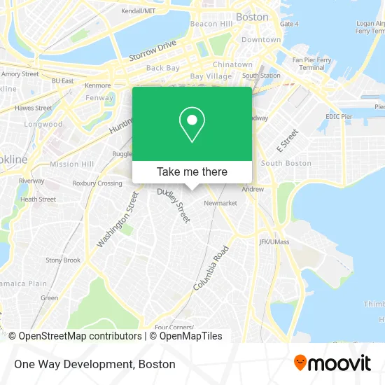
See One Way Development, Boston, on the map
Public Transit to One Way Development in Boston
Wondering how to get to One Way Development in Boston? Moovit helps you find the best way to get to One Way Development with step-by-step directions from the nearest public transit station.
Moovit provides free maps and live directions to help you navigate through your city. View schedules, routes, timetables, and find out how long does it take to get to One Way Development in real time.
Looking for the nearest stop or station to One Way Development? Check out this list of stops closest to your destination: Dudley St @ Adams St; Ruggles; Massachusetts Ave @ Island St; Massachusetts Ave Opp Magazine St; Albany St Opp Randall St; Newmarket; Andrew.
Bus: 1, 15, 41, 45, 8, CT3, SL4, 9, 10, 171.Train: FAIRMOUNT, NEEDHAM, FRANKLIN/FOXBORO, ORANGE LINE, PROVIDENCE/STOUGHTON.Subway: RED LINE.
Want to see if there’s another route that gets you there at an earlier time? Moovit helps you find alternative routes or times. Get directions from and directions to One Way Development easily from the Moovit App or Website.
We make riding to One Way Development easy, which is why over 1.7 million users, including users in Boston, trust Moovit as the best app for public transit. You don’t need to download an individual bus app or train app, Moovit is your all-in-one transit app that helps you find the best bus time or train time available.
For information on prices of bus, subway and train, costs and ride fares to One Way Development, please check the Moovit app.
Use the app to navigate to popular places including to the airport, hospital, stadium, grocery store, mall, coffee shop, school, college, and university.
One Way Development Address: 67 Kemble St Ste 11 street in Boston
- Dearborn Stem Academy,
- Republic Services,
- Massachusetts Consumer,
- Yes,
- Bennett Locksmith,
- Childrens Museum,
- Boston Event Photographer,
- Flying Embers Brewery & Social Club,
- Long Live Roxbury,
- Boston Salads & Prepared Foods,
- Be Our Guest (Showroom),
- Casa Esperanza, Inc.,
- Xfinity,
- F.W. Webb Company - Boston,
- U-Haul Moving & Storage at Mass Ave Boston,
- Orchard Gardens School,
- Bully Boy Distillers,
- Herc Rentals,
- Commercial Air Conditioning,
- St Patrick's Roxbury Parish of Archdiocese of Boston
Places Near One Way Development (Boston)
- Castle Island, Boston,
- Boston Common, Boston,
- North End, Boston,
- Massachusetts General Hospital, Boston,
- Seaport District, Boston,
- Leader Bank Pavilion (Leader Bank Pavillion), Boston,
- House Of Blues, Boston,
- Isabella Stewart Gardner Museum, Boston,
- Wang Theater, Boston,
- Museum Of Science, Boston,
- Boston Children's Hospital, Boston,
- Quincy Market, Boston,
- Cheers, Boston,
- Faneuil Hall, Boston,
- Wilbur Theatre, Boston,
- Mgm Music Hall, Boston,
- Boston Convention & Exhibition Center, Boston,
- Boston Medical Center, Boston,
- Prudential Center, Boston,
- Td Garden, Boston
How to get to popular places in Boston with public transit
Get around Boston by public transit!
Traveling around Boston has never been so easy. See step by step directions as you travel to any attraction, street or major public transit station. View bus and train schedules, arrival times, service alerts and detailed routes on a map, so you know exactly how to get to anywhere in Boston.
When traveling to any destination around Boston use Moovit's Live Directions with Get Off Notifications to know exactly where and how far to walk, how long to wait for your line, and how many stops are left. Moovit will alert you when it's time to get off — no need to constantly re-check whether yours is the next stop.
Wondering how to use public transit in Boston or how to pay for public transit in Boston? Moovit public transit app can help you navigate your way with public transit easily, and at minimum cost. It includes public transit fees, ticket prices, and costs. Looking for a map of Boston public transit lines? Moovit public transit app shows all public transit maps in Boston with all Bus, Train, Subway and Ferry routes and stops on an interactive map.
Boston has 4 transit type(s), including: Bus, Train, Subway and Ferry, operated by several transit agencies, including MBTA, Southeastern Regional Transit Authority, MetroWest Regional Transit Authority, Rhode Island Public Transit Authority, WRTA, Lowell Regional Transit Authority, Merrimack Valley Transit, Montachusett Regional Transit Authority, Cape Cod Regional Transit Authority, Brockton Area Transit Authority, Martha's Vineyard Transit Authority, the WAVE - Nantucket Regional Transit Authority, GATRA, Cape Ann Transportation Authority and Massport