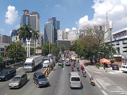
Directions to Ortigas Center station (Pasig City) with public transit
The following transit lines have routes that pass near Ortigas Center
How to get to Ortigas Center station by bus?
Click on the bus route to see step by step directions with maps, line arrival times and updated time schedules.
How to get to Ortigas Center station by train?
Click on the train route to see step by step directions with maps, line arrival times and updated time schedules.
Bus stops near Ortigas Center in Pasig City
- Sm Mega Mall Uv Express Terminal, 3 min walk,
- San Miguel Ave, Pasig City, Manila, 4 min walk,
- Shaw Blvd, Mandaluyong City, Manila, 4 min walk,
- Sheridan / United Street, Mandaluyong City, Manila, 6 min walk,
- Mmda Edsa Starmall- Shaw Bus Terminal Southbound, Mandaluyong City, Manila, 6 min walk,
- Shaw Blvd, Shaw Blvd, Manila, 7 min walk,
- Shaw College, Shaw Blvd, Manila, 8 min walk,
- Epifanio De Los Santos Avenue / Shaw Blvd Intersection, Mandaluyong City, Manila, 8 min walk,
- Edsa Central, 9 min walk,
- Edsa Starmall Uv Express, 10 min walk,
- Sierra Madre / Sultan, Makati City, Manila, 10 min walk,
- Mayflower, Mandaluyong City, Manila, 11 min walk,
Train station near Ortigas Center in Pasig City
- Santolan Mrt, 27 min walk,
Bus lines to Ortigas Center station in Pasig City
- UV, J. P. Rizal St / Spain Street Intersection, Marikina City, Manila,
- UV, Sm Mega Mall Uv Express Terminal,
- UV, Marikina Heights Uv Express,
- JEEP, EDSA - Shaw - Ortigas Complex,
- JEEP, Antipolo - JRC Ortigas/Shaw,
- JEEP, EDSA Shaw E Rodriguez Ortigas Ave,
- JEEP, EDSA/Shaw - E. Rodriguez (Ugong) via J. Vargas Ave.,
- JEEP, Antipolo - EDSA/Shaw Blvd.,
- JEEP, SHAW BLVD - ORTIGAS,
- BUS, Antipolo-Divisoria via Shaw Blvd,
- JEEP, Pasig-Stop Shop,
- JEEP, EDSA/Shaw Central - Tanay via Antipolo,
- JEEP, EDSA Shaw Angono,
- JEEP, ANTIPOLO - JRU ROSARIO,
- JEEP, Binangonan - JRC via Angono,
- JEEP, Angono EDSA Shaw Blvd,
- JEEP, Edsa/Shaw.Central -Tipas (Taguig) via San Joaquin,
- JEEP, EDSA/Shaw Central - Morong via Antipolo, Theresa,
- JEEP, Pasig-Quiapo via Sta Mesa,
- JEEP, EDSA/Shaw Central - Morong via Binangonan, Cardona,
What are the closest stations to Ortigas Center?
The closest stations to Ortigas Center are:
- Sm Mega Mall Uv Express Terminal is 220 meters away, 3 min walk.
- San Miguel Ave, Pasig City, Manila is 231 meters away, 4 min walk.
- Shaw Blvd, Mandaluyong City, Manila is 239 meters away, 4 min walk.
- Sheridan / United Street, Mandaluyong City, Manila is 372 meters away, 6 min walk.
- Mmda Edsa Starmall- Shaw Bus Terminal Southbound, Mandaluyong City, Manila is 447 meters away, 6 min walk.
- Shaw Blvd, Shaw Blvd, Manila is 459 meters away, 7 min walk.
- Shaw College, Shaw Blvd, Manila is 511 meters away, 8 min walk.
- Epifanio De Los Santos Avenue / Shaw Blvd Intersection, Mandaluyong City, Manila is 581 meters away, 8 min walk.
- Edsa Central is 651 meters away, 9 min walk.
- Edsa Starmall Uv Express is 698 meters away, 10 min walk.
- Mayflower, Mandaluyong City, Manila is 765 meters away, 11 min walk.
- Sierra Madre / Sultan, Makati City, Manila is 766 meters away, 10 min walk.
- Santolan Mrt is 2074 meters away, 27 min walk.
Which bus lines stop near Ortigas Center?
These bus lines stop near Ortigas Center: BUS, E, JEEP, P2P.
Which train line stops near Ortigas Center?
MRT3 (North Avenue)
What’s the nearest train station to Ortigas Center in Pasig City?
The nearest train station to Ortigas Center in Pasig City is Santolan Mrt. It’s a 27 min walk away.
What’s the nearest bus station to Ortigas Center in Pasig City?
The nearest bus station to Ortigas Center in Pasig City is Sm Mega Mall Uv Express Terminal. It’s a 3 min walk away.
What time is the first train to Ortigas Center in Pasig City?
The MRT3 is the first train that goes to Ortigas Center in Pasig City. It stops nearby at 5:07 AM.
What time is the last train to Ortigas Center in Pasig City?
The MRT3 is the last train that goes to Ortigas Center in Pasig City. It stops nearby at 9:26 PM.
What time is the first bus to Ortigas Center in Pasig City?
The BUS is the first bus that goes to Ortigas Center in Pasig City. It stops nearby at 3:02 AM.
What time is the last bus to Ortigas Center in Pasig City?
The BUS is the last bus that goes to Ortigas Center in Pasig City. It stops nearby at 3:37 AM.
See Ortigas Center, Pasig City, on the map
Public Transit to Ortigas Center in Pasig City
Wondering how to get to Ortigas Center in Pasig City, Philippines? Moovit helps you find the best way to get to Ortigas Center with step-by-step directions from the nearest public transit station.
Moovit provides free maps and live directions to help you navigate through your city. View schedules, routes, timetables, and find out how long does it take to get to Ortigas Center in real time.
Looking for the nearest stop or station to Ortigas Center? Check out this list of stops closest to your destination: Sm Mega Mall Uv Express Terminal; San Miguel Ave; Shaw Blvd; Sheridan / United Street; Mmda Edsa Starmall- Shaw Bus Terminal Southbound; Shaw Blvd; Shaw College; Epifanio De Los Santos Avenue / Shaw Blvd Intersection; Edsa Central; Edsa Starmall Uv Express; Mayflower; Sierra Madre / Sultan; Santolan Mrt.
Bus: BUS, E, JEEP, P2P, UV, UV, UV.Train: MRT3.
Want to see if there’s another route that gets you there at an earlier time? Moovit helps you find alternative routes or times. Get directions from and directions to Ortigas Center easily from the Moovit App or Website.
We make riding to Ortigas Center easy, which is why over 1.5 million users, including users in Pasig City, trust Moovit as the best app for public transit. You don’t need to download an individual bus app or train app, Moovit is your all-in-one transit app that helps you find the best bus time or train time available.
For information on prices of bus and train, costs and ride fares to Ortigas Center, please check the Moovit app.
Use the app to navigate to popular places including to the airport, hospital, stadium, grocery store, mall, coffee shop, school, college, and university.
Ortigas Center Address: Ortigas Center, Pasig, Metro Manila, Philippines street in Pasig City
Places Near Ortigas Center (Pasig City)
How to get to popular places in Manila with public transit
Get around Pasig City by public transit!
Traveling around Pasig City has never been so easy. See step by step directions as you travel to any attraction, street or major public transit station. View bus and train schedules, arrival times, service alerts and detailed routes on a map, so you know exactly how to get to anywhere in Pasig City.
When traveling to any destination around Pasig City use Moovit's Live Directions with Get Off Notifications to know exactly where and how far to walk, how long to wait for your line, and how many stops are left. Moovit will alert you when it's time to get off — no need to constantly re-check whether yours is the next stop.
Wondering how to use public transit in Pasig City or how to pay for public transit in Pasig City? Moovit public transit app can help you navigate your way with public transit easily, and at minimum cost. It includes public transit fees, ticket prices, and costs. Looking for a map of Pasig City public transit lines? Moovit public transit app shows all public transit maps in Pasig City with all Bus and Train routes and stops on an interactive map.
Manila has 2 transit type(s), including: Bus and Train, operated by several transit agencies, including LRTA, LTFRB, MRTC, PNR, P2P, UV Express and BGC Bus