Directions to P&G/Gillette (Boston) with public transportation
The following transit lines have routes that pass near P&G/Gillette
 Bus: 11, 47, 9, RED LINE SHUTTLE, RED LINE SHUTTLE.
- Train: FITCHBURG, FRAMINGHAM/WORCESTER, HAVERHILL, COMMUTER RAIL SHUTTLE, FAIRMOUNT LINE SHUTTLE.
- Subway: RED LINE, GREEN LINE B, GREEN LINE C, GREEN LINE D, GREEN LINE E.
How to get to P&G/Gillette by bus?
Click on the bus route to see step by step directions with maps, line arrival times and updated time schedules.
From Watertown, MA, Watertown Town
58 minFrom Roadrunner, Boston
75 minFrom Vertex Pharmaceuticals, Inc., Boston
76 minFrom The Mall At Chestnut Hill, Newton
87 minFrom Beth Israel Deaconess Hospital-Milton, Milton
89 minFrom Four Points by Sheraton Boston Logan Airport, Revere
104 minFrom Goodwill Store, Boston
68 minFrom Melrose Wakefield Hospital, Malden
115 minFrom Cambria Hotel Boston Somerville, Somerville
84 minFrom Boston College, Boston
77 min
How to get to P&G/Gillette by train?
Click on the train route to see step by step directions with maps, line arrival times and updated time schedules.
How to get to P&G/Gillette by subway?
Click on the subway route to see step by step directions with maps, line arrival times and updated time schedules.
From Roadrunner, Boston
66 minFrom Vertex Pharmaceuticals, Inc., Boston
65 minFrom The Mall At Chestnut Hill, Newton
68 minFrom Beth Israel Deaconess Hospital-Milton, Milton
61 minFrom Goodwill Store, Boston
44 minFrom Melrose Wakefield Hospital, Malden
36 minFrom Cambria Hotel Boston Somerville, Somerville
42 minFrom Boston College, Boston
66 min
Bus stops near P&G/Gillette in Boston
Subway stations near P&G/Gillette in Boston
Train station near P&G/Gillette in Boston
- South Station, 7 min walk,VIEW
Bus lines to P&G/Gillette in Boston
- 9, Copley - City Point,VIEW
- 11, Chauncy & Summer - City Point,VIEW
- 47, Broadway - Central Square,VIEW
- RED LINE SHUTTLE, Kendall/MIT - Broadway via Pearl Street,VIEW
- RED LINE SHUTTLE, JFK/UMass - Broadway,VIEW
- RED LINE SHUTTLE, Braintree - Broadway,VIEW
- RED LINE SHUTTLE, Harvard - JFK/UMass via Congress Street,VIEW
- RED LINE SHUTTLE, Harvard - Broadway,VIEW
- RED LINE SHUTTLE, North Quincy - Broadway (Shuttle),VIEW
- RED LINE SHUTTLE, Quincy Center - Broadway (Express),VIEW
- RED LINE SHUTTLE, Quincy Center - Broadway (Shuttle),VIEW
- RED LINE SHUTTLE, JFK/UMass - Park Street,VIEW
- RED LINE SHUTTLE, Kendall/MIT - JFK/UMass,VIEW
- RED LINE SHUTTLE, Kendall/MIT - Broadway via Downtown Crossing,VIEW
- RED LINE SHUTTLE, Ashmont - Park Street via Post Office,VIEW
- RED LINE SHUTTLE, JFK/UMass - Park Street via Post Office,VIEW
- RED LINE SHUTTLE, North Quincy - Broadway,VIEW
- RED LINE SHUTTLE, Harvard - JFK/UMass via State Street,VIEW
- RED LINE SHUTTLE, JFK/UMass - Kendall/MIT (Shuttle),VIEW
- RED LINE SHUTTLE, Ashmont - Broadway (Shuttle),VIEW
What are the closest stations to P&G/Gillette?
The closest stations to P&G/Gillette are:
- Broadway Station - Red Line is 32 yards away, 1 min walk.
- South Station Bus Terminal is 289 yards away, 4 min walk.
- Boylston is 475 yards away, 6 min walk.
- South Station is 564 yards away, 7 min walk.
- Tufts Medical Center is 610 yards away, 8 min walk.
Which bus lines stop near P&G/Gillette?
These bus lines stop near P&G/Gillette: 11, 47, 9.
Which train lines stop near P&G/Gillette?
These train lines stop near P&G/Gillette: FITCHBURG, FRAMINGHAM/WORCESTER, HAVERHILL.
Which subway line stops near P&G/Gillette?
RED LINE (Ashmont/Braintree)
What’s the nearest subway station to P&G/Gillette in Boston?
The nearest subway station to P&G/Gillette in Boston is Boylston. It’s a 6 min walk away.
What’s the nearest train station to P&G/Gillette in Boston?
The nearest train station to P&G/Gillette in Boston is South Station. It’s a 7 min walk away.
What’s the nearest bus station to P&G/Gillette in Boston?
The nearest bus station to P&G/Gillette in Boston is Broadway Station - Red Line. It’s a 1 min walk away.
What time is the first subway to P&G/Gillette in Boston?
The GREEN LINE D is the first subway that goes to P&G/Gillette in Boston. It stops nearby at 5:09 AM.
What time is the last subway to P&G/Gillette in Boston?
The GREEN LINE E is the last subway that goes to P&G/Gillette in Boston. It stops nearby at 2:16 AM.
What time is the first train to P&G/Gillette in Boston?
The PROVIDENCE/STOUGHTON is the first train that goes to P&G/Gillette in Boston. It stops nearby at 4:20 AM.
What time is the last train to P&G/Gillette in Boston?
The LAKE SHORE LIMITED is the last train that goes to P&G/Gillette in Boston. It stops nearby at 8:32 PM.
What time is the first bus to P&G/Gillette in Boston?
The SLW is the first bus that goes to P&G/Gillette in Boston. It stops nearby at 4:19 AM.
What time is the last bus to P&G/Gillette in Boston?
The FLIXBUS N2605 is the last bus that goes to P&G/Gillette in Boston. It stops nearby at 9:25 AM.
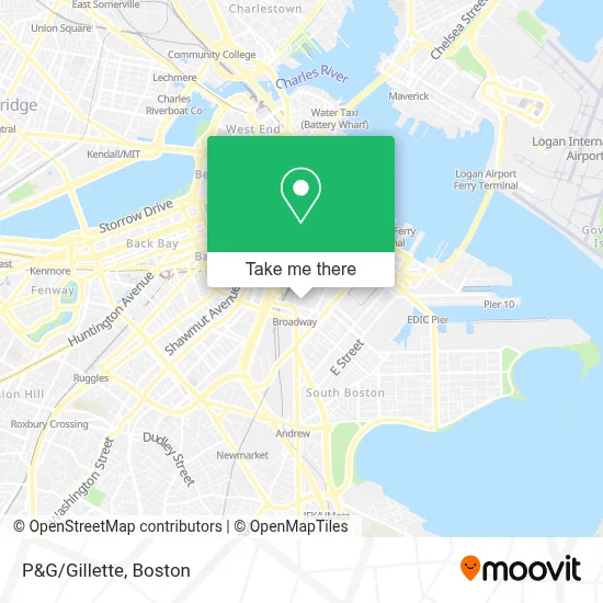
See P&G/Gillette, Boston, on the map
Public Transit to P&G/Gillette in Boston
Wondering how to get to P&G/Gillette in Boston? Moovit helps you find the best way to get to P&G/Gillette with step-by-step directions from the nearest public transit station.
Moovit provides free maps and live directions to help you navigate through your city. View schedules, routes, timetables, and find out how long does it take to get to P&G/Gillette in real time.
Looking for the nearest stop or station to P&G/Gillette? Check out this list of stops closest to your destination: Broadway Station - Red Line; South Station Bus Terminal; Boylston; South Station; Tufts Medical Center.
Bus: 11, 47, 9, RED LINE SHUTTLE, RED LINE SHUTTLE, FLIXBUS 2610, FLIXBUS 2611, FLIXBUS 2612, FLIXBUS 2614, FLIXBUS 2619.Train: FITCHBURG, FRAMINGHAM/WORCESTER, HAVERHILL, COMMUTER RAIL SHUTTLE, FAIRMOUNT LINE SHUTTLE, FRANKLIN LINE SHUTTLE, KINGSTON LINE SHUTTLE, SL1.Subway: RED LINE, GREEN LINE B, GREEN LINE C, GREEN LINE D, GREEN LINE E, ORANGE LINE.
Want to see if there’s another route that gets you there at an earlier time? Moovit helps you find alternative routes or times. Get directions from and directions to P&G/Gillette easily from the Moovit App or Website.
We make riding to P&G/Gillette easy, which is why over 1.7 million users, including users in Boston, trust Moovit as the best app for public transit. You don’t need to download an individual bus app or train app, Moovit is your all-in-one transit app that helps you find the best bus time or train time available.
For information on prices of bus, subway and train, costs and ride fares to P&G/Gillette, please check the Moovit app.
Use the app to navigate to popular places including to the airport, hospital, stadium, grocery store, mall, coffee shop, school, college, and university.
P&G/Gillette Address: 1 Gillette Park street in Boston
- Ulta Beauty,
- Cambria Hotel,
- Cambria Hotel Boston, Downtown-South Boston (The Cambria Boston Downtown),
- West Broadway Quarters,
- Fox & the Knife,
- Six House,
- Broadway Station MBTA,
- Cambria Hotel Boston Downtown South Boston,
- Gillette World Shaving Headquarters,
- MBTA Broadway Station,
- MBTA #815 Providence Train,
- James M. Kelly Bridge,
- Bayberry Management,
- Moonshine 152,
- James F. Walsh Square,
- Sims Barber Lab (Sim's Barber Lab),
- Martins News Shop,
- Mbta Cabot Yard Cng Compressor Building,
- Stoltze Design (Ithaka Contracting & Design),
- Entrance Airport HOV Ln
Places Near P&G/Gillette (Boston)
- Boston Convention & Exhibition Center, Boston,
- Wilbur Theatre, Boston,
- House Of Blues, Boston,
- North End, Boston,
- Isabella Stewart Gardner Museum, Boston,
- Mgm Music Hall, Boston,
- Boston Medical Center, Boston,
- Castle Island, Boston,
- Td Garden, Boston,
- Quincy Market, Boston,
- Leader Bank Pavilion (Leader Bank Pavillion), Boston,
- Museum Of Science, Boston,
- Prudential Center, Boston,
- Boston Children's Hospital, Boston,
- Faneuil Hall, Boston,
- Massachusetts General Hospital, Boston,
- Wang Theater, Boston,
- Seaport District, Boston,
- Boston Common, Boston,
- Cheers, Boston
How to get to popular places in Boston with public transit
Get around Boston by public transit!
Traveling around Boston has never been so easy. See step by step directions as you travel to any attraction, street or major public transit station. View bus and train schedules, arrival times, service alerts and detailed routes on a map, so you know exactly how to get to anywhere in Boston.
When traveling to any destination around Boston use Moovit's Live Directions with Get Off Notifications to know exactly where and how far to walk, how long to wait for your line, and how many stops are left. Moovit will alert you when it's time to get off — no need to constantly re-check whether yours is the next stop.
Wondering how to use public transit in Boston or how to pay for public transit in Boston? Moovit public transit app can help you navigate your way with public transit easily, and at minimum cost. It includes public transit fees, ticket prices, and costs. Looking for a map of Boston public transit lines? Moovit public transit app shows all public transit maps in Boston with all Bus, Train, Subway and Ferry routes and stops on an interactive map.
Boston has 4 transit type(s), including: Bus, Train, Subway and Ferry, operated by several transit agencies, including MBTA, Southeastern Regional Transit Authority, MetroWest Regional Transit Authority, Rhode Island Public Transit Authority, WRTA, Lowell Regional Transit Authority, Merrimack Valley Transit, Montachusett Regional Transit Authority, Cape Cod Regional Transit Authority, Brockton Area Transit Authority, Martha's Vineyard Transit Authority, the WAVE - Nantucket Regional Transit Authority, GATRA, Cape Ann Transportation Authority and Massport